All Activity
- Past hour
-
Doesn't seem like this is gonna be it. Monday might have been a mirage.
-
December 2025 regional war/obs/disco thread
Kitz Craver replied to Torch Tiger's topic in New England
We don’t need blockbusters, let’s just try and keep it festive for all moving towards Christmas. Compared to recent Holiday periods, that would be a win -
The Euro is still by far the best model, i would rather have it in my camp than any other model.
-
So far, GFS looks a bit flatter out front vs 6z.
-
That’s some solid analysis haha
-
12z GFS is a solid Hit for Northern NC/Southern VA
-
Cause the euro by itself also isn’t the best place to be. Seen that so many times when euro was showing a boom and other models weren’t and euro busted big time. Example last year.
-
NWS:
-
https://easternmassweather.blogspot.com/2025/12/exceedingly-difficult-forecast-yields.html B-
-
With a massive grain of salt - the gfs has much more moisture and is colder. Verbatim, more than a minor event for many edit: not colder but the front thump is thumpin
-

December 2025 Short/Medium Range Forecast Thread
Carvers Gap replied to John1122's topic in Tennessee Valley
And that CFSv2 at 6z sure looks a lot like the GEFS ext last night for December. -
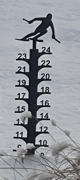
A nice, festive 6”-7” here. All light and fluffy with no signs of ice. Interesting that we stayed ice/rain free here while it sounds like Nashua got into it a bit. Usually the exact opposite over the past few years. I don’t trust the precision of this gauge but here it is for reference.
-
Watch the follow-up on the Gfs. Might be something, might not.
-

Winter 2025-2026 Offers Return to Normalcy
40/70 Benchmark replied to 40/70 Benchmark's topic in New England
Exceedingly Difficult Forecast Yields "Mixed" Results: What's Next? Poorly Modeled Atmospheric Warm Layer Complicated Forecast Unique Circumstances Hindered Forecast Effort Given the circumstances, the forecast for yesterday's system can be considered an admirable effort. Personal time constraints warranted an early publication on Sunday evening, approximately 36 hours prior to the onset of the event. This proved crucial given the fact that modeling struggled to accurately portray a subtle warm layer above the surface over eastern areas right up until the time the event was actually unfolding. Given that the atmospheric profile was marginal to support snowfall to begin with, this obviously had major repercussions across a large portion of the area. Precipitation Type Issues Proved Difficult to Diagnose Eastern Mass Weather did well identifying the zone of maximum snowfall amounts, as well as the totals in Sunday's Final Call. Note that the maximum amounts of 9-9.5" from Dover, NH, to Dunbarton, NH over the Peterborough, NH are either in, or very near the heaviest 5-10" band denoted on the forecast. However, accuracy was lacking on the southern end of the snowfall area, where a poorly modeled layer of mid level warmth at approximately the 900mb level became more accurately modeled during the day on Monday and into Monday night, after the issuance of the forecast. This became much more apparent by the 00z Tuesday European model, which was released early Monday morning. Clearly there is a layer of above freezing at the 900MB level in this forecast sounding for Methuen, MA by about 1PM on Tuesday, which implies sleet already mixing at that point. However, temperatures near the surface at this particular locale only approached freezing in the latter stages of the event on Tuesday evening, thus the air at the surface remained cold. This is why forecasters attributing the dearth of snowfall over Eastern Mass to elevation, or sun strength are lazy or negligent at best, and ignorant at worst. Suggesting that topography, solar irradiance or warm ground was the primary inhibitor to snowfall accumulations when the warmest layer was in fact above the surface, just over two weeks removed from the winter solstice is pure folly. What is also utter folly is failing to use a rather unique forecasting situation as a learning experience, and taking inventory of potential "red flags" to take heed of moving forward. Let Snow Growth Guide Forecasts Eastern Mass Weather remained rather conservative with snowfall amounts for this system, forecasting 4-8" over the vast majority of the area that received predominately snowfall, and 5-10" in a relatively narrow corridor from interior southeastern New Hampshire, down into Worcester county, Mass. This proved to be a wise call, as some outlets were forecasting up to a one foot of snowfall over a relatively large area. The primary reason may have also been interpreted as a warning that the lower and/or mid levels of the atmosphere were indeed going to verify warmer than forecasts 36-48 hours prior to the onset of the event. Poor snow growth in conjunction with progressive nature of the system was noted in the Final Call as the reason that amounts exceeding 8" would be scarce. However, in hindsight, given the marginal profile of the atmosphere as it pertained to being supportive of snowfall in general, it would have been a prudent course of action to be even more conservative on the southeastern half of the forecast snow shield, which resided over eastern Mass. Final Grade: B- Looking Ahead Throughout First Half of December Frigid air looks to infiltrate the region by Friday, as a polar vortex lobe looks to pay the area a visit. Then there may not be a long wait to utilize the lessons learned from this most recent trying storm forecast, given the patten that is poised to settle in of the first half of December that is largely consistent with the intensity and character of this weak, eastern-biased La Niña event. -
I love this place, if the GFS was showing something but the Euro wasn't everyone would be like shut the blinds this storm is done. Now it's the other way around and there is all this doom and gloom. All hail the Europeans.
-
If the euro holds like we better hope the other models follow suit soon. Less than 48hrs out and there’s like a 200 mile difference between the gfs and euro in precip shield.
-

The Return of the 12/5 Snowstorm
NorthArlington101 replied to SnowenOutThere's topic in Mid Atlantic
not willing to throw in the towel with a EURO median of 1.5" or so for most of us... though I won't pretend this can't miss. -
Meh..still in the envelope between the Euro, NAM and GFS. Heading over to the long range thread for next week
-
Yeah, it slides south still. Bob Chill looks solid for this one
-
After missing out on snow on Friday, it looks like we'll have that warm/cutter mid month. So then we're looking at second half of month for any snow. However, the fast flow is not allowing for anything. At least it'll be cold
-

December 2025 Short/Medium Range Forecast Thread
Carvers Gap replied to John1122's topic in Tennessee Valley
JB mentioned that all of the predicted stalls of the MJO have not occurred yet. He said modeling is having to adjust to the idea that the MJO is just continuing on around. Now, FTR I am not opposed to the Euro idea of a stalled MJO in 8-1! I really don't know honestly. I do think the MJO is going to reload though and rotate around once again. I found the CFSv2 seasonal this AM to be reasonable for DJF. This fits with a weak Nina. I have noticed multiple models w/ the NAO beginning to fire. To me this implies that cold drops into the Plains, very cold air at times. Then, the cold pushes south eastward. Basically this goes in sequence....cold -> thaw -> very cold. -
Hinted on most guidance. Maybe an inch or so. Borderline in ern areas.
-
Gfs is congrats North Carolina and southern Va. figures south of us will probably cash in before we do. Why not? lol
-
So GFS looks slightly more norther with the precip shield. Not sure it's going to be enough tho..it's not substantially farther north than 6z so far


