All Activity
- Past hour
-
glad we don't live there
-
Your area got between a third and .6 of an inch. I wouldn't call that getting screwed.
-
Looks decent as long as you don't believe the GFS - seems to be the dry outlier on QPF... NBM still 1-2" SNE...
-
There are spots for sure.
-
Hope you can grab a little sleep tonight with the heat humidity.
-
Could use the rain here for sure.
-
I can see both sides of the argument. June has been warm, but we also have had plenty of cool stretches and sort of lacked oppressive dews aside from a day or so.
-
Hope it does. Ponds are full.
-
Monday better not stein
-
It was 102 last year. Meh...
-
Total Meh. Compare it the last June not even close. AC I think twice this month. They are struggling.
-
BOS has to do 95-97 for ORH to hit 90.
-
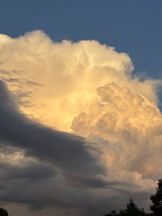
Those are absolutely the best. Sunset with giant clouds.
-

Late May/June 2026 Medium/Long Range
Stormchaserchuck1 replied to JenkinsJinkies's topic in Mid Atlantic
Yeah, El Nino generally favors warm Stratosphere. El Nino/-QBO is what you really want, 23-24 had 4 separate Stratosphere warmings. I know it didn't correlate highly to the NAO that Winter, but the combo can produce, 09-10 was El Nino/-QBO. -
There were times in the past that had major PV disruptions during a El Niño / +QBO combinations. They tended to ocur in later winter versus early in December to Jan.
-
Yeah he lives in N Weymouth and got the second cell. My son’s friend lives near there and sent a video similar too. What a weenie. I got like a min of peas from the first cell. These were micro cells with the sun shining through the core yet ltg, hail, and almost half inch of rain there.
-
https://x.com/hullnewsphotog/status/2068486450534879600
-
meh torch to me is 90 plus with high dews.. just because its above normal doesn't mean torch..
-
2026-2027 Super El Nino
Stormchaserchuck1 replied to Stormchaserchuck1's topic in Weather Forecasting and Discussion
65-66 had a -PNA? -
Another awesome night on the river, which is running about 2 feet higher than typical thanks to all the rain up north.
-
Nice shot of storm 2 departing
-

2026-2027 Super El Nino
40/70 Benchmark replied to Stormchaserchuck1's topic in Weather Forecasting and Discussion
Basin-Wide has a wide degree of variation...can end up with an east0based pattern, like 2023, or more Modoki like, per 1957 and 1965. - Yesterday
-
Been thunder for about 45 min. More rainbows too.
-
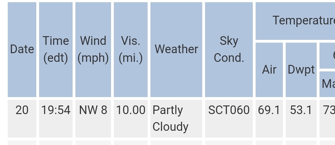
.thumb.jpg.6a4895b2a43f87359e4e7d04a6fa0d14.jpg)
Central PA Summer 2026 Discussion/Obs Thread
Yardstickgozinya replied to Voyager's topic in Upstate New York/Pennsylvania
Yup. No more rumbles of thunder here, but the west end of Mechanicsburg is getting another shower, just enough to get the ground wet.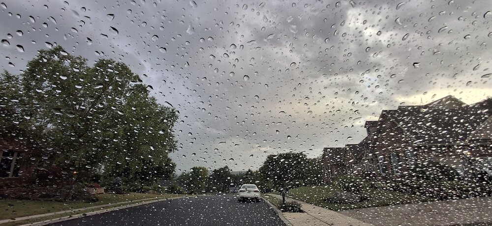
-
https://x.com/nwsspc/status/2068416532716146766?s=46&t=nTdsbQZkQMPkUI3zGjAXJg marginal and slight risk out pretty large area with marginal and slight looks to be in mid Atlantic for Monday https://x.com/nwsspc/status/2068384926446104704?s=46&t=nTdsbQZkQMPkUI3zGjAXJg marginal and slight out as well majority of Great Plains and Midsouth and mid west Ohio valley parts of ozarks and tn valley also big outlook too for tomorrow .