All Activity
- Past hour
-

October Comes Early: Late September Multi-Hazard Hybrid Storm
moneypitmike replied to WxWatcher007's topic in New England
Looks like we get a short break coming across the vineyard now. -
.thumb.gif.f92b16c631a1d15d405ed77b33f0710d.gif)
October Comes Early: Late September Multi-Hazard Hybrid Storm
Torch Tiger replied to WxWatcher007's topic in New England
'Grats! Hopefully that keeps training right over the south coastal areas -
(002).thumb.png.6e3d9d46bca5fe41aab7a74871dd8af8.png)
E PA/NJ/DE Autumn 2026 Obs/Discussion
ChescoWx replied to PhiEaglesfan712's topic in Philadelphia Region
Hey Kevin - thanks! It has some subtropical characteristics....but it's more of a hybrid mid latitude cyclone....the storm Thursday-Friday was cold core for sure. -
October Comes Early: Late September Multi-Hazard Hybrid Storm
EastonSN+ replied to WxWatcher007's topic in New England
I hope its wrong. -

Strong Nor'Easter/Hybrid Storm Late September 2026
wthrmn654 replied to Rjay's topic in New York City Metro
Dam my whole house was just shaking like craft in the winds all sudden -

October Comes Early: Late September Multi-Hazard Hybrid Storm
WinterWolf replied to WxWatcher007's topic in New England
That’s legit! -
 Rainfall has been really pedestrian here so far, under .25. with the bulk of the rain still to come. Some decent gusts at times, perhaps a few near 40.
 -

October Comes Early: Late September Multi-Hazard Hybrid Storm
WxWatcher007 replied to WxWatcher007's topic in New England
I like what I see on radar and satellite. -

Strong Nor'Easter/Hybrid Storm Late September 2026
Prue11 replied to Rjay's topic in New York City Metro
And most of that fell last night into early this morning -

Strong Nor'Easter/Hybrid Storm Late September 2026
Rmine1 replied to Rjay's topic in New York City Metro
Precip hitting a brick wall in western Suffolk. wind however is starting to crank -

Strong Nor'Easter/Hybrid Storm Late September 2026
NJwx85 replied to Rjay's topic in New York City Metro
This was the 12z EURO through 00z Tuesday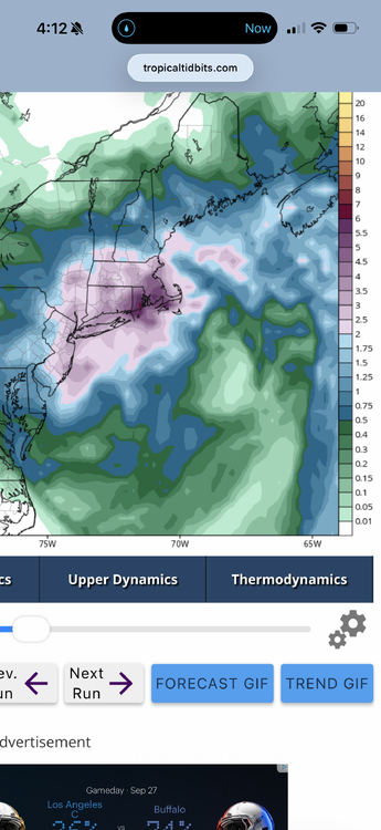
-

Strong Nor'Easter/Hybrid Storm Late September 2026
weathermedic replied to Rjay's topic in New York City Metro
I'm at 1.14 so far -
Strong Nor'Easter/Hybrid Storm Late September 2026
Prue11 replied to Rjay's topic in New York City Metro
2.22” central suffolk -
Strong Nor'Easter/Hybrid Storm Late September 2026
wthrmn654 replied to Rjay's topic in New York City Metro
I'm well over an inch so far -

October Comes Early: Late September Multi-Hazard Hybrid Storm
butterfish55 replied to WxWatcher007's topic in New England
Yeah, this band means business. There's going to be some impressive rain totals in the Raynham/Taunton/route 44 area when all is said and done. -

Strong Nor'Easter/Hybrid Storm Late September 2026
steve392 replied to Rjay's topic in New York City Metro
So what are some preliminary rain totaks so far? I'm still at 1/2" of rain. Really thought we'd be getting dumped on the way this looked last night. -
 drug store online [url=http://geninduspharma.com/#]Gen Indus Pharma[/url] online chemists
 -
Strong Nor'Easter/Hybrid Storm Late September 2026
wthrmn654 replied to Rjay's topic in New York City Metro
For jersey name l maybe, not long island -

Strong Nor'Easter/Hybrid Storm Late September 2026
mob1 replied to Rjay's topic in New York City Metro
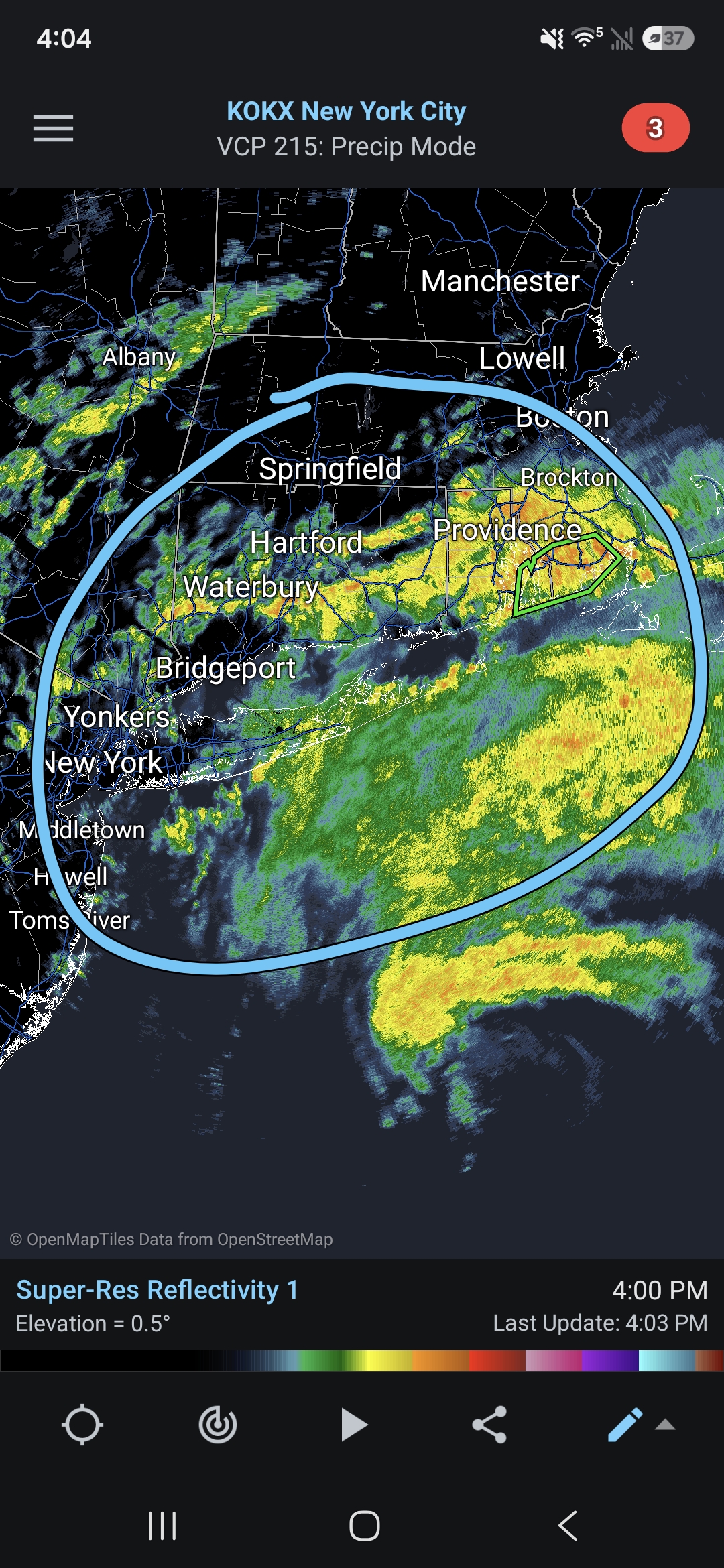
NAM is pretty far south with the precipitation so we'll see, but I'm assuming some of this will rotate through in the next 6-12 hours.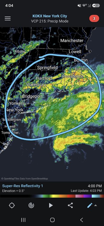
-

October Comes Early: Late September Multi-Hazard Hybrid Storm
Modfan2 replied to WxWatcher007's topic in New England
1.65” prior to the meet of this arriving -
October Comes Early: Late September Multi-Hazard Hybrid Storm
moneypitmike replied to WxWatcher007's topic in New England
Just raised a flashflood warning for me. t 349 PM EDT, Doppler radar indicated thunderstorms producing heavy rain across the warned area. Between 1 and 1.5 inches of rain have fallen. The expected rainfall rate is 1 to 2 inches in 1 hour. Additional rainfall amounts of 1 to 3 inches are possible in the warned area. Flash flooding is ongoing or expected to begin shortly. -

Strong Nor'Easter/Hybrid Storm Late September 2026
Neblizzard replied to Rjay's topic in New York City Metro
What are the models showing for later tonight across NYC/NNJ? I haven’t had time to look at the data . There’s been no rain all afternoon. -

October Comes Early: Late September Multi-Hazard Hybrid Storm
kdxken replied to WxWatcher007's topic in New England
Lolz -
October Comes Early: Late September Multi-Hazard Hybrid Storm
moneypitmike replied to WxWatcher007's topic in New England
Just had some more thunder with it. -
October Comes Early: Late September Multi-Hazard Hybrid Storm
moneypitmike replied to WxWatcher007's topic in New England
I've been under it for about 30 minutes or so. Crazy.