All Activity
- Past hour
-
Another 1" late yesterday afternoon into the overnight so we finished at 6" total.
-
That actually began on 3/31. At the time I had a side gig. That night I had to do an audit at a liquor store in methuen. Despite having company provided ID and a authorization letter from the alcohol company requesting their products be audited the owner of the liquor store was 100% convinced I was a government agent lol...I recall him saying something such as " only the government would send someone out in a blizzard"..lol....to make a long story short he kicked me out of his store lol..
-

2026-2027 El Nino
Terpeast replied to Stormchaserchuck1's topic in Weather Forecasting and Discussion
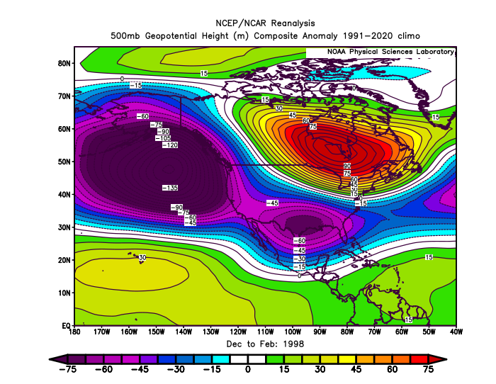
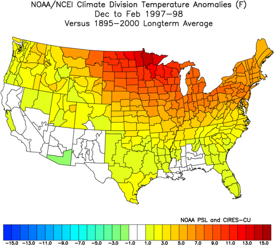
Thanks for sharing. I didn’t realize how well 23-24 matches up with 97-98. I thought it was a good 72-73 match, adjusted to today’s climate. Will be interesting to see how RONI plays out this year now that it is official. -
5.78 “ rain this month to date. Water pouring out of hillsides still this morning. Hopefully that’s it until Mayorch
-
Just further east down rt. 2 from @HoarfrostHubb but I'm giving the same grade and could be convinced of an A- given I wasn't here for the first three weeks of March to witness the melt. By the same token, I missed 3 out of 4 weeks of December when when we had good cold temperatures (and maybe a bit of snow??) as well. My criteria for a good winter is 'can I step out the door of my house and winter recreate.' The cold onset of winter allowed the weston ski track to make snow and provide good, consistent snow, I was able to ski out my door and at the great brook nordic center daily for 6+ weeks before I left the area at the end of February. And I got out on the local ice a few times as well before the big snows came. Up north the alpine skiing was good, the nordic skiing was good and I even got to skate on Lake Morey in VT which I've been wanting to do for some time now. I had hoped to do some ski touring up north on nice March days which isn't going to happen but I was able to explore Mt. Wachusett State park on my skis several times which was actually a lot more fun than I expected.
-
Iced up this morning; windshield was covered.
-
Oh. I don’t recall those. I figured you meant the April Fools storm
-
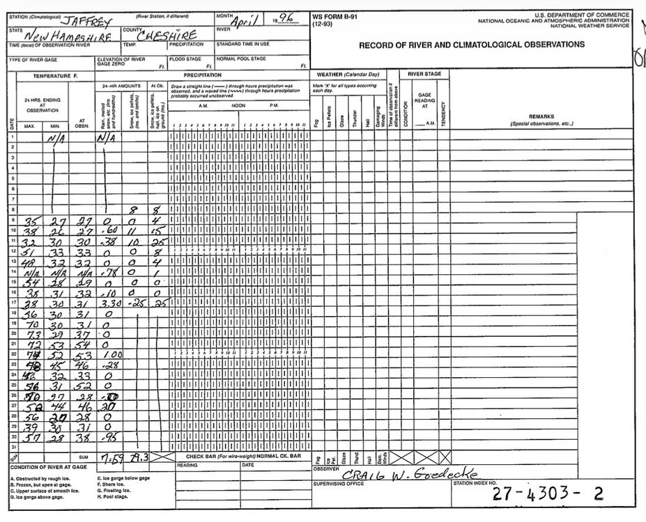
Is that the April record for Jaffrey?
-
Yup. 29.3” for the month
-

2026-2027 El Nino
bluewave replied to Stormchaserchuck1's topic in Weather Forecasting and Discussion
I don’t think RONI is a relevant metric for measuring El Niños since 2023-2024 had an even warmer North American atmospheric response than 1997-1998 did with a very similar 500 mb pattern.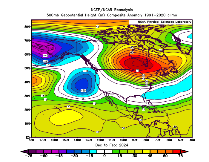

-
95-96 is at the top of my list ....
-
I feel like Jaffrey was pounded in both of those. Off to the original COOP forms…
-

2026-2027 El Nino
PhiEaglesfan712 replied to Stormchaserchuck1's topic in Weather Forecasting and Discussion
That one was weird, and really didn't behave as an el nino, due to a major volcano. Pinatubo actually caused a temporary decrease in global temperatures. If not for that, 1992 would have probably would have been another global warmest year on record (at the time), after a 3rd strong el nino in 10 years. Pinatubo caused the summer of 1992 to be one of the coldest on record CONUS, and longer term, the cold and snowy winters of 92-93, 93-94, and 95-96 in many places in the Eastern US. As for modoki el ninos, 2009-10 is probably the only strong el nino that's a modoki. -
The Eastah Nor’eastah of 96
-
2 major snowstorms in April 96...one postponed the home opener and the 2nd one began shortly after the home opener was played. Also a few days later there was a mix of snow and sleet...
-
We'll see the extent of the ridge / warmth beyond this period which is centered on around april 1. The 4/1 4/5 or 6 looks potentially very warm in the especially in the usual warmer spots in inland NJ
-
Not April 1997?
-
Sign me up! April 96 is my favorite April of all time..
-
Obviously clown range BS, but please…NO. Next mid to late November…we’d all welcome it. Not on 4/7.
-
Records: Highs: EWR: 77 (1988) NYC: 76 (1988) LGA: 74 (2012) JFK: 66 (1987) Lows: EWR: 16 (1940) NYC: 12 (1888) LGA: 17 (1940) JFK: 22 (2014) Historical: 1765: A major snowstorm hit from Pennsylvania to Massachusetts. From Philadelphia, PA came this report: "On Sunday night last there came on here a very severe snowstorm, the wind blowing very high, which continued all the next day, when it is believed there fell the greatest quantity of snow that has been known for many years past; it being generally held to be two feet, or two feet and a half, on the level, and in some places deeper". (Ref. Wilson Wx. History) 1885: The minimum temperature for the date is 17°F in Washington, DC. (Ref. Washington Weather Records - KDCA) 1907: The maximum temperature for the date is 85°F in Washington, DC. (Ref. Washington Weather Records - KDCA) 1912 - Residents of Kansas City began to dig out from a storm produced 25 inches of snow in 24 hours. The snowfall total was nearly twice that of any other storm of modern record in Kansas City before or since that time. A record 40 inches of snow fell during the month of March that year, and the total for the winter season of 67 inches was also a record. By late February of that year Kansas City had received just six inches of snow. Olathe KS received 37 inches of snow in the snowstorm, establishing a single storm record for the state of Kansas. (23rd-24th) (The Kansas City Weather Almanac) (The Weather Channel) 1929: St. Louis, MO soared to 92°; their all-time record high for March. (Ref. Wilson Wx. History) 1934: Washington, DC had 3.7 inches of snow on 23rd and 24th. (Ref. Washington Weather Records - KDCA) 1957: Amarillo, TX picked up 11 inches of snow from an early spring storm. Drifts piled up to 14 feet in places. (Ref. Wilson Wx. History) 1959: The second major spring snowstorm in less than a week dumped 10 to 20 inches of snow across northeastern Colorado. 14.3 inches was reported in Denver where winds gusted over 35 mph creating near blizzard conditions with visibilities frequently down to ½ mile. (Ref. Wilson Wx. History) 1975: "The Governor's Tornado" hop-scotched a 13-mile path across the western part of Atlanta, GA during the early morning hours, causing considerable damage to the Governor's mansion. Hundreds of expensive homes, businesses and apartment complexes were damaged. Total losses were estimated at $56 million dollars. Three people lost their lives and another 152 were injured by the F3 tornado. (Ref. Wilson Wx. History) 1983: Late season snowstorm in the SE U.S. and parts of NC got 9 inches of snow on the 23rd and 24th. Click for Map of NC showing snow amounts Ref. Allen Huffman 1987 - A winter-like storm in the central U.S. produced blizzard conditions from South Dakota to western Kansas. Snowfall totals ranged up to 24 inches at Neligh NE, with 19 inches at Winner SD. Winds gusting to 60 mph created twelve foot snow drifts in Nebraska stranding thousands on the highways. (Storm Data) (The National Weather Summary) 1988 - Thunderstorms developing along a cold front produced severe weather from Minnesota to northeastern Texas. The thunderstorms spawned ten tornadoes, including one which injured five persons near Raymondville MO. (The National Weather Summary) (Storm Data) 1989 - Low pressure off the coast of Virginia brought heavy rain to the Middle Atlantic Coast States, and heavy snow to the Northern Appalachians. Cape Hatteras NC was soaked with 5.20 inches of rain in 24 hours, and snowfall totals in Vermont ranged up to 12 inches. Winds gusted to 52 mph at New York City. (Storm Data) (The National Weather Summary) 1990 - The storm system which produced heavy snow in the Lower Missouri Valley the previous day, spread heavy snow across parts of the Upper Ohio Valley and the Middle Atlantic Coast Region. Snowfall totals of 2.2 inches at Philadelphia PA and 2.4 inches at Atlantic City NJ were records for the date. Up to six inches of snow blanketed southern Ohio. In the Middle Atlantic Coast Region, snow coated the blossoms of cherry trees which had bloomed in 80 degree weather the previous week. (Storm Data) (The National Weather Summary) 1993: "The Winter of the Return of the Big Snows" continued to set records. Boston, MA had 8.6 inches of snow on this day to push its monthly total to 38.9 inches, which set a new March monthly snowfall record. (Ref. Wilson Wx. History)
-
Just say a quarter inch and be done.
-
Maybe .1" or .2" if I cared to measure, but nah. The 'flakes' were basically snow pellets..almost like cauliflower rice or those tiny styrofoam packing balls
-
Nah man I used my index finger to measure..Just trying to make sure it is up to the AMWX scientific standards..
-
38 / 22 cool but sunny today light years better than yesterday which should still wind up the coldest (day time) for the next 1-2 weeks if not well beyond that. Back and forth warmer Thu with the warmest spots to low 70s with enough sun followed by cooler Fri - Sun. Looks like a dry next 7 days till Wed/Thu next week . Overall warmer to at times much warmer Mar 30 - april 5th as it looks the sw / inland areas could see next round of 80s in the warmest case.
-
I'm sure hour 348 will verify


