All Activity
- Past hour
-
Yes the worse of it is approaching the NYC metro area. Thinking tomorrow will be even worse too.
-
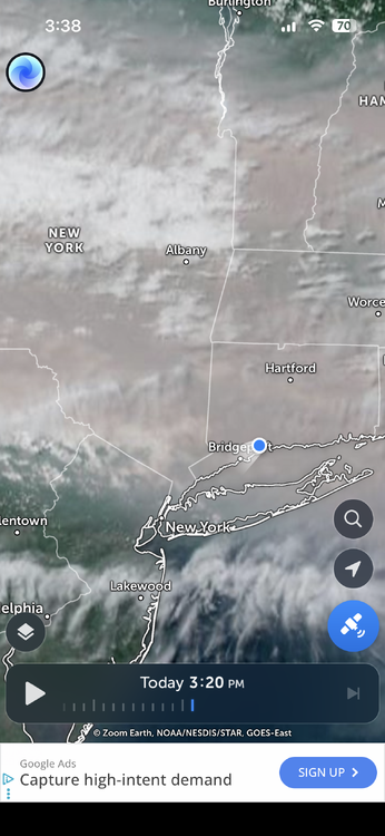
Short range models have it getting worse here late this afternoon/evening. Makes sense with the cold front sagging south. And it's already very noticeable.
-
 Looks like a Mad Max scene
 -
Got noticeably worse here the last few hours. Think you guys in NYC area aren’t in the full brunt of it yet.
-
95/71
-

E PA/NJ/DE Summer 2026 Obs/Discussion
Birds~69 replied to PhiEaglesfan712's topic in Philadelphia Region
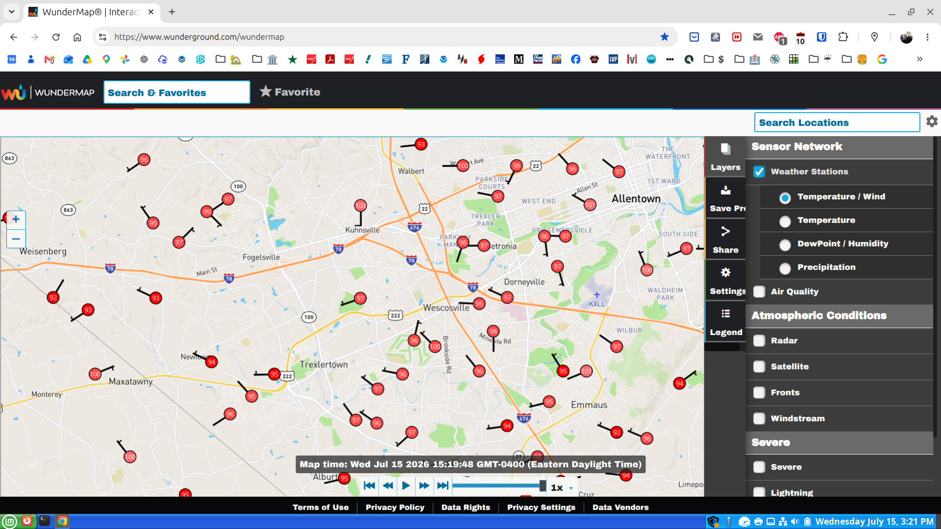
100F/DP 73F at 3:30pm The wind is doing its job...certainly not calm. -
Smells like a bad bbq in mid Staten Island.
-
Mid 90s on the beaches now with the wind shift NW. Typical hottest readings there after the cold front passes. Elsewhere in Nassau County looks like 97-100. Downslope dandy. High IMBY looks to be 95.
-
E PA/NJ/DE Summer 2026 Obs/Discussion
Albedoman replied to PhiEaglesfan712's topic in Philadelphia Region
this is what I mean by the winds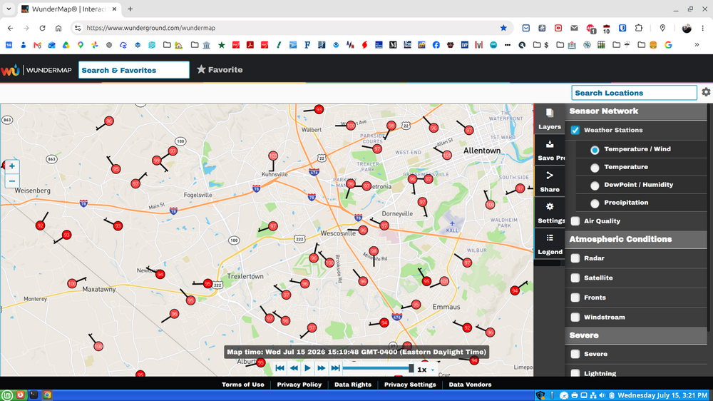
-
 lol. Literally in the AFD. Can’t make this stuff up Not much chance for showers through Thursday night. Any that do form would likely bring more smoke to the ground, and not result in much rainfall.
 -
 depends on the hot dog
 -
 how does that compare to a normal sunny day at the same time ?
 -

Central PA Summer 2026 Discussion/Obs Thread
WmsptWx replied to Voyager's topic in Upstate New York/Pennsylvania
Ow, My Balls! -
 right now my station solar radiation is ~100 watts/m2 (whatever that means), with a UV index <1
 -
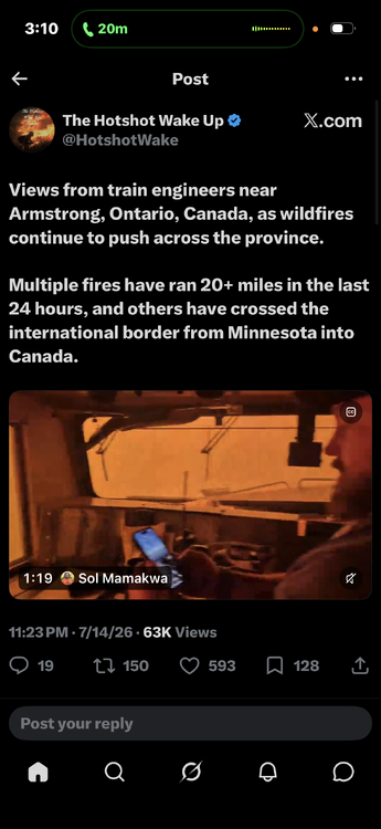
We smoke train .. choo choo
-
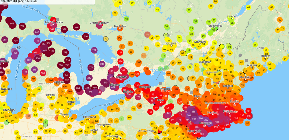
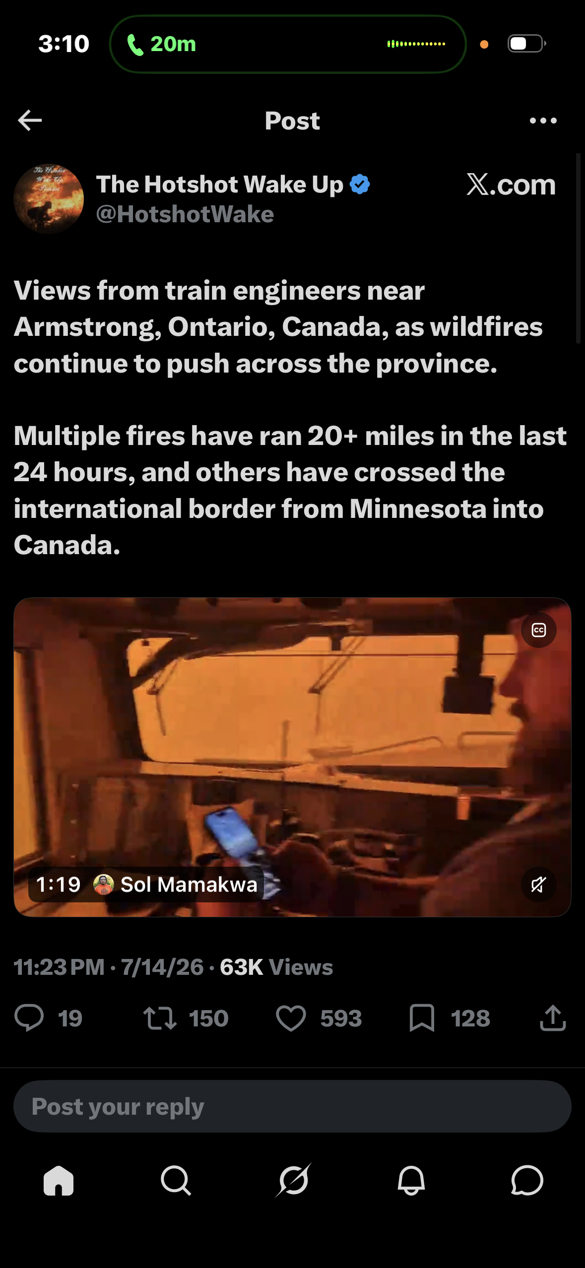
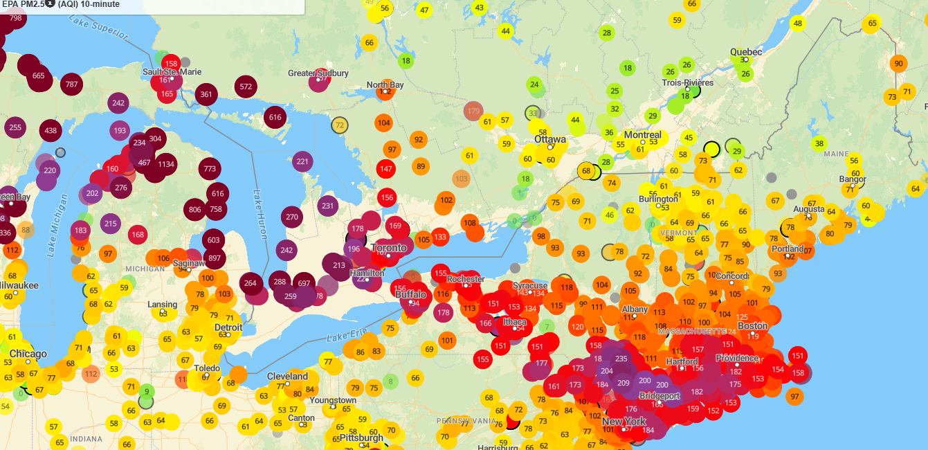
Insane AQI back over the Great Lakes. Can't imaging what values tomorrow will be down this way.
-
-
A shower with moderate to heavy rain just popped right over my area at 3PM.
-
Mt Holly must have been inhaling too much wildfire smoke when writing 103 for a forecast high here. Sitting at 96. Don't think we go any higher with cloud coverage increasing. Not too hazy.
-
 Roman:"You know what the gourmet here wanted? Hot dogs! You know what they're made of, Chet? Huh? Lips and a**holes!" https://www.quotes.net/mquote/115045
-
95/70 heat index at 102. Smells like a firepit outside, no where near 2023 but its pretty hazy out
-
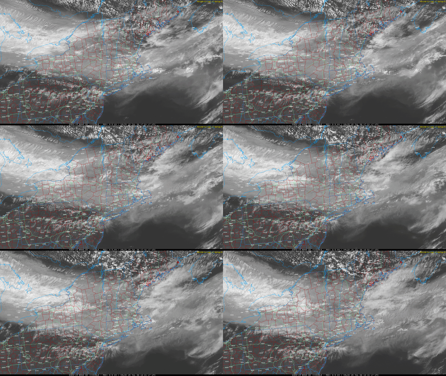
It’s getting converged and stretched between the ridge and trough and training our way. You absolutely love to see it.
-
 Isn't that how hot dogs usually smell?
 -
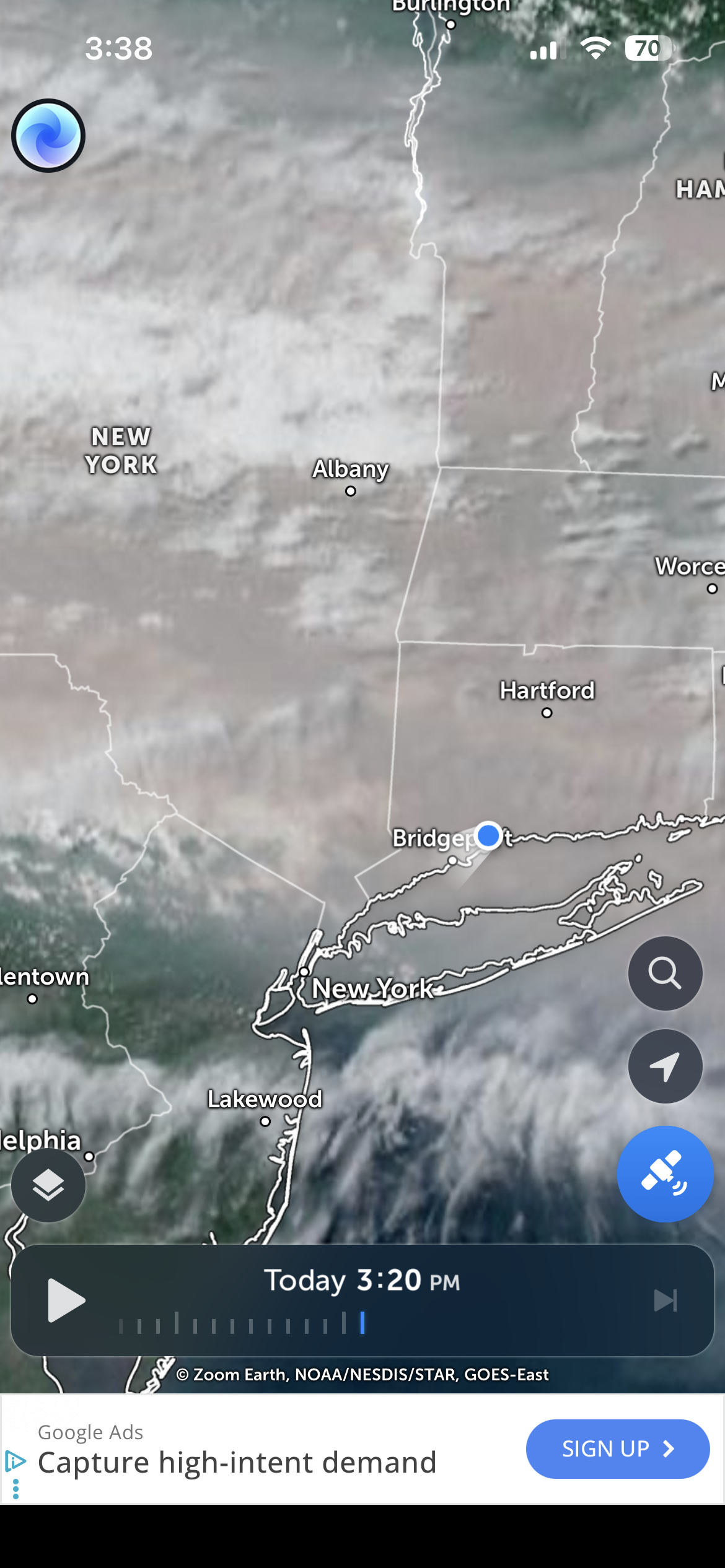
The smoke is really thicc aloft now. We have CAA undercutting it…pretty gusty NW flow. 17G30mph at 1p1.
-
Window fans in tonight!!!







.thumb.jpeg.f5c6ba9d911ec96b3b124f8606aee58e.jpeg)