All Activity
- Past hour
-
They verify more often than they do not
-
Last half hour has been the worst, definitely close to hurricane sustained with some higher gusts. .
-
Which is it's experimental forecast
-
I’ve seen several write ups talking about how elevation could make a difference this winter. Why is that? It seems to me that in the winter location (eg, which side of the storm you’re in) makes a lot more difference than elevation. Heck I’m usually warmer than the lower elevations in a cutter.
-
Scott, Ray, Ginx... have met them all. Truth be told I'm a transplant from MA. Why I moved, don't ask! Deep down shhhh, I live for a good snow. First tropical system after moving lost power for a week...that sealed it for experiencing named storms.
-
Upper atmosphere is what matters. And if you were at some Elevation…that too.
-
Got caught in a mixed rain/snow shower today in Franconia Notch. Could see legit flakes flying around while the temperature was in the upper 40s. Bizarre. I’ll remember that when it’s 32 and raining this winter lol
-
One SVR LSR report pet peeve of mind is "wires down." A LTG strike can do that! Just over time, it seems issuing warnings have become looser and looser as to criteria. I recall last summer, they issued a flash flood warning for the DC metro even before the line of tstms got to the metro! Given a line can quickly weaken as to rainfall rates, that is putting the wagon in front of the horse..
-

Fall 2026 Medium/Long Range Pattern Thread
KakashiHatake2000 replied to John1122's topic in Tennessee Valley
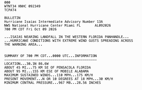
https://www.nhc.noaa.gov/refresh/graphics_at4+shtml/092349.shtml?gm_track#contents Today I learned you can zoom in a region or state specific zone to get a closer look at the cone track of the hurricane thought I would share . -
https://www.threads.com/share/BAU6zWmE9q/
-
You and @CoastalWx have so much in common it sounds! Want to know how much a snow weenie he is? Last winter, when he *finally* got 6" of snow in a storm after an excruciating 4 years w/o one at his house, he goes "it looks VIOLENTLY BEAUTIFUL out there!" I never thought I'd see those two words used together!
-
PDS Flood Emergency for Coastal Okaloosa County, .
-
Look at the disparity from sustained to gusts. In a minimal HU, NHC will say "max winds sustained 65 kt with gusts to 80 kt" Standard gust factor over water. However, over land, that difference becomes much larger!
-
I generally agree with you, especially being in the mid-Atlantic where a severe warning is verified on a 35mph gust that takes down a dead tree branch, but I don't think that this one matters too much. I might argue that 115mph sustained is a too high of a marker for an EWW. That's an EF2 tornado sustained! Hopefully this cam stays up. https://maps.app.goo.gl/5GBwpLHVo3nQd6CH8
-
Sounds like @CoastalWx response! It's not snow, so MEH!
-
It has been in ET transition for at least the last 6 hr. Once the srn part of the eyewall was gone, that was the first signal.
-
If so, they are violating their own directive. Why have thresholds for warnings if they are just deliberately ignored? Why not lower the criteria for a svr tstm warming for winds less then 58 mph in gusts b/c they can still do damage? How about pea size hail? A lot of pea size hail can devastate crops. Issue a warning for that? It is slippery slope. There comes a point of diminishing returns. Excessive alerts eventually become counterproductive.
-
My point was all that Sandy damage happened after its extratropical transition. If the only criteria is supposedly “damage that occurred while it was tropical” then it doesn’t count.
-
Well modelled IMHO. A huge difference between a mid-latitude winter snowstorm and a tropical system of any CAT. Hurricanes are a whole different beast. I would take a 2 footer over 100+ mph. hurricane. Different adrenaline rush too.
-
I assume many people thought that this would be a halfacane at landfall, but this is more impressive than the radar presentation would lead on.
-
Whoa! So it did happen at the very last min. Just delayed from what the HAFS showed earlier. This is non-trivial rise in what, less than 90 min? From the winds where the pressure was taken, the actual pressure is about 970 mb That barely supports 85 kt winds in a purely tropical system, which Isaias is not and has not been for some time. Operationally, I can see it higher when it makes landfall, post-analysis though? Katrina its rapid weakening phase originally was 120 kt at landfall, but they reduced it to 110 kt. Lili was 90 kt, but reduced it to 80 kt later. Also, when a TC is rapidly weakening near landfall, NHC often keeps it higher for winds that reality b/c they do not want to have ppl et their guard down too much, They clearly did this w/ Milton. So obvious when you saw FL and SFMR winds, and the assigned intensity. I find that disingenuous. We all look at the same data and see things for what they are. Don't insult our intelligence! So models had the right idea, just timing was off, but you really can't expect them to nail down something as mesoscale as an inner core of HU as to when it starts to degrade quickly.
-
I mean I think it’s probably a cat 1 at this point but this is what the majority of October land falling storms look like in the US. The system that pulls them north rips them apart.
-
PNS might have better mixing, but almost looks like a second wind max there on both radars.
-
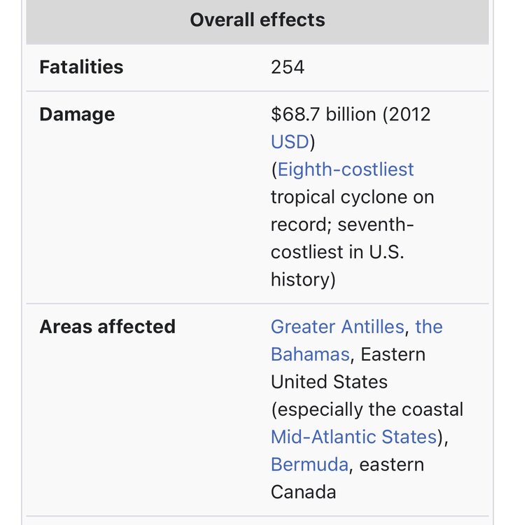
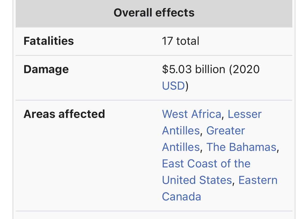
Big difference between sandy and 2020 Isaias. Sandy was deadly and caused way more damage.