NaoPos Posted June 13, 2013 Share Posted June 13, 2013 Link to comment Share on other sites More sharing options...
phlwx Posted June 13, 2013 Share Posted June 13, 2013 For the scorecard -- GFS still shows warm front breaking Philly, NAM gets it right to the city (temps get to 81/82 on raw NAM, upper 70's on MOS). With the thunder threat pushing in this morning, it's going to be a messy forecast on temperatures and a likely close call on the city itself. I think north of the city is more a heavy rain threat, south/southwest of the city is probably the best spot for severe. Link to comment Share on other sites More sharing options...
phlwx Posted June 13, 2013 Share Posted June 13, 2013 STW until 11 AM for Central PA, most of MD, DC, NoVa, parts of WV. Link to comment Share on other sites More sharing options...
Minnesota Meso Posted June 13, 2013 Share Posted June 13, 2013 For the scorecard -- GFS still shows warm front breaking Philly, NAM gets it right to the city (temps get to 81/82 on raw NAM, upper 70's on MOS). With the thunder threat pushing in this morning, it's going to be a messy forecast on temperatures and a likely close call on the city itself. I think north of the city is more a heavy rain threat, south/southwest of the city is probably the best spot for severe. The US Open golf tourney is in jeopardy regarding their 1st round of play, if early morning convection is minor, it may still rain enough to delay things, if the convection allowing models (cam's) are right, there may be some damage this morning, with another round of strong storms late in the afternoon, if the players get out at all, it may be without a gallery to follow them...they can get the players off the course quickly, but the fans is a different thing. Link to comment Share on other sites More sharing options...
phlwx Posted June 13, 2013 Share Posted June 13, 2013 The US Open golf tourney is in jeopardy regarding their 1st round of play, if early morning convection is minor, it may still rain enough to delay things, if the convection allowing models (cam's) are right, there may be some damage this morning, with another round of strong storms late in the afternoon, if the players get out at all, it may be without a gallery to follow them...they can get the players off the course quickly, but the fans is a different thing. I can't see them not allowing a gallery out there given it's the US Open...but I can see them calling the gallery off pretty quickly (logistics on parking, transit down there are pretty crappy since there's not a lot of parking and most of the attendees are taking buses from lots 15 miles away). Going to be tough to get everyone through 18 today regardless (IMO). Course is in crappy shape (at least by pro standards) and this morning's rains will not help much. Link to comment Share on other sites More sharing options...
Sunny and Warm Posted June 13, 2013 Share Posted June 13, 2013 pretty impressive radar for 6am upstream of the CWA. Link to comment Share on other sites More sharing options...
Quakertown needs snow Posted June 13, 2013 Share Posted June 13, 2013 thunder / rain here now. Link to comment Share on other sites More sharing options...
Sunny and Warm Posted June 13, 2013 Share Posted June 13, 2013 thunder / rain here now.the western end of that line in WVA looks to be strengthening/holding together better than the northern end in PA. Don't know what that means for later. Link to comment Share on other sites More sharing options...
LVblizzard Posted June 13, 2013 Share Posted June 13, 2013 Loud thunder and bright lightning here, but it seems like nothing compared to what we may see in 2 hours. Link to comment Share on other sites More sharing options...
NaoPos Posted June 13, 2013 Share Posted June 13, 2013 That line of storms is really gonna screw things up for later me thinks Link to comment Share on other sites More sharing options...
snowlurker Posted June 13, 2013 Share Posted June 13, 2013 That line of storms is really gonna screw things up for later me thinksThe SPC seemed to say the same thing last night. Link to comment Share on other sites More sharing options...
Boch23 Posted June 13, 2013 Share Posted June 13, 2013 At this point i'm just looking for an actual thunderstorm to move through. Not heavy rain with a rumble or 2 of thunder. Which is all I've seen this year.Also 90% of delco is in Mod Risk or maybe is more accurate. Link to comment Share on other sites More sharing options...
Boch23 Posted June 13, 2013 Share Posted June 13, 2013 URGENT - IMMEDIATE BROADCAST REQUESTED SEVERE THUNDERSTORM WATCH NUMBER 304 NWS STORM PREDICTION CENTER NORMAN OK 730 AM EDT THU JUN 13 2013 THE NWS STORM PREDICTION CENTER HAS ISSUED A * SEVERE THUNDERSTORM WATCH FOR PORTIONS OF DELAWARE EASTERN MARYLAND CENTRAL AND SOUTHERN NEW JERSEY SOUTHEASTERN PENNSYLVANIA COASTAL WATERS * EFFECTIVE THIS THURSDAY MORNING FROM 730 AM UNTIL 1100 AM EDT. * PRIMARY THREATS INCLUDE... SEVERAL DAMAGING WIND GUSTS TO 70 MPH POSSIBLE SEVERAL LARGE HAIL EVENTS TO 1.5 INCHES IN DIAMETER POSSIBLE THE SEVERE THUNDERSTORM WATCH AREA IS APPROXIMATELY ALONG AND 45 STATUTE MILES EAST AND WEST OF A LINE FROM 15 MILES NORTH OF TRENTON NEW JERSEY TO 55 MILES SOUTH SOUTHEAST OF DOVER DELAWARE. FOR A COMPLETE DEPICTION OF THE WATCH SEE THE ASSOCIATED WATCH OUTLINE UPDATE (WOUS64 KWNS WOU4). PRECAUTIONARY/PREPAREDNESS ACTIONS... REMEMBER...A SEVERE THUNDERSTORM WATCH MEANS CONDITIONS ARE FAVORABLE FOR SEVERE THUNDERSTORMS IN AND CLOSE TO THE WATCH AREA. PERSONS IN THESE AREAS SHOULD BE ON THE LOOKOUT FOR THREATENING WEATHER CONDITIONS AND LISTEN FOR LATER STATEMENTS AND POSSIBLE WARNINGS. SEVERE THUNDERSTORMS CAN AND OCCASIONALLY DO PRODUCE TORNADOES. Link to comment Share on other sites More sharing options...
DiehardFF Posted June 13, 2013 Share Posted June 13, 2013 RAP gives PHL a cape value of 1000, then later it wants give higher calues. Bucks County is like where the warmfront settles. Hopefully the GFS is right. Link to comment Share on other sites More sharing options...
SP Posted June 13, 2013 Share Posted June 13, 2013 Not a great day to be in the gallery at the open. There might be some crazy photos and video coming from the event as several rounds of wx pass through. Hope for a safe day. Anyone catch that morning wake up storm in northern Monmouth, passing through as I type? Link to comment Share on other sites More sharing options...
Quakertown needs snow Posted June 13, 2013 Share Posted June 13, 2013 warning up Link to comment Share on other sites More sharing options...
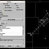
NaoPos Posted June 13, 2013 Share Posted June 13, 2013 that line is looking fat by lanco, decent velocity sig too: Link to comment Share on other sites More sharing options...
Quakertown needs snow Posted June 13, 2013 Share Posted June 13, 2013 this means business Link to comment Share on other sites More sharing options...
hazwoper Posted June 13, 2013 Share Posted June 13, 2013 No tornado warning for this? Link to comment Share on other sites More sharing options...
Quakertown needs snow Posted June 13, 2013 Share Posted June 13, 2013 open will get a big hit Link to comment Share on other sites More sharing options...
fsu_wxgirl Posted June 13, 2013 Share Posted June 13, 2013 New severe storm warning out Link to comment Share on other sites More sharing options...
Boch23 Posted June 13, 2013 Share Posted June 13, 2013 The National Weather Service in Mount Holly NJ has issued a* Severe Thunderstorm Warning for...western Delaware County in southeast Pennsylvania...New Castle County in northern Delaware...Cecil County in northeast Maryland...northeastern Kent County in northeast Maryland...Chester County in southeast Pennsylvania...* until 930 am EDT* at 836 am EDT... National Weather Service Doppler radar indicated aline of severe thunderstorms. These severe storms extended fromTerre Hill to Wakefield to Carney... moving east at 60 mph. Thesestorms are capable of producing one inch diameter hail... anddamaging winds in excess of 60 mph.* Severe thunderstorms will be near...Parkesburg and Honey Brook around 845 am EDT...Oxford and Coatesville around 850 am EDT...West Grove and Downingtown around 855 am EDT...Lionville and Kennett Square around 900 am EDT...Paoli and Betterton around 905 am EDT...Chelsea and Talleyville around 910 am EDT...Precautionary/preparedness actions...Very heavy rain will also occur with this line of severethunderstorms... which could flood low lying areas quickly and coverroads with water. Do not drive into areas where water covers theRoad.Frequent cloud to ground lightning is occurring with thisline of severe thunderstorms. When thunder roars... move indoors!Remember... if you can hear thunder... you are close enough to bestruck by lightning.A Severe Thunderstorm Watch remains in effect until 1100 am EDTThursday morning for Delaware and northeastern Maryland and NewJersey and southeastern Pennsylvania. Link to comment Share on other sites More sharing options...
Quakertown needs snow Posted June 13, 2013 Share Posted June 13, 2013 heavy hitter Link to comment Share on other sites More sharing options...
White_Mtn_Wx Posted June 13, 2013 Share Posted June 13, 2013 Storm overhead, heavy rain and frequent lightning Link to comment Share on other sites More sharing options...
Quakertown needs snow Posted June 13, 2013 Share Posted June 13, 2013 hail? Link to comment Share on other sites More sharing options...
NJHurricane Posted June 13, 2013 Share Posted June 13, 2013 any wind obs very much appreciated with this line Link to comment Share on other sites More sharing options...
ChescoWx Posted June 13, 2013 Share Posted June 13, 2013 Very heavy rain now here in NW Chesco with frequent lightning - wind not that strong Temp 64.5 Link to comment Share on other sites More sharing options...
NaoPos Posted June 13, 2013 Share Posted June 13, 2013 impressive: Link to comment Share on other sites More sharing options...
fsu_wxgirl Posted June 13, 2013 Share Posted June 13, 2013 Listening to Lancaster County Fire and EMS...have heard them report a downed tree and powerline, not sure where exactly any wind obs very much appreciated with this line Link to comment Share on other sites More sharing options...
blackhound Posted June 13, 2013 Share Posted June 13, 2013 In West Chester proper the rain is starting up. Sky is extremely dark and distant rumbles of thunder. Link to comment Share on other sites More sharing options...

Recommended Posts
Archived
This topic is now archived and is closed to further replies.