brooklynwx99
-
Posts
6,215 -
Joined
-
Last visited
Content Type
Profiles
Blogs
Forums
American Weather
Media Demo
Store
Gallery
Everything posted by brooklynwx99
-
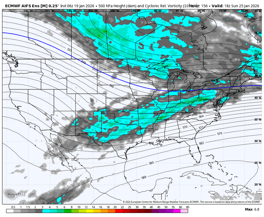
GFS is on crack, moving on. CMC, ICON, and UKMET are all looking euro-esque
-

Extreme Cold, Snow & Sleet: SECS 1/24 - 1/26
brooklynwx99 replied to TriPol's topic in New York City Metro
it’s overrunning to coastal -
Extreme Cold, Snow & Sleet: SECS 1/24 - 1/26
brooklynwx99 replied to TriPol's topic in New York City Metro
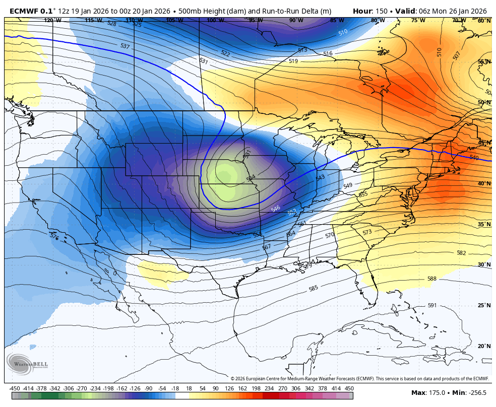
euro is a full phase, ends up tucking offshore. huge hit that run to run change is nuts
-
euro is phasing!!
-
Extreme Cold, Snow & Sleet: SECS 1/24 - 1/26
brooklynwx99 replied to TriPol's topic in New York City Metro
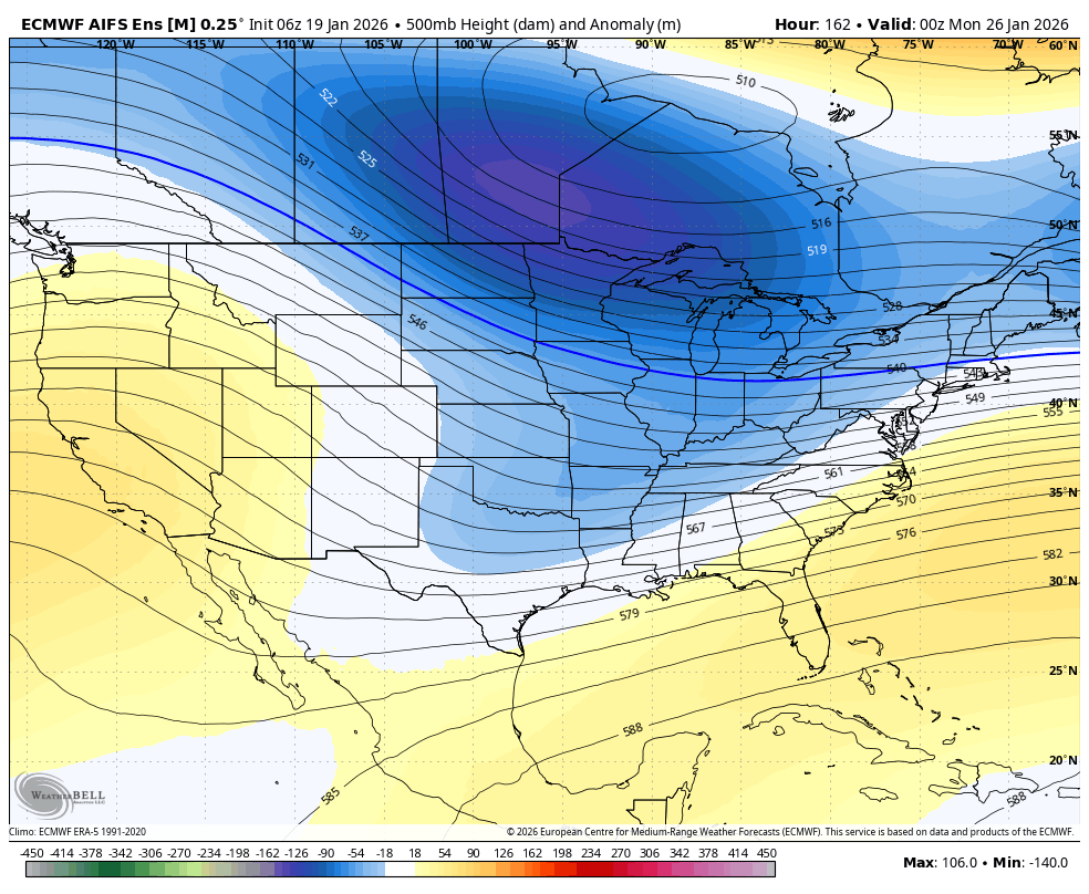
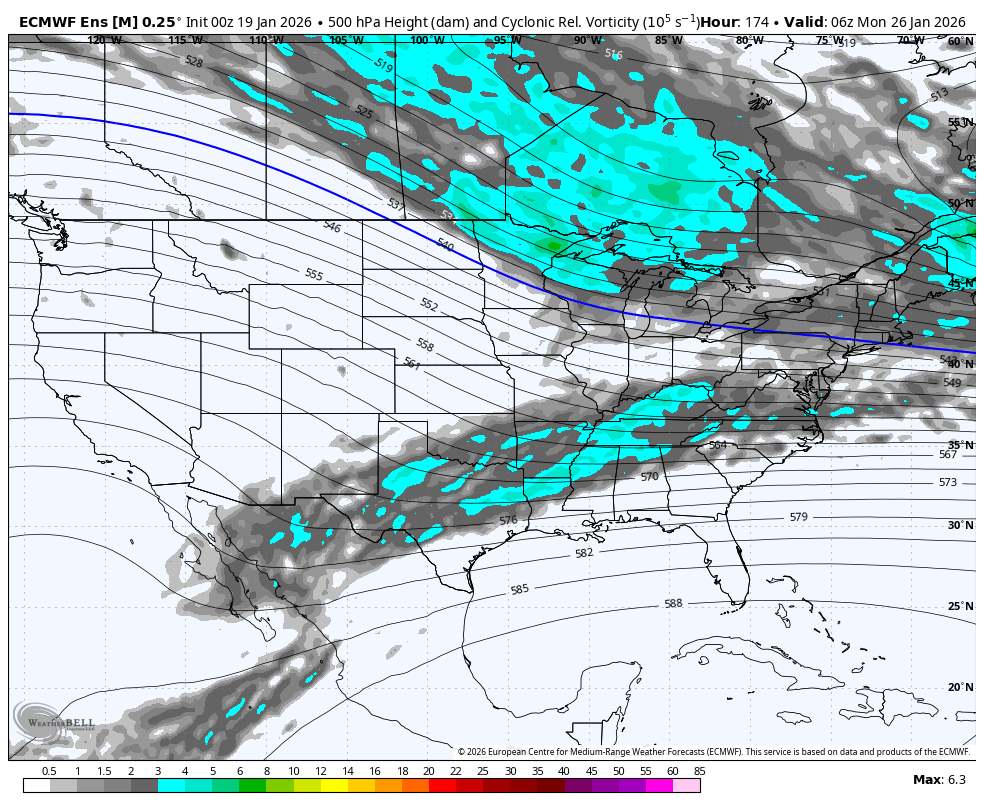
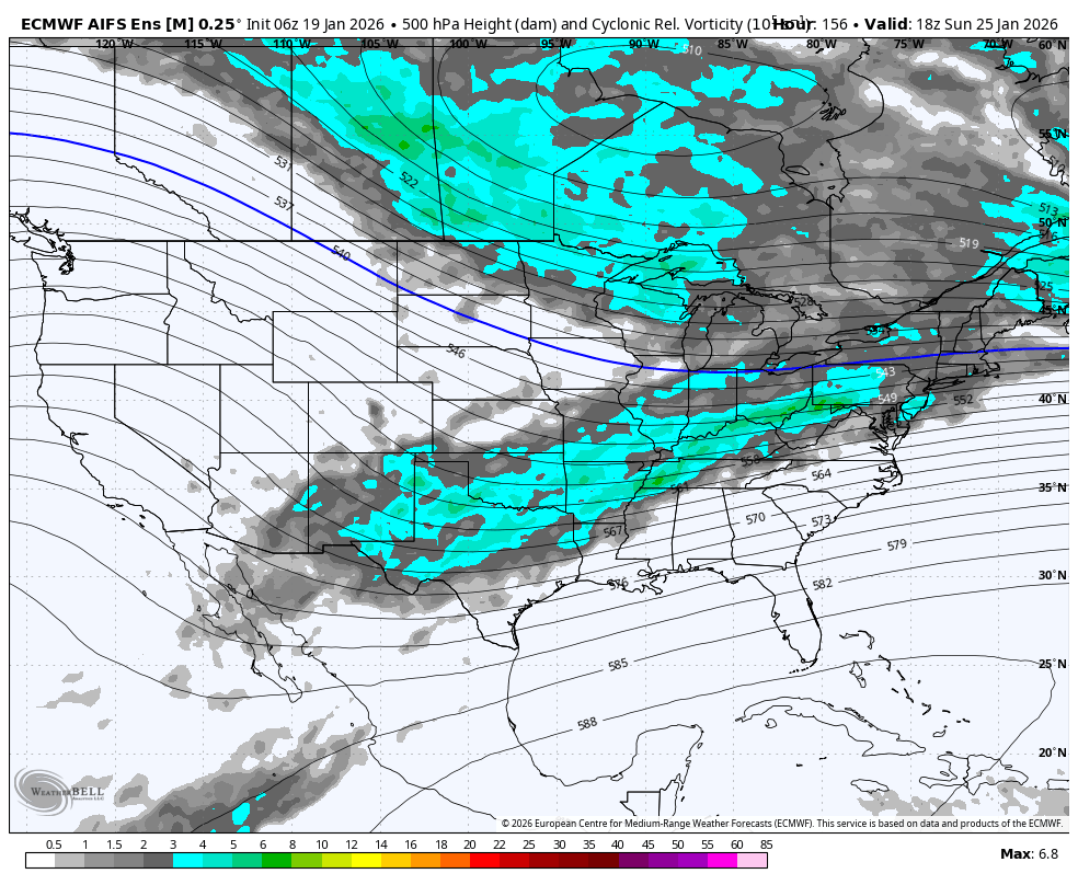
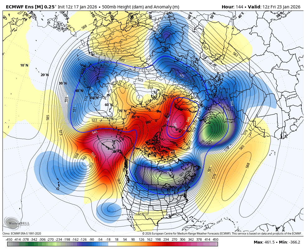
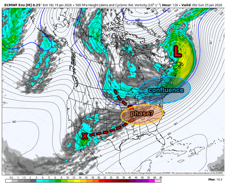
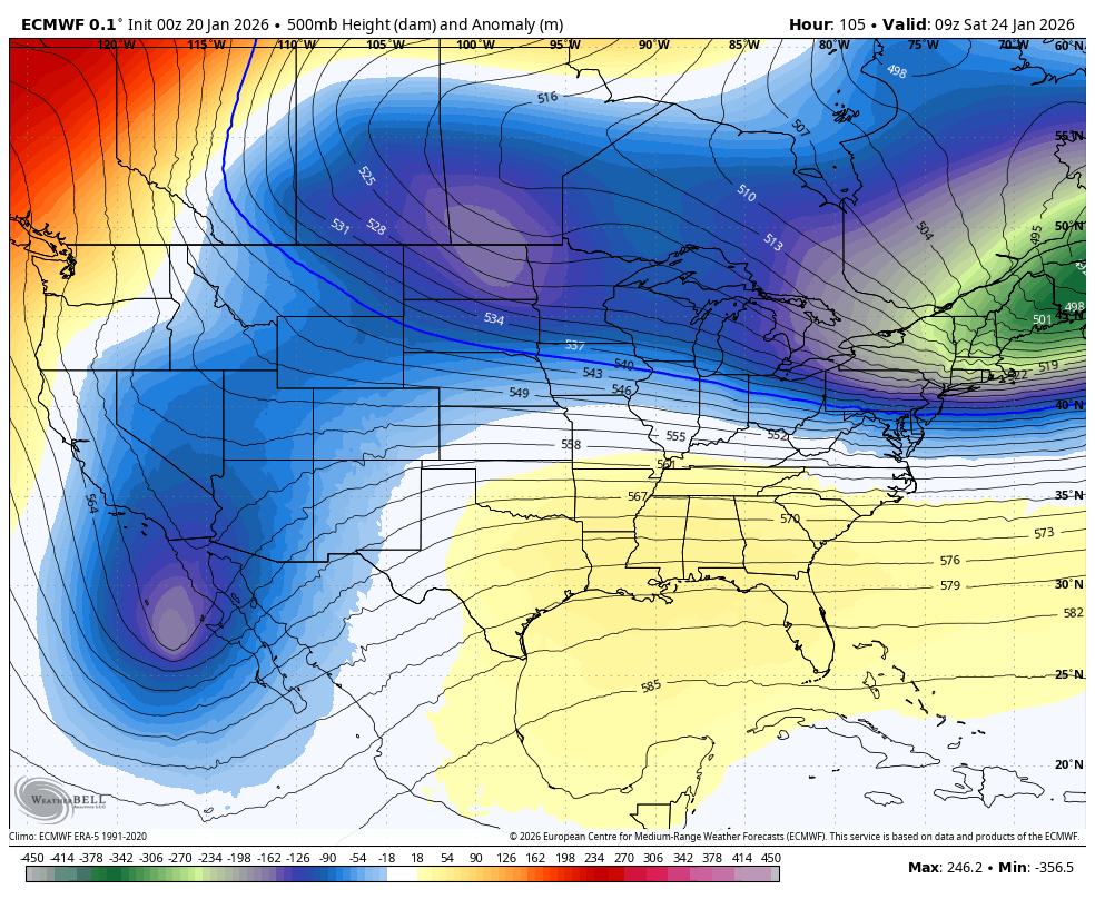
the TPV changing its orientation over the last day is big for us. went from centered over Nova Scotia to centered over the Plains. heights downstream have adjusted considerably higher as a result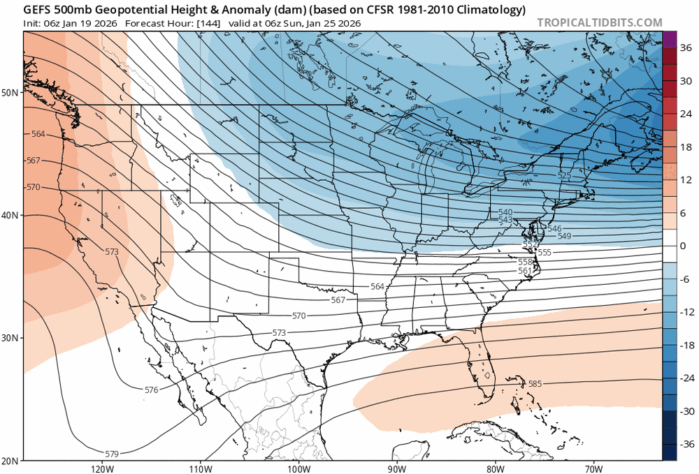
-
January 2026 regional war/obs/disco thread
brooklynwx99 replied to Baroclinic Zone's topic in New England
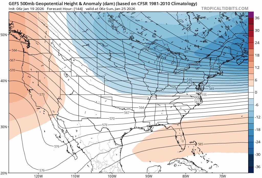
the trend with the TPV splitting in two more is what you want to see - allows for heights in the SE to rise more.thumb.gif.4065a6e63ae13f745b5a674f6b40bf38.gif)
-
Extreme Cold, Snow & Sleet: SECS 1/24 - 1/26
brooklynwx99 replied to TriPol's topic in New York City Metro
the trend with the TPV splitting in two more is what you want to see - allows for heights in the SE to rise more.thumb.gif.b23a3c5d2bb8e456fcd3ffc015eee7be.gif)
-
Extreme Cold, Snow & Sleet: SECS 1/24 - 1/26
brooklynwx99 replied to TriPol's topic in New York City Metro
CMC and GFS both moved towards a more efficient phase, great to see -
lol this does not require an explanation
-
Extreme Cold, Snow & Sleet: SECS 1/24 - 1/26
brooklynwx99 replied to TriPol's topic in New York City Metro
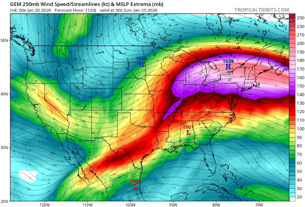
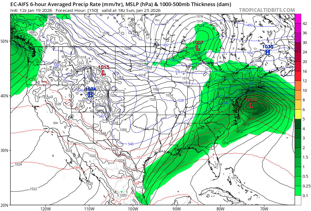
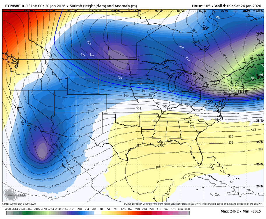
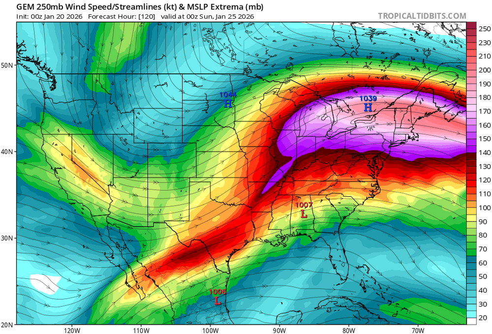
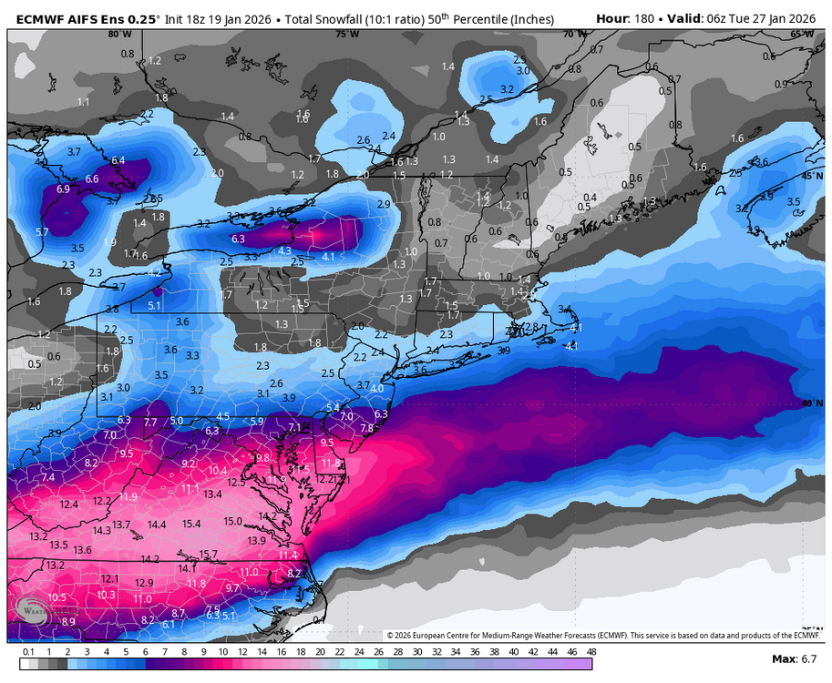
we're getting closer now, and models are beginning to hone in on significant to potentially major snowfall across the mid-Atlantic. we have seen the AI models lead the way with the CMC, GFS, and ECMWF becoming a bit more aggressive. the AIFS and AIGFS have pared back a bit, but they were quite amped to start regardless, the pattern is favorable for someone to see MECS impacts... we have a very favorable synoptic setup for the MA with strong confluence due to an anomalous 50/50 ULL, a southern stream vort, deep Arctic air in place, and even a potential interaction with the northern stream. right now, the RIC to DC corridor is most favored to see 6"+, but that is certainly possible even into NYC given high ratios and the propensity for these systems to inch north towards game time. it will be important to see if, and where this stream interaction occurs, as it could have drastic impacts on how far north precip eventually gets good luck, and happy tracking! we will have more in the tank after this regardless

-
we're getting closer now, and models are beginning to hone in on significant to potentially major snowfall across the mid-Atlantic. we have seen the AI models lead the way with the CMC, GFS, and ECMWF becoming a bit more aggressive. the AIFS and AIGFS have pared back a bit, but they were quite amped to start regardless, the pattern is favorable for someone to see MECS impacts... we have a very favorable synoptic setup for the MA with strong confluence due to an anomalous 50/50 ULL, a southern stream vort, deep Arctic air in place, and even a potential interaction with the northern stream. right now, the RIC to DC corridor is most favored to see 6"+, but that is certainly possible even into NYC given high ratios and the propensity for these systems to inch north towards game time. it will be important to see if, and where this stream interaction occurs, as it could have drastic impacts on how far north precip eventually gets good luck, and happy tracking! we will have more in the tank after this regardless
-
January 2026 regional war/obs/disco thread
brooklynwx99 replied to Baroclinic Zone's topic in New England
yeah, I feel like there would have been a secondary developing. jet is at least better aloft -
January 2026 regional war/obs/disco thread
brooklynwx99 replied to Baroclinic Zone's topic in New England
AIFS-EPS likes that idea
-
EPS has more phasing

-
January 2026 regional war/obs/disco thread
brooklynwx99 replied to Baroclinic Zone's topic in New England
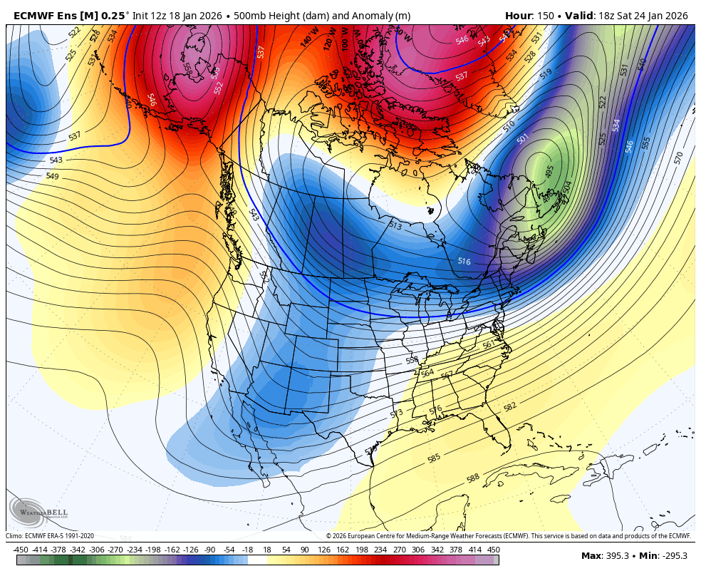
i mean, you have overrunning and then a rotting, highly anomalous block with +PNA due to tropical forcing -
January 2026 regional war/obs/disco thread
brooklynwx99 replied to Baroclinic Zone's topic in New England
AIFS might be the most ridiculous shit i have ever seen


-
i'd be getting excited down here. this has all the hallmarks of a mid-Atlantic MECS (up by me is less certain for sure)... ample moisture, strong 250mb jet, some phasing potential, antecedent Arctic air, and confluence in place
-
i'd be excited if I was in the metro... northern fringes can do well with banding and these systems love to tick north up to game time. we'll have to monitor confluence and the phasing potential, but this could be formidable. and that's not even mentioning the 28-29th

-
January 2026 regional war/obs/disco thread
brooklynwx99 replied to Baroclinic Zone's topic in New England
this might do it for you then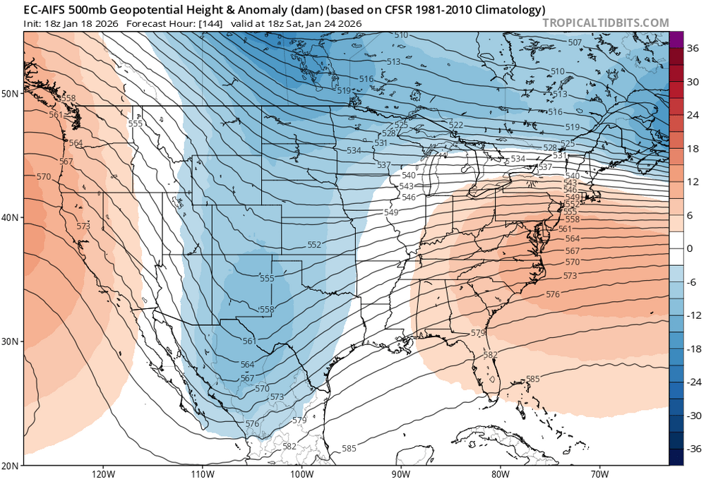
-
January 2026 regional war/obs/disco thread
brooklynwx99 replied to Baroclinic Zone's topic in New England
this can def work. legit overrunning chance, anyone from DC to BOS should be watching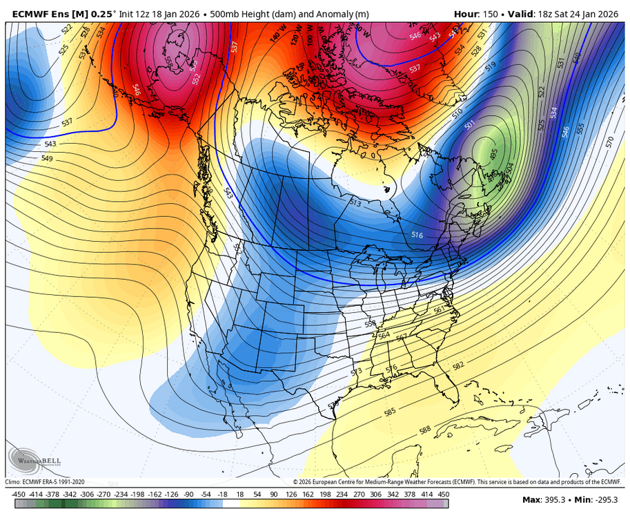
-
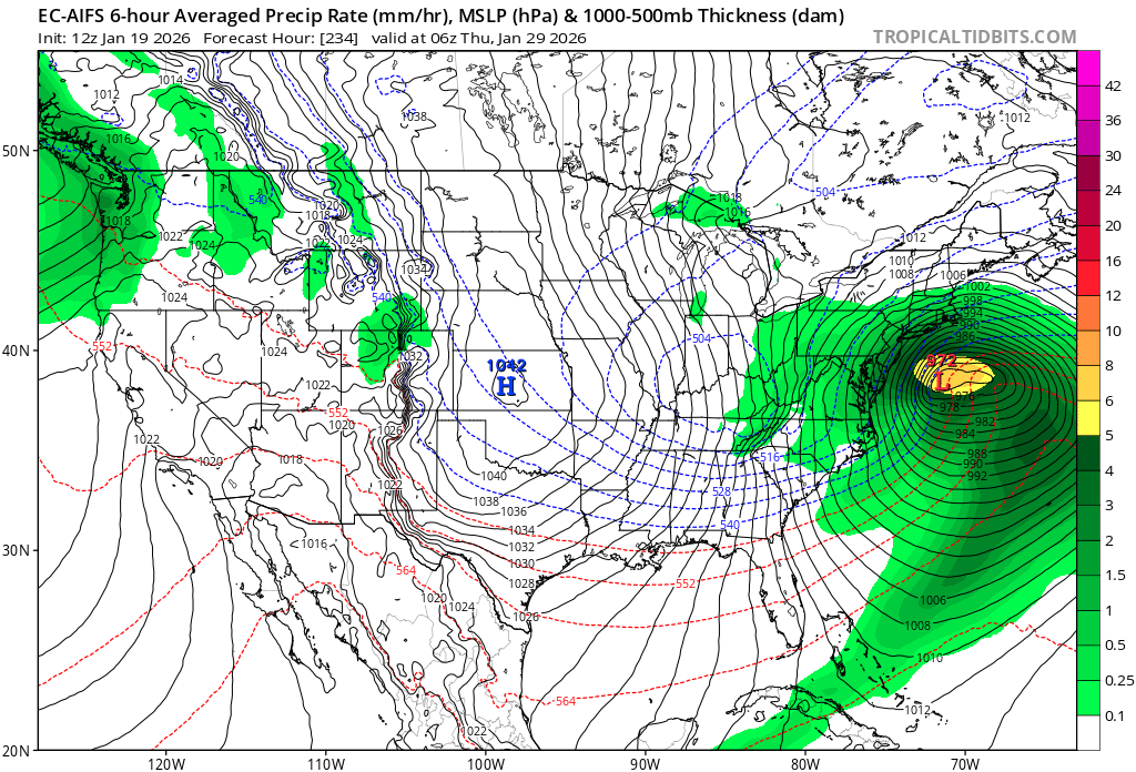
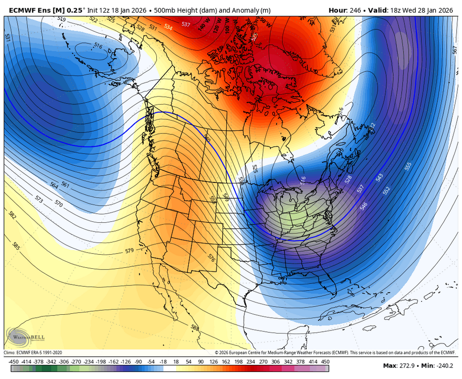
this is probably the best shot at repeating a Feb 2021 type stretch (sure, ended up not awesome for the MA, but you’d run it back) in quite some time. hopefully we can cash in… we have high end overrunning potential around the 25th and then a more prototypical big coastal chance as the -NAO decays and the PNA rises


-
this is probably the best shot at repeating a Feb 2021 type stretch in quite some time. hopefully we can cash in… we have high end overrunning potential around the 25th and then a more prototypical big coastal chance as the -NAO decays and the PNA rises

-
January 2026 regional war/obs/disco thread
brooklynwx99 replied to Baroclinic Zone's topic in New England
another animation, I know, but this is how you get a MECS. retrograding Scandi block, 50/50 ULL, PNA rising nothing is guaranteed, but this is how you pull it off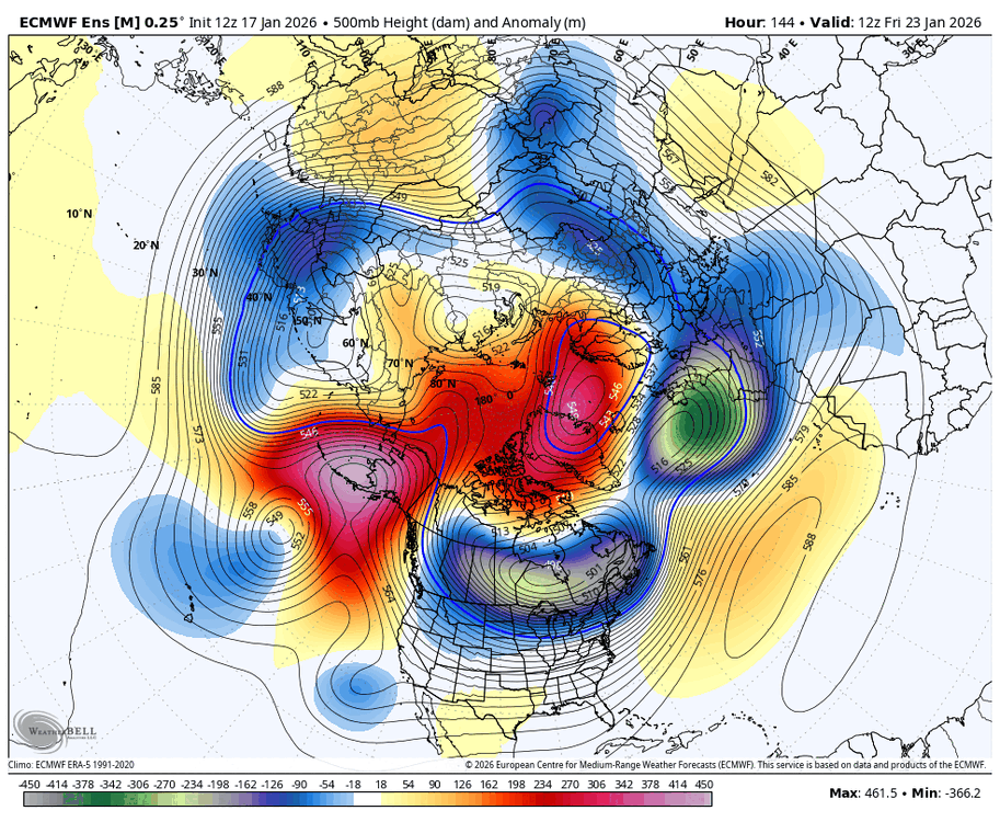
-
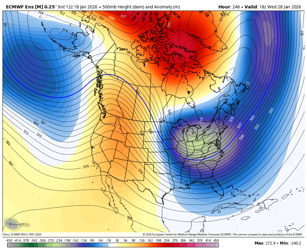
it probably moderates for a week as the Pacific jet overextends but you'd probably get another window as it retracts
-
obviously nothing is guaranteed, but that is what you want to see if you are big game hunting


.gif.7d3c18b2671b71caf2e5e52a09c5d826.gif)
.gif.45c8448368d2a75d230b20ead12a1a95.gif)