

brooklynwx99
-
Posts
6,101 -
Joined
-
Last visited
Content Type
Profiles
Blogs
Forums
American Weather
Media Demo
Store
Gallery
Everything posted by brooklynwx99
-

January 2026 regional war/obs/disco thread
brooklynwx99 replied to Baroclinic Zone's topic in New England
always has to be something -
January 2026 regional war/obs/disco thread
brooklynwx99 replied to Baroclinic Zone's topic in New England
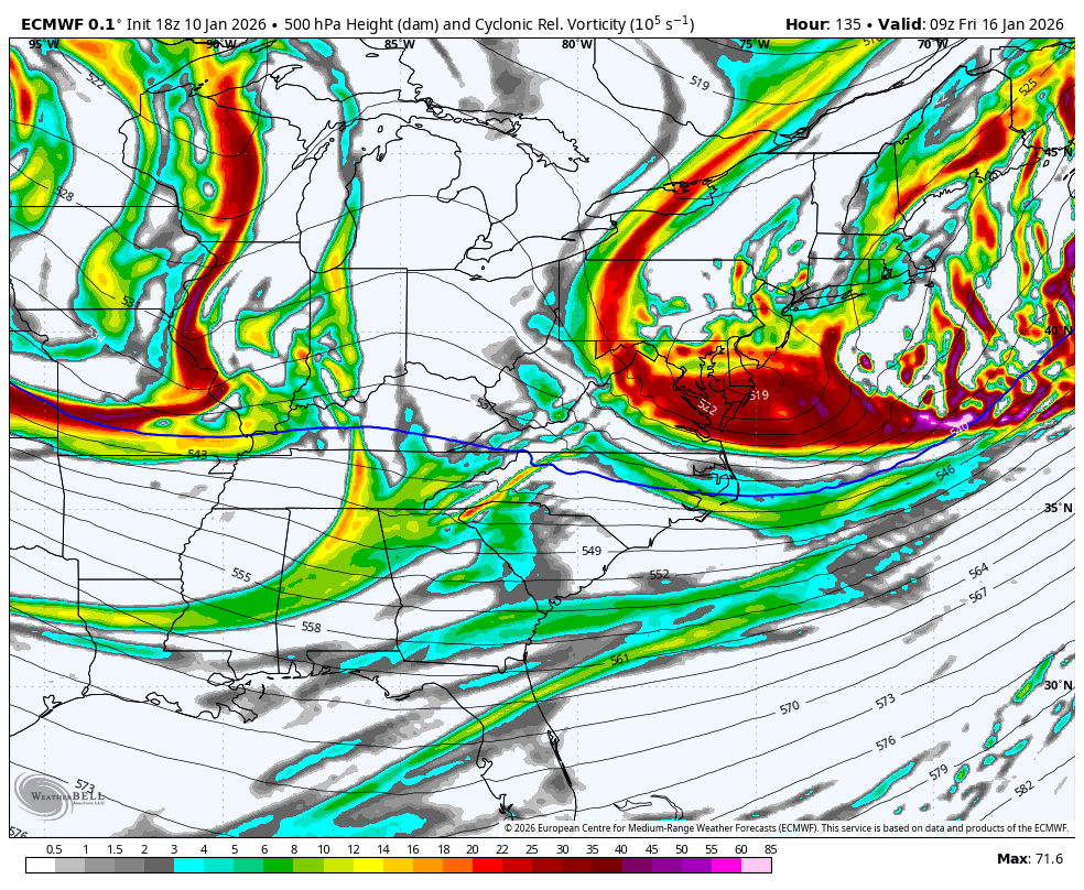
usually when you have a vort of that intensity at that latitude it’s a nuke. truly incredible -
January 2026 regional war/obs/disco thread
brooklynwx99 replied to Baroclinic Zone's topic in New England
PVA axis is more N-S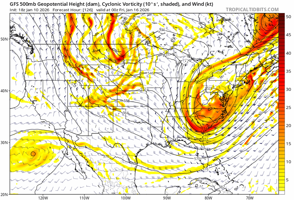
-
January 2026 regional war/obs/disco thread
brooklynwx99 replied to Baroclinic Zone's topic in New England
it’s gonna do it again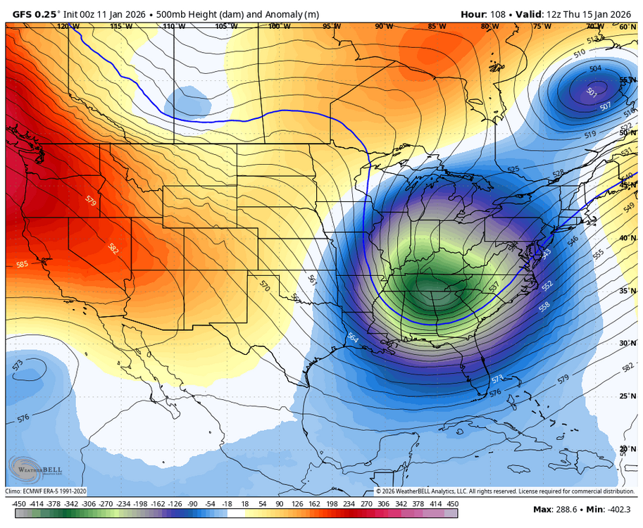
-
January 2026 regional war/obs/disco thread
brooklynwx99 replied to Baroclinic Zone's topic in New England
i mean, tick it more amped and you curl the PVA back west. it’s close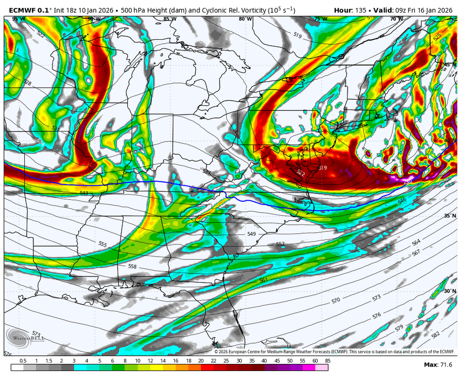
-
January 2026 regional war/obs/disco thread
brooklynwx99 replied to Baroclinic Zone's topic in New England
it really unreal how this isn’t a MECS at first glance. that vort is insane
-
January 2026 regional war/obs/disco thread
brooklynwx99 replied to Baroclinic Zone's topic in New England
yeah, stronger and more neg tilted -
January 2026 regional war/obs/disco thread
brooklynwx99 replied to Baroclinic Zone's topic in New England
yeah, not as exotic as 12z but still a bomb -
January 2026 regional war/obs/disco thread
brooklynwx99 replied to Baroclinic Zone's topic in New England
absolutely, allows that NS piece over the Lakes to come in at a good angle... that's why the GFS is as amped as it is -
January 2026 regional war/obs/disco thread
brooklynwx99 replied to Baroclinic Zone's topic in New England
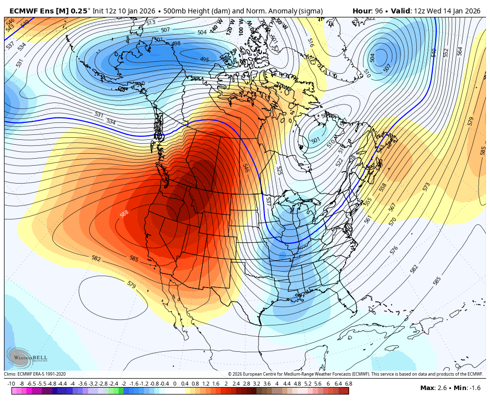
the +PNA ridge in and of itself argues for a coastal... that's 2.5 sigma over ID, nearly ideal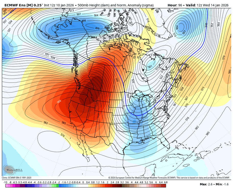
-
January 2026 regional war/obs/disco thread
brooklynwx99 replied to Baroclinic Zone's topic in New England
this is really as large of an amped shift as you'll see on the EPS at this range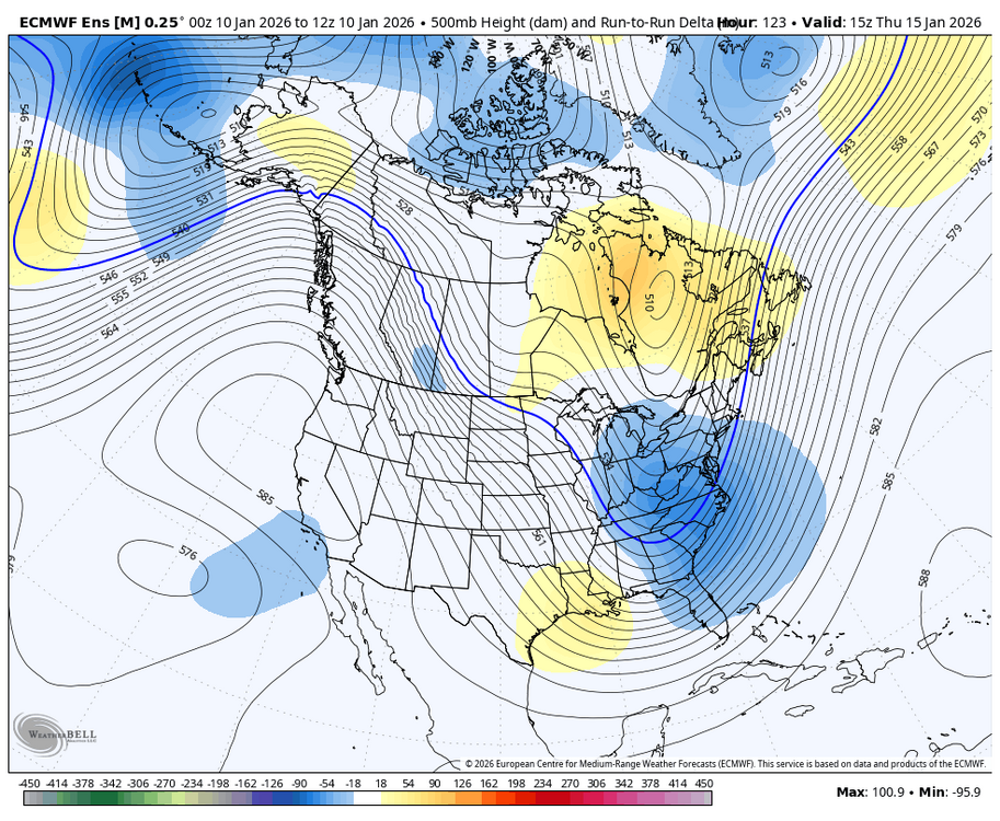
-
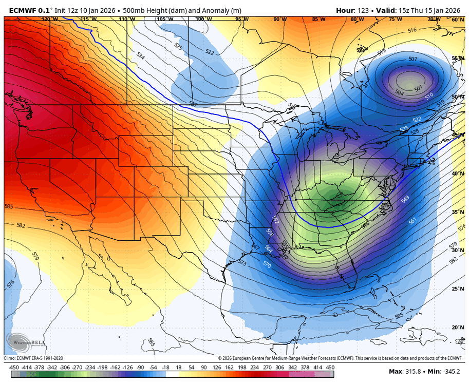
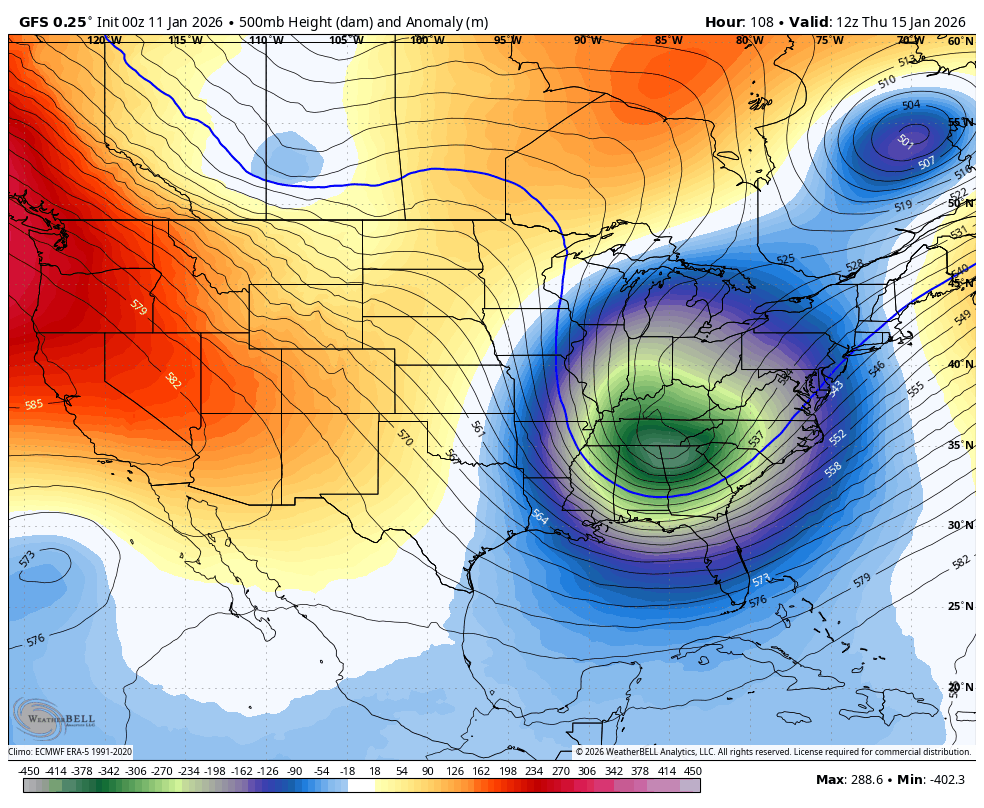
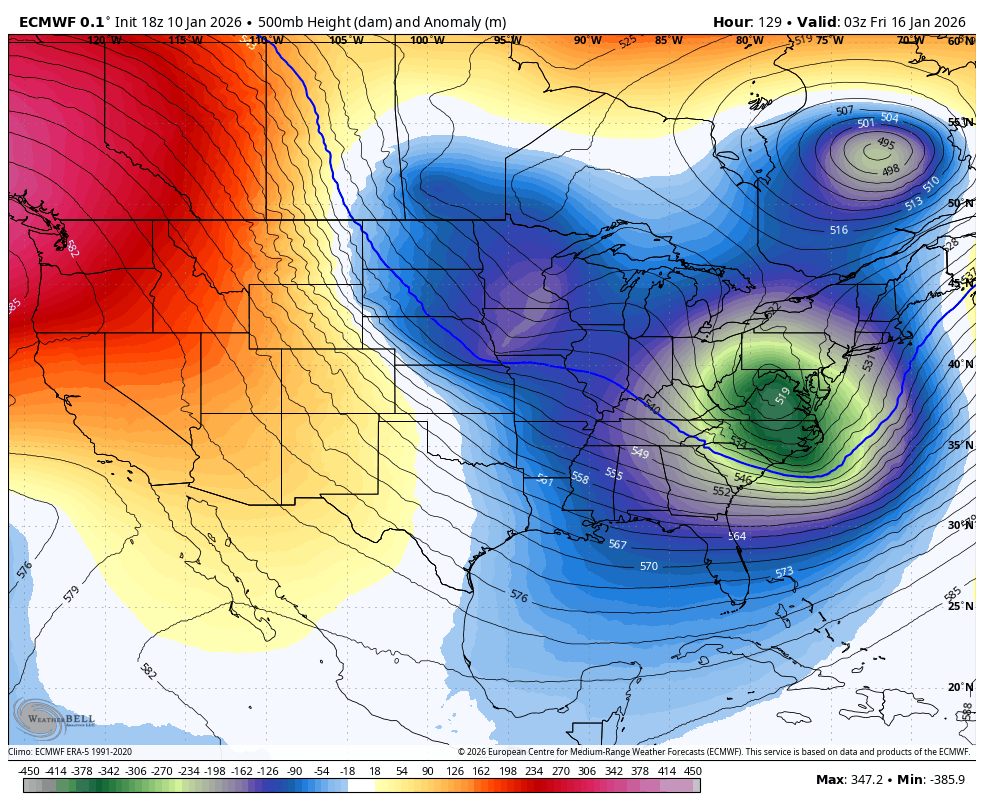
the main differences between the GFS and the ECMWF are that the kicker on the ECMWF is more defined, hurting amplification, and the TPV is also closer to the trough. we'll see how those features trend overall, though, they are actually pretty similar from a synoptic standpoint now

-
the main differences between the GFS and the ECMWF are that the kicker on the ECMWF is more defined, hurting amplification, and the TPV is also closer to the trough. we'll see how those features trend overall, though, they are actually pretty similar from a synoptic standpoint now
-
January 2026 regional war/obs/disco thread
brooklynwx99 replied to Baroclinic Zone's topic in New England
could have been better, but yeah, hard to ask for a better shift -
stop doing what? that is a significant move towards a more amplified solution... definitely much more than I thought was going to happen
-
January 2026 regional war/obs/disco thread
brooklynwx99 replied to Baroclinic Zone's topic in New England
bit of a shift here if you ask me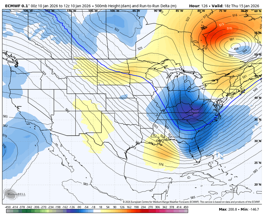
-
holy shit. let's go
.thumb.png.f2eb0e76302a545c71b8aae0341c182c.png)
-
January 2026 regional war/obs/disco thread
brooklynwx99 replied to Baroclinic Zone's topic in New England
wait until you see the euro -
January 2026 regional war/obs/disco thread
brooklynwx99 replied to Baroclinic Zone's topic in New England
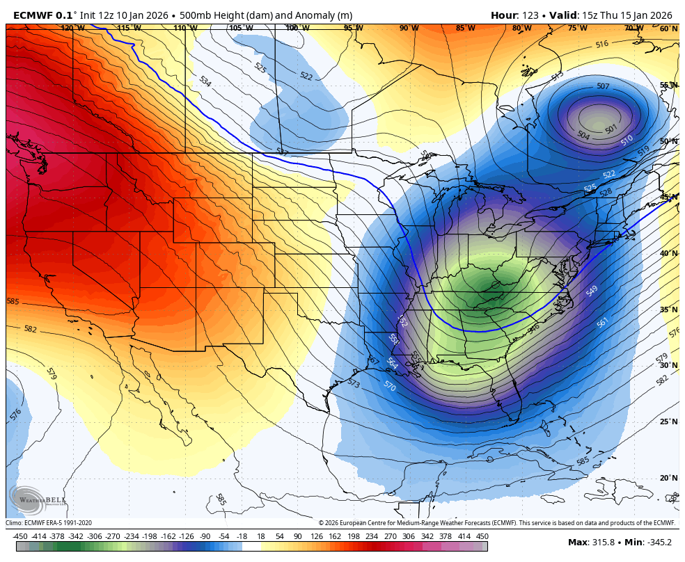
euro is notably more amped with the whole trough. holy shit.thumb.png.54db090721df00a6eb587adf849e1f18.png)
-
January 2026 regional war/obs/disco thread
brooklynwx99 replied to Baroclinic Zone's topic in New England
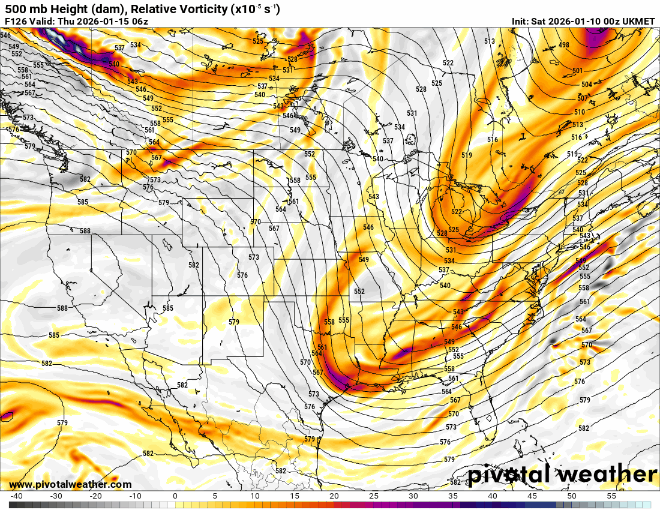
AIFS is pretty similar, no significant changes -
it's notably more amped though
-
I would have to think that the GFS is cracked out, but it was able to actually revert back to a 00z-like solution. combine that with the trends on the AIFS and the GEFS becoming way more amped and I'm a bit intrigued. I would like to see any other guidance entertain it... AIFS/ICON are close and UKMET made a big amped move. certainly possible, but temper enthusiasm for now
-
January 2026 regional war/obs/disco thread
brooklynwx99 replied to Baroclinic Zone's topic in New England
i agree with you there. it's possible, but needs more support


.png.420ab7b67d1ca3fe6554f4419ea44658.png)

.png.3b00ad795358a9c81492e23c3cf8a959.png)