brooklynwx99
-
Posts
6,237 -
Joined
-
Last visited
Content Type
Profiles
Blogs
Forums
American Weather
Media Demo
Store
Gallery
Everything posted by brooklynwx99
-
i think the 5th isn't much but the 8th could definitely be a solid front end thump to rain. and that's before any blocking gets going, which is looking more and more likely
-
that tweet on the last page has the NMME from Jan 8th. like are you serious lmao what use does that have right now
-
ENS and OP runs have a lot of chances with the boundary nearby and lots of moisture, even before the Scandi ridge tries to retrograde. could be looking at a pretty active period
-
ENS and OP runs have a lot of chances with the boundary nearby and lots of moisture, even before the Scandi ridge tries to retrograde. could be looking at a pretty active period
-
just a flurry of opportunities on the GFS and CMC today. active with cold nearby is a good combo
-
also, not sure what utility extended guidance like the CanSIPS has when we’re already in February. bordering on useless and that tweet was just engagement bait to piss off people that like snow. i’m sure it worked
-
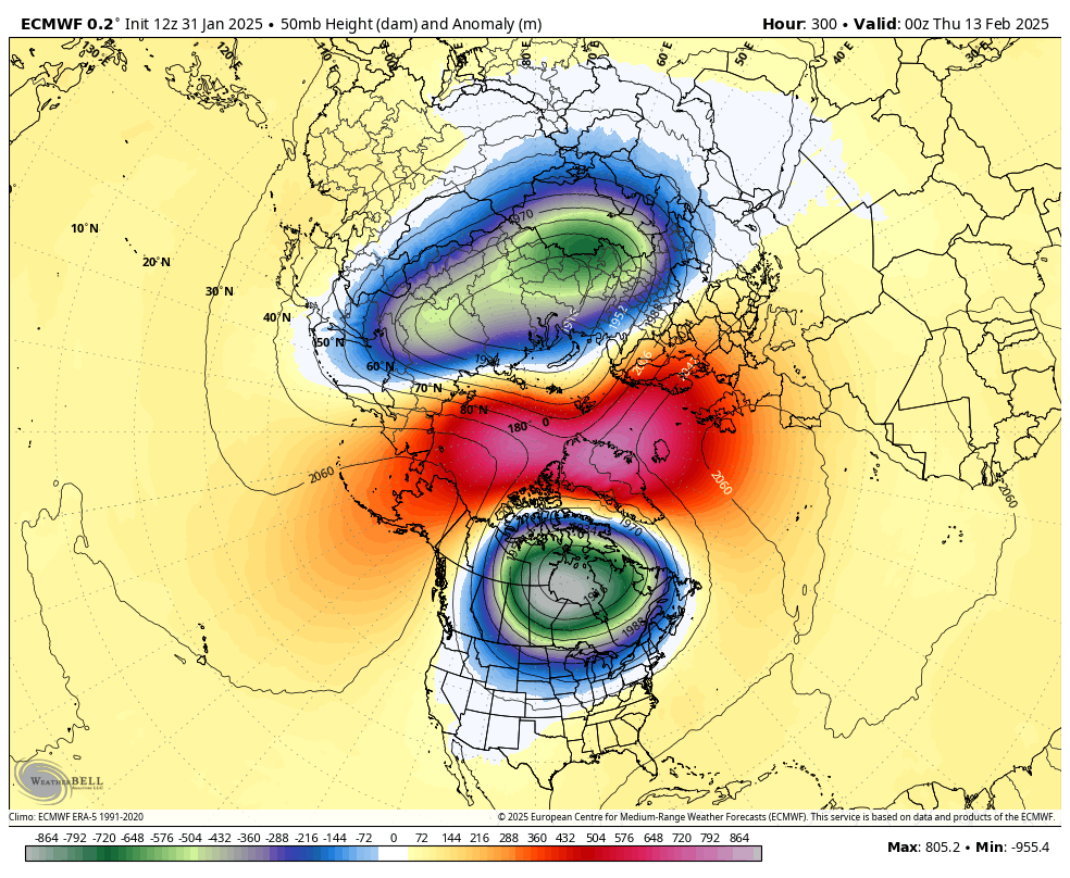
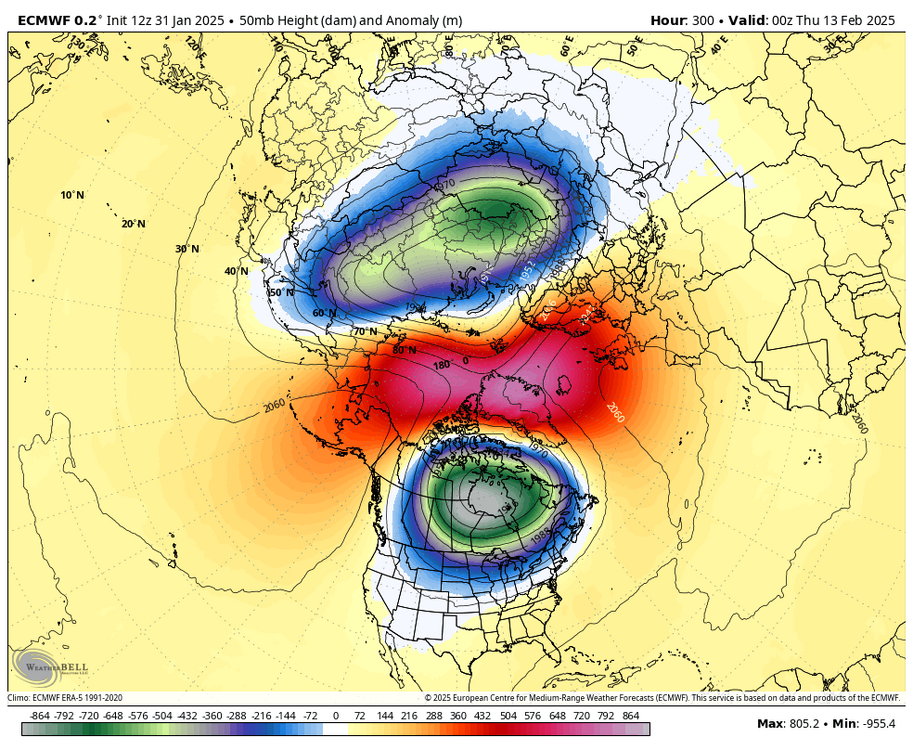
i mean, you’re correct, there’s likely going to be a significant disruption at 50mb that would bolster any blocking from the retrograding Scandi ridge
-
-PNA helping to lead to wave breaking in the N ATL and retrograde the Scandi ridge is a pretty classic progression. along with the 50mb shenanigans it gives me pretty good confidence in a blocking episode
-
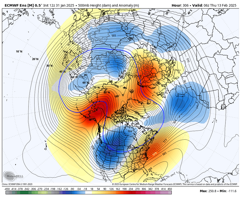
the -PNA, Scandinavian ridging, and N Atl trough all point to -NAO development. also take into account the 50mb vortex getting blown up and the MJO moving through the MC and a retrograding block is a legit possibility
-
i’m liking the -NAO showing up around mid month. looks like a lot of pieces are there for a retrograding block
-
also, ensembles are all pretty snowy up by you guys. lots of angst for the best snow means all year
-
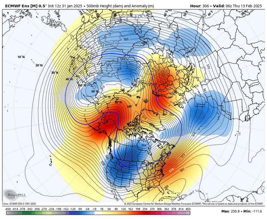
EPS is setting up for a pretty legit -NAO mid month. -PNA, retrograding Scandi ridge, and low N Atl heights
-
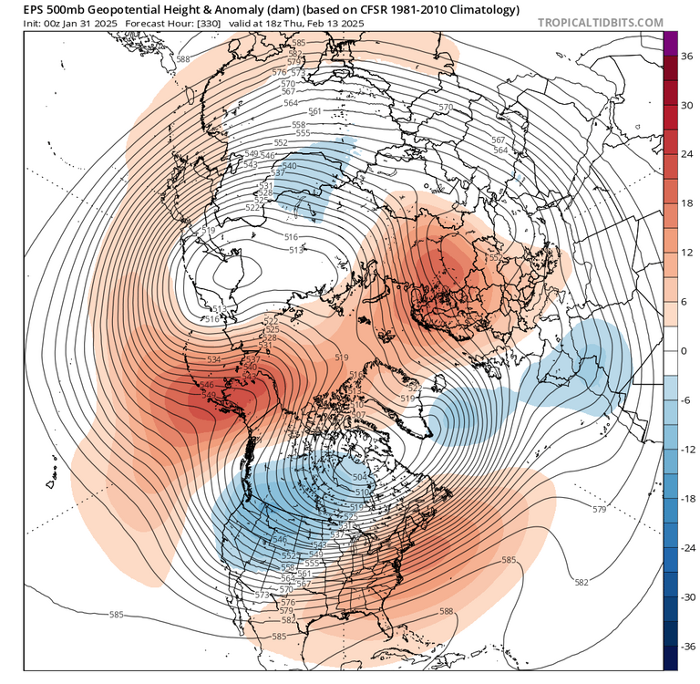
a weakening 50mb vortex (which there is good support for), Scandinavian ridging, and a -PNA are also solid precursors for -NAO later on. that’s about all i’ve seen from others on social media
-
lol who are you following on twitter? i haven’t seen anybody “locking in” an exact repeat of March 2018. a 14 year old posting from his parents’ basement doesn’t count
-
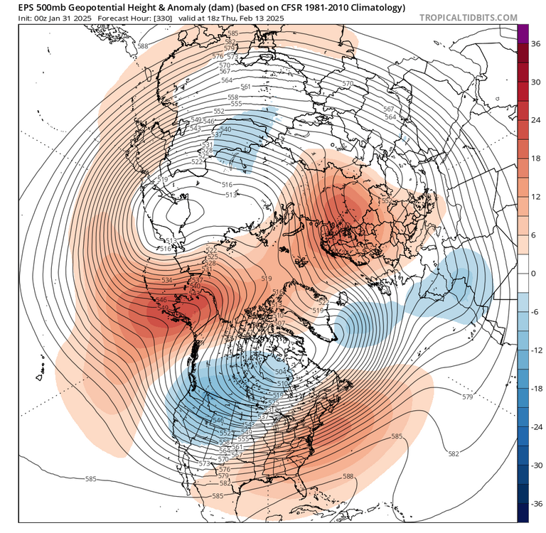
i don’t think anybody has said that on Twitter or wherever else. all i’ve seen is that it increases the -NAO risk, which is true when you have a -PNA and Scandi ridging MJO is also passing through the MC, which also often happens with -NAO episodes
-
honestly, I would sign up for this even down here. the Greenland ridging nosing in is also a nice touch. not even a SE ridge here... more of a weak WAR
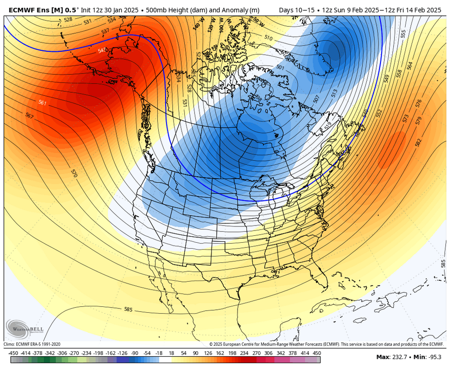
-
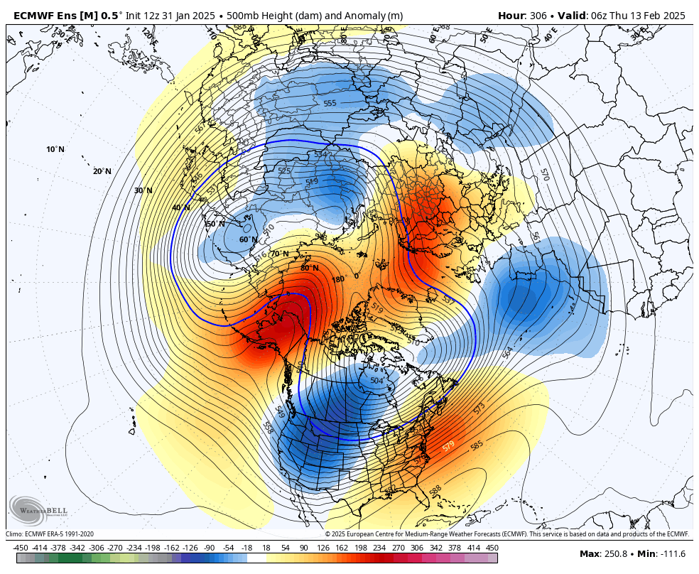
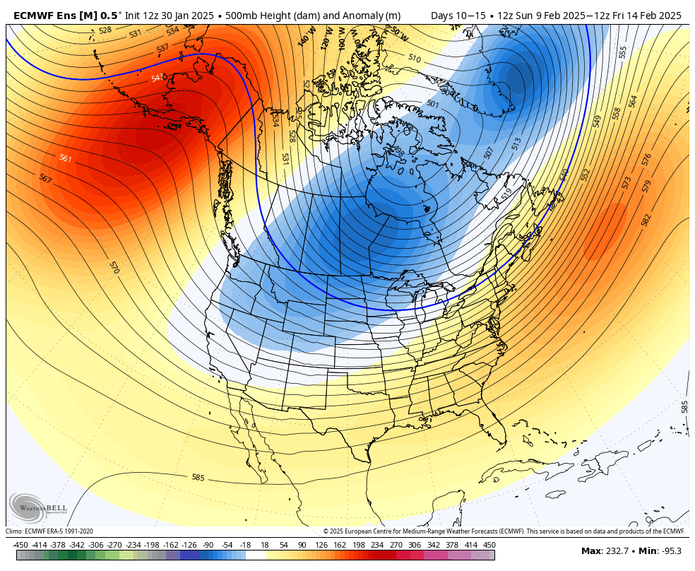
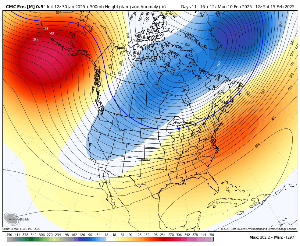
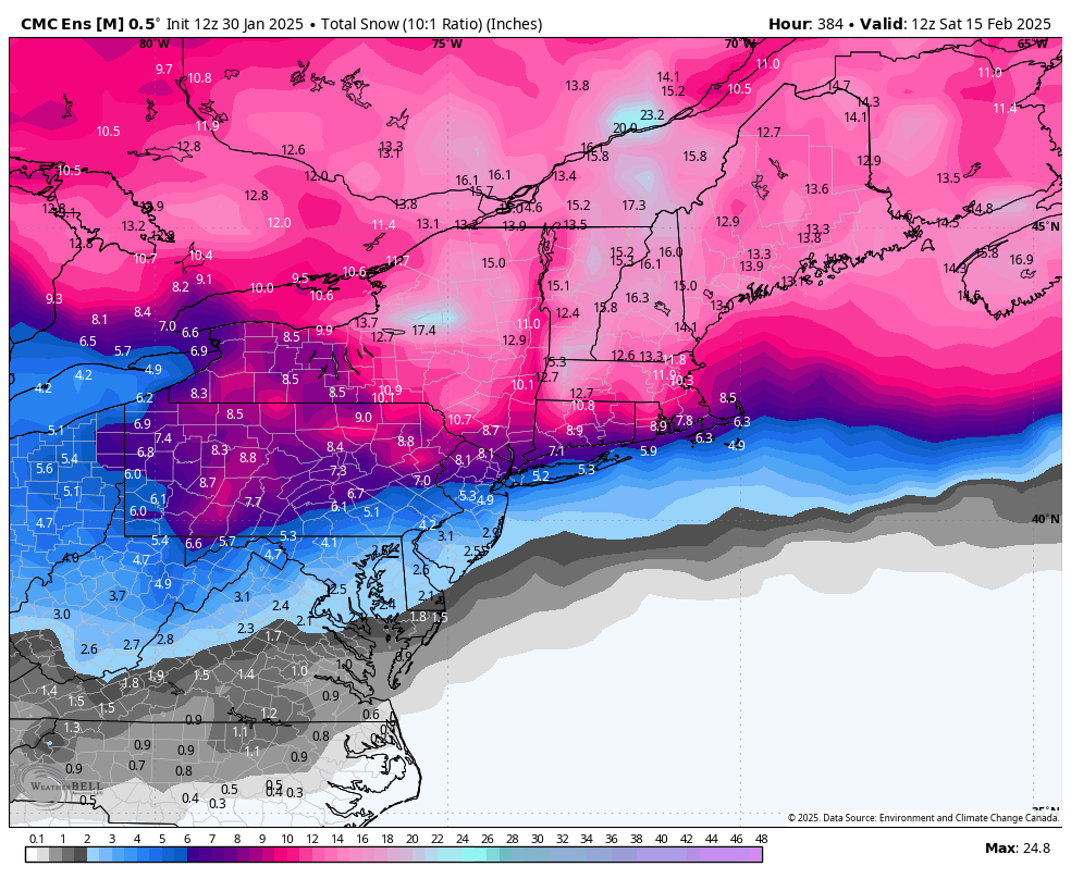
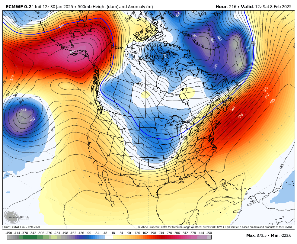
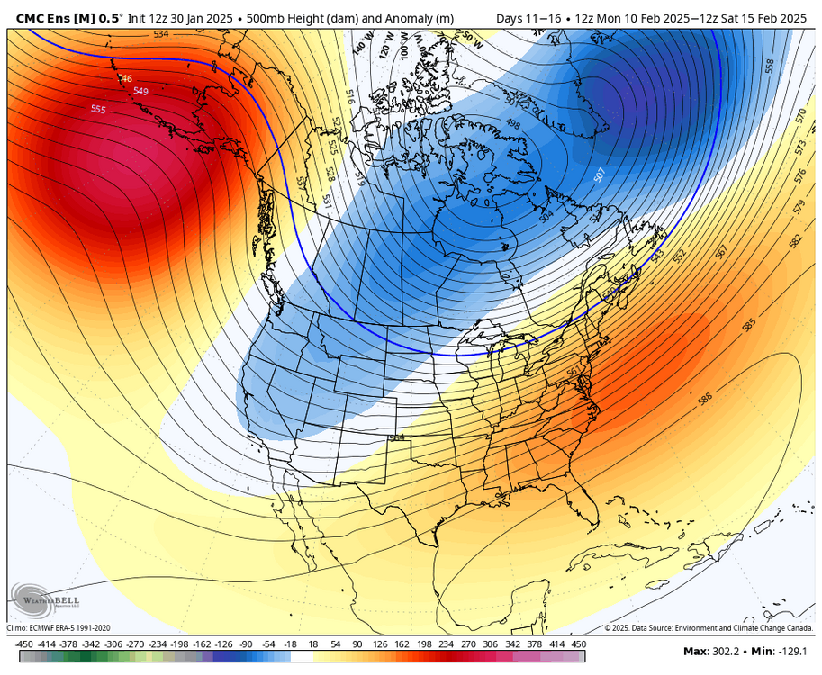
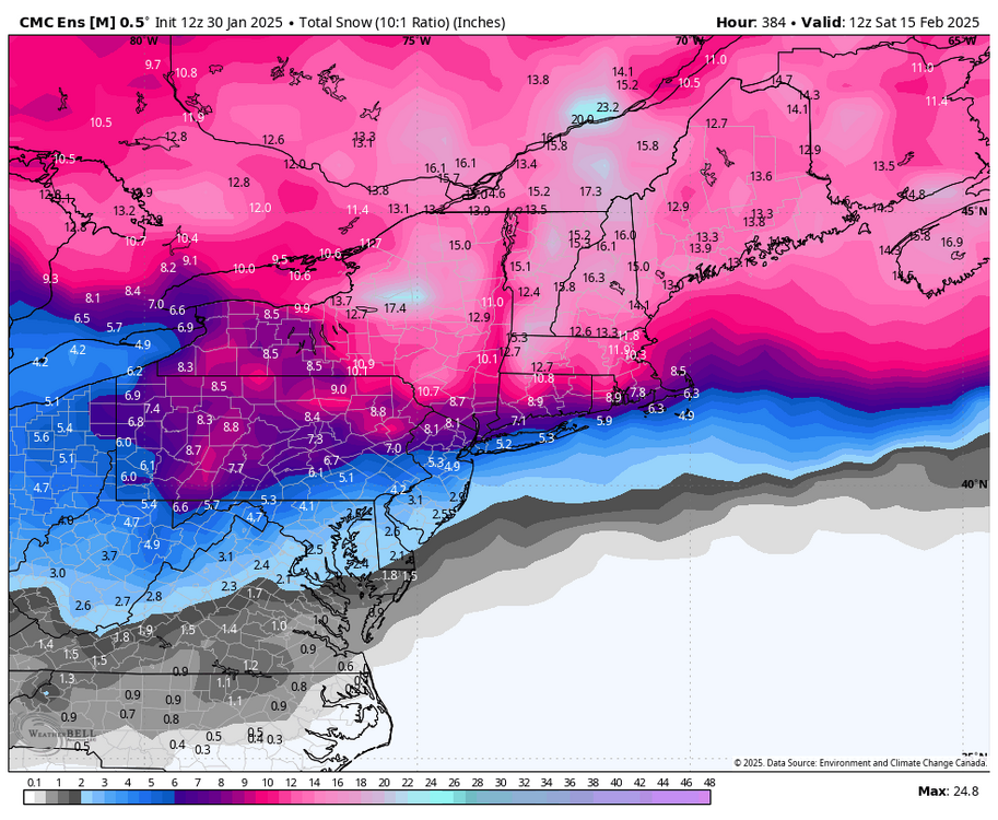
to prove my point further, the GEPS snow mean is pretty robust (as are the other ensembles), and the 500mb pattern looks like this. there's obviously members here that have us on the colder side of the boundary with the -EPO bringing colder HP to the north
-
that is also worth noting when looking at ensembles... a weak SE ridge on the mean with a -EPO doesn't really mean a lack of snow. sure, there are likely some periods of time and some members that are warmer, but it's not the same as a SE ridge with a +EPO. nuance is important. we are likely going to be near a gradient that will present opportunities after the 5th or so. it's going to be changeable and we'll likely have some warm days in there, but that doesn't preclude snow or some mixed systems
-
my point was that just because there's a 500mb ridge overhead it's easy to assume that it's warm, but that isn't always the case when there's HP coming into Canada from a -EPO. but you're being obtuse for whatever reason
-
thanks for completely misunderstanding my point
-
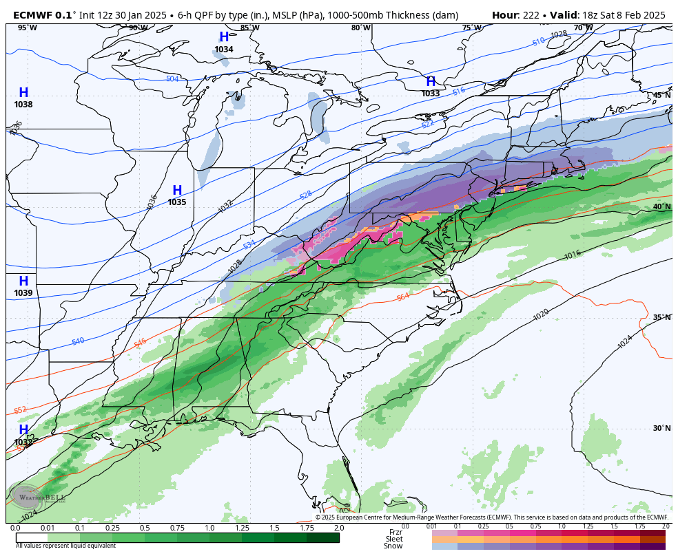
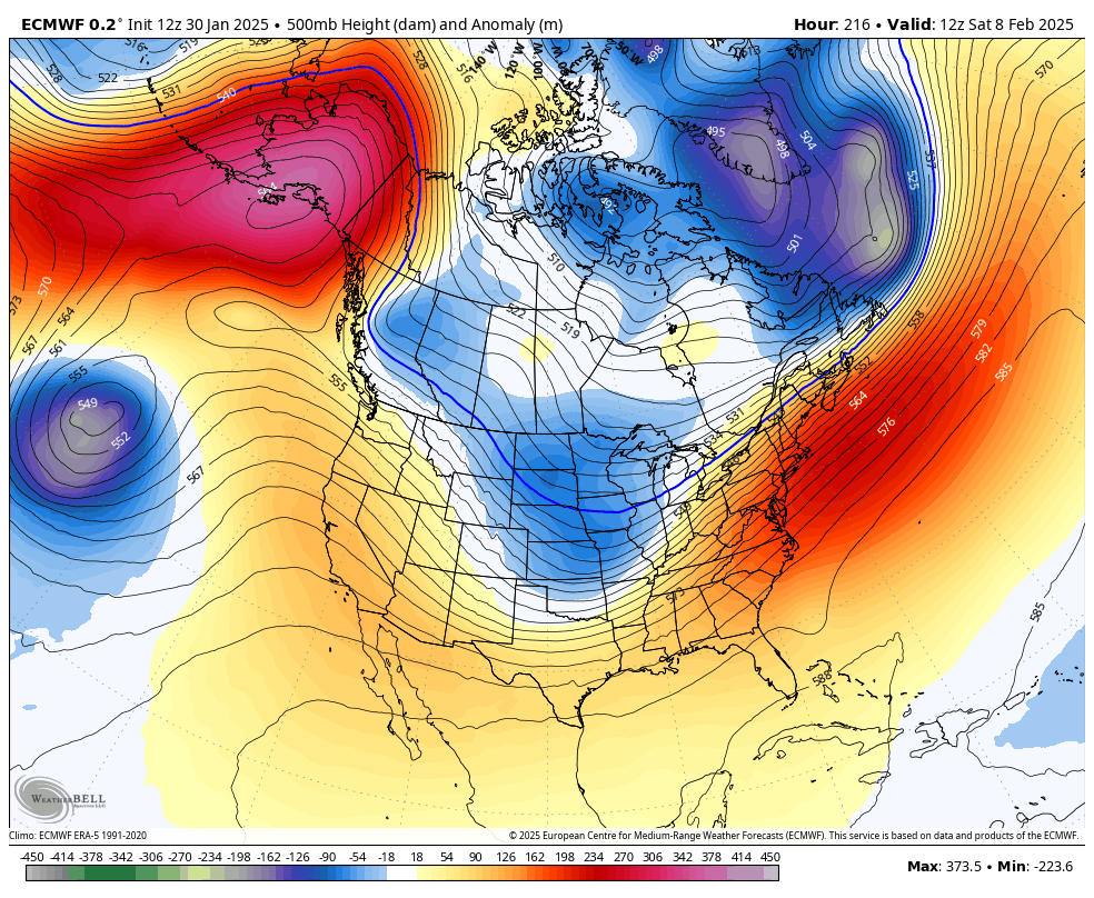
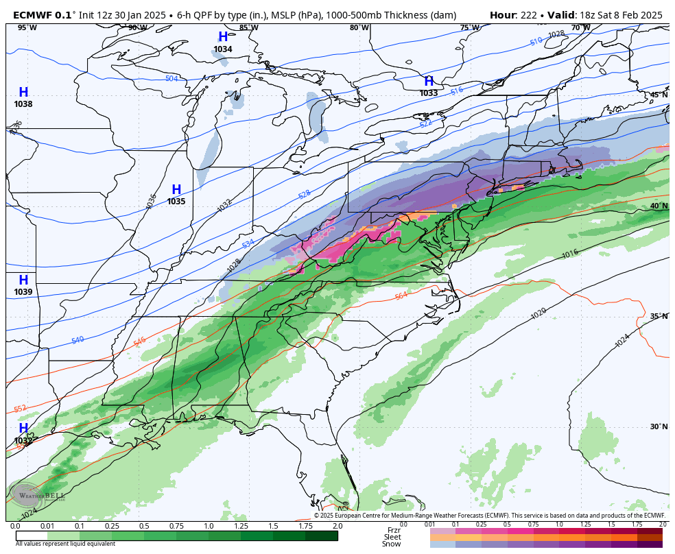
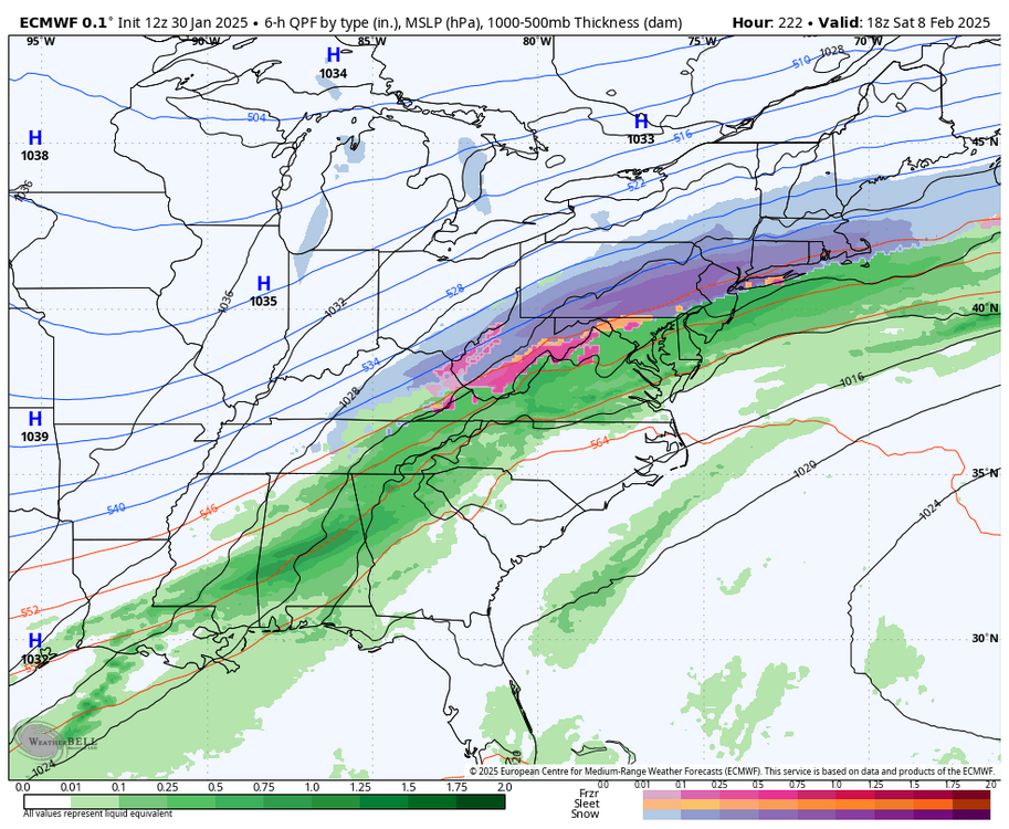
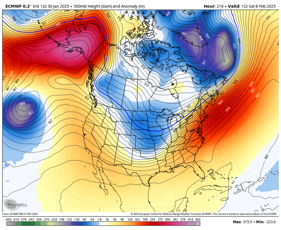
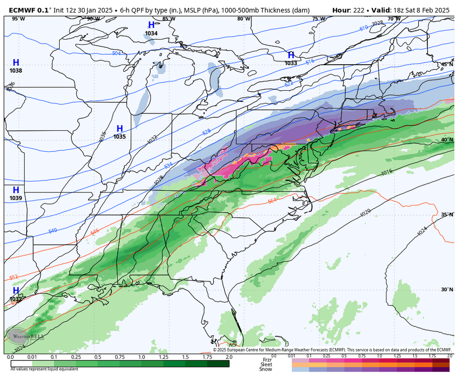
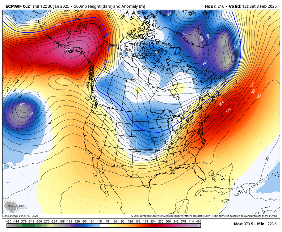
just for the sake of argument, the ECMWF shows why 500mb ridges in the east along with a -EPO don't really portend a lack of wintry weather... the E US is actually under an anomalous 500mb ridge here, but there's enough HP to the north to lock in colder air and lead to a heavy snow event
-
just for the sake of argument, the ECMWF shows why 500mb ridges in the east along with a -EPO don't really portend a lack of wintry weather... the E US is actually under an anomalous 500mb ridge here, but there's enough HP to the north to lock in colder air and lead to a heavy snow event
-
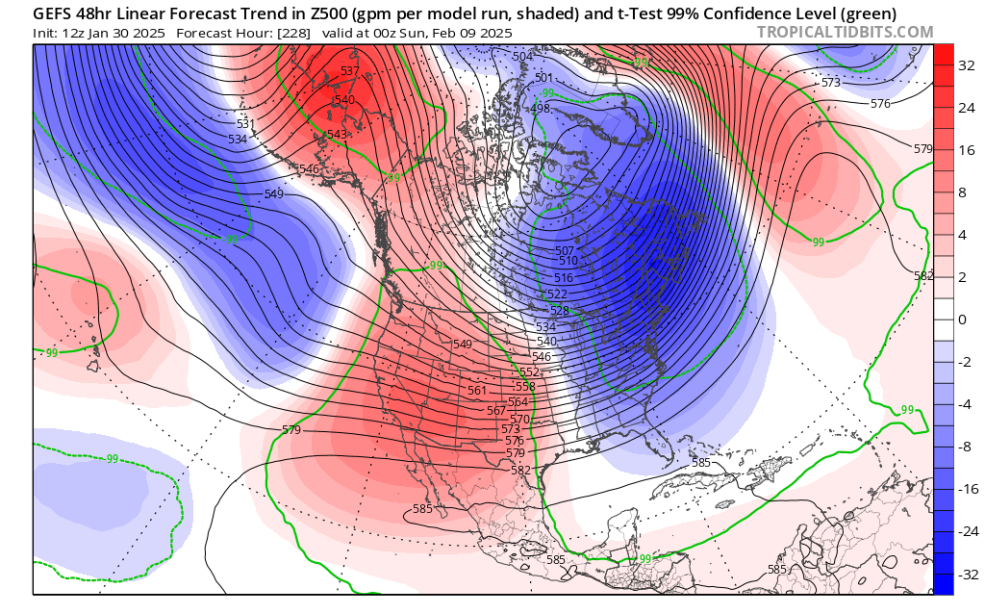
this same exact trend has shown itself like three times already this winter in the D7-10 range with guidance underdoing the strength of the Pacific jet
-
yeah, not torching with the TPV in Canada and a stout -EPO. looks active with cold nearby. might have to eat a cutter to set up another wave, but it's active and i'll roll the dice on it even down here
-
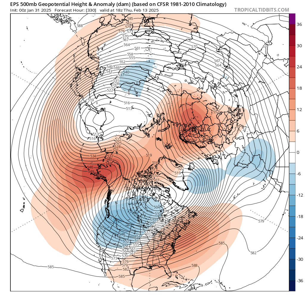
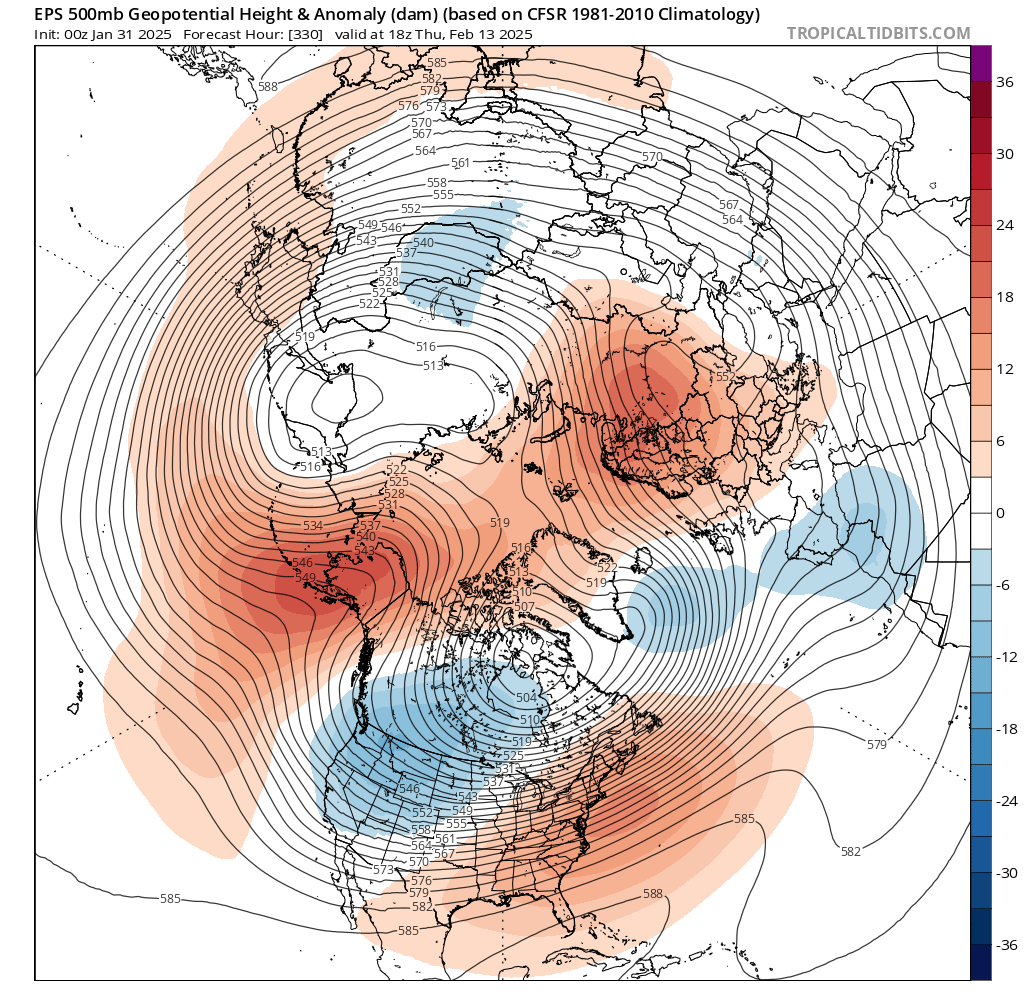
WxBell is 91-20 climo and TT is 81-10 climo, hence the discrepancy