brooklynwx99
-
Posts
6,233 -
Joined
-
Last visited
Content Type
Profiles
Blogs
Forums
American Weather
Media Demo
Store
Gallery
Everything posted by brooklynwx99
-

December 2025 regional war/obs/disco thread
brooklynwx99 replied to Torch Tiger's topic in New England
meanwhile, RGEM is coming in even more amped lmao -
just a classic post-2016 NYC metro subforum exchange about the RGEM lmao
-
December 2025 regional war/obs/disco thread
brooklynwx99 replied to Torch Tiger's topic in New England
gotta love the GFS suite
-
why even bother with snowmaps? use liquid and then apply 10:1 or slightly above / below depending on DGZ and dynamics. this event would produce 12-15:1 pretty easily on the northern end of the precip shield; these events usually do so
-
lol it has 0.4" liquid in NYC. 3-5" is a perfect description
.thumb.png.d89b73188c3a45e216fd5afba8b80678.png)
-
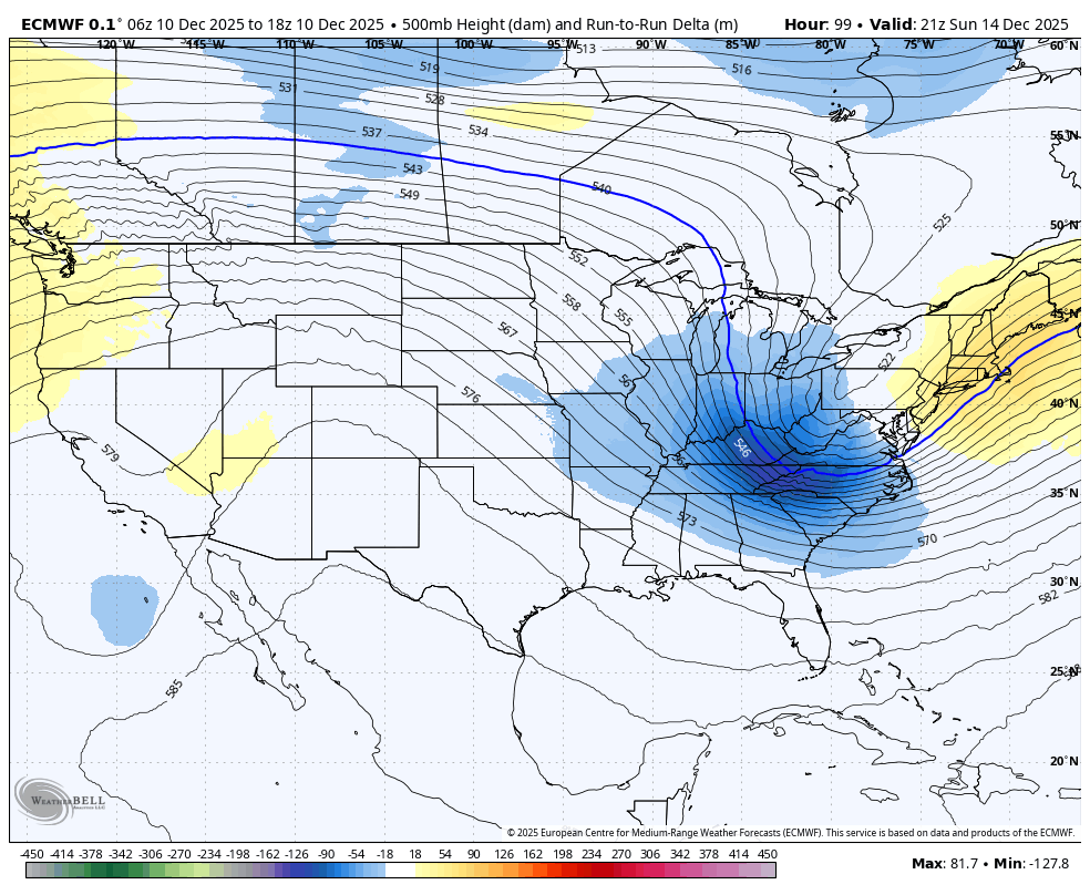
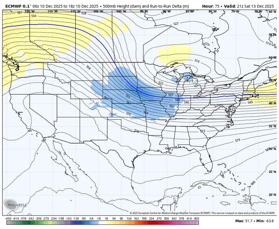
yup, move towards the euro with the TPV more tucked in and higher heights over the NE
-
December 2025 regional war/obs/disco thread
brooklynwx99 replied to Torch Tiger's topic in New England
RGEM looking good. TPV better oriented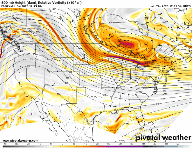
-
2025-2026 ENSO
brooklynwx99 replied to 40/70 Benchmark's topic in Weather Forecasting and Discussion
yeah, seasonal forecasting is really awfully tough. i appreciate the effort that you put into it... i help put together seasonal / LR stuff for work and it is not easy whatsoever. luckily even laymen know that the error is high after a couple weeks -
December 2025 regional war/obs/disco thread
brooklynwx99 replied to Torch Tiger's topic in New England
it's because he's a troll and he sucks -
2025-2026 ENSO
brooklynwx99 replied to 40/70 Benchmark's topic in Weather Forecasting and Discussion
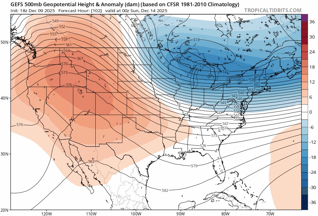
yeah, i was wondering, because I wouldn't say that there's been a standing wave out there... looks like typical MJO propagation to me we'll finally have legit WHEM forcing in late Dec, which should have us break colder into early Jan. just getting some IO/MC influence right now that will wash out, hence the warmer pattern later this month
-
December 2025 regional war/obs/disco thread
brooklynwx99 replied to Torch Tiger's topic in New England
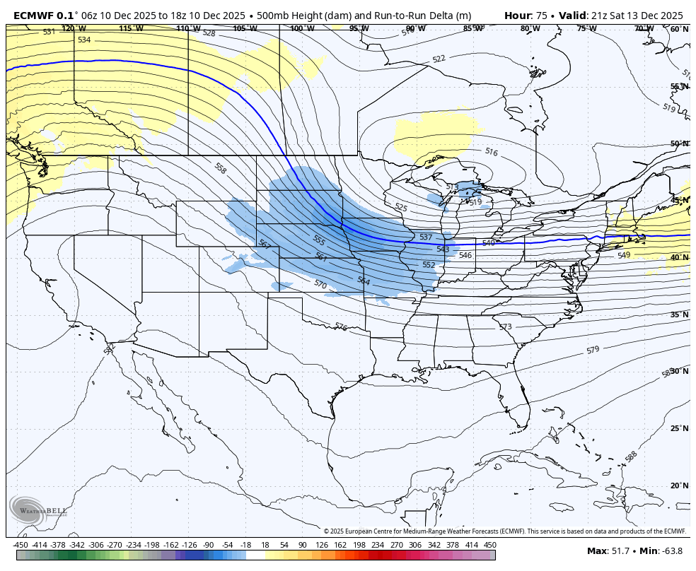
the CMC isn’t that far off from the ECMWF, the ECMWF is just a bit deeper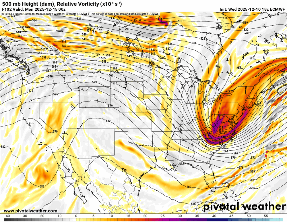
-
December 2025 regional war/obs/disco thread
brooklynwx99 replied to Torch Tiger's topic in New England
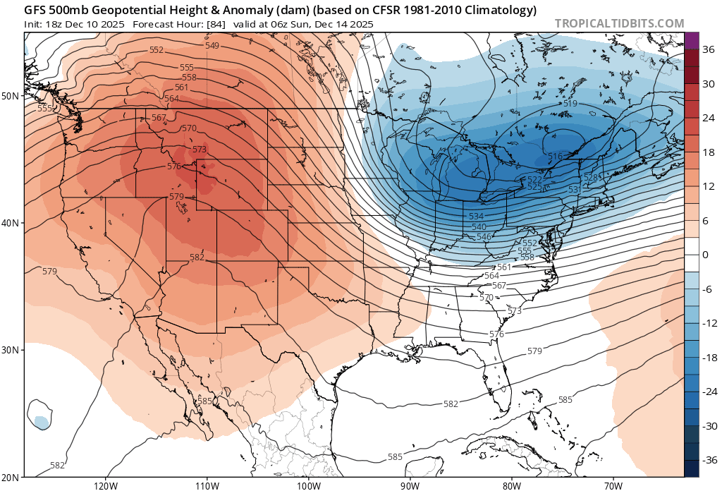
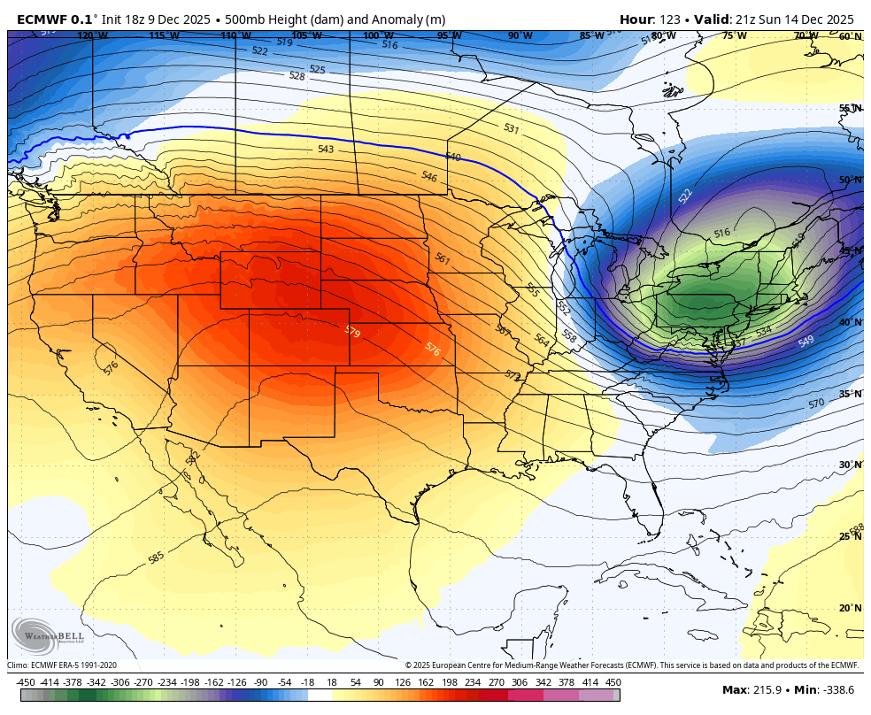
yeah, GFS made a material shift towards a euro-like solution, though i have a feeling that the euro’s overamplification bias may be showing
-
December 2025 regional war/obs/disco thread
brooklynwx99 replied to Torch Tiger's topic in New England
yeah, these love to amp up the fluff factor with sloped 700-500mb FGEN on the NW side of the precip shield. that would likely verify 4-6” along that corridor -
December 2025 regional war/obs/disco thread
brooklynwx99 replied to Torch Tiger's topic in New England
the GEFS is just going to do what the GFS does at this range -
December 2025 regional war/obs/disco thread
brooklynwx99 replied to Torch Tiger's topic in New England
personally i’m wondering if there’s an inflection point where things blow up. 18z euro was teetering, honestly. we’ve been trending that way for a while model cycle now
-
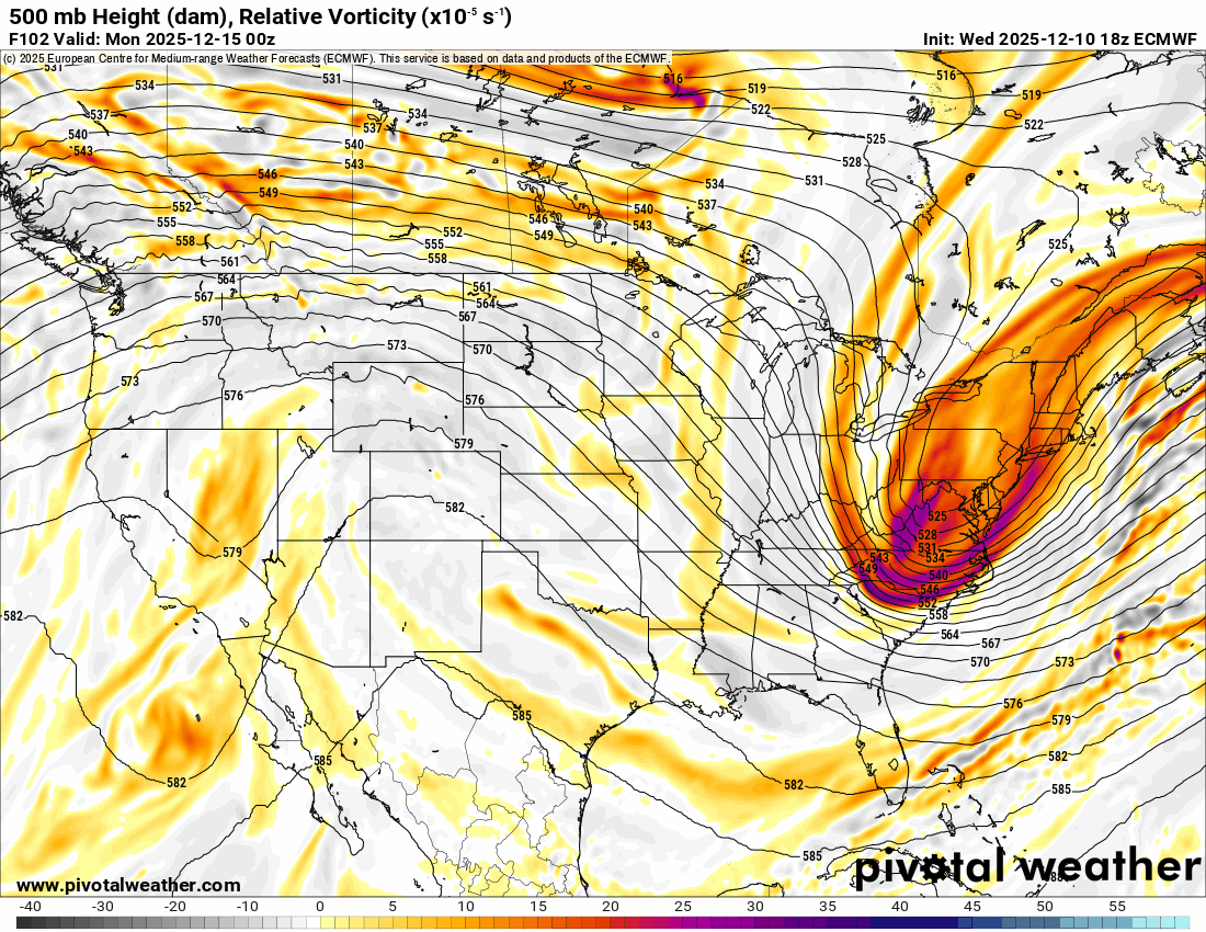
euro is a nice moderate event, comes in more amped with the TPV leaning more southwest
-
December 2025 regional war/obs/disco thread
brooklynwx99 replied to Torch Tiger's topic in New England
could tell it was going to be more amped around here. PNA is better and heights are lower farther SW
-
December 2025 regional war/obs/disco thread
brooklynwx99 replied to Torch Tiger's topic in New England
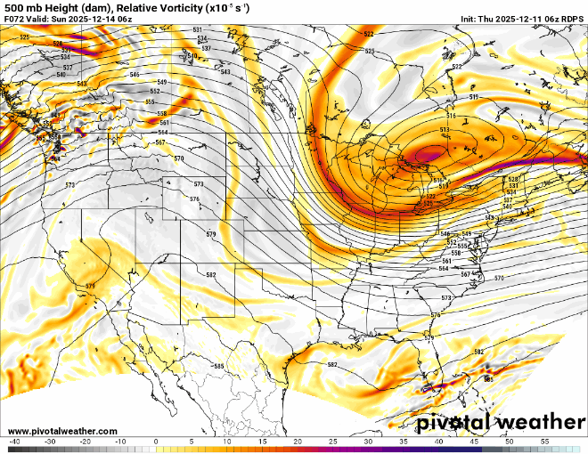
yeah, vort really trying to buckle here
-
December 2025 regional war/obs/disco thread
brooklynwx99 replied to Torch Tiger's topic in New England
euro and CMC keep the main TPV lobe farther west, GFS and ICON have it leaking east which suppresses heights downstream -
December 2025 regional war/obs/disco thread
brooklynwx99 replied to Torch Tiger's topic in New England
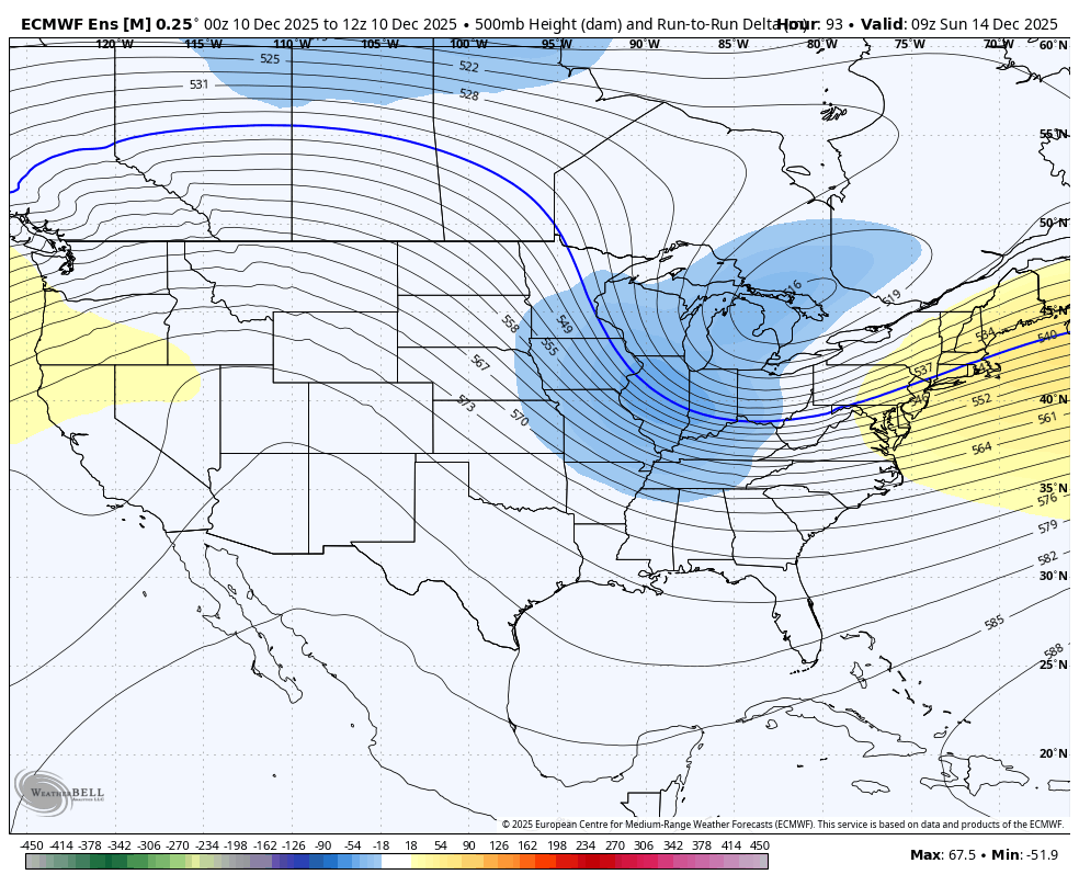
similarly nice changes on the EPS
-
December 2025 regional war/obs/disco thread
brooklynwx99 replied to Torch Tiger's topic in New England
if that vort moves hundreds of miles SW you have a MECS on your hands. not even exaggerating (not like that's going to happen) -
with the GFS and CMC looking more amped and the ECMWF and AIFS largely holding serve, I think we're trending towards the first plowable snowfall of the year for the metro. let's give it a couple more days, but things are looking good
-
December 2025 regional war/obs/disco thread
brooklynwx99 replied to Torch Tiger's topic in New England
honestly, perfect recovery from 00z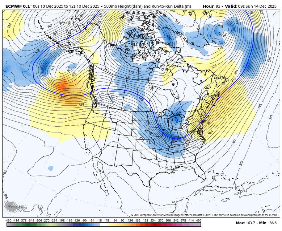
-
December 2025 regional war/obs/disco thread
brooklynwx99 replied to Torch Tiger's topic in New England
if you get the TPV that amped, you can def get 6" of snowfall on 0.4" liquid. the fluff factor is usually strong with these systems -
December 2025 regional war/obs/disco thread
brooklynwx99 replied to Torch Tiger's topic in New England
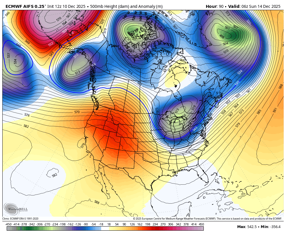
AIFS is a borderline SECS. TPV is more amped


.png.e3c2f8425f34587314b6b58dfeb70ea3.png)