brooklynwx99
-
Posts
6,215 -
Joined
-
Last visited
Content Type
Profiles
Blogs
Forums
American Weather
Media Demo
Store
Gallery
Everything posted by brooklynwx99
-

December 2025 regional war/obs/disco thread
brooklynwx99 replied to Torch Tiger's topic in New England
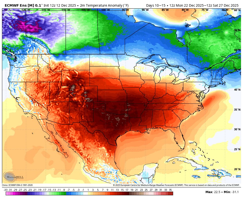
merry torchmas!!!
-
2025-2026 ENSO
brooklynwx99 replied to 40/70 Benchmark's topic in Weather Forecasting and Discussion
the EPS shows this colder wedging pretty well. might be a bit overdone, but I doubt really torches from NYC north. hell, New England can even see some mixed systems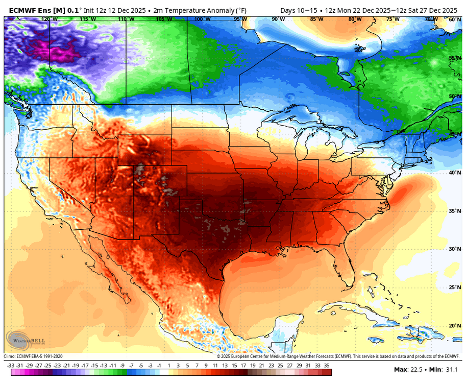
-
2025-2026 ENSO
brooklynwx99 replied to 40/70 Benchmark's topic in Weather Forecasting and Discussion
last time I checked, though, most people don't life 5000 feet above the surface, let alone 15000 feet. if it's NN to BN at the surface in the NE at times, nobody will care if it's +20F over some barren cornfield in NE -
December 2025 regional war/obs/disco thread
brooklynwx99 replied to Torch Tiger's topic in New England
yeah, not really a torch pattern with the -WPO encroaching into AK and the TPV elongated like that. sure, it's a torch for 75% of the CONUS, but who cares -
2025-2026 ENSO
brooklynwx99 replied to 40/70 Benchmark's topic in Weather Forecasting and Discussion
you know, some of you keep giving that guy a platform by breathlessly posting about him. we know he sucks -
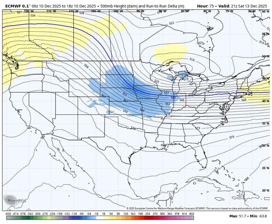
the GFS just has to be tossed assuming the ECMWF holds steady. it is awful with these anafront type systems and is almost always too progressive with them we’re still on track for plowable snowfall in the metro IMO
-
2025-2026 ENSO
brooklynwx99 replied to 40/70 Benchmark's topic in Weather Forecasting and Discussion
lol Webb going on his weenie crusade when he hypes just as much as literally everyone else on that platform -
December 2025 regional war/obs/disco thread
brooklynwx99 replied to Torch Tiger's topic in New England
meanwhile, RGEM is coming in even more amped lmao -
just a classic post-2016 NYC metro subforum exchange about the RGEM lmao
-
December 2025 regional war/obs/disco thread
brooklynwx99 replied to Torch Tiger's topic in New England
gotta love the GFS suite
-
why even bother with snowmaps? use liquid and then apply 10:1 or slightly above / below depending on DGZ and dynamics. this event would produce 12-15:1 pretty easily on the northern end of the precip shield; these events usually do so
-
lol it has 0.4" liquid in NYC. 3-5" is a perfect description
.thumb.png.d89b73188c3a45e216fd5afba8b80678.png)
-
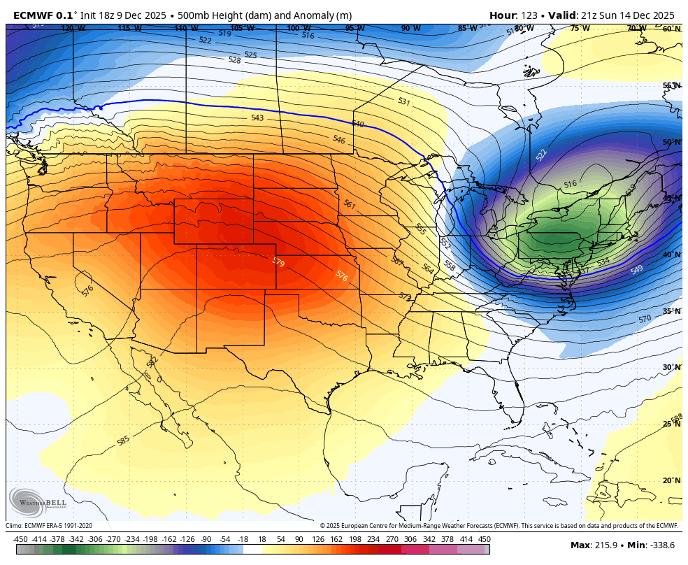
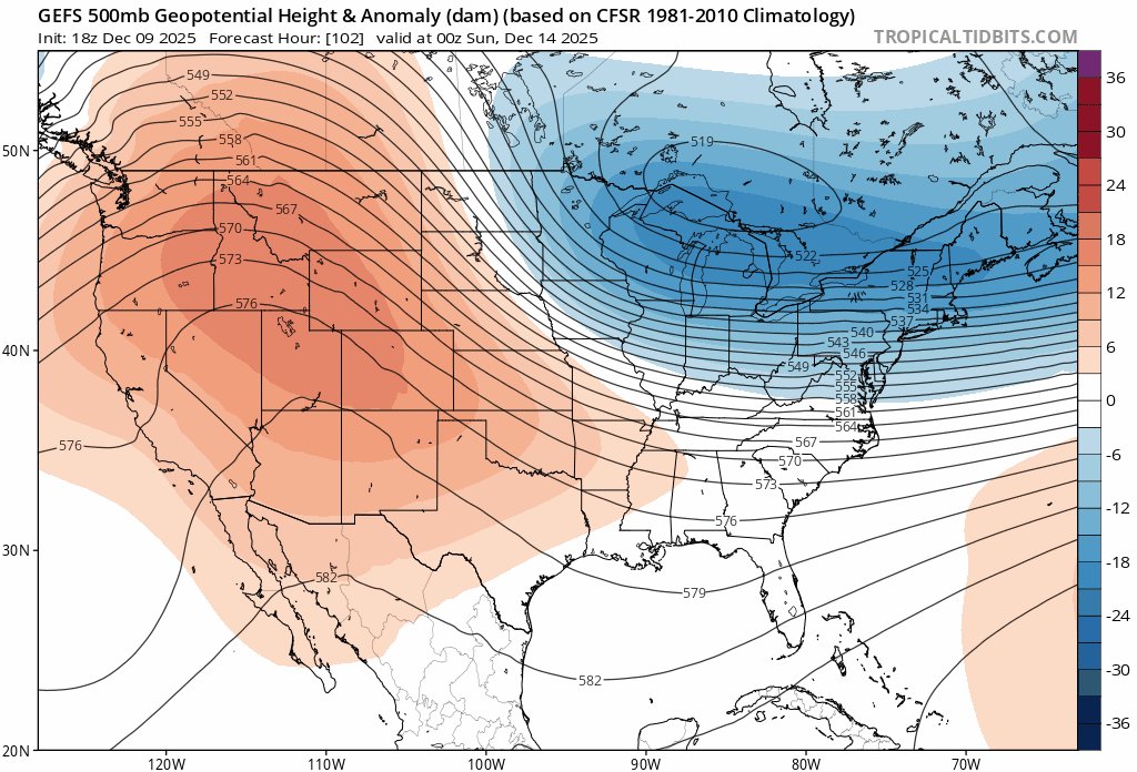
yup, move towards the euro with the TPV more tucked in and higher heights over the NE
-
December 2025 regional war/obs/disco thread
brooklynwx99 replied to Torch Tiger's topic in New England
RGEM looking good. TPV better oriented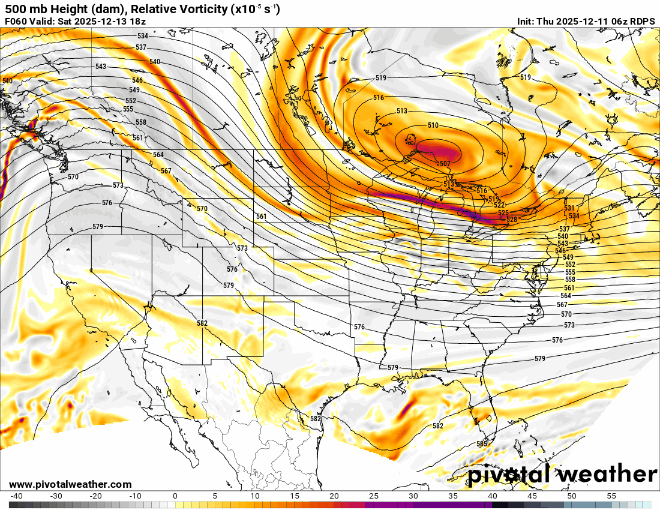
-
2025-2026 ENSO
brooklynwx99 replied to 40/70 Benchmark's topic in Weather Forecasting and Discussion
yeah, seasonal forecasting is really awfully tough. i appreciate the effort that you put into it... i help put together seasonal / LR stuff for work and it is not easy whatsoever. luckily even laymen know that the error is high after a couple weeks -
December 2025 regional war/obs/disco thread
brooklynwx99 replied to Torch Tiger's topic in New England
it's because he's a troll and he sucks -
2025-2026 ENSO
brooklynwx99 replied to 40/70 Benchmark's topic in Weather Forecasting and Discussion
yeah, i was wondering, because I wouldn't say that there's been a standing wave out there... looks like typical MJO propagation to me we'll finally have legit WHEM forcing in late Dec, which should have us break colder into early Jan. just getting some IO/MC influence right now that will wash out, hence the warmer pattern later this month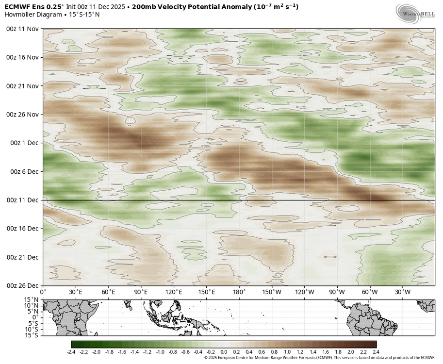
-
December 2025 regional war/obs/disco thread
brooklynwx99 replied to Torch Tiger's topic in New England
the CMC isn’t that far off from the ECMWF, the ECMWF is just a bit deeper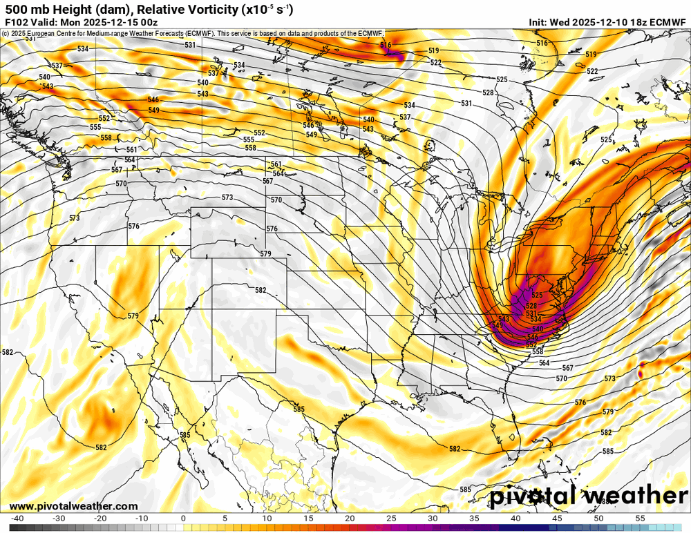
-
December 2025 regional war/obs/disco thread
brooklynwx99 replied to Torch Tiger's topic in New England
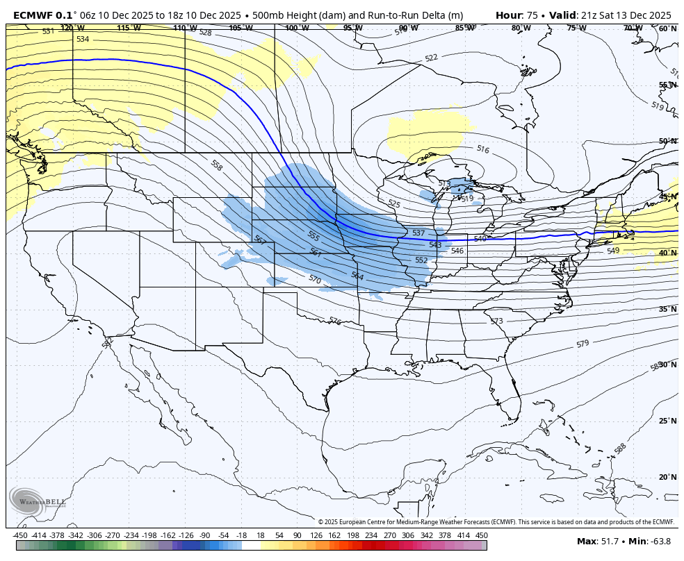
yeah, GFS made a material shift towards a euro-like solution, though i have a feeling that the euro’s overamplification bias may be showing
-
December 2025 regional war/obs/disco thread
brooklynwx99 replied to Torch Tiger's topic in New England
yeah, these love to amp up the fluff factor with sloped 700-500mb FGEN on the NW side of the precip shield. that would likely verify 4-6” along that corridor -
December 2025 regional war/obs/disco thread
brooklynwx99 replied to Torch Tiger's topic in New England
the GEFS is just going to do what the GFS does at this range -
December 2025 regional war/obs/disco thread
brooklynwx99 replied to Torch Tiger's topic in New England
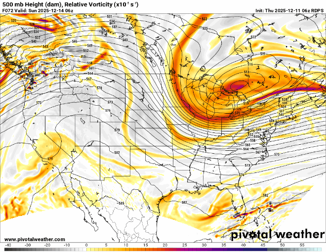
personally i’m wondering if there’s an inflection point where things blow up. 18z euro was teetering, honestly. we’ve been trending that way for a while model cycle now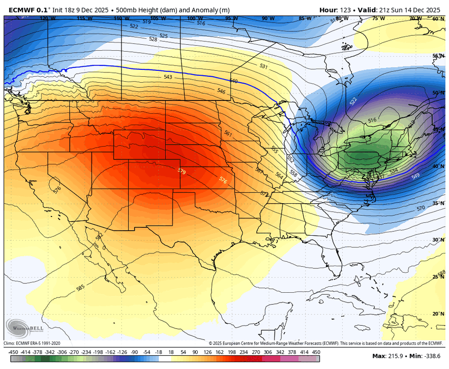
-
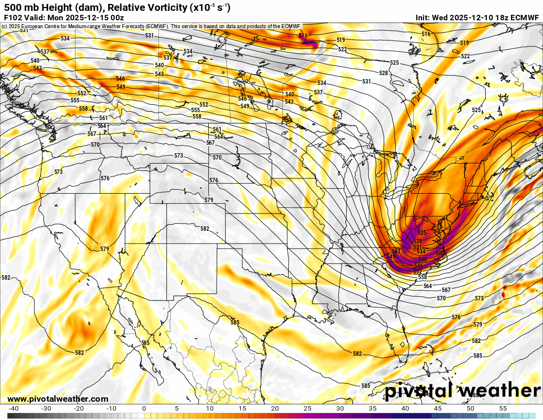
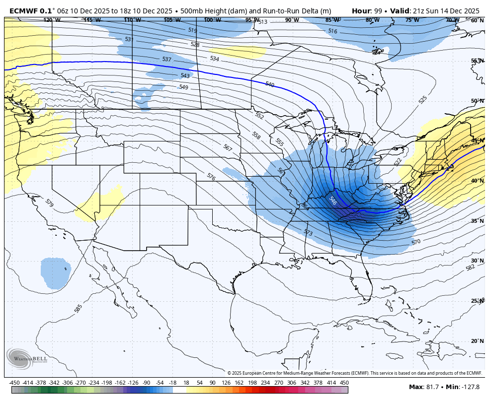
euro is a nice moderate event, comes in more amped with the TPV leaning more southwest
-
December 2025 regional war/obs/disco thread
brooklynwx99 replied to Torch Tiger's topic in New England
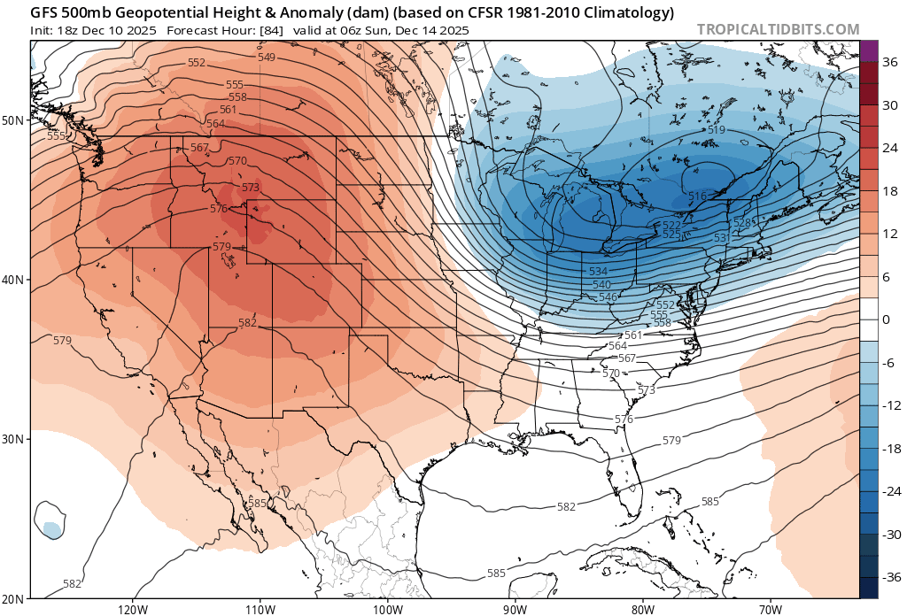
could tell it was going to be more amped around here. PNA is better and heights are lower farther SW
-
December 2025 regional war/obs/disco thread
brooklynwx99 replied to Torch Tiger's topic in New England
yeah, vort really trying to buckle here


.png.e3c2f8425f34587314b6b58dfeb70ea3.png)