brooklynwx99
-
Posts
6,215 -
Joined
-
Last visited
Content Type
Profiles
Blogs
Forums
American Weather
Media Demo
Store
Gallery
Everything posted by brooklynwx99
-
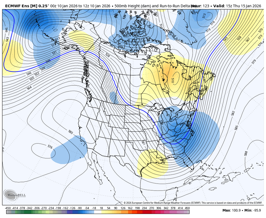
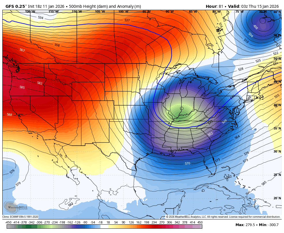
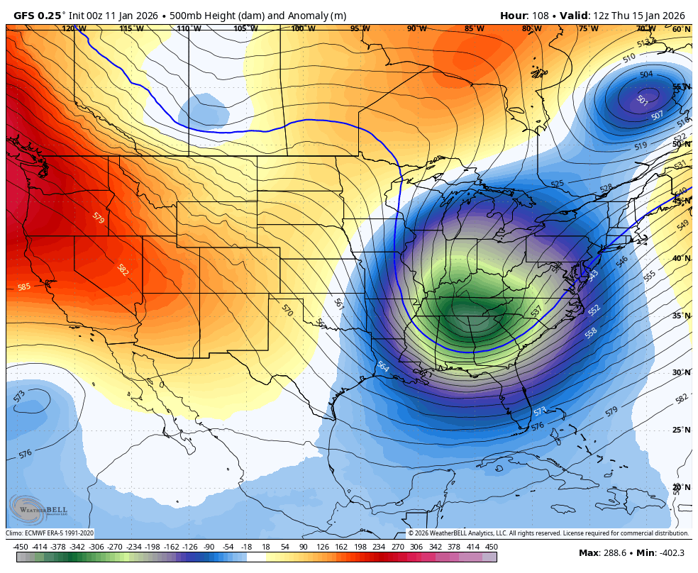
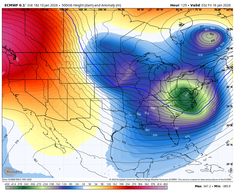
GFS looks quite a bit more consolidated
-

January 2026 regional war/obs/disco thread
brooklynwx99 replied to Baroclinic Zone's topic in New England
it’s an average, you’re going to have members with the gradient south of the mean. not all that surprising -
January 2026 regional war/obs/disco thread
brooklynwx99 replied to Baroclinic Zone's topic in New England
hopefully we can eke something out before the 20th... the pattern looks to open up after the 22nd as more moisture gets involved and cold becomes more entrenched -
January 2026 regional war/obs/disco thread
brooklynwx99 replied to Baroclinic Zone's topic in New England
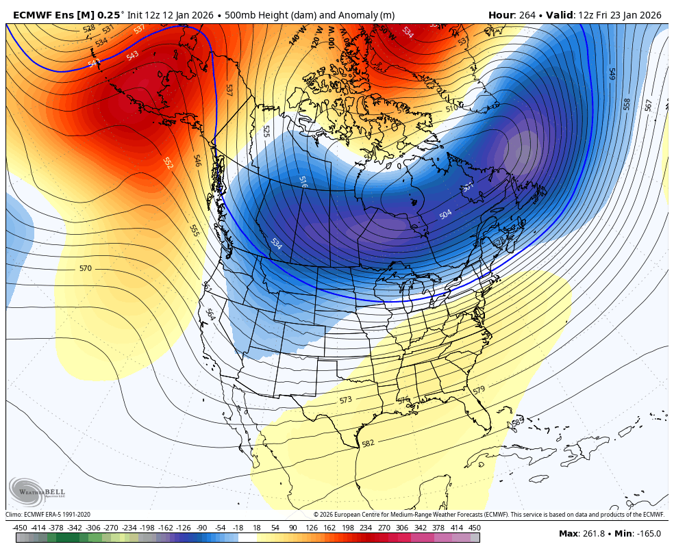
yeah, the 22-24th is a solid timeframe with established cold air, low heights over SE Canada, and some -NAO/-EPO. can see how you'd get something ejecting out of the west into cold air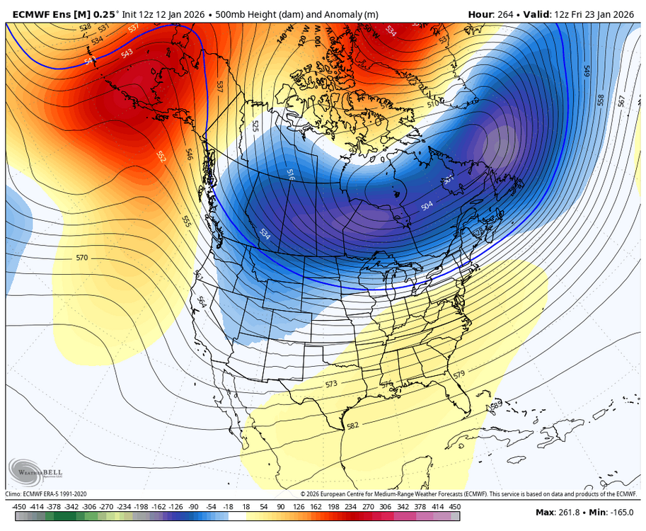
-
January 2026 regional war/obs/disco thread
brooklynwx99 replied to Baroclinic Zone's topic in New England
when you're forecasting past a week out, using ensembles and focusing on the broader pattern to point out timeframes of interest is generally the way to go. this will be taught in every forecasting classroom on the planet. now that we're a few days later on, we can see that there are two distinct waves rather than a single trough (which, by the way, some OP runs had) this is the way long range forecasting is... the data change sometimes. it doesn't make the process any less valid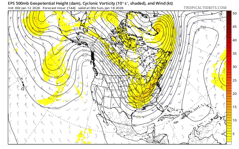
-
January 2026 regional war/obs/disco thread
brooklynwx99 replied to Baroclinic Zone's topic in New England
why are you like this, dude -
2025-2026 ENSO
brooklynwx99 replied to 40/70 Benchmark's topic in Weather Forecasting and Discussion
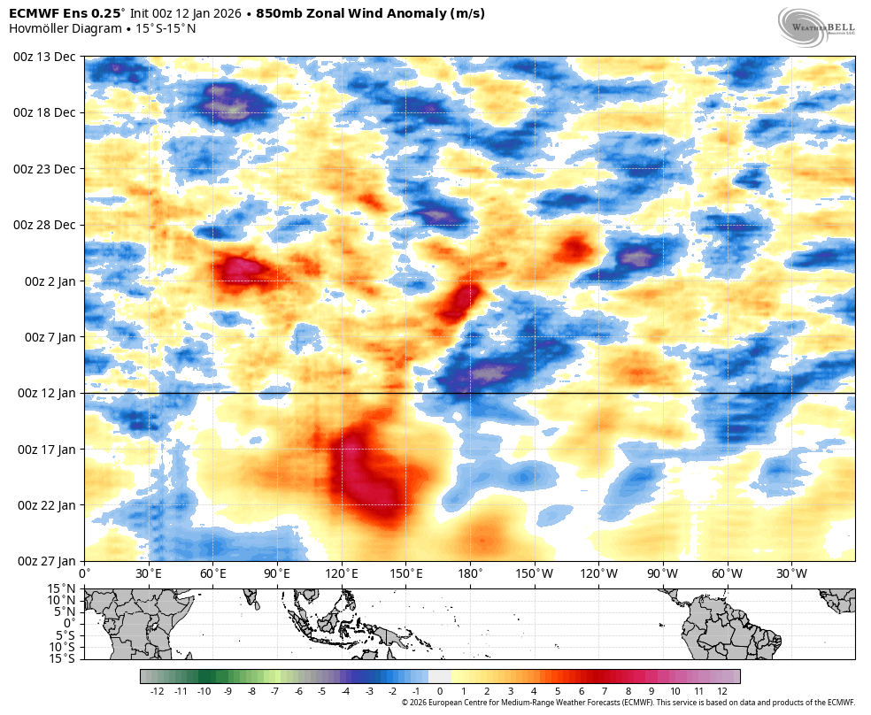
yeah that can certainly happen... i think early Feb looks pretty good, though, as the favorable tropical forcing should stick around for a bit based on hovmollers -
2025-2026 ENSO
brooklynwx99 replied to 40/70 Benchmark's topic in Weather Forecasting and Discussion
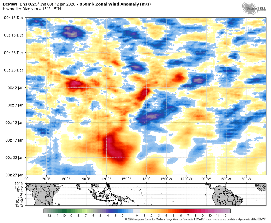
it seems like the opposite is likely to occur given the tropical forcing and subsequent jet extension all of the ensembles are seeing -
2025-2026 ENSO
brooklynwx99 replied to 40/70 Benchmark's topic in Weather Forecasting and Discussion
we continue to see legit CPAC and WHEM convection show up late month with legit subsidence over the MC, which should help us out. this coincides with impressive WWBs west of the dateline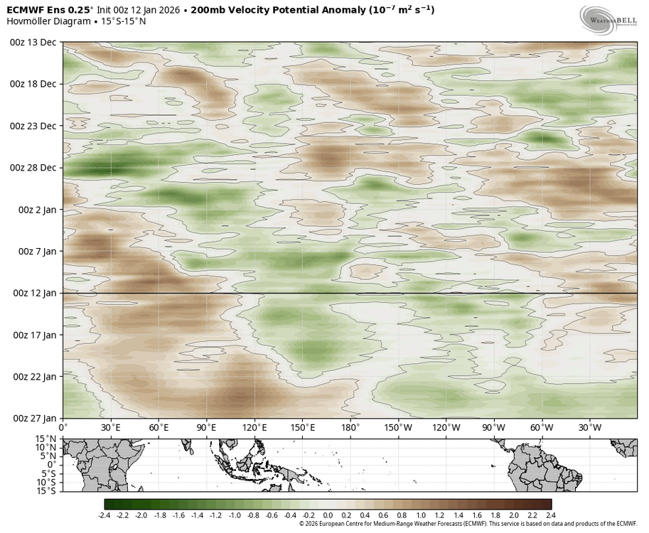
-
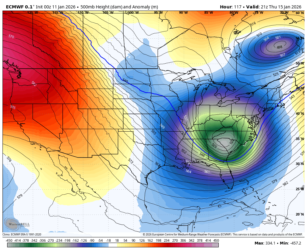
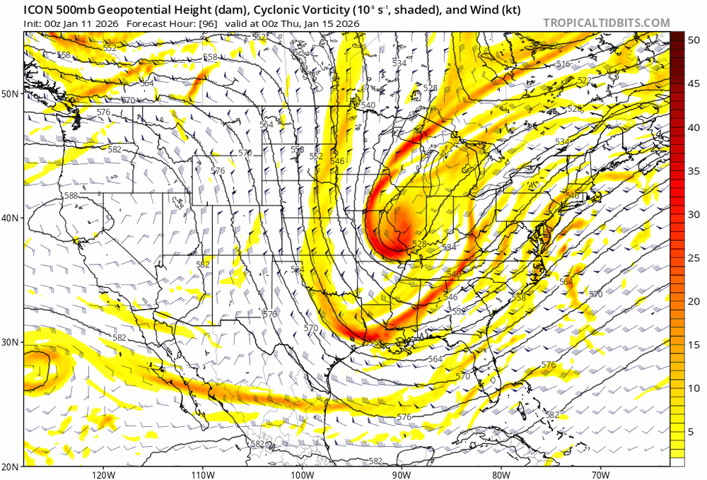
the GFS has the TPV farther east and the ridge comes over the top, allowing the ULL to dig more compared to the ICON

-
2025-2026 ENSO
brooklynwx99 replied to 40/70 Benchmark's topic in Weather Forecasting and Discussion
can’t remember the last time we’ve seen subsidence like this over the MC… straight up P8 forcing late month
-
this system is honestly annoying the crap out of me at this point and I'd rather just get to the 18th, which has had a better chance all along
-
lol
-
January 2026 regional war/obs/disco thread
brooklynwx99 replied to Baroclinic Zone's topic in New England
this somehow produces like 3-6” of snow. how do you even make this up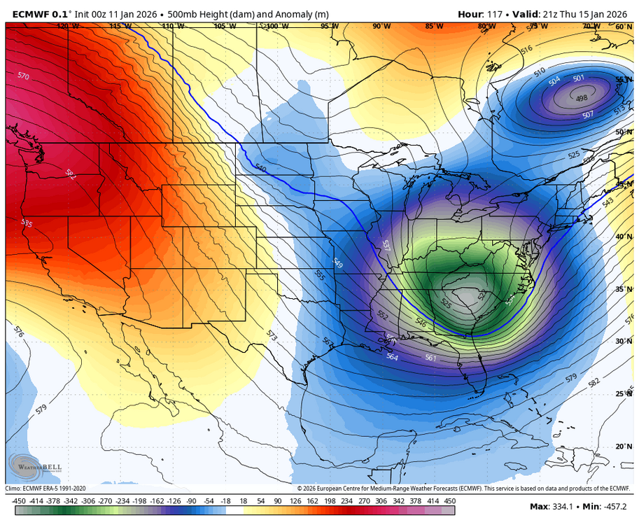
-
January 2026 regional war/obs/disco thread
brooklynwx99 replied to Baroclinic Zone's topic in New England
always has to be something -
January 2026 regional war/obs/disco thread
brooklynwx99 replied to Baroclinic Zone's topic in New England
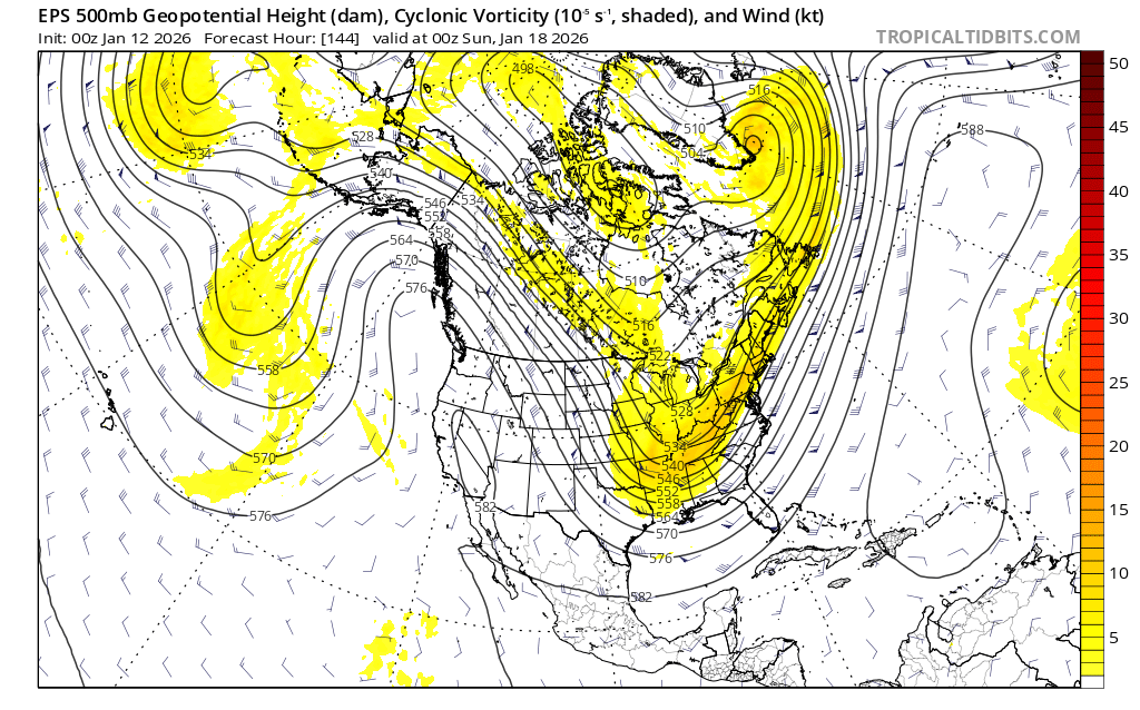
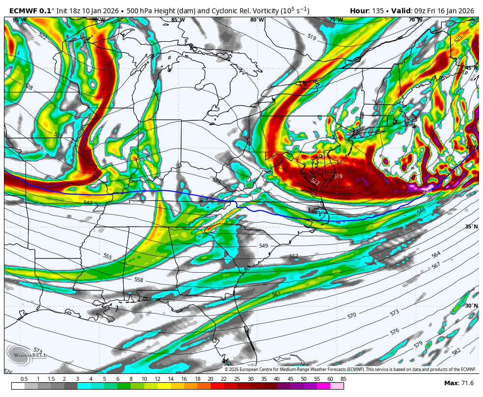
usually when you have a vort of that intensity at that latitude it’s a nuke. truly incredible -
January 2026 regional war/obs/disco thread
brooklynwx99 replied to Baroclinic Zone's topic in New England
PVA axis is more N-S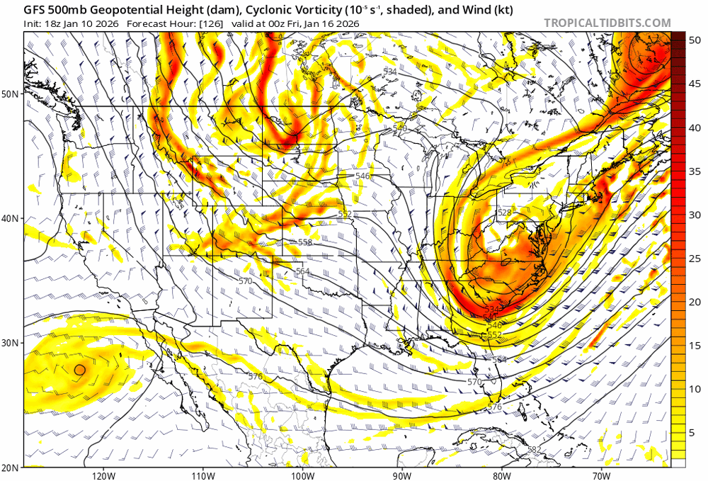
-
January 2026 regional war/obs/disco thread
brooklynwx99 replied to Baroclinic Zone's topic in New England
it’s gonna do it again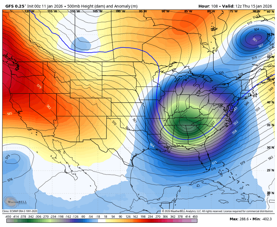
-
January 2026 regional war/obs/disco thread
brooklynwx99 replied to Baroclinic Zone's topic in New England
i mean, tick it more amped and you curl the PVA back west. it’s close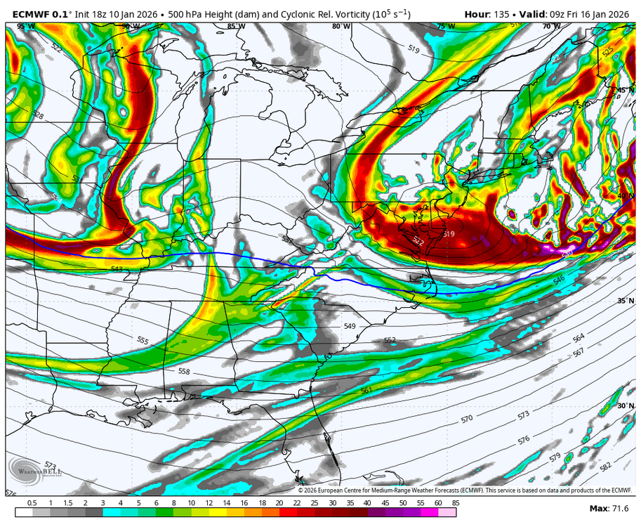
-
January 2026 regional war/obs/disco thread
brooklynwx99 replied to Baroclinic Zone's topic in New England
it really unreal how this isn’t a MECS at first glance. that vort is insane
-
January 2026 regional war/obs/disco thread
brooklynwx99 replied to Baroclinic Zone's topic in New England
yeah, stronger and more neg tilted -
January 2026 regional war/obs/disco thread
brooklynwx99 replied to Baroclinic Zone's topic in New England
yeah, not as exotic as 12z but still a bomb -
January 2026 regional war/obs/disco thread
brooklynwx99 replied to Baroclinic Zone's topic in New England
absolutely, allows that NS piece over the Lakes to come in at a good angle... that's why the GFS is as amped as it is -
January 2026 regional war/obs/disco thread
brooklynwx99 replied to Baroclinic Zone's topic in New England
the +PNA ridge in and of itself argues for a coastal... that's 2.5 sigma over ID, nearly ideal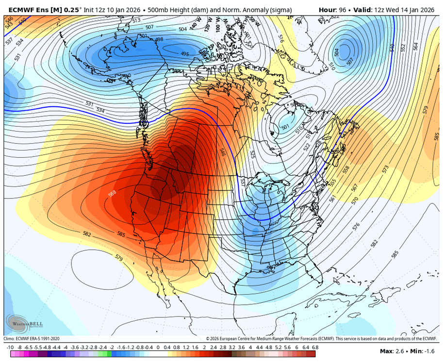
-
January 2026 regional war/obs/disco thread
brooklynwx99 replied to Baroclinic Zone's topic in New England
this is really as large of an amped shift as you'll see on the EPS at this range