
lookingnorth
-
Posts
483 -
Joined
-
Last visited
Content Type
Profiles
Blogs
Forums
American Weather
Media Demo
Store
Gallery
Everything posted by lookingnorth
-

MO/KS/AR/OK 2025-2026 Winter Discussion
lookingnorth replied to stormdragonwx's topic in Central/Western States
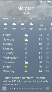
The storm total was about 6.5" in Norman. That's less than I was hoping for, but I kind of expected it to underperform somehow. Plus, it was still the biggest snowstorm I've personally experienced since January 2010 in NC, so I can't complain. I like how it's supposed to be cold the next few days, so while I'm sure it will melt a good bit in the sun, melting should be slower than it is after some storms. -
MO/KS/AR/OK 2025-2026 Winter Discussion
lookingnorth replied to stormdragonwx's topic in Central/Western States
I don't know a good place to see a map of that, but you can see the recently launched (Jan 25 00Z) soundings here: https://www.spc.noaa.gov/exper/soundings/ It looks like the warm nose is around 750 mb or 6000 ft. You can see estimated winter skew-T maps here: https://www.spc.noaa.gov/exper/mesoanalysis/new/viewsector.php?sector=15# -
MO/KS/AR/OK 2025-2026 Winter Discussion
lookingnorth replied to stormdragonwx's topic in Central/Western States
It seems Norman has been in a dry slot most of today, and the HRRR shows that continuing this evening into tonight. Hopefully that winds up not being the case. -
MO/KS/AR/OK 2025-2026 Winter Discussion
lookingnorth replied to stormdragonwx's topic in Central/Western States
It looks like the OKC area may experience a lull in the snowfall soon. -
January 25/26 Jimbo Back Surgery Storm
lookingnorth replied to Jimbo!'s topic in Southeastern States
I grew up in NC and still have family there, so I like to see what's happening in the Southeastern forum from time to time. -
January 25/26 Jimbo Back Surgery Storm
lookingnorth replied to Jimbo!'s topic in Southeastern States
I am in Norman, OK, and I will say that a lot of the models were showing sleet for me at this time frame, but we are getting snow currently. It's no guarantee that the warm nose will be less intense than modeled in the Southeast, but just a data point to consider. -
MO/KS/AR/OK 2025-2026 Winter Discussion
lookingnorth replied to stormdragonwx's topic in Central/Western States
There's been some light sleet in Norman, and Google Maps is saying there are travel impacts on I-35 and I-44 south of the OKC metro. -
MO/KS/AR/OK 2025-2026 Winter Discussion
lookingnorth replied to stormdragonwx's topic in Central/Western States
The latest run of the NAM does look a bit drier than previous runs across much of Oklahoma. -
MO/KS/AR/OK 2025-2026 Winter Discussion
lookingnorth replied to stormdragonwx's topic in Central/Western States
I want this northward trend to stop soonish, though, or I'll have to start worrying about ice in Norman. -
Maybe Charctic is incorrect, but this is what that source shows: https://imgur.com/sSjMIiT.
-
It looks like the Arctic sea ice extent has been the lowest on record for the date for about the past week. Does anyone more skilled at Arctic sea ice monitoring have any insight?
-
Is there really still sea ice in the Bay of Fundy this time of year? https://imgur.com/E67jL9d
-
It looks like the Arctic sea ice extent has flatlined for the past three weeks or so. Does anyone have any idea why?
-
MO/KS/AR/OK 2024-2025 Winter Discussion
lookingnorth replied to JoMo's topic in Central/Western States
Based on that map, it looks like the biggest bust was around the Stillwater area, as they were expecting 4" or so IIRC. We got about what I was expecting in Norman, with just under an inch of snow. -
MO/KS/AR/OK 2024-2025 Winter Discussion
lookingnorth replied to JoMo's topic in Central/Western States
It's not looking interesting for the Norman/OKC area, but hopefully you all in Tulsa and points northeast get something good. The 06Z HRRR is trending a bit drier for everyone unfortunately. -
Plains States Observations and Discussion Thread
lookingnorth replied to lookingnorth's topic in Central/Western States
I lost power last night from one of the storms that produced a tornado. But thankfully the tornado did not hit me. I have seen some branches down in Norman today, but I didn't notice any major damage. -
It looks like Tucson didn't hit 100, but they still managed to set 3 daily records, topping out at 99.
-
Now I'm wondering what the record longest consecutive stretch of record highs is for a location with at least a 100 year POR.
-
It looks like almost every city in Arizona but Flagstaff broke their October record high in the past few days. It hit 113F in Phoenix and Yuma. Some record highs were set in California as well. San Jose managed to hit 106, breaking the old monthly record high by 5F.
-
Plains States Observations and Discussion Thread
lookingnorth replied to lookingnorth's topic in Central/Western States
It's quite hot today, 102°F with a heat index of 109°F at the Norman mesonet site. Maximum HI today was 111°F. -
MO/KS/AR/OK 2023-2024 Winter Discussion
lookingnorth replied to JoMo's topic in Central/Western States
Yeah, we had a couple good weeks in January, and a decent snow in February, but overall this winter was unimpressive. At least we weren't setting records for winter warmth like they were further north. -
MO/KS/AR/OK 2023-2024 Winter Discussion
lookingnorth replied to JoMo's topic in Central/Western States
Doesn't feel much like winter today, with much of Oklahoma getting into the upper 80s, and the southern part of the state having some areas in the 90s. -
The mountains do block radar coverage, but it looks decent around Lake Tahoe, assuming this map is correct.
-
Mid to Long Range Discussion ~ 2024
lookingnorth replied to buckeyefan1's topic in Southeastern States
I find the CPC is usually pretty good on their 6-10 day and 8-14 day outlooks. Getting accurate forecasts beyond 14 days out is just extremely hard. -
Southeast Sanitarium - Winter 23/24 Edition
lookingnorth replied to eyewall's topic in Southeastern States
I believe it's happened twice before. 1990-91 and 1991-92 each only had a trace of snow. Same with 1948-49 and 1949-50. But the third time in over 120 years of records is still pretty bad.


