

radarman
-
Posts
14,464 -
Joined
-
Last visited
Content Type
Profiles
Blogs
Forums
American Weather
Media Demo
Store
Gallery
Everything posted by radarman
-
Won't surprise me if tornado damage may be observed in Garland
-
I just enjoyed that from Love Field. Sirens were blaring. Airline employees took shelter. Couplet moved right overhead. Got a nice view outside facing west. Nice little storm but rain wrapped and no sign of touchdown.
-
Jay reported like 55 or something in March 01. I doubt it's official.
-
Berkshire East reporting 18" and power outages. Closed for the day.
-
nah, the village is a lot lower. Like 6800' The peak is 8600'. It's going to be a huge, huge disaster probably.
-
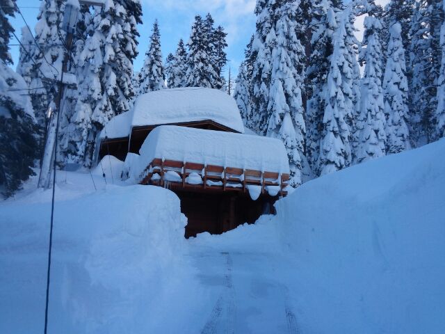
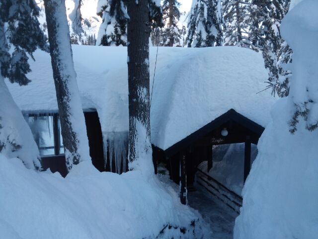
I've posted these before, but this was near Alpine Meadows late Jan 2017. Squaw Valley reported 26 feet for the month. The pack is probably bigger now amazingly.
-
 QPF aside the GEFS members had a couple way SE runs that hopefully are outliers and might bump the mean toward the main cluster closer in
 -
Fully game on at the Beast yesterday
-
Yeah, massive gradient between here and there. Berkshire East got dumped on with zero sign of pingers. Most of the mesos rocketed that sleet line into S VT yesterday but it hit a wall somewhere in N Amherst.
-
2" of sludge here. Joy
-
10 miles north of the Pike but still not comfortable. Expecting 3 or 4" here, heavily compacted.
-
2/2/15 was the best of those 3 storms out this way by far. This won't be no 2/2/15 here unfortunately. Also, no superbowl the night before.
-
March 2nd Moderate Risk ArkLaTex
radarman replied to Ed, snow and hurricane fan's topic in Central/Western States
I don't think there was a tornado warning in Northlake, if that's where the video is. That's Denton Co. -
March 2nd Moderate Risk ArkLaTex
radarman replied to Ed, snow and hurricane fan's topic in Central/Western States
where in the metroplex? -
March 2nd Moderate Risk ArkLaTex
radarman replied to Ed, snow and hurricane fan's topic in Central/Western States
Took out power completely at UNT. Trying to get a radar back up remotely... -
March 2nd Moderate Risk ArkLaTex
radarman replied to Ed, snow and hurricane fan's topic in Central/Western States
"destructive" SVR coming for W of Ft Worth. Winds to 80 -
March 2nd Moderate Risk ArkLaTex
radarman replied to Ed, snow and hurricane fan's topic in Central/Western States
Mineral Wells gusted to 71mph -
wouldn't be the first coup it's scored as the northern outlier, but I appreciate the words of encouragement.
-
Watches up here too
-
March 2nd Moderate Risk ArkLaTex
radarman replied to Ed, snow and hurricane fan's topic in Central/Western States
yep, good memory -
March 2nd Moderate Risk ArkLaTex
radarman replied to Ed, snow and hurricane fan's topic in Central/Western States
Jan 10th 2020 was moderate just east of Dallas... Plano/Garland -
March 2nd Moderate Risk ArkLaTex
radarman replied to Ed, snow and hurricane fan's topic in Central/Western States
ENH across Collin/Denton county, slight in Dallas -
March 2nd Moderate Risk ArkLaTex
radarman replied to Ed, snow and hurricane fan's topic in Central/Western States
Moderate Risk in the entire DFW metroplex is rare... 4/28/20 the last time. Not sure how far you'd have to go back before that -
well, unless we pull a 0-1" here the Nam/Euro combo was a total bust 36-24 hrs ago. But we could still pull a 0-1" I guess. Those who know me know I typically hug the nam, except when it doesn't give me snow obv.
-
notice how the split in opinion seems to be function of latitude and longitude and which side of the r/s line you're on


