

radarman
-
Posts
14,464 -
Joined
-
Last visited
Content Type
Profiles
Blogs
Forums
American Weather
Media Demo
Store
Gallery
Everything posted by radarman
-
It's been hit and miss on these thunderstorms the last few days, today more hit than miss, with some heavy downpours out of nothing cells. But in terms of wind it's been 100% meh, I can't recall a more boring start to the severe wx season here in Btown, aka the ICT of SNE. Maybe southern portions of the east slope got a half decent storm the other day.
-
This That's how you FF
-
Ask Dallas about Porzingis staying healthy.
-
Blight in June? Is that a thing?
-
We've been hearing that the Nam was gonna be discontinued for years too, then every winter folks remember that they'd have to work between 830 and 945AM if they cancel it.
-
Tanned feet? Is that like the Huck Finn look? Anyway now that the dews might finally show up (7 weeks late) we'll consider retrieving that bin from the attic.
-
we do outdoor work in boots and carhartts, not flip flops and bermuda shorts. Maybe you could scoop oak leaves out of the pool in those and it would be ok.
-
sprinkler? Nice find though. I guess the weather service tossed it, or overlooked it.
-
certainly. Jeans a t shirt. Possible exception made for full court 5 on 5.
-
tough day? lol Having come back from DFW last week which tied its all time record DP of 80 on Thursday, I'm thinking we can survive sun and clouds, pop up showers, and mid 60s dews. Might even break out the shorts finally. Most of us haven't even considered them since last September.
-
never seen fewer mosquitoes here. I think the very dry May with multiple frosts and a mid month 27 degree morning must have done a serious number on them.
-
FWD disco casually dropping mentions of Jarrell 97
-
DFW may approach all time record dews of 80F. It's been hit 5 times, interestingly, twice in 97 (late may, again mid June).
-
Got attacked by a Scissortailed Flycatcher in Texas today while climbing a ladder past her nest with 3 babies in it. Truly a magnificent bird!
-
2 days in a row with greater than 4" hail in the metroplex
-
Just missed. Looked like small hail up in Leverett
-
PWM may set a record low max today. Yesterday was #3 on the (roughly) midnight high. But the daytime high was 5 degrees colder than the record low max from 1915.
-
Pretty good bet that somewhere in the Shirley Lake/Granite Chief area of PT will have snow into August this year. It's not too bad of a hike over from High Camp
-
I'm not seeing it here Lloyd Nice storm though
-
Yeah looking like it's weakening and ticking west also. I could have used the rain. Might get a few sprinkles.
-
Congrats on the hail folks Here locally seeing some velocities on the UMass radar to 45-50 MPH in this cell as it drops down the valley. Not severe but not terrible.
-

The 2023 Lawn, Garden, Landscape Party Discussion
radarman replied to Damage In Tolland's topic in New England
Dig a little canal into the neighbor's yard maybe -
In lieu of installing I just leave the doors and windows open during the day when home. Hopefully I don't get an uninvited visitor dropping in, but it's not out of the question.
-
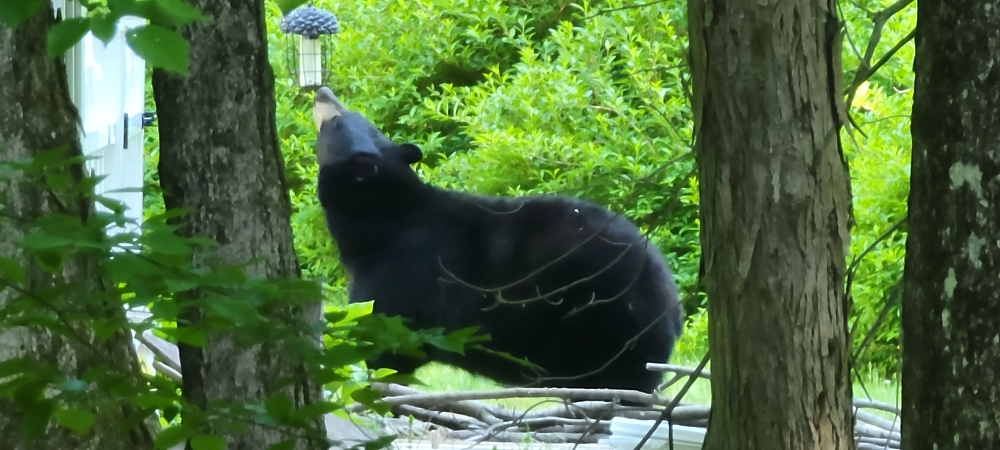
This fella just wandered out onto the lawn. I saw my wife go running and thought maybe her phone was ringing. Big guy
-
May obs/discussion thread - Welcome to Severe Season!!
radarman replied to weatherwiz's topic in New England
Our backyard firepit Mosquitos mostly preclude Last night, glorious


