MillvilleWx
-
Posts
5,530 -
Joined
-
Last visited
Content Type
Profiles
Blogs
Forums
American Weather
Media Demo
Store
Gallery
Everything posted by MillvilleWx
-
I am loving this ass kicking the Pats are receiving. Not a Bad Bunny listener, but I enjoyed the vibe and energy from the music. My Mom is from Ecuador, so I understand some of the lyrics. It was a good time.
-
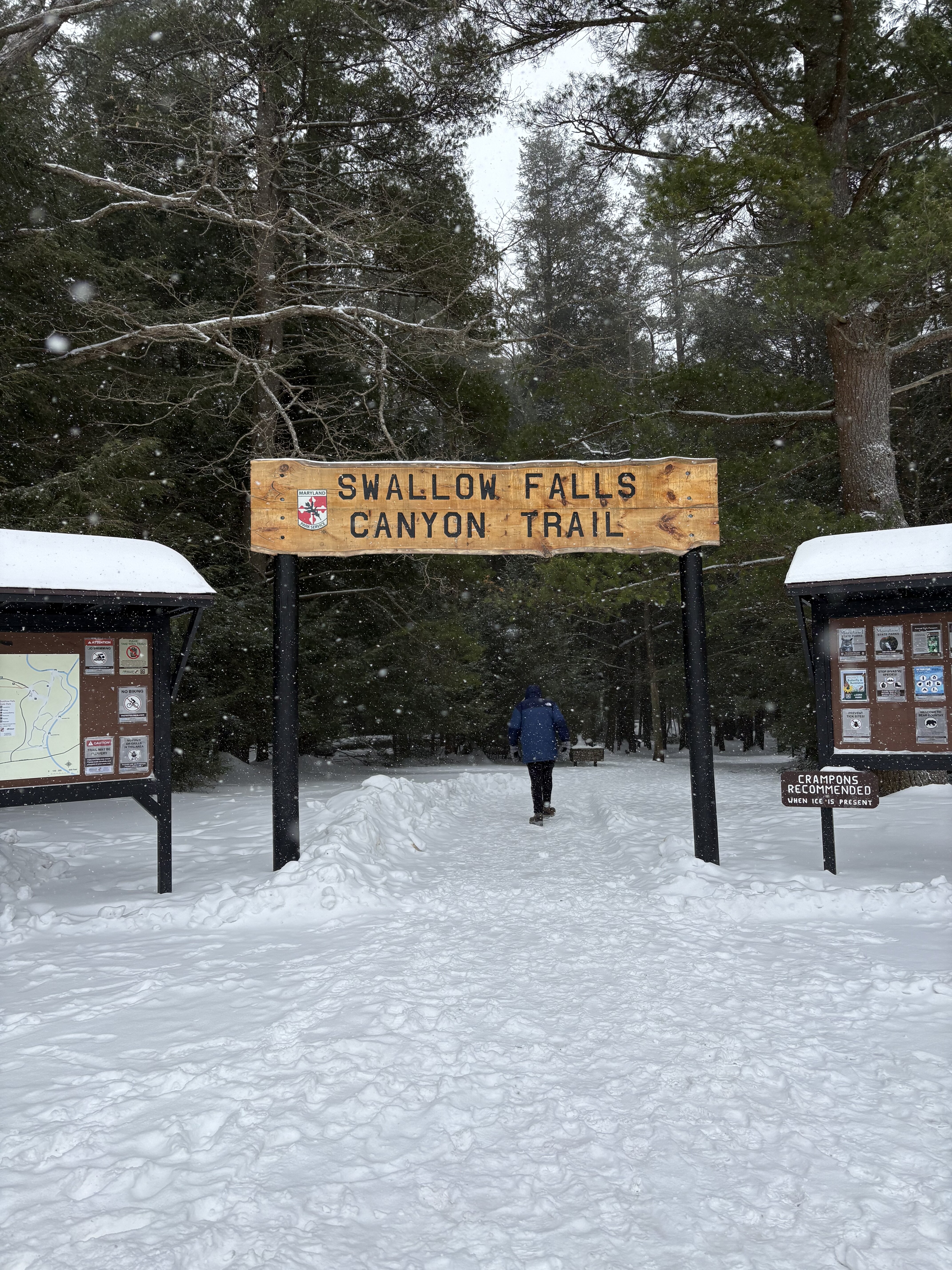
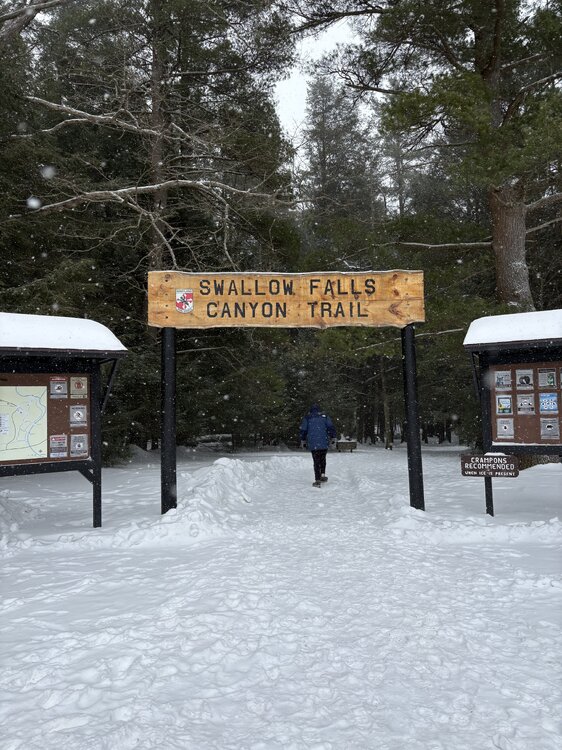
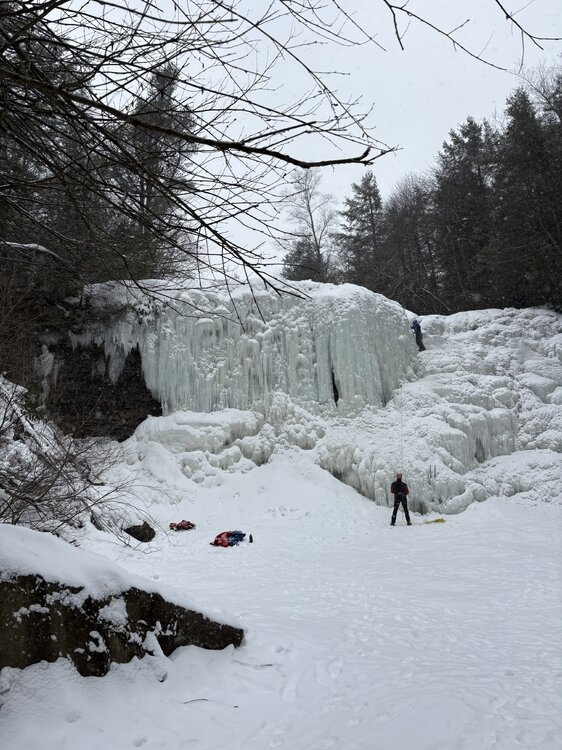
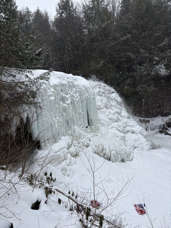
Some shots I took with @katabaticwhen we visited Swallow Falls on Friday 2/6
- 46 replies
-
- 11
-

-

-
I want to take a moment and thank @katabatic for amazing hospitality and a truly fun trip out to Western MD and the Canaan Valley region, including a slide over into Davis, WV. That was such a fun day of friendship and loving every moment of winter. It was a truly deep winter day with temps in the upper teens to low 20’s with snow falling the entire day. Saw all of the intensities too from light flurries to heavy snow. The Arctic front capture is a moment I’ll never forget. That was absolutely wild. It’s been a long time since I’ve seen something like that. Likely since 2/14/15 up at college. Would do it again in a heart beat!! Thanks again @katabatic!! Now I have excuse to come up there since we never got a chance to eat at Englanders
-
Some insane wind gusts out of nowhere in the lowlands. Mixing must be finishing out right before sunset. That was out of nowhere after a lull
-
We love verification!! What an experience.
-
One of the strongest gusts we had. We had one that was stronger but I didn’t have a camera ready. Easy 50+ in video. The one I missed was 60+. I had to stand still and keep my balance. 86AEF405-E88D-44A0-9A56-1715E7C91F9F.mov
-
Right as the squall was hitting. Pardon language end of video. Just surreal IMG_0009.mov
- 553 replies
-
- 11
-
-

-

-

-
On top of Keyers Ridge. Wind gusts 40-60mph with snowfall rates easily at 2”/hr. The gas station 150 yards from us completely disappeared when it came through. Absolutely stunning display of Mother Nature. EB5754F4-B744-483F-951F-C958A305BD6C.mp4
- 553 replies
-
- 19
-
-
-
That was one of the most insane, ferocious weather experiences of my life. Just wow. Videos will be shared.
-
Legit SN+ on top of Keysers Ridge before the squall. Reports upstream were 2-3” in 45 min. This is gonna be wild.
-
Sure was!! Man, what a pull!
-
Moderate to heavy snow in Davis, WV 25° @katabatic and I stopping to get pizza
- 553 replies
-
- 10
-
-

-
HRRR is best when it's inside 8 hrs, but can more useful up to 12 hrs if it is assimilating the data correctly. It has its struggles with certain setups and is best within convective environments or well-established thermal environments. Winter is not its strong suit, but can be useful at times. Right now, regional CAMs are better at handling this type of setup. Best ascent has been modeled south through the day, but some very light precip is still plausible north of I-66, but not looking likely at this point.
-
I'm probably going to slide out to western Garrett Co. for this one. I am off after Thursday AM, so I'm probably going to leave early Friday AM and head out there for the Arctic front and snow squalls. Should be fun! Anyone care to join the ride?
-
Analysis of pavement temps after today show there has been very little movement up in the temperatures with most places between 22-27F off the asphalt. Anything that does fall will easily stick to every single surface, so anything could be impactful for rush hour on Wednesday morning. Unless we get nothing of course.....but I'm not manifesting that
-
Got to 37F briefly in the neighborhood today, but was down to 33F when I left the house and falling. Expecting some black ice issues to crop up with some of this melting and subsequent refreezing. Stuff will take a small hit next few days, even with any refresher snow we receive before it settles back to pure concrete this weekend.
-
You’re not even using it to its full capabilities! At least put up the Kuchera and give yourself an extra 0.1”
-
Just some context for how insane this cold outbreak is in Florida, here are some nuggets for your viewing pleasure.... Great Falls, MT was officially warmer than Key West, FL today by 4 whole degrees (62F vs 58F) Boca Raton, FL never got out of the 40s for a high (48F) Havana, Cuba just BARELY beat out Great Falls for a high today (63F vs 62F) 12z sounding from KEY eclipsed their low 850mb temp record for the day by reporting below 0C after never recording below 5C on this date at any point in their history of record dating back to 1954 The 850mb temperature at KEY was -1.8C at 12z. If this is confirmed, it will be the all time coldest 850mb temperature ever recorded via RAOB at Key West, again dating back to obs from 1954. Over 40000 soundings have been launched in its period of record
-
Currently 26° after a low of 14°. Didn’t feel too bad this morning coming home. Still chilly
-
This is easily one of the craziest cold stretches in my lifetime. Insane enough, one of my coldest was the 2021 Arctic Outbreak when I lived in TX. Midland was below freezing for 8 days in a row with 3 days highs in the teens and one morning below zero. I seem to bring winter with me wherever I go….I’ll take it!! I love winter
-
Did a live interview with BBC this evening. Love my job and completing interviews!
-

The “I bring the mojo” Jan 30-Feb 1 potential winter storm
MillvilleWx replied to lilj4425's topic in Southeastern States
Right now the snowfall is light to moderate in your area, but watching the banding the east near and north of Goldsboro. If that can make it to the RDU area, you could push 7-8", no question. That stuff is heavy over in that direction. Likely 1-2"/hr stuff. 5" in 4hrs is incredibly impressive. So glad you guys in the RDU area got in on the action after a ridiculous hole in the precip field. -
January 30th- Feb 1st ULL and coastal storm obs
MillvilleWx replied to JoshM's topic in Southeastern States
Reports from New Bern are over 10" with some reports closing in on a foot according to MHX. Been chatting with them working at WPC. This is going to rival 1989 and 1965 in your parts. Incredible storm! -
And as @Terpeastmentioned, that was late March too. Roll that into February and you would be looking at a wall of white. That is a pretty Northern Hemi setup right there for these parts. Still need some luck in the storm department, but the look is pretty solid for potential.