MillvilleWx
-
Posts
5,537 -
Joined
-
Last visited
Content Type
Profiles
Blogs
Forums
American Weather
Media Demo
Store
Gallery
Everything posted by MillvilleWx
-
Hoping you can hit that 6.0” mark!! I’m out here betwee MBG and Shepardstown. I’m thinking 8-10” is pretty doable at this point. Perhaps we can push a foot! Will be close. Enjoy the snow my friend
-
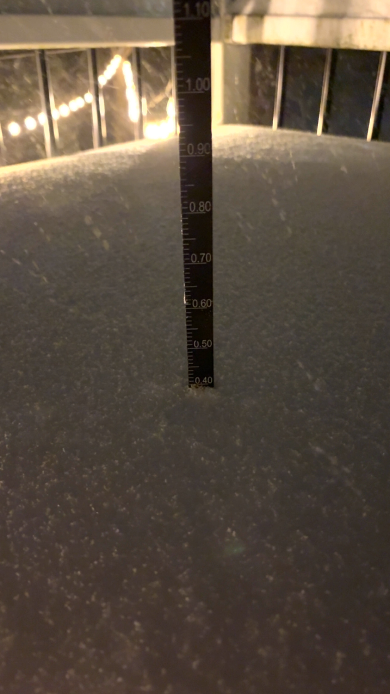
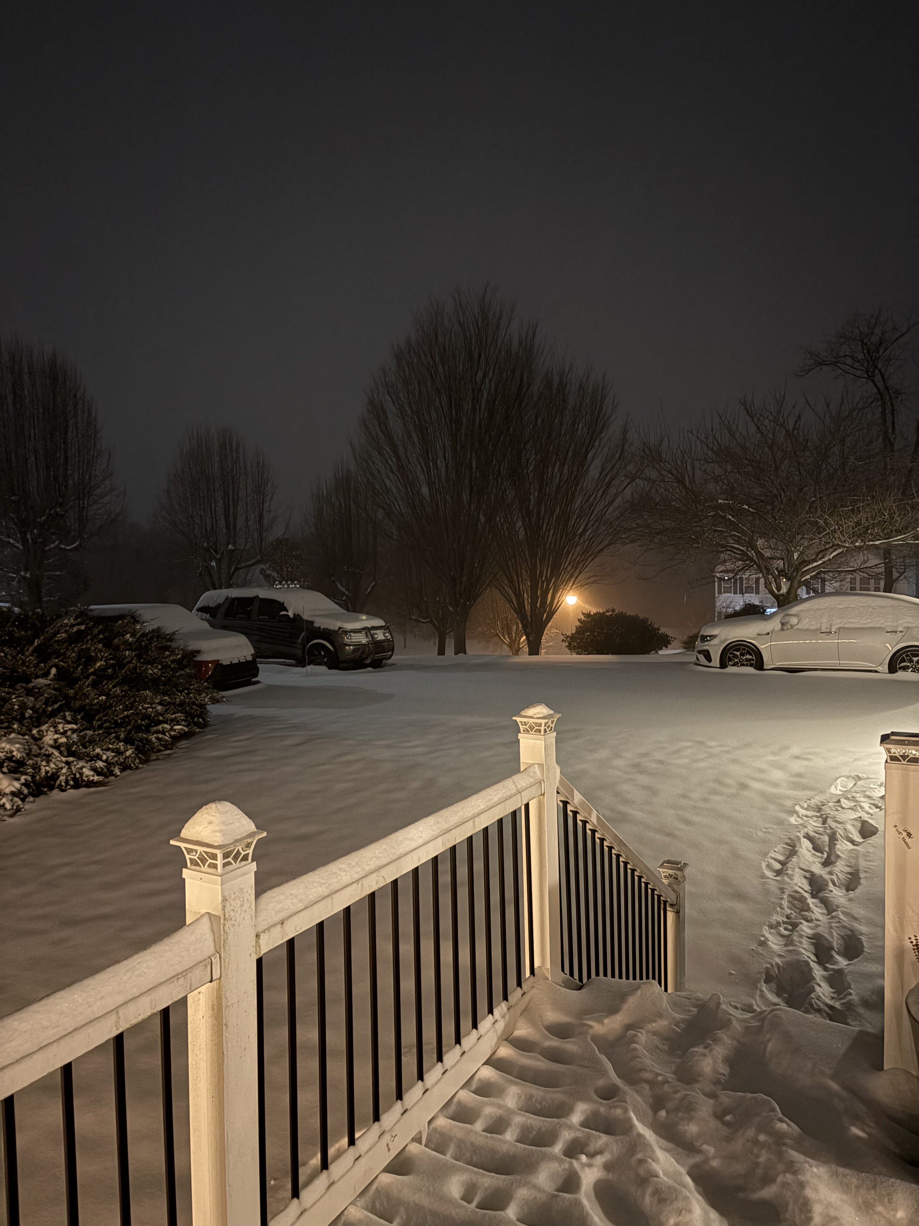
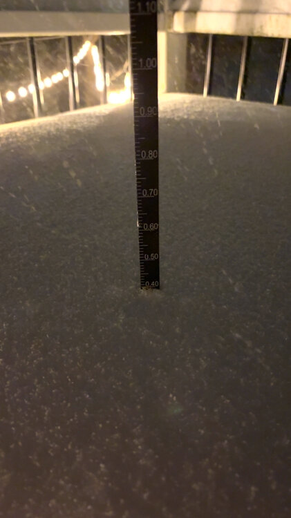
4.0” on the official 6am ob 12z/7am measurement will be sent to Sterling Steady SN, still not heavy just yet, but absolutely pouring snow out. Gorgeous
-
Hi
-
Measurement incoming at 6am, but trained spotter less than a mile down the road from me was 3.0” at 5am. Should be pushing 4” or more with this measurement. Pics and measurement to come
-
SN- to SN with more bands about to swing through. We measured 1” as of 320AM. HRRR doing well up here with the storm, so far.
-
No chance. I would be SHOCKED. 2021 was beyond anything I thought I would ever witness living in Texas.

-
Yeah. I’ve met some normal people there once
-
Internal model ratio is really nice too. QPF solid for our areas. The key is that morning period. Really slams us good out here.
-
Oh okay. You referenced CAD, so I was more talking about traditional surface CAD. Here it kind of holds on a bit longer due to latitude, but they will changeover out here. Sorry if I misunderstood!
-
Further west in these setups is typically more favorable. Cold air near the surface is very tough to erode within the Piedmont down through the Shenandoah. South to southeast flow can eventually get here and change over ptype, but they are last to change in a typical setup.
-
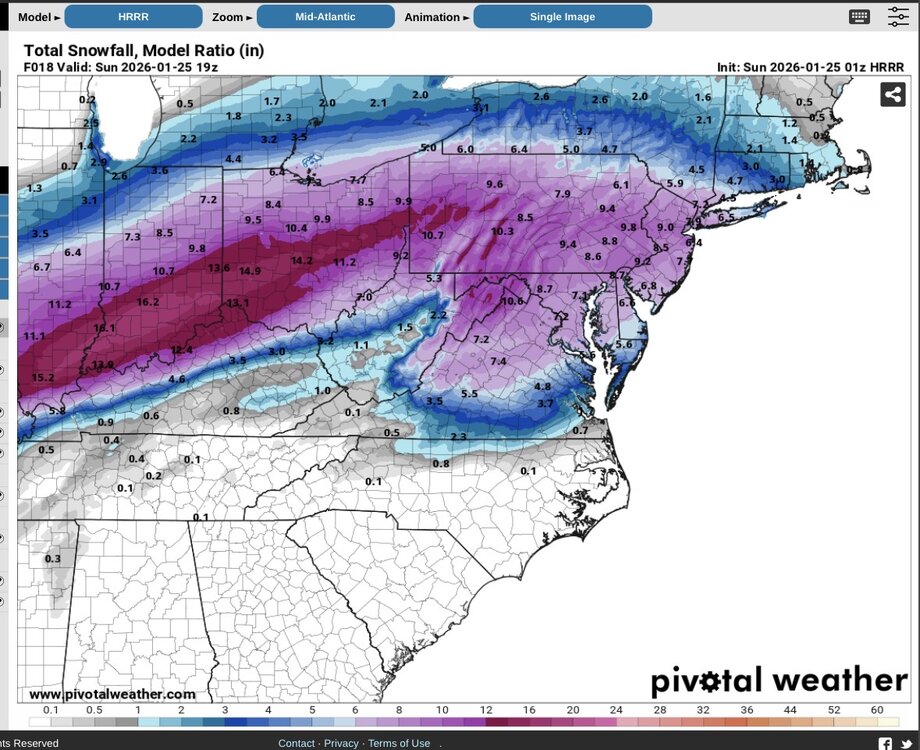
The key for out here is that one 7hr block between 11-18z. The 7H jet really cranks and precip explodes over eastern WV and slides north. That’s actually something I’ve noticed with the AIFS doing as well and why it keeps a maxima of QPF and snow over our areas. HRRR is indicating that and other CAMs have similar signatures. 1-2”/hr are 100% possible in that type of evolution. Never breaks out of the teens during height of snow. Dendrites followed by massive aggregates before the flip. Should be fun….hopefully
-
Beautiful out here! I wouldn’t mind living in the Panhandle. Long commute, but man! It’s so pretty
-
That’s actually model output my friend!! Ratios out here average 11-12:1 on a normal setup. Welcome to the great NW (Crew) lol
-
Chilling 6 miles east of MBG, between there and Shepardstown! Southern Berkeley county. Good spot imo for this one
-
NW crew should like trends. Not even looking at Model or Kuchera ratios, QPF is between 0.65 to 1.1 inches prior to flip. Average and NBM put Winchester through Berkeley/Jefferson Counties in WV around 0.75-0.9” of precip with a vast majority falling between 11-18z. Ratios will be very high overnight and slowly fall after 11z, but still easily 13-16:1 throughout most of the event. Unless NAM’s win on thermal progression (they could), I think 7-10” is very plausible at the low end with 10-14” very much in the range if the rates come to fruition.
-
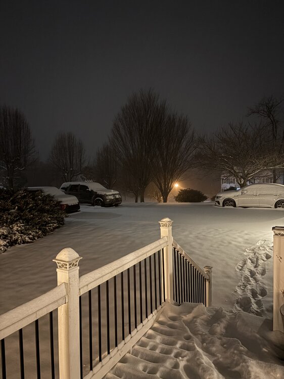
About 6 miles east of Martinsburg, WV Currently 14.9/-4.0 Let’s rock!!
-

Jan 24-26 Weekend Snow and Sleetfest Model Thread Part Tres
MillvilleWx replied to H2O's topic in Mid Atlantic
Yup! -
Jan 24-26 Weekend Snow and Sleetfest Model Thread Part Tres
MillvilleWx replied to H2O's topic in Mid Atlantic
Final Forecast for the Storm Some adjustments were made to reduce snow a touch and increase sleet which is a lower ratio component of the forecast. Still will be a formidable storm with some ice accretion added for good measure. A lot of the snowfall range should be take for a south to north crescendo with higher ranges more likely to the north of the lines presented. Will not be perfect by any stretch, but gives a good proxy. High impact event regardless as cold air behind the storm is very legit and we will struggle to break freezing for several days post storm. Be warm and safe everyone!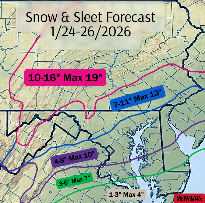
-
January 24-26: Miracle or Mirage JV/Banter Thread!
MillvilleWx replied to SnowenOutThere's topic in Mid Atlantic
They run away with the tupper ware bowls -
Jan 24-26 Weekend Snow and Sleetfest Model Thread Part Tres
MillvilleWx replied to H2O's topic in Mid Atlantic
West of the Bay, even at my location on the water is not getting above freezing. I would be concerned about some light freezing rain or drizzle with this storm if I’m along and east of I-95, and especially eastern AA county. -
Jan 24-26 Weekend Snow and Sleetfest Model Thread Part Tres
MillvilleWx replied to H2O's topic in Mid Atlantic
I’ll say this for the northwest crew, the models are really good out this way with these ratios. 18-20:1 is a good bet for the first 4-6 hrs of the storm before they slowly scale back, but even still, it’s probably 15:1 or better through 15z Sunday. After that, it’ll be a degrading column with the warm nose trying to approach, but flakes will be massive. Clumped aggregates that’ll still amount to 10-12:1 before a flip of any kind. -
Jan 24-26 Weekend Snow and Sleetfest Model Thread Part Tres
MillvilleWx replied to H2O's topic in Mid Atlantic
20/3 at my place currently 11/-7 where I’ll be for the storm This Arctic shot is no joke -
Jan 24-26 Weekend Snow and Sleetfest Model Thread Part Tres
MillvilleWx replied to H2O's topic in Mid Atlantic
I would gladly if it came to it -
Jan 24-26 Weekend Snow and Sleetfest Model Thread Part Tres
MillvilleWx replied to H2O's topic in Mid Atlantic
I don't have a map for Richmond proper, but I do think there will be a lot of sleet and ZR down there. I would guess 2-4" of snow and sleet, but add 0.3-0.75" of freezing rain accretion on top of that. It's not looking good for south-central VA down into the Carolina Piedmont. Stay safe down there! -
Jan 24-26 Weekend Snow and Sleetfest Model Thread Part Tres
MillvilleWx replied to H2O's topic in Mid Atlantic
Yeah, like I told Snowen, I have not paid attention to ZR much, so apologies for not really having an answer on that. I've been focused on the snow and sleet like crazy, so I can't give a great answer. I'll say this, any freezing rain will accrete very very efficiently with these temperatures. I think most here stay in the low to mid-20s MAX. Only east of the Bay and far southern MD will break 26F imo. It's going to be really hard to scour out.