MillvilleWx
-
Posts
5,537 -
Joined
-
Last visited
Content Type
Profiles
Blogs
Forums
American Weather
Media Demo
Store
Gallery
Everything posted by MillvilleWx
-
I loved the burger. Best one they’ve ever had. That said, it’s McDonald’s, so the bar is low lol 73° in Perry Hall area. Little humid out today. Better get used to it I guess
-

Outta gas and Outta Time: Early March Winter Storm finale
MillvilleWx replied to Ji's topic in Mid Atlantic
House at 16’ was probably around 0.25” of snow with light snow when I left. Crofton area looks like at least 0.5”. Really pretty out -
Thanks for the list of locations!! Great spots that will help fill more of the gaps that need coverage. And LOL!! The fight is on!! I’ll send you both a PM with my phone number so we can communicate and drum something up. There’s more in the sub I want to meet too.
-
Sweet!! Love it. Where are they going to be located, if I may ask? Also, gotta find a time to meet for lunch one day and chat meteorology and learn more about the Mesonet program. I was actually shadowed by a student at UMD this past Friday that knows you. She was incredibly bright and has interest in WPC. Small world!!
-
Outta gas and Outta Time: Early March Winter Storm finale
MillvilleWx replied to Ji's topic in Mid Atlantic
Took some time away from models after a crazy 7 day stretch at the winter desk. Just from a glance, I haven’t been too enthused. Still a shot at some snow, but max potential is probably 2-4”. Need something with more umph this time of year to really get anything appreciable. Judging by the ensembles after this one, I’m gearing up for spring mode. Baseball is on the horizon and I’m ready to tackle some outdoor walks, hiking, and meals outside. I’ll always welcome some snow though, so if it happens, I’ll accept. -
Outta gas and Outta Time: Early March Winter Storm finale
MillvilleWx replied to Ji's topic in Mid Atlantic
Our products have deadlines, so we can’t adjust the overnight forecast with the 06z guidance. If things remain like they are, it’ll be reflected in the next update.- 959 replies
-
- 10
-

-
2/26 - Follow-up Hopium Battlezone Storm
MillvilleWx replied to DDweatherman's topic in Mid Atlantic
DOAH!! Wow, I feel dumb lol. Noted -
2/26 - Follow-up Hopium Battlezone Storm
MillvilleWx replied to DDweatherman's topic in Mid Atlantic
Haven’t looked too much as I’m taking some much needed R&R from weather after that stretch. I’d lean no right now at a quick glance. -
Bringing this over from another spot so it has more visibility. Wanted to shed a little light on something interesting about this last storm. As for obs, currently 40/25°
-
2/26 - Follow-up Hopium Battlezone Storm
MillvilleWx replied to DDweatherman's topic in Mid Atlantic
We did some reanalysis of the GFSv16 (Current model iteration) and GFSv17 (Newer GFS that will replace the current version) and found the current GFS actually did a phenomenal job at SLP placement for majority of its runs and absolutely smoked the CMC and ECMWF overall. However, it did have a 48 hr window where the SLP depiction was about 50-75 miles too far west and that caused a lot of QPF negative feedback on the western periphery of the main field. It handled a lot of other areas correctly and outperformed the EC and CMC still on QPF as those models were way too light on QPF. Overall, it was a great job by the GFS, but as is always the case, the result is usually a blend of models and not just one individual deterministic. The NBM QPF was skewed by some overly zealous members, mainly some CAMs that will actually not be there for the next version of the NBM (NBM5.0). We are working with MDL (Model Diagnostics Lab) to generate these analyses to improve upon what we have and go forward. Overall forecast ended up being amazing for the high impacted areas and average at best for those on the edges. With a storm like this, every mile can make a big difference in appreciable impacts.- 227 replies
-
- 29
-
-

-
"Don’t do it" 2026 Blizzard obs, updates and pictures.
MillvilleWx replied to Ginx snewx's topic in New England
Incredible seeing the totals out of RI and SE Mass with this one. I was on the winter desk the entire storm at WPC and the forecasts I generated prior to the storm were consistently 30+ inches across that area. My highest forecast point was 34.2” and that even got beat. Incredible storm up there. Congrats to all who cashed big time. One for the record books and one for the memory bank. I’ll always remember my chase to Waltham in Feb 2013. Still one of the greatest storms I’ve ever witnessed and probably the second best pure blizzard I’ve ever seen (Feb 9-10, 2010 back home in Baltimore). Good luck in the dig up there and enjoy the rest of this winter! -
"Don’t do it" 2026 Blizzard obs, updates and pictures.
MillvilleWx replied to Ginx snewx's topic in New England
Plan is in spring I believe. I’ll have to double check, but I know it’ll be around prior to tropical season, so this is the last winter for V4.3. Next winter will be V5.0 or V5.1, so I’m looking forward to that on the desk. Definitely performing better than the current NBM operational. We see it in a lot of the verification. -

-
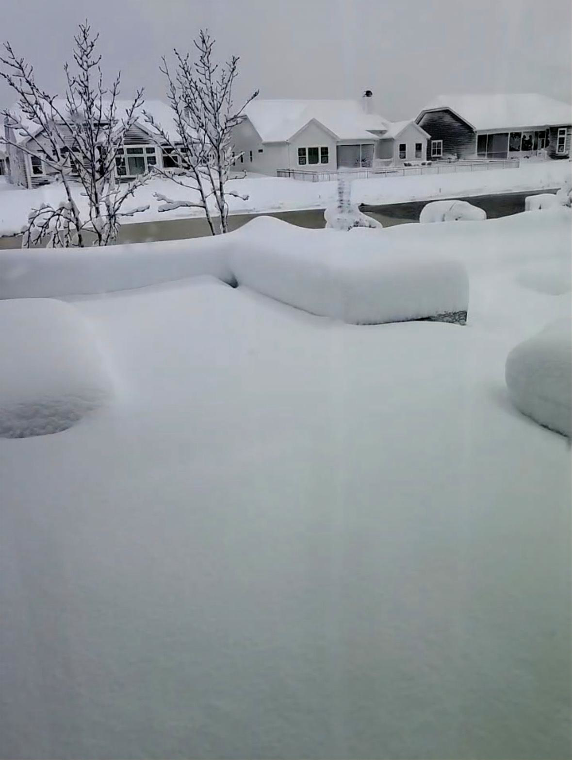
Feb 22nd/23rd "There's no way..." Obs Thread
MillvilleWx replied to Maestrobjwa's topic in Mid Atlantic
Picture from parents place west of Rehoboth Beach. 19.3" on the measure and it really could've been a bit more with some compaction. Incredible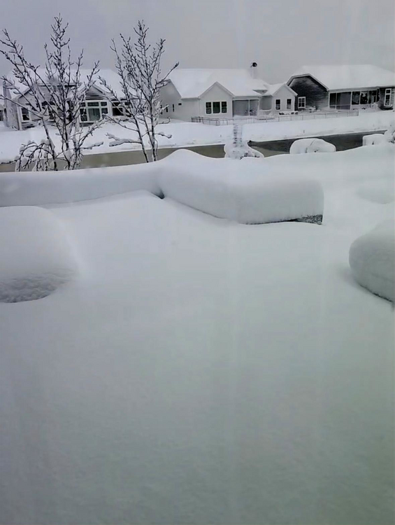
-
Feb 22nd/23rd "There's no way..." Obs Thread
MillvilleWx replied to Maestrobjwa's topic in Mid Atlantic
Pictures and videos from parents west of Rehoboth look surreal. Probably a solid 18-22" there and still snowing lightly. Thankfully they kept their power. Snow came up to the bottom of the patio table, which should be 20+ of clearance. Might be the most snow that area has seen in decades. -
Feb 22nd/23rd "There's no way..." Obs Thread
MillvilleWx replied to Maestrobjwa's topic in Mid Atlantic
Certainly looks that way, but I'm definitely not counting on it in the lowlands. This time of year takes a lot at 16ft elevation. However, those with elevation could get some the next one later this week, but jury still out. How'd you end up doing out there? -
Feb 22nd/23rd "There's no way..." Obs Thread
MillvilleWx replied to Maestrobjwa's topic in Mid Atlantic
Measured 2.4" this morning at my place, but probably compacted, so likely closer to 3". Can't verify that though, so I'm not going to report it. Definitely hurt to miss a lot of the bands over the Edgewater area. Not much to show for it this go around. A big branch did come down last night apparently, so more wood for fire pit this spring and summer incoming!! -
Feb 22nd/23rd "There's no way..." Obs Thread
MillvilleWx replied to Maestrobjwa's topic in Mid Atlantic
Nah, they are getting obliterated. Family west of Rehoboth is over 6” and just getting crushed with 1+”/hr rates. DE will do just fine with this one. -
Feb 22nd/23rd "There's no way..." Obs Thread
MillvilleWx replied to Maestrobjwa's topic in Mid Atlantic
Man, the deformation axis over the eastern shore is going to be WILD. 2-3”/hr rates in some of these at this point. Got a nice coastal front signature near Fenwick and the MD/DE border at the coast. Incredible -
Feb 22nd/23rd "There's no way..." Obs Thread
MillvilleWx replied to Maestrobjwa's topic in Mid Atlantic
The model ratio on the NBM is too high and it’s overshooting the QPF. Unless I’m completely missing something (plausible), this will be overdone west of the bay outside the norlun, which you can see is absent from this output because it’s a blend. -
Feb 22nd/23rd "There's no way..." Obs Thread
MillvilleWx replied to Maestrobjwa's topic in Mid Atlantic
Hey there! Not sure how those graphics are created, but those outputs are actually all models (This case it’s the HRRR) so it’s not the current representation surface analysis. It’s just a fancy way of model projection on the website. Pretty cool -
Feb 22nd/23rd "There's no way..." Obs Thread
MillvilleWx replied to Maestrobjwa's topic in Mid Atlantic
32° in Edgewater Moderate snow with it accumulating on everything but the roads so far, although they are starting to get slushy. -
Feb 22nd/23rd "There's no way..." Obs Thread
MillvilleWx replied to Maestrobjwa's topic in Mid Atlantic
I have no idea what they are doing. I lowered your totals on the WPC end. I'm missing something, or they are messing up something. -
Feb 22nd/23rd "There's no way..." Obs Thread
MillvilleWx replied to Maestrobjwa's topic in Mid Atlantic
Hanging out with Tony Montana? -
Feb 22nd/23rd "There's no way..." Obs Thread
MillvilleWx replied to Maestrobjwa's topic in Mid Atlantic
That's actually a good spot for our area. The issues don't arise until later when it gets kicked east-northeast. If it were to move northeast from there, or north-northeast like it has been, we would be in decent shape, but looks like it'll move away after is slows/stalls for 2-4 hrs. as the ULL maturation captures it. I think something is causing it to kick which I would need to look into. Is what it is. Still an incredible storm to watch unfold.