FXWX
-
Posts
1,395 -
Joined
-
Last visited
Content Type
Profiles
Blogs
Forums
American Weather
Media Demo
Store
Gallery
Everything posted by FXWX
-
Actually climate summary I saw shows 100. Last 90 was July 2022; I think. Could be wrong
-
At my elevation I usually struggle to hit/top 90... I have bounced between 95 and 97 today!!!!
-
I've had 80 on all 3 of my sensors!
-
Never heard of any; yellow perch my have the upper hand now...
-
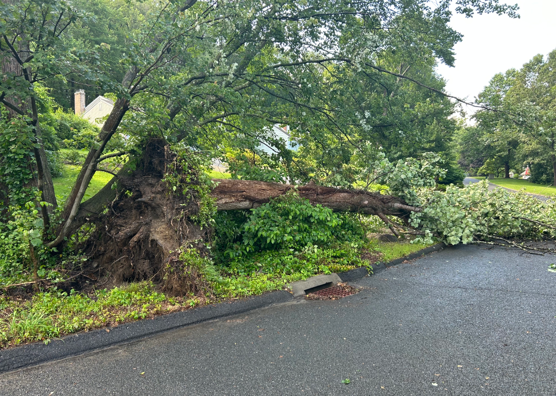
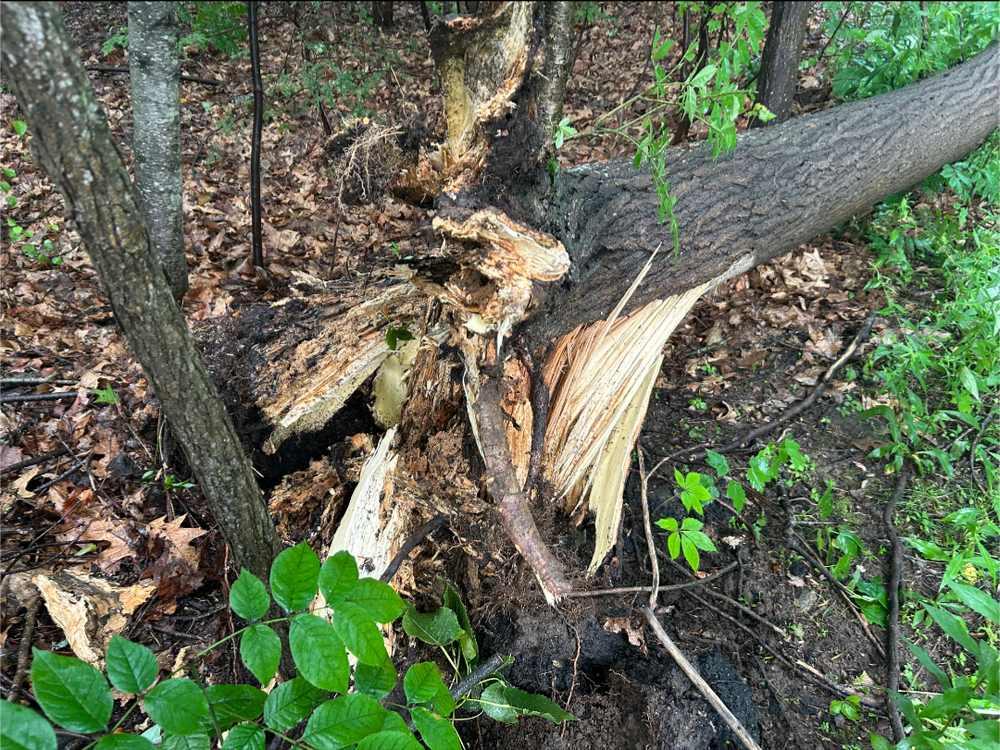
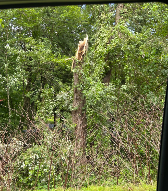
Also the occasional chipmunk! Did note 14,000 outages in MA and scattered reports across eastern NY and Northern New England... Bottom line is the New England region has an aging dense hardwood tree canopy with an abundance of diseased and previous damaged trees! We need either a derecho or CAT 3 to clean house...
-
Are you implying I shouldn't post a picture if a sizable tree falls across a road just because it happened in CT?
-
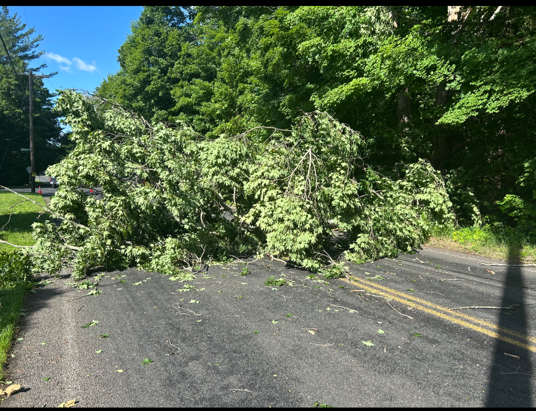
New tree issue in Burlington CT... 100% leaf cover and 40 mph working it's magic on poorly maintained trees...

-
Yes... it has always been a bluegill hot spot...
-
Probably not a well-organized one... All of the tree damage was a mile or two apart... Looks like downburst on the leading edge of the storm; all of trees / tree limbs were blown southwest to northeast; but nothing concentrated.
-
Actually not, surprisingly... On the Lake Grada side of town close to the Unionville line...
-
Burlington CT

-
PXL_20250613_160850663.TS.mp4 The cicada bugs are out of control on the Cape... Give a listen!
-
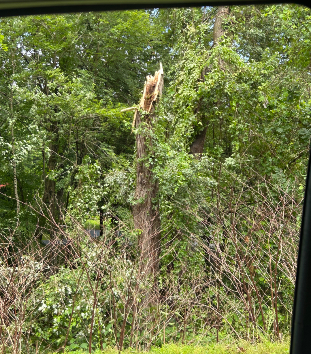
Probably was a small / localized event... I have experienced a couple of similar events across this part of Burlington that never registered anything on USGS...
-
1.25" here
-
52 mph!!!
-
42 mph gust here just now!
-
I think it's real this time
-
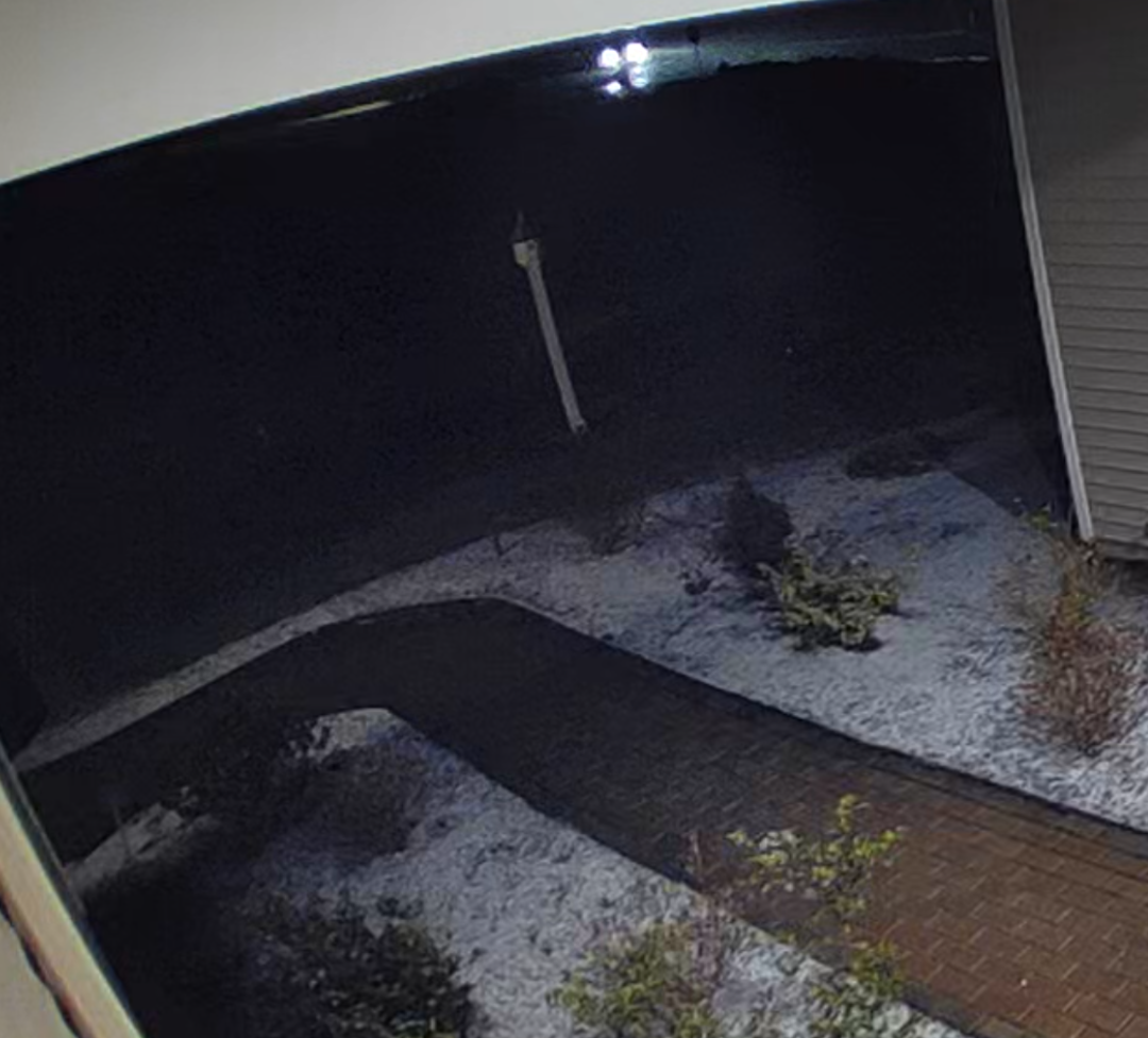
Snow only accumulating on mulch... Not sidewalk...

-
Meso's are bullish; not so much on the global side of things. There have been numerous attempts at a SNE thump over the past 2 or 3 weeks; roll the dice enough times and sooner or one will happen?
-
Did you read their reasoning? It's MA that they think has the greatest potential to see gusts to 50 mph with other zones peaking 35-45 mph. Maybe they are wrong, but they state why they are doing what they are doing. Calling them laughable is over the top...
-
51 mph gust here...
-
That is one special mind-altering bubble you live in! Lol
-
Euro several 70+ days in SNE... Gfs blah 40's & 50's
-
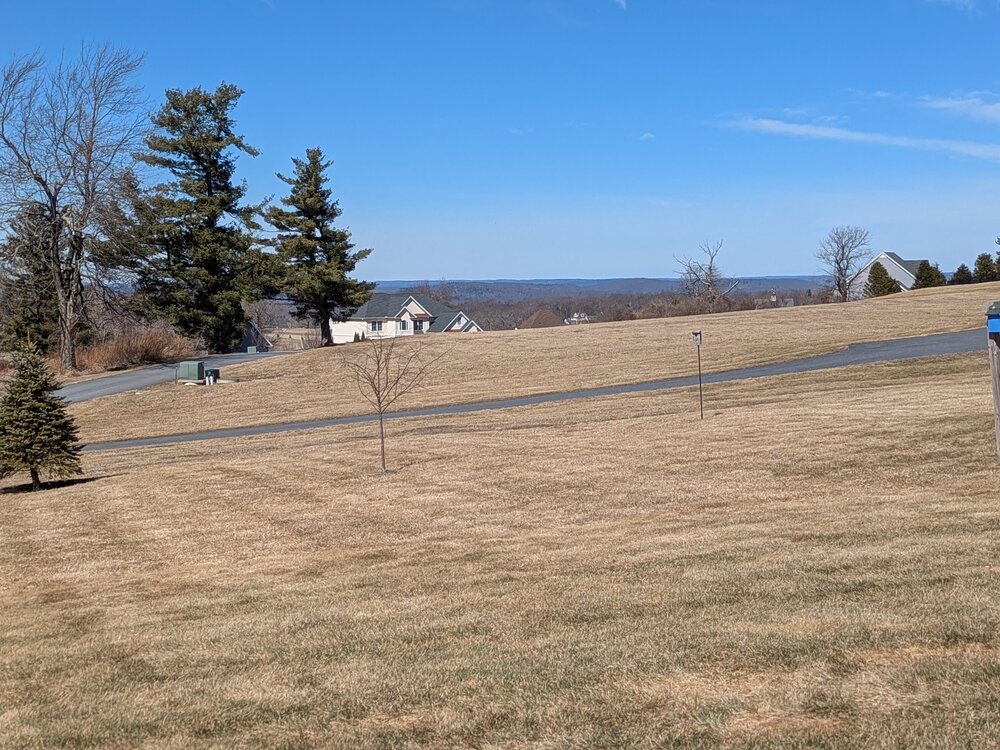
57 degrees... First afternoon on the patio enjoying the view!