
WxWatcher007
-
Posts
33,203 -
Joined
-
Last visited
Content Type
Profiles
Blogs
Forums
American Weather
Media Demo
Store
Gallery
Everything posted by WxWatcher007
-
I’m ok. In the eye.
- 755 replies
-
- 14
-

-
In the eye. Waiting for first light.
-
 Dead center of a dirty eye. What a feeling. Duct taped the window so it should be fine for now. On a mini damage survey with staff there is an undisclosed number of windows blown in. The eyewall gusts were pushing dead center on the windows. Power out of course and some localized damage. Seems modest so far. We’ll see what daylight reveals.
 -
Finally in the eye, though it’s the dirty part. Occasional breeze but it’s quiet.
-
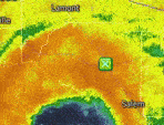
Anybody have the data for this?? This report is right on top of me and the power/window went right around this time. Just had 3 additional green flashes.
-
Absolutely hellacious eyewall. Intensifying hurricanes at landfall produce. This has been very impressive. Still going.
-
Absolutely wild. My hotel window blew in during the biggest gust. It would have come all the way in if I wasn’t at the window recording.
-
Where are you approximately? Just east of downtown Bay City (WxW)
-
Eyewall approaching here. Green power flashes continue.
-
Gust to 76 at Port O’Connor
-
Rocking
-
Starting to rock.
-
Those FL winds are nothing to sneeze at. Still getting deep convection wrapping around the core so the only limitation at this point is time.
-
Power starting to go out in the area
-
What do you know. Center tightens and the winds go up. Multiple unflagged SFMR of 72kt.
-
Recon finding stronger FL winds. Latest VDM had a peak FL wind of 77kt but well away from the center still. That said, the eye has dramatically contracted, from 58 miles six hours ago to 8nm now. That’s a feat in itself lol.
-
Windier than it looks. That lead band was pretty strong with good gusts and plenty of lightning.
-
-
Very little in the way of pressure falls so far. I’m just in chips fall mode at this point. At least the bands are putting on a show.
-
- 755 replies
-
- 10
-
-
Beryl barely moved between those center fixes.
-
I feel like we keep saying this, but this is the best it has looked. Almost a fully closed eye and lightning starting (maybe) to show up in the northern eyewall. Yep. We’re likely to avoid a real disaster. I’m not sure it’s going to ride due north the next ~9 hours, but wobbles of course always matter in these final hours.
-
Despite being on the cusp of hurricane status again I totally agree. Too broad, too much time mixing out dry air, not much time left. Gradual is the word of the day. Only thing to watch however is that conditions improve all the way to the coast.
-
Easy to do with a 58 mile wide ragged eye. It’s even larger than it was earlier.
-
Based on the recon data, I think it’s finally starting to intensify. May be close to hurricane strength based on latest dropsonde and recon data.


