hudsonvalley21
-
Posts
4,228 -
Joined
-
Last visited
Content Type
Profiles
Blogs
Forums
American Weather
Media Demo
Store
Gallery
Everything posted by hudsonvalley21
-
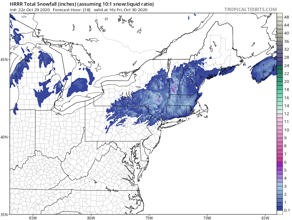
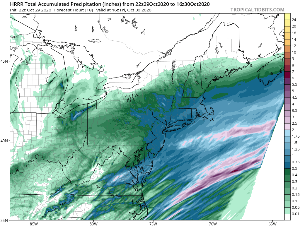
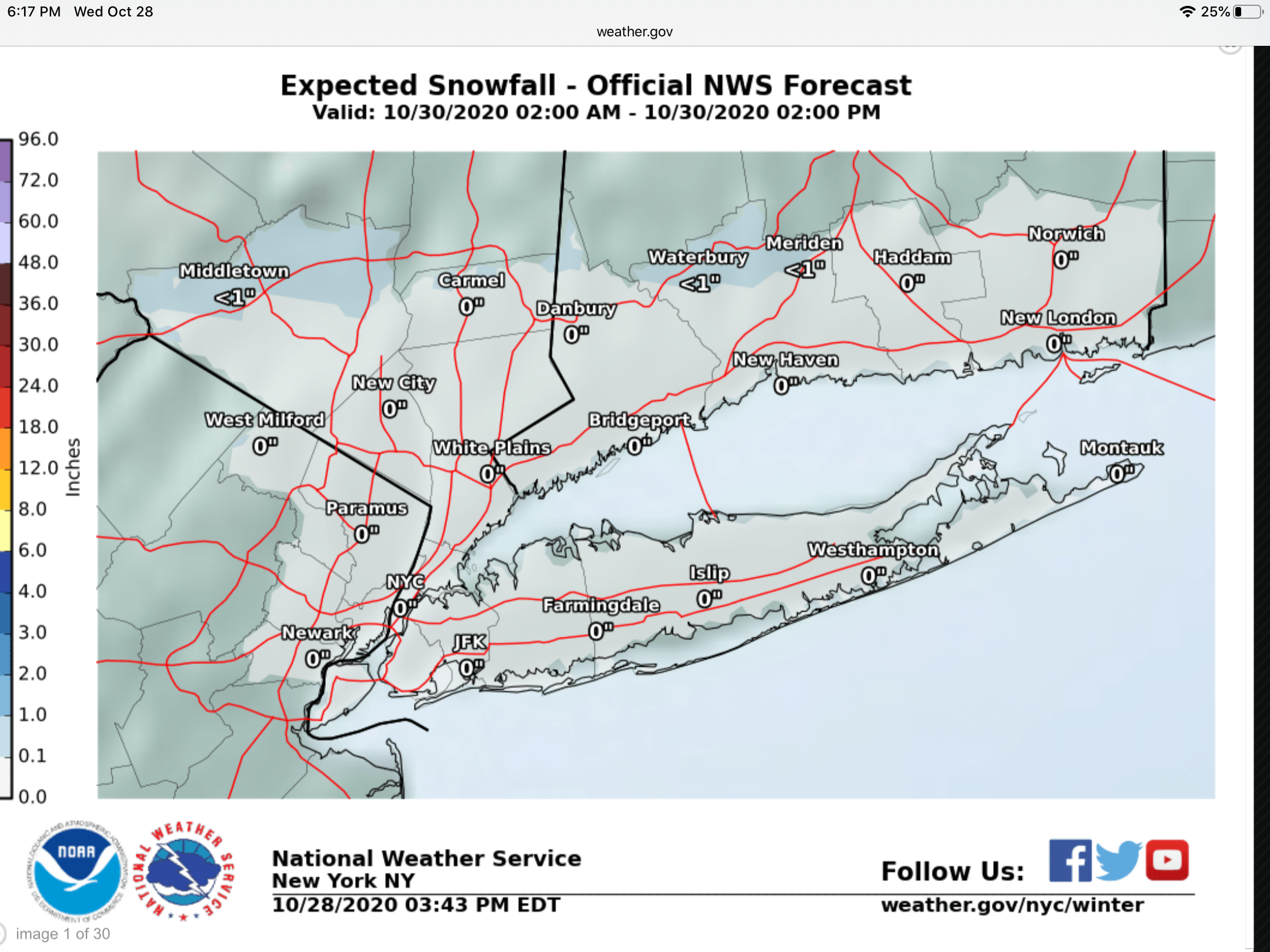
remnants of zeta and potential first flakes for some areas
hudsonvalley21 replied to forkyfork's topic in New York City Metro

-
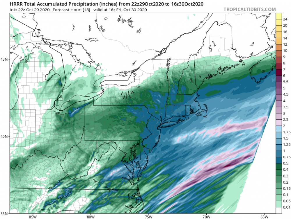
46/46 currently with 1.39 in the bucket so far today.
-
remnants of zeta and potential first flakes for some areas
hudsonvalley21 replied to forkyfork's topic in New York City Metro
46/46 currently with 1.39 in the bucket so far today. -
remnants of zeta and potential first flakes for some areas
hudsonvalley21 replied to forkyfork's topic in New York City Metro
0.70 here. -
I think the elevation around the peak of storm king is around 1,200’. The hiking trails around black rock are around 800 or so. Still some leaves in the trees around that area. Like gravitylover mentioned you will have too see where the ra/sn line sets up. Elevation will definitely have a factor. Good luck 47 degrees with 0.70 so far in the bucket.
-
0.29 here.
-
Wonder if they will lay down the beet juice
-

-
La la lock it up. Fo sho

-
Great find thanks for sharing Rob!
-
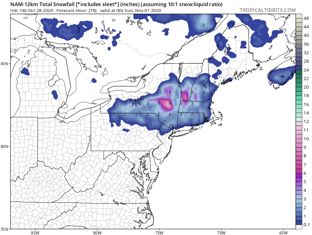
33 for the low here.
-
0.75 here
-
There is a history for those late October nor’easter/tropical systems. Some have performed very well. The battle for the change of the season.
-
Next round
-
Definitely. Hopefully we can keep this pattern going for awhile especially into snow measuring board season.
-
-
0.45 today, event total = 0.73
-
0.45 today, event total = 0.73
-
.28 here
-
0.26 in the Davis so far.
-
0.26 here so far.
-
Lookin that way.
-
Yup
-
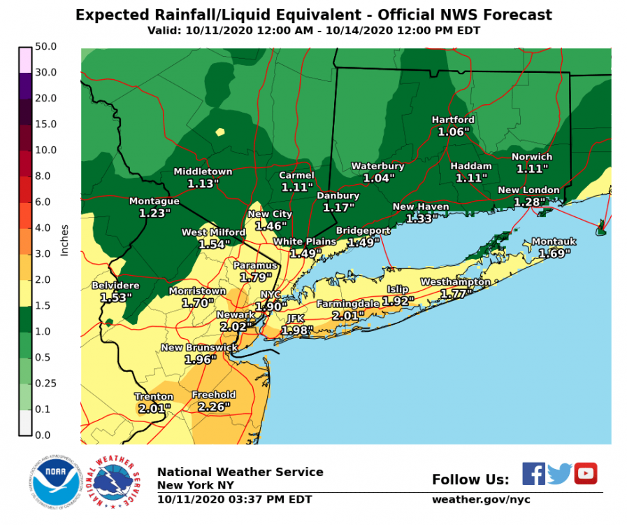
Upton has backed off on the QPF
-
Upton’s updated QPF map has backed off somewhat.