hudsonvalley21
-
Posts
4,265 -
Joined
-
Last visited
Content Type
Profiles
Blogs
Forums
American Weather
Media Demo
Store
Gallery
Everything posted by hudsonvalley21
-
Yup I it’s funny how that worked out. -6 at my home with 125’ of elevation and going over Storm King Mtn. this morning it was +2 up on top at 1,200’.
-
I’m at 8.0” for the total. Agree on the band that set up shop over us gave us the jackpot. The ratios in the evening also helped out too. As Rob mentioned it was at 14:1.
-
8.0” as of 12:30 am. Light snow still falling. 22/20.
-
8.0” as of 12:30 am. Light snow still falling. 22/20.
-
6.4” here. Definitely changed over to a higher snow ratio and gusts out of the n/e around 20-25. Down to 24 degrees the ground layer is definitely freezing up. With a forecast low of 14 tonight, it will be a tricky drive on the roads.
-
6.4 here, 26/24 with light snow and n/e winds getting occasional gusts around 20-25. It definitely seems like us here on the east side of the county did well with accumulation.
-
Thanks, nice write up. These models are the ones to be focusing on at this timeframe.
-
Maybe it’s not done trending yet.
-

-
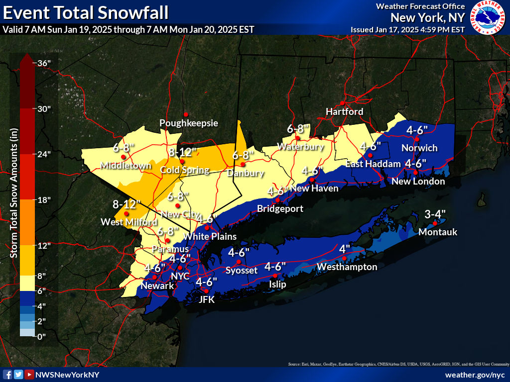
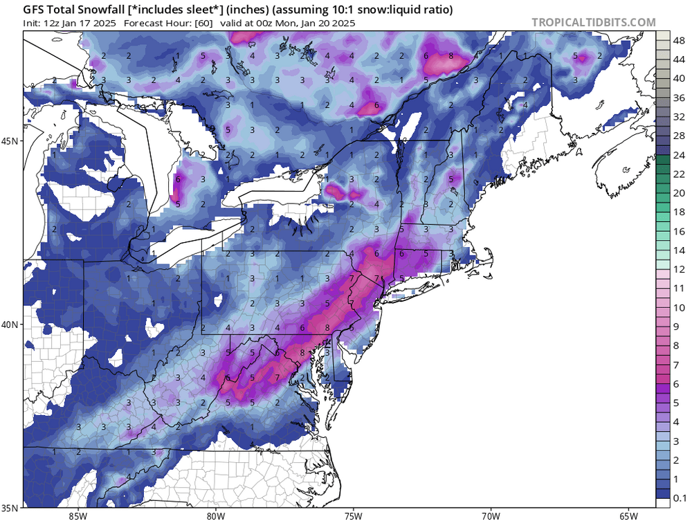
Upton’s latest snow map.

-
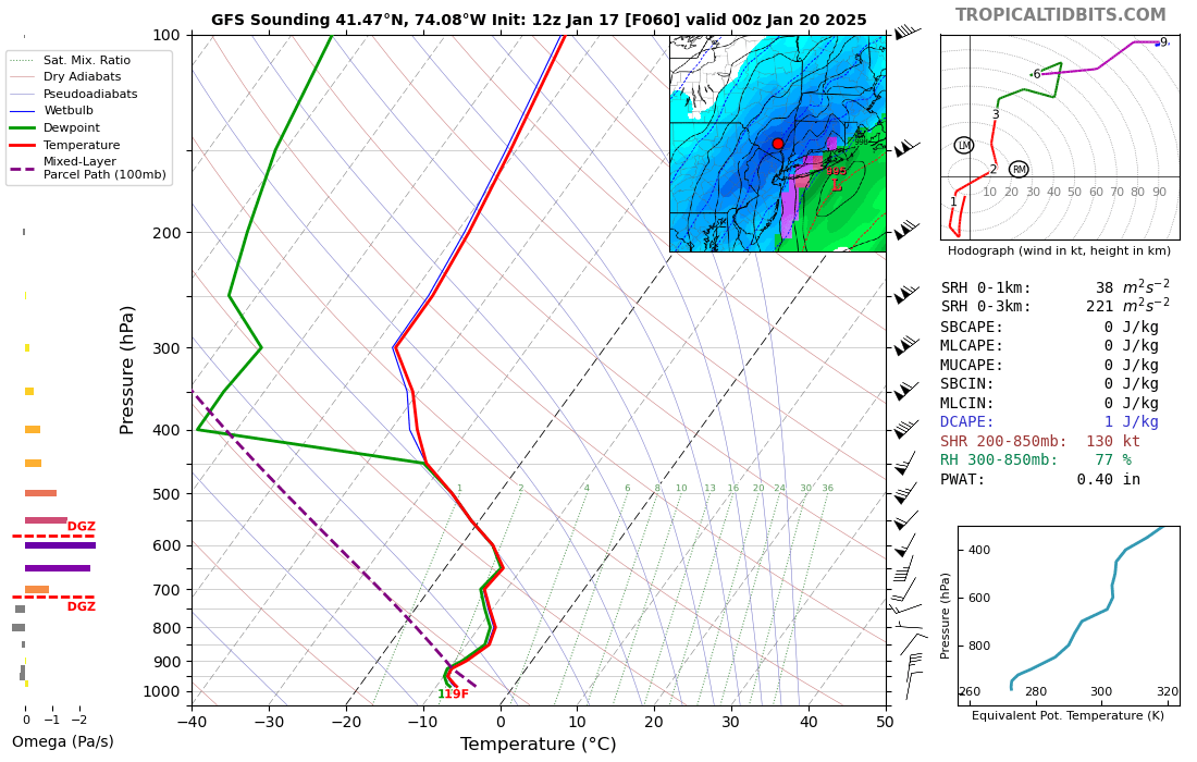
QPF up this way near KSWF is .40 at 00z Monday (lower than the other 2 soundings) The snowfall map is higher up this way definitely a better snow ratio up this way.
-
Same here coating on all surfaces. Light snow currently 23/20
-
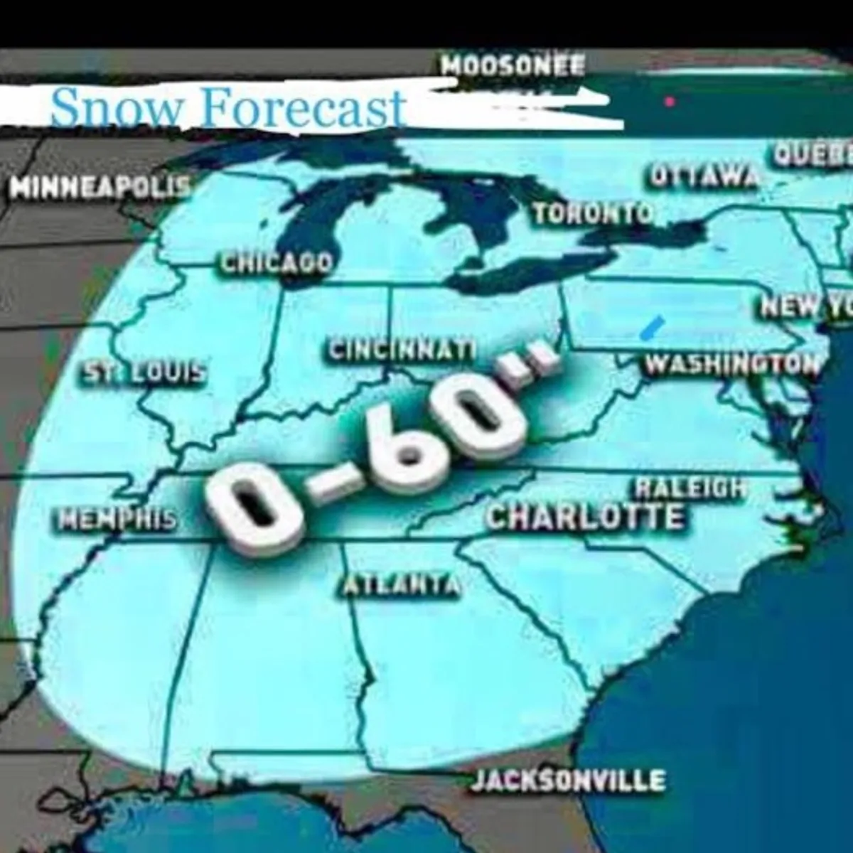
Get him a T-shirt

-
Definitely feeling like winter especially with the windchill effect. Took down the outside Christmas decorations yesterday, on the plus side, little snow cover to move thru. Hopefully we don’t get the winds up to 60 today as Walt was mentioning in the earlier post.
-
I’ll use this one.

-
Jan 11th-12th Super Bomb or Super Bummed?
hudsonvalley21 replied to Rjay's topic in New York City Metro
Agree, we’re 5 days away. You know that there will be adjustments. It’s all about timing. Once all the players are on the field and some samplings are made, hopefully we’ll have model consensus.- 993 replies
-
- 1
-

-
- metsfan vs snowman
- bomb
- (and 2 more)
-
Had light snow showers over the weekend here. A couple gave a dusting and that melted quickly. Used the leaf blower as Rob did and had a good results.
-

-
.2 here with light snow currently, 23/22 skies are starting to brighten up. A coating on all surfaces and the salt spreaders are out.
-
Jan 11th-12th Super Bomb or Super Bummed?
hudsonvalley21 replied to Rjay's topic in New York City Metro
Now it’s a toss for a different result run to run.
- 993 replies
-
- 2
-
-
- metsfan vs snowman
- bomb
- (and 2 more)
-
Had numerous light snow showers here yesterday and a few flakes this morning.
-
Agree with you 100%. In the NE forum there is some great analysis and discussions you just have to move around the chatter. Walt’s posts are excellent, you can learn so much from his posts. I really appreciate his time and efforts along with sharing his knowledge.