FallsLake
-
Posts
6,318 -
Joined
-
Last visited
Content Type
Profiles
Blogs
Forums
American Weather
Media Demo
Store
Gallery
Everything posted by FallsLake
-
Does anybody have a euro snow map? If it's similar to last run, then I think nothing has changed (..model wars).
-
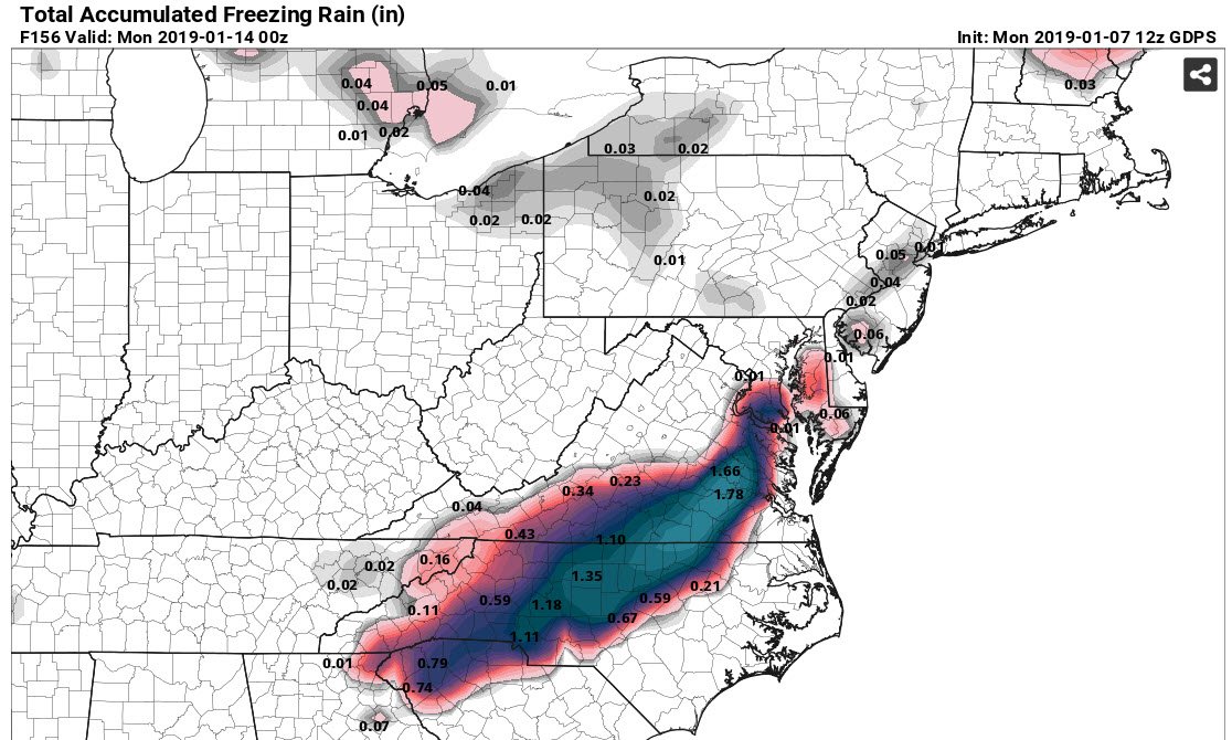
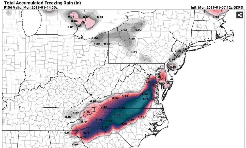
Ice is confined to the western areas of NC/VA; with lesser amounts (spots up to .25-.50") compared to the CMC.
-
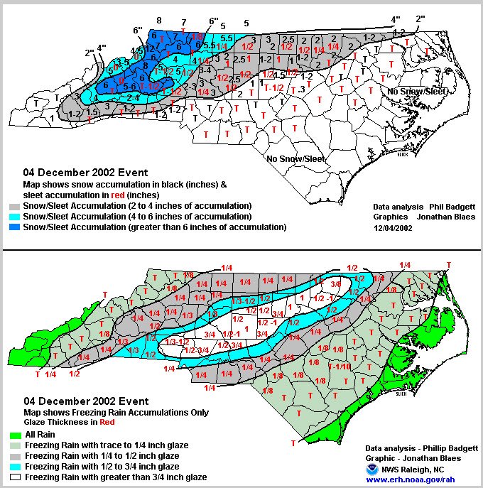
Yep 2002 looks close to what the Canadian is showing:
-
^^The ICON would be similar with maybe lesser amounts of ice in the NW because of more snow.
-
Oh this wouldn't be that bad...
-
Canadian is very close to the same solution. But wake County would be the dividing line of significant ice.
-
Definitely not a good solution; but one of many real possibilities. Does have some snow/ice in the far western areas before it pushes everything to rain.
-
RDU looks to never get above freezing....ICE
-
12z NAM shows highs on Thursday in the 30s (outside mountains) for many of us. Dew points in the single digits in south VA to near 20 in NE Ga.
-
If we can get a good low track / high location, we should be good for surface temps. The initial cold front coming through this week is cold. GFS(s) have low teens (dew points) for many of us. If we can keep that from being scored out, we may have something with this storm.
-
I had a link at one point but even then it was like looking at the euro on Tropical Tidbits.
-
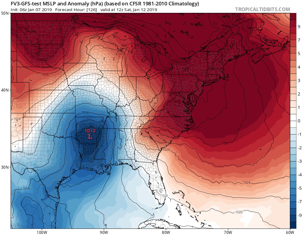
For right now, this is good enough for me: While the aforementioned mid-upr low/trough will lift newd and away from the nern US through the end of the week, renewed nrn stream amplification is forecast to occur from cntl Canada to the cntl Appalachians Fri-Sun. At the same time, a srn stream shortwave trough is forecast to migrate across the srn US, with some interaction/phasing possible invof the srn middle Atlantic coast over the weekend. While the complexity of the flow will yield uncertainty regarding forecast details for the next several days, the overall pattern is one supportive of cyclogenesis from the GOM to the middle Atlantic coast, with sufficient cold air in place to support snow across parts of the middle Atlantic states, including probably the NC Piedmont, by Sat-Sat night.
-
For a miller B, we just don't want the low to get higher then Tennessee; then transfer SE to the South Carolina coast. We of course need a strong CAD to force this situation.
-
Like I said above, we're going to have to keep an eye on how this evolves. The FV3 just barrows the low up the Apps. I could see this ending up a miller B (with CAD holding strong) with a transfer to the coast.

-
The overnight runs took a step back. The FV3-GFS did show more ice potential on the 6z run; maybe starting to show more CAD influence. Also not sure if this still occurs, but until recently the models would tend to lose (or miss-interpret) storms around the day 5/4 mark (not sure why). Today into tomorrow, look to see if the models jump to another depiction (hopefully back to a snowier solution).
-
At this point I will (personally) lean towards the FV3-GFS over the old GFS. I'm pulling for the old GFS, but the FV3 did very well with the last storm. Not sure if I would tie it with the euro (yet) but there may be the day in the near future where the FV3 is crowned King.
-
Not sure how much snow fell during 2000 (The year of the "Carolina Crusher"). We would definitely be way above normal. RDU already is above.
-
If I could get another foot, I would tip my hat to your two feet.
-
^^Yep, verbatim (for RDU) it would be snow to rain then back to heavy snow. That would be a crazy storm..
-
It seems that has been the rule for the last three years(..at least). I keep wondering when we get another big eastern NC storm.
-
Single digits (on GFS) do get into western NC briefly. This is going to be a colder surface then last time.
-
You would think this would trend colder, at least on the surface. I keep on harping on the initial cold, but with dew points falling into the teens before this system arrives the CAD that does set up will have a better chance of verifying colder and farther south.
-
Definitely looking promising for some sort of wintery event. Thinking/hoping that CAD is a little stronger and more folks can get in the game. Big difference from the last event is this is popping up much closer to go time.
-
Looks like the 12z ICON is on board for a winter storm. At hr 156 has the snow line from SW NC to Raleigh then Rocky Mount. It only shows rain/frozen so I'm sure there is some ice below that line. Edit: Has the surface freezing line from Greenville SC to south of Charlotte, to south/east of Raleigh.
-
Hopefully today we see more model agreement on this next weekends potential. One thing I really like is we get cold air in place before the precip comes in. Also on the FV3-GFS it lost the lakes low (from 0z) and showed more of a CAD signature. If we get a good CAD setup expect more transition precip types to start showing up in later runs.