

olafminesaw
-
Posts
3,052 -
Joined
-
Last visited
Content Type
Profiles
Blogs
Forums
American Weather
Media Demo
Store
Gallery
Posts posted by olafminesaw
-
-
The NYC and NE subs must be melting down right about now
-
 2
2
-
-
9 minutes ago, mclean02 said:
Not sure how that 8.2 happens in gso but I will take it lol
This has been a really persistent feature, particularly on the globals. As I mentioned a page or two ago, there could be enhancement from a jet streak, which often over-performs Obviously that value is crazy, but I could see someone getting 3-5" somewhere in the Piedmont, but fairly localized
-
 1
1
-
-
36 minutes ago, TARHEELPROGRAMMER88 said:
EPS map? GEFS trended in our favor at 06z.

-
1
-
 1
1
-
 1
1
-
-
9 minutes ago, msuwx said:
.thumb.png.fd3e758c8455d69a052e4a80cb9fda38.png)
So close, but phases too late. Even with the south trend yesterday, the phase hasn't worked out for us on really any of the models (except the NAM). Have to depend on banding away from the main LP to get the job done. One reason for the NAM's depiction (I believe, I'm a little out of my depth here) is enhancement due to the placement and strength of a jet streak

-
Anyone have the 6z Euro? Looks decent at H5
-
I wouldn't shocked to see a double maxima, one over the western Piedmont, where banding develops and where temps are better intially. Over the eastern Piedmont could stay pretty dry waiting for the transfer and rates will have a hard time overcoming temps of 34-36 initially. And of course closer to the coast will fair better, with 3"+ for NE NC
-
-
Better still
-
3
-
-
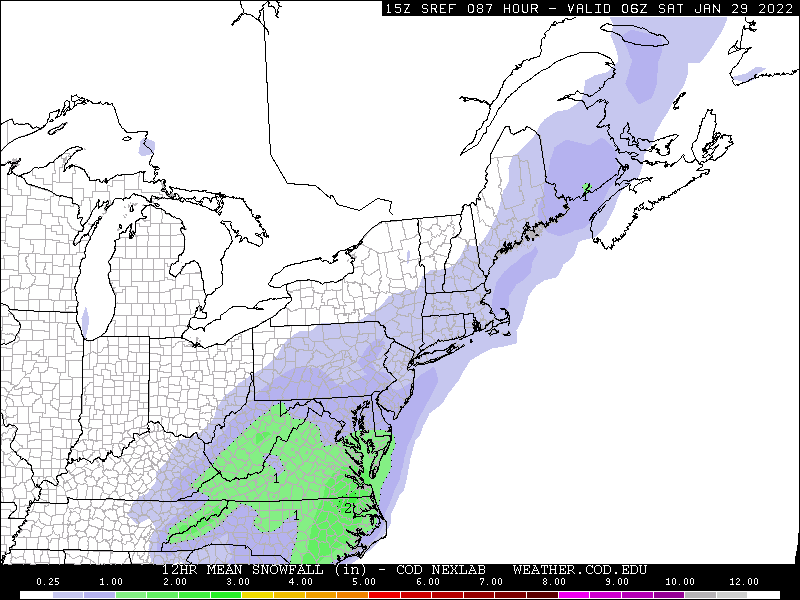
RGEM is meh. Close to something decent though
-
Main takeaway:

-
1
-
-
Big improvement on the NAM through hour 60. Seems they NAM likes to over-amplify at this range though, so tog be taken with a grain rain of salt
-
1
-
-
-
15 minutes ago, NorthHillsWx said:
Honestly I’d be very happy with a 1-3” event to cap off this pattern. Would get many near climo for the season with February and March to go
Me too. I just know that one day, it'll be "the big one". It's kinda my Moby Dick. When I was a kid DC seemed to rarely get more than 6" or so of snow. Then magical 09-10 hit when I was in middle school. I had no idea 2-3 feet of snow was possible, let alone two storms of that magnitude in a single winter. It was like being transported to another planet, and ever since, I've craved that same feeling to happen again
-
3
-
-
6 minutes ago, PantherJustin said:
Ik it’s a Tuesday at 220PM but it’s always telling when you look at the forum and no one has said anything in 45 min and we’re 4 days out ….

It's been a long couple of days since that absolutely bonkers GFS run. Always disappointing when a high ceiling event falls through, even knowing how unlikely a high impact event was in reality
-
1
-
-
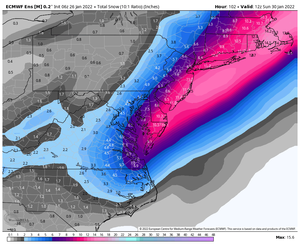
Elizabeth City's record of 9.2" for the month of January seems to be within reach
-
1
-
-
-
CMC Looks much like the GFS so far

-
What a monster weenie run for Boston. Holy cow
-
1
-
1
-
-
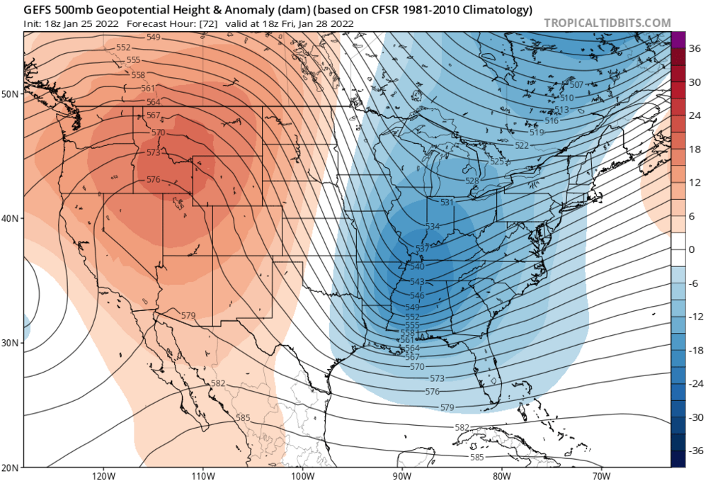
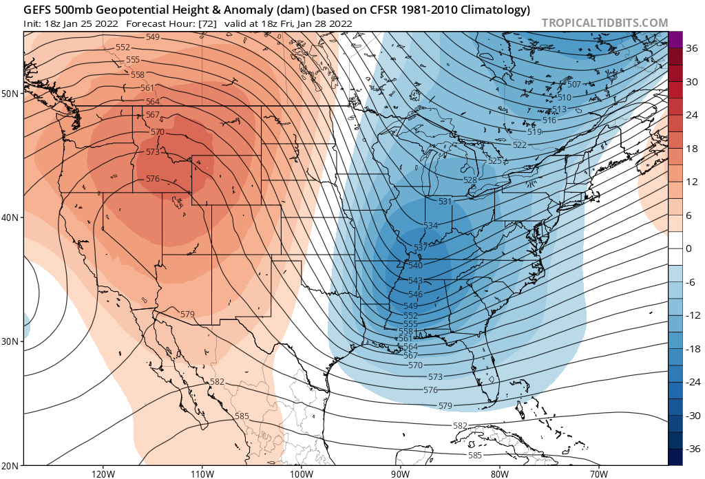
My best understanding is we need a weaker Northern stream and earlier phasing with the Southern stream, correct?
-
6 minutes ago, BooneWX said:
I said it yesterday and I’ll say it again. It ain’t dead until the RGEM says it’s dead.
The RGEM wasn't exactly perfect with our last storm. It was definitely over-amped for the majority of it's runs
-
RGEM is real close to a solution that work well for most. I think no matter what happens NE NC will fair the best

-
14 minutes ago, PantherJustin said:
Can we talk about easy it must be to be a meteorologist in New England? Like close your eyes and Sleep during you shift easy…. They have nothing to look at except track…. They always have Cold Air, They never have Mixing issues or CAD (lol)…. It literally must be as simple as “ohh hey it’s Cold out, here comes liquid yep big storm 16-24” maybe more that’s the only reason I’m watching the track back to you Bob for sports” no this post isn’t me whining it’s making fun of them
I know you're kidding around, but any big wrapped up low that passes close to the coast, they worry about mixing. Small changes in track can have huge differences in totals, especially for areas right near the water. The cape can get nothing and just inland can get 12"+.
-
3
-
-
4 minutes ago, StantonParkHoya said:
As a general rule growing up in ENC, we rarely saw DC, NYC, BOS also do well when we did. Snow in NC, particularly in this part, is an exclusive business.
Yep. It's easy to forget how far East of us New England is. Boston is about the same distance East of Greensboro as it is North. (400+ miles)
-
4 minutes ago, yoda said:
I want to say I like the 18z NAM h5 at 84... even though its the NAM.... at 84... yay or nay @stormtracker?
Seems to be not quite as good as the GFS at that hour, but better than the Euro
.png.657a76f8c88939569ff34185c1345023.png)


Potential 1/28-1/30 2022 winter storm
in Southeastern States
Posted
Eh, getting into the range where that's no longer true. The higher resolution of the OP serves our purposes better