

olafminesaw
-
Posts
3,060 -
Joined
-
Last visited
Content Type
Profiles
Blogs
Forums
American Weather
Media Demo
Store
Gallery
Posts posted by olafminesaw
-
-
Although I know the GFS is smoking something...Definitely potential there if something does spin up. Of course with more troughs moving into the gulf this time of year, potential Is more limited, but I could definitely see a strong hybrid type system somewhere.
-
-
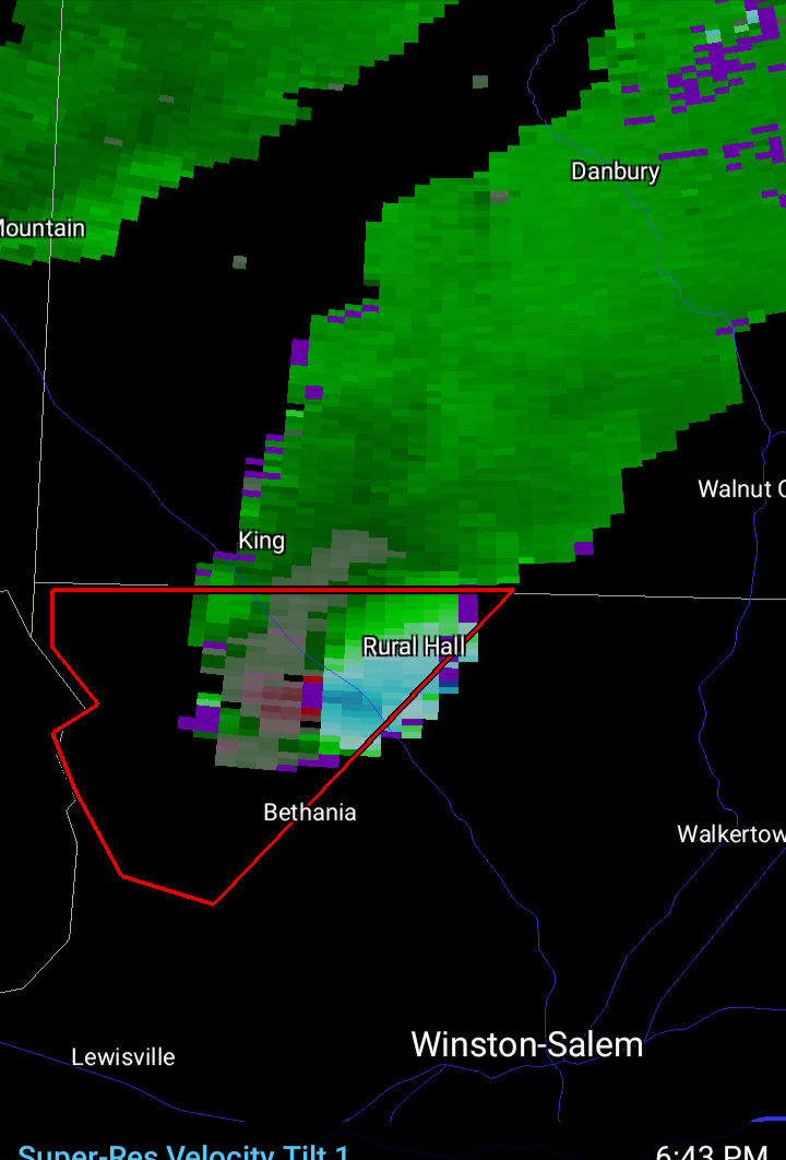
A bit of a couplet possibly developing

-
-
40 minutes ago, WxSynopsisDavid said:
Concerning cloud cover, that’s not entirely true. Some of our biggest days (8/6/93 and 2/24/16) featured cloud cover extensively across the region during early half of the day. Regardless, this threat is driven by a warm front lifting to I64, surface low in OH, and a secondary surface low trying to develop back in western NC. Classic, textbook setup that has produced some of the regions biggest days for severe weather. Though I will say some soundings suggest zero capping inversion which could be a limiting factor as that would suggest a mixed/messy convective mode.
You see the wedge eroding on visible. Pretty neat with mid level clouds moving west to east and low level clouds/fog moving south to north
-
 1
1
-
 1
1
-
-
Purely based on radar, i'm thinking this zone will be a primary threat area (behavior of early convection and of course areas that clear can be indicators)

-
A lot of cloud cover moving into the primary threat regions. Typically limits potential. Probably for the best.
Although FWIW, the HRRR has clearing pushing in from the south, between 10 am (Charlotte) and 2 pm (VA border)

-
Fairly strongly worded disco for a d2 slight risk from SPC. Just depends on capping will allow development while instability is higher.
..NC/VA...
   Low 60s dewpoints will likely be in place across much of NC early
   Friday morning, with higher values near the coast. This moist air
   mass is forecast advect northward throughout the day amid the
   southerly low-level flow ahead of the approaching outflow, with the
   northern extent of this better moisture acting as an effective warm
   front. Isolated thunderstorm development along this warm front is
   possible, where wind profiles support supercells. Damaging wind
   gusts and a tornado or two are possible with these storms if
   updrafts can mature.

   After this initial isolated threat, more widespread thunderstorm
   development is possible as the outflow moves into the region amid
   mid 60s dewpoints and moderate buoyancy. Damaging wind gusts within
   any more organized bowing segments are the primary severe risk.
-
Although it's been hot the past couple days, it's certainly been nice to soak up the sun. Let's lock in a stretch of weather like this with highs in the low 80s, dews in the 50s in mid July.
-
7 hours ago, WinstonSalemArlington said:
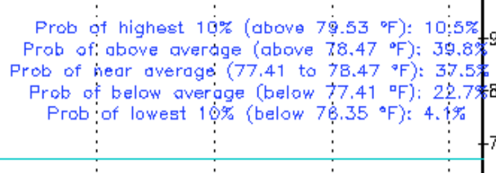
Probabilities for the Piedmont:
-
-
29 minutes ago, NorthHillsWx said:
One of the wildest tornado videos in history was that Myrtle Beach tornado that developed along a sea breeze front and roared directly down the beach in front of the high rises for miles. I think that was EF-2. Coastal fronts 9 times out of 10 wreck havoc on storms as they approach the beach and almost always cause them to be undercut and become outflow dominant. However, violent tornadoes and outbreaks like yesterday are exceptionally rare and the setup for discrete super cells like we saw yesterday out in the clear rarely materializes in that area. Really was likely a historic day yesterday but thank the lord it hit some of the least populated areas in the southeast. A really really close call with Columbia as well.
I would imagine there are quite a few similarities to a typical Carolina Alley outbreak, just further south.
-
19 minutes ago, nwohweather said:
Not violent, it's pretty difficult. From Mothers Day to Labor Day we really take on a fully tropical climate which lacks the wind aloft in sea breeze thunderstorms to put down anything. Also most stronger lows do not affect us as they go poleward as deepening occurs out of OK/TX in the winter and stay to the west of the Apps. It's certainly rare to see things line up, but when it does you have ample moisture to bring those LCL's down like yesterday
I was able to find two cases:
Galveston:https://www.tornadotalk.com/galveston-tx-tornadoes-september-12-1961/
Georgia: https://www.weather.gov/chs/TornadoOutbreak-May2008
There's a possible third in Tampa but I can't seem to find any info on it (I'm not counting the 1966 long tracker as F4 damage for that one was more inland).
There are others that are more inland (one West of New Orleans) but I decided to research only truly coastal locations.
-
5 minutes ago, nwohweather said:
Heck of a day down here and really we lucked out. Due to the water table (whole place is a swamp) basements are not something common at all in this region. Thank God this didn't head to around Charleston, you have a metro area the size of Dayton with absolutely no basements. Really a worst case scenario for violent tornadoes
Is there any kind of precedent for violent tornadoes in coastal cities? I feel like they are extremely rare (the recent New Orleans tornado nearly meeting the criteria).
-
6 minutes ago, gtg947h said:
It's not over yet... another Enhanced area for today covering most of Georgia, Alabama, and eastern Tennessee
Covers a more populated region this time around, including Atlanta
-
The most classic a hook echo, supercell, cc combo I've seen east of the Appalachians. Holy cow that's not good
-
51 mph gust at GSO. Consistently gusting in the mid 40s with this slug of moisture
-
I've experienced more wimpy tropical storm warnings than what we've been seeing this morning (wind gust to 40 at GSO). Won't take much convection to mix 50-60 mph gusts to the surface. I'm not anticipating 60 +, but could be fun (although these high shear low CAPE squall lines always seem to be underwhelming)
-
As per usual at this range, some question as to whether discrete supercells will form ahead of the main line. Regardless, unusual to see the word "outbreak" this early in the SPC disco.
-
Looks like the only EF3+ tornado in New Orleans going back to 1980 was in 2017 (an EF3). That damage definitely looks like it could be in that territory.
-
1
-
-
About as incredible of nighttime footage as I've seen
https://www.facebook.com/ScotPilieWx/videos/651457422801824/
-
13 minutes ago, Eskimo Joe said:
Looks like some gravity waves evident in east Mississippi ahead of the line? Might be an indication the atmosphere is primed for a decent tornadic event. Also surprised at the lack of posts for a D1 MOD. Is this not a popular subforum?
More discussion on the Central/Western Sub-forum. It's kinda awkwardly between subs, especially with not many posters in AL/MS
-
 1
1
-
-
-
This one must have taken some extra time to write
A northern-stream and southern-stream shortwave will phase over the MS Valley on Friday night, with an associated surface cyclone moving northeast from the Deep South, deepening to 990-995 mb by the time it reaches north-central NC early Saturday morning. Deep southerly flow from this system will help draw plenty of low-level moisture from the Atlantic, with PW values of 1.25-1.75 inches. Thus bands of WAA-induced showers will move in from the south on Friday evening and Friday night, when POPs increase to likely and then categorical over much of the area. Not expecting any thunder during this period given a complete lack of instability with a low-level inversion in place. However, this changes in the late overnight hours into early Saturday morning, when southerly low-level flow really starts to increase as the surface low approaches and deepens. Thus outside of the far NW, temperatures and dew points will start to rise through the 50s and even lower-to-mid-60s, with MLCAPE reaching as high as 300-500 J/kg. Meanwhile a squall line associated with a strong cold front will be moving through the area around 09z to 15z. While instability will not be too impressive due to the time of day and widespread precipitation, some damaging winds and isolated tornadoes are still possible with the squall line given the very strong low/mid level wind fields and rich low-level moisture. The one exception is across the Triad region, where the cold front should probably arrive early enough to shut off any instability and threat of storms. The most favorable location for severe weather is in the eastern Sandhills and southern Coastal Plain, which will have the longest opportunity for WAA and daytime heating before the cold front moves through. This is also where 0-1 km shear and 0-6 km shear look to be at least 40-50 kts and 60-80 kts, respectively, which is more than enough to support supercells and tornadoes. Thus the SPC has introduced an enhanced risk for severe storms in the far SE, and has expanded the slight risk to include the US-1 corridor and points east. The slower the frontal timing the better the severe threat as it would give these areas more time to destabilize. Total rainfall of around 0.75-1.25 inches is expected on average across central NC. This isn`t enough to cause any significant flooding concerns, but some localized urban and poor drainage flooding can`t be ruled out. Widespread precipitation will come to an end from west to east with the passage of the cold front on Saturday morning. However, our region will be in a strong pressure gradient between the rapidly- deepening 970-980 mb surface cyclone just off the coast New England and high pressure building over eastern TX and the lower MS Valley. Thus strong NW winds gusting as high as 30-40+ mph are expected during the day and into the evening. This will result in temperatures initially in the 50s and 60s early Friday morning falling into the 30s and 40s through the day. As the mid/upper trough swings through on Saturday afternoon, models show potential for a few wet snowflakes to fall across the NE Piedmont and especially the northern Coastal Plain, as temperatures aloft will be falling to well below freezing. However, with surface temperatures still above freezing during the afternoon and having been well above freezing over the past week, ground temperatures should be too warm for any accumulations to take place-
1
-


May Observations 2022
in Southeastern States
Posted
Should be the hottest day of the year, for a while, although heating up slower than the NWS forecast. Could be a contender for earliest hottest day of the year even (although I'm sure we'll probably hit mid-upper 90s again at some point)
Also, it's kinda silly how when there's high cirrus clouds, it's just classified as overcast and the NWS page has an icon showing thick cloud cover.