

olafminesaw
-
Posts
3,052 -
Joined
-
Last visited
Content Type
Profiles
Blogs
Forums
American Weather
Media Demo
Store
Gallery
Posts posted by olafminesaw
-
-
Intense
-
 1
1
-
-
It's pretty clear to me the EWRC wasn't really a better case scenario for PR

-
6 minutes ago, JC-CT said:
Ok, so you right click, then click "Search Google for image"
Good tip. Not legit as it turns out.
-
Roseau looks like it will sustain a direct hit. It's hard to imagine what it's going to feel like for those people expecting a possible category 3 as of this morning.
-
1
-
-
-
Talk about a complex setup

-
1
-
-
-
9 minutes ago, donsutherland1 said:
Maria, now a tropical storm, was situated at 12.3°N, 52.6°W. According to historic climatology, just under 1-in-5 tropical cyclones that formed within 100 nautical miles of Maria's area of development made U.S. landfall. However, a large number of those systems tracked generally westward, many dissipating in the process.
The synoptic pattern as currently modeled argues against such a scenario. Therefore, excluding the systems that tracked generally westward and failed to make a turn more to the north, the smaller sample yields a landfall probability closer to 2-in-5. That's quite high.
Notable systems that made U.S. landfall included Hurricanes David (1979), Frederic (1979), and Ivan (2004).
At least for now, Maria bears watching.
These write ups are great. What would be awesome is if you could do the day 3 and/or day 5 NHC forecast positions as well. Maybe even create a weighted average (maybe like 40% current, 40% d3 and 20% d5). Obviously would be a lot of work, assuming you do it manually, but it would be a genuinely helpful metric for forecasting.
-
1
-
-
-
Sorry guys for bringing the storm south with me (got back to Newport News this afternoon). It's gonna be epic. I really think Pittsburgh winters kinda suck. After a couple little snowfalls they start to get depressing because they happen so often. The big ones are really what make me love snow. Might as well live somewhere in the Mid Atlantic where its sunny sometimes.
-
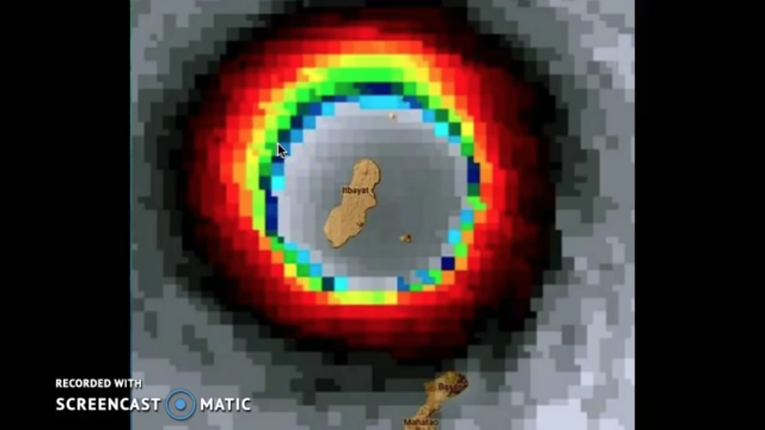
Perhaps the most beautiful cat 2 I've ever seen.

-
36 minutes ago, Rjay said:

Still no word from the island, 5 days later. It's a rather worrisome situation to say the least.


Hurricane Maria
in Tropical Headquarters
Posted
Still a bit of a weakness left by Jose at 144.