

olafminesaw
-
Posts
3,060 -
Joined
-
Last visited
Content Type
Profiles
Blogs
Forums
American Weather
Media Demo
Store
Gallery
Posts posted by olafminesaw
-
-
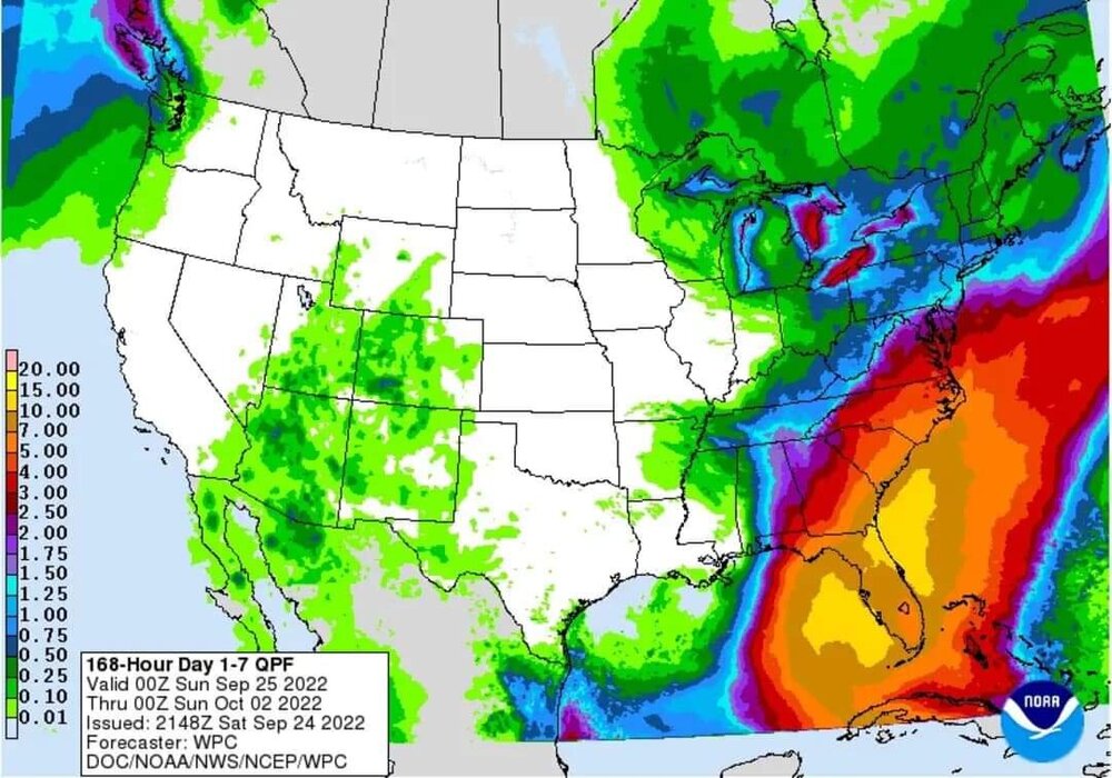
Juicy next week or so thanks largely to Ian
-
23 hours ago, olafminesaw said:
Shrimp incoming in 6-12 hours
Found the weenie

I do feel like when the NHC calls for RI, they're usually right. Delayed, but probably not denied
-
Just now, MattPetrulli said:
Something of note also, GFS trending a little lesser with the dry air the more west it goes
Looks like a classic setup for flooding for somewhere in the SE
-
 1
1
-
-
1 minute ago, hawkeye_wx said:
The GFS is so far west it doesn't even track the center over Cuba anymore.... goes through the Yucatan channel, out into the open gulf, where it will certainly miss the trough and slow way down.
Probably strong enough though that it will still be a significant impact.
-
3 minutes ago, Hotair said:
It is getting prettier. As of 11:29

Shrimp incoming in 6-12 hours
-
3
-
-
Seems like a pretty good analog:
-
1
-
-
There's some missing data, but Sable island recorded a gust of 120 mph last night
-
-
7 minutes ago, Rjay said:
8pm advisory:
125mph
935mb
N at 46mph.
46 mph

-
Yeah, obviously, that's a highly unlikely outcome. Has there ever been a storm that's made multiple landfalls in the US as a major? (excluding barrier islands etc.)
-
1 minute ago, Intensewind002 said:
How exactly does a phase between a tropical cyclone and a trough happen? Can someone explain it to me?
This explains it pretty well:
-
 2
2
-
-
Still moving right of the track, but starting to turn more North. May be a case of the storm being stronger and resisting the pull of the trough?
-
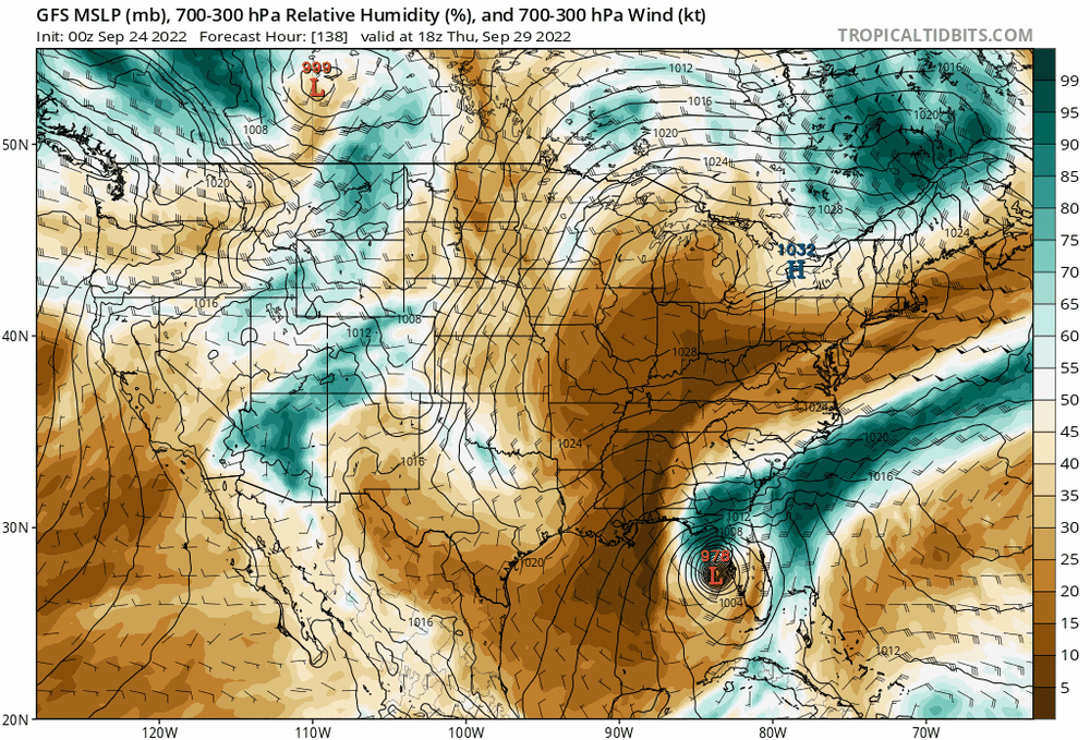
The GFS has landfall in FL right around the same time that the Euro has landfall in NC
-
1
-
-
Looks like it's tracking about 50 miles east of the cone right now (part of the reason Bermuda got hit so hard). We'll see how this effects Novia Scotia going forward. Moving more NE than NNE as the official track had projected
-
1
-
-
The GFS actually shows equally high wind gusts on the West side of the track. Halifax gusts over 80 mph
-
14 minutes ago, hawkeye_wx said:
The Euro is also amplifying the eastern US trough again, like some previous runs (prior to last night). The trough is going to capture the hurricane.
Update: No capture after all, just swept out to sea.
It makes landfall in, wait for it...Nova Scotia
-
1
-
-
4 minutes ago, MANDA said:
Still a long ways to go with this and final outcome is days away. Just as an aside though. IF the CMC is correct with temperatures in the 50's in parts of SC it could make for an interesting overrunning situation for parts of the SE and POSSIBLY Mid-Atlantic as warm, very moist tropical air gets lifted over the cooler air mass. Big high to the north with vast onshore flow so not out of the question that an excessive rain event develops somewhere along or east of the mountains depending on eventual track.
Absolutely. A stalled out front and a slow moving cyclone, with already signs of a PRE showing up on the models is a little concerning.
-
36 minutes ago, WxSynopsisDavid said:
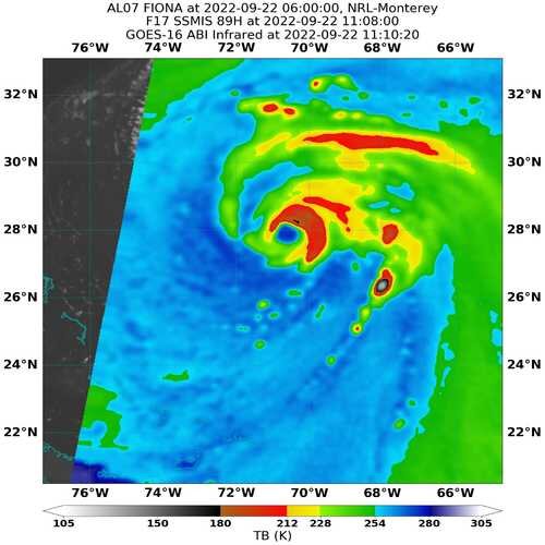
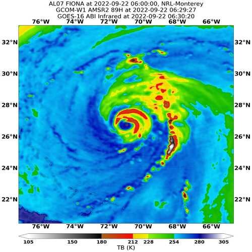
Yeah these internal processes can be prolonged and last a day or more. Some cyclones can be plagued with constant internal processes their whole life. Theory here is that Fiona has had this constant EWRC to fend off the sheared environment it was in.
It would seem I was wrong, it just took all day yesterday for the EWRC to complete and now the eye just needs to wrap convection around and contract. The satellite ended up being misleading in this case
https://tropic.ssec.wisc.edu/real-time/mimtc/2022_07L/web/mainpage.html
-
1 hour ago, WxSynopsisDavid said:
Double eyewall so it’s likely an EWRC or the one from yesterday that haven’t completed yet. These internal processes can take 24hrs or more to complete.
Seems to be some kind of constant EWRC process that keeps repeating. Already a partial secondary eyewall.
-
Models starting to tighten up on a LA to FL landfall. Actually pretty good agreement at this range
.thumb.png.fd08ef6def83f98977048fafd0b303de.png)
-
1
-
-
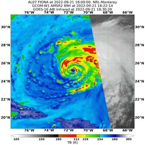
Wonky structure issues continue
-
Don't know how the HWRF does with hybrid systems, but...

-
6 minutes ago, StormChaser4Life said:
Not sure Fiona will hit 140mph. Think max may have been reached. Not looking as great on satellite.
Perhaps an EWRC. Not exactly a classic structure either way, although still obviously a solid core
-
1
-
-
The latest NHC track makes landfall on Cape Breton Island as a 100 mph cat 2, with up to 10 inches of rain. No comments on surve yet, although the rocky coastline will help mitigate surge.


.png.f5002d586b248ef5635f147c1cbbee6b.png)
.png.266f886a014aa954de9da276f197e720.png)

Hurricane Ian
in Tropical Headquarters
Posted
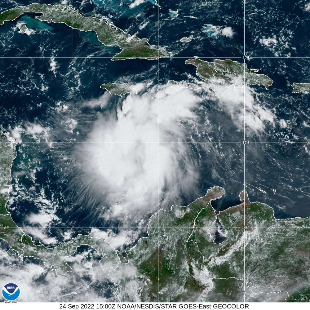
Looks like a big 'ol plate of scrambled eggs. Like something straight out of the WPAC. Maybe Dmin tonight can get some convection going and get this thing going