

olafminesaw
-
Posts
3,063 -
Joined
-
Last visited
Content Type
Profiles
Blogs
Forums
American Weather
Media Demo
Store
Gallery
Posts posted by olafminesaw
-
-
BWI: 8.7"
IAD: 9.9"
DCA: 6.4"
RIC: 6.3"
SBY: 5.8"
-
 1
1
-
-
-
10 minutes ago, NorthArlington101 said:
The 12z GFS made a *slight* shift towards a stormier outcome for Black Friday, lol.
Just a casual 971 mb low...

-
1
-
-
3 minutes ago, BuffaloWeather said:
up and over 5 feet. will measure next at 9.
Even with the inevitable movement of the band north (and again back south), you should get another 12-18" through Sunday
-
2 minutes ago, eyewall said:
The band is still producing waterspouts:
https://twitter.com/SimonStormRider/status/1593603532959191040/photo/1That's wild. Truth stranger than fiction. I can picture the trailer for: Sharknado 14, lake effect....
-
2
-
-
2 minutes ago, BuffaloWeather said:
33.9" as of 8:20 am
If the HRRR is to be believed, you will double that by the end of the storm

-
2
-
-
Seems based on the GEFS & EPS, the pattern flips to torch right around the 1st of December. Right on schedule!
-
Pretty impressive low at GSO of 24. It was 27 at 4:30 and 4:45 and dropped 3 degrees and back up in those 15 minutes. Noticeable cold pockets north of the airport as well on my way to work this morning, about 3-4 degrees colder than near the airport.
-
1
-
-
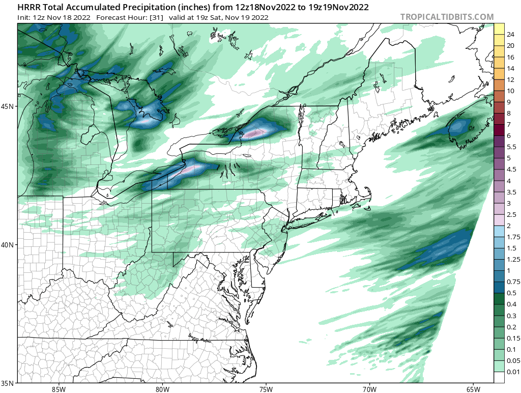
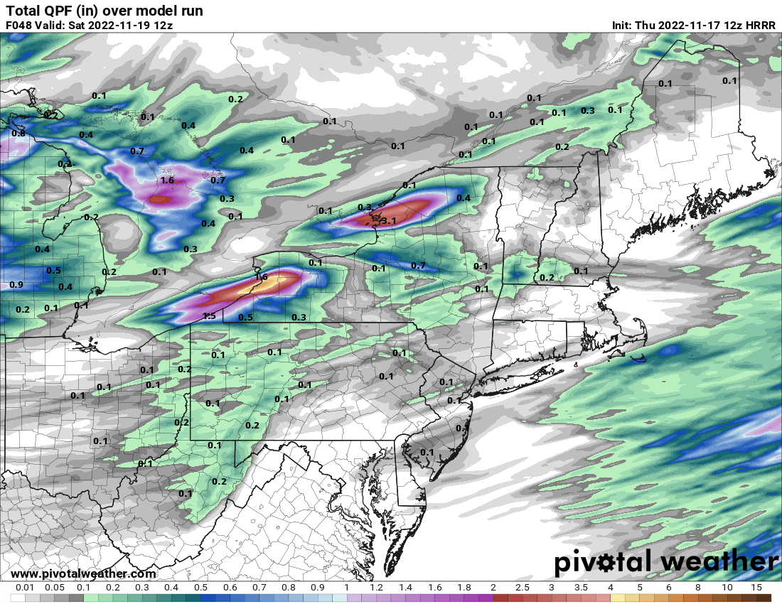
Nearly 6" of QPF!
-
Tornado watch tomorrow perhaps

-
I feel like this is probably not quite right...
-
1
-
 6
6
-
-
4 minutes ago, Modfan2 said:
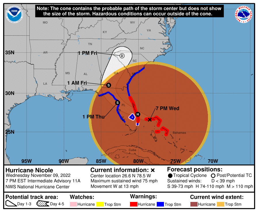
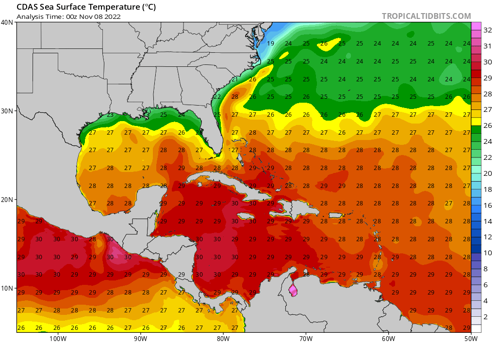
While I agree I don’t see CAT 3 on this; the Gulf Stream here is only 1-10 miles off shore from West Palm to Ft Pierce so I can see it strengthen to possibly a CAT 2
The gulf stream isn't really any warmer than the water Nicole is currently traversing. The warmest waters it will cross will be just before reaching the Bahamas
.thumb.png.2f5cea62309b7f0429b62bb51aa5fc5b.png)
-
I kept wondering why the advisory times are one hour earlier, took me forever to figure out why... Hurricanes after fall back are not the norm apparently
-
 1
1
-
-
The 12zHAFS nailed the evolution today if you flip through the IR frames. Like, shocking really. Gets convection ramping up again around midnight
-
1
-
-
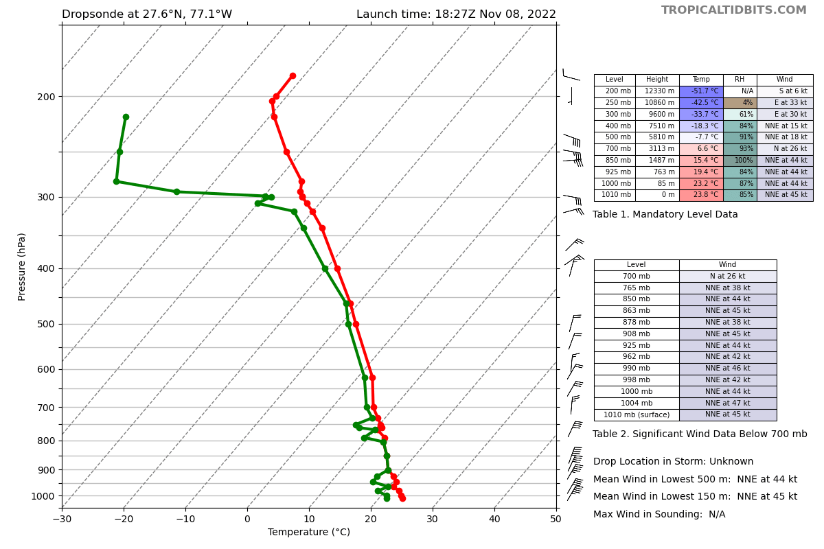
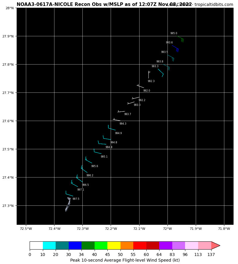
Recon finds a pressure of 980 mb or so and supports winds of 55-60 kts
-
45 kt surface winds recorded 200 miles or so West of the center (from the upper level recon flight), this thing is really starting to expand

-
Indeed, looks pretty darn good all of a sudden

-
21 minutes ago, Ed, snow and hurricane fan said:
HWRF has landfall near the Space Coast as a 963 mb tropical storm.
It seems like regardless of how much the pressure drops, it's maxing out between 60-75 mph. Any pressure drops below 980 are primarily expanding the wind field
-
2
-
-
Seems Nicole is going to need to get down to around 980-85 mb to reach hurricane strength. Of course this will be higher impact than a typical cat 1 due to it's size
-
Certainly a tight core

-
36 minutes ago, MattPetrulli said:

A little temperature increase when going over the center, maybe an attempt to form an inner core despite the mid satellite presentation.
.The HWRF doesn't begin to build a tropic core until this evening. I presume this will occur once Nicole begins to turn back to the south over warmer water, as long as dry air doesn't inhibit development

-
The 4 pm discussion said it's still moving westward. I will say, watching the LLC in the short-term can be misleading, but still seems odd
-
9 minutes ago, GaWx said:
The recon had it at 26.5N, 70.5W a little before 2 PM EST. The 10AM NHC forecast for 7 PM is for 27.0N, 70.5W. So, Nicole is already as far west as and 35 miles south of the NHC position for 5 hours later! Does anyone feel confident about the implications on future track adjustments? Further south? Or something different?
It appears another recon flight will be in the storm in 4-5 hours. It will be interesting to see if the LLC continues to move south or moves back to the W or NW in that timeframe.
-
1
-
-
The Euro seems to really broaden the wind-field, without increasing max wind speed. Has a massive area of 35-45 mph winds, but probably would be a 50 mph landfall


.png.c3ff77dceae2d6dbc8f4bd15fefdb7a8.png)
11/29/22 MDT Outlook Issued -- Regional outbreak possible.
in Central/Western States
Posted
Already a nasty looking warned cell in central Louisiana