

olafminesaw
-
Posts
3,063 -
Joined
-
Last visited
Content Type
Profiles
Blogs
Forums
American Weather
Media Demo
Store
Gallery
Posts posted by olafminesaw
-
-
It's currently moving NNE

-
 2
2
-
 3
3
-
-
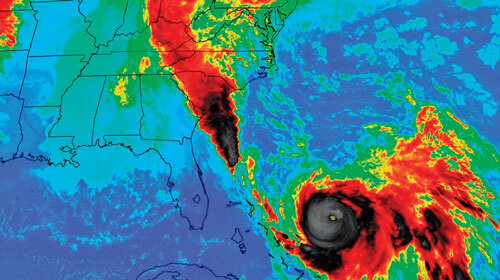
The closest analogue we have is estimated to cause 75 billion in damage (based on a study in 2018) and last time this occured, the entire island of fort Myers beach was under 3-6 ft of water:
-
5 minutes ago, OSUmetstud said:
I disagree on this being a predecessor rainfall event. That's not a distinct area of rainfall separated from the TC. The radar rainfall is continuous and Miami is fairly close to Ian.
PREs are coherent mesoscale regions of heavy rainfall, with rainfall rates ≥100 mm (24 h)−1, that can occur approximately 1000 km poleward of recurving tropical cyclones (TCs). PREs occur most commonly in August and September, and approximately 36 h prior to the arrival of the main rain shield associated with the TC.
Joaquin being the premier example (although ultimately the hurricane went OTS)
-
11
-
-
-
Ian is about halfway across Cuba and seems to be holding up well this far, although it is just now getting to the higher terrain (about 1,500 ft hills)
-
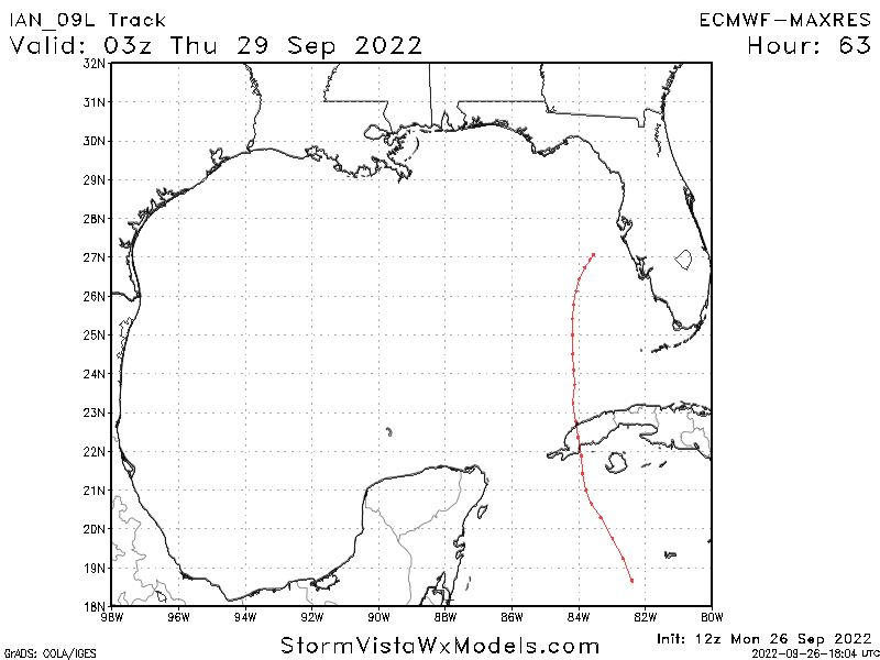
The 6z GFS makes landfall far enough South/east that surge may not be much of a factor for Tampa in that scenario
-
 1
1
-
-
Starting to move into shear, but as other have said, a more easterly movement would mitigate
-
3 minutes ago, hlcater said:
The core is cleaner on cayman’s radar and MW passes. Seems justified to me. But we shall see.
Yeah, sometime winds take a while to respond to improvemants on structure, but I suspect by the time they make the first pass, it will be at least 85 kts
-
Meanwhile...Noru back at it again

-
2
-
-
1 minute ago, Superstorm93 said:
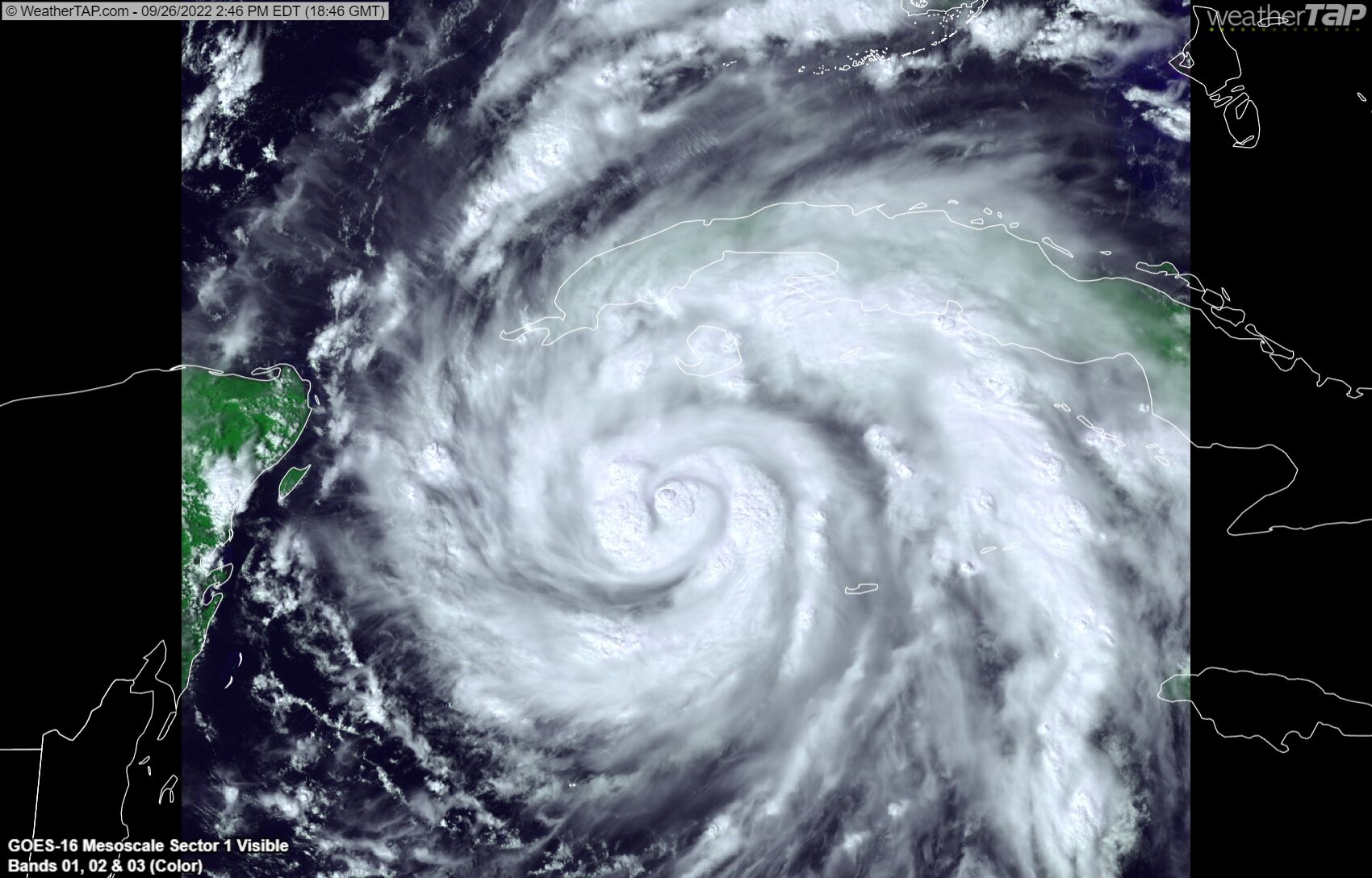
The banding structure is incredible with Ian this afternoon.
While the storm has ingested some dry air, I would guess that the bursts near the core have at least dropped the central pressure a few millibars since the last fix.
I would expect the storm to resume a rather quick pace of intensification overnight as it nears the Cuban coast.

And just like that, a couple of hot towers firing near the eye

-
10
-
-
2 minutes ago, Superstorm93 said:
So far, not good.
The takeaway here is the turn towards the coast that the GFS has as well. Not good indeed
-
13 minutes ago, MattPetrulli said:
Could distance away from radar and/or radar quality, but the inner core looks quite ragged currently.
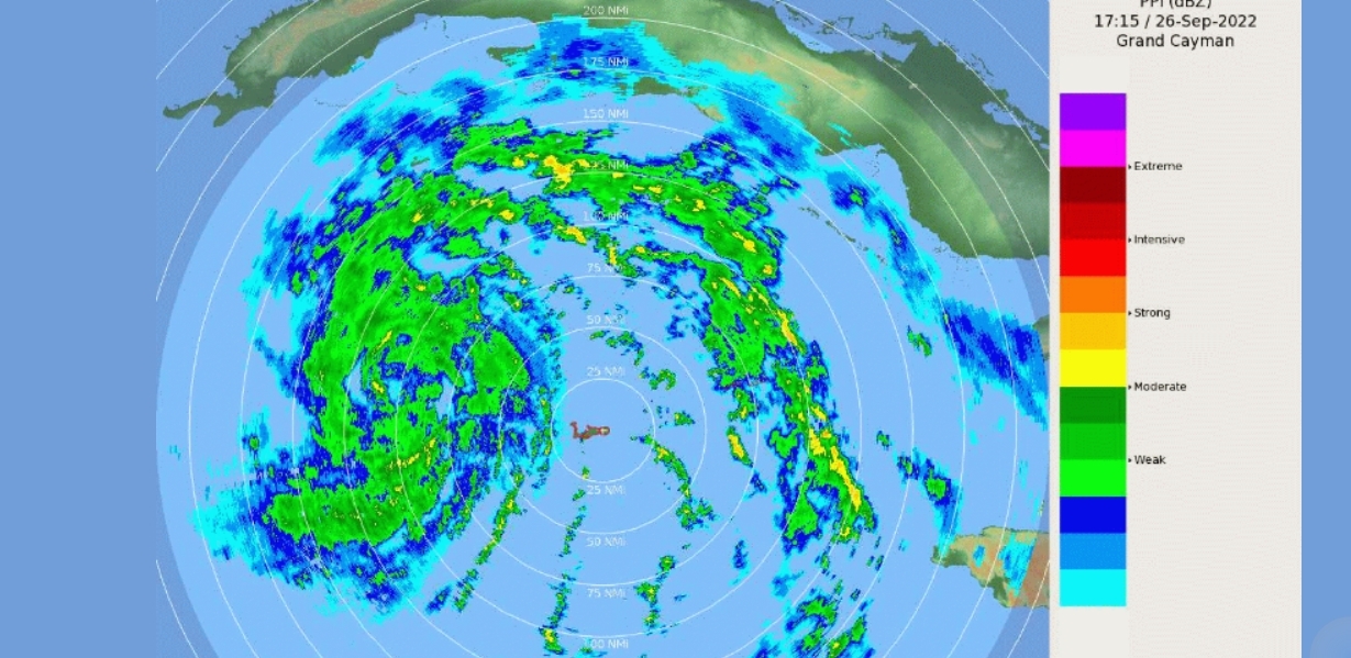
Seems to be merging/consolidating eyewalls, but as you said, it's hard to tell based on radar quality
-
Hard to tell, but seems like it's trying to form an eyewall inside the larger original eyewall, kind of like what would occur during an EWRC. I'll be curious if this dissipates as the outer eyewall contracts, or if it becomes the dominant eyewall and they meld together
-
One thing to note is that winds aren't actually pushing into the bay from the south until Thursday afternoon, due to approach angle. This may mitigate a GFS solution somewhat as the storm is starting to weaken. Probably too little too late, but still
-
 1
1
-
-
The GFS is a hair east through 57.
-
Gotta love the NAM

-
2
-
-
Updated surge forecast upped to 5-10'

-
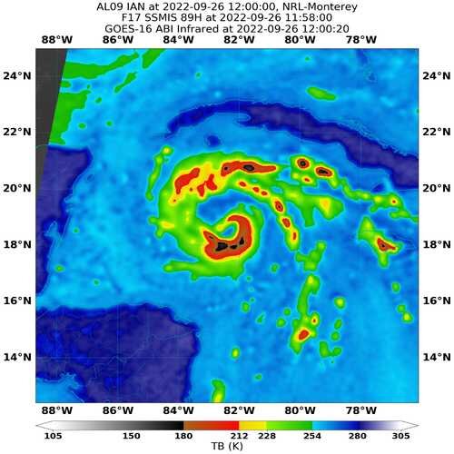
Per radar, Ian is still trying to close off the eyewall. Judging by the past few hours this will likely take at least a few more hours to occur. Until it does so, Ian may maintain only modest strengthening. At the very least, land interaction may end up tightening the core starting in 12 hours or so.
-
 1
1
-
-
Structure from a few hours ago
-
2
-
-
Yeah, I think we will still have a good amount of track until it passes over Cuba.
Meanwhile it appears that the structure has degraded somewhat, perhaps ingesting some dry air
-
3 minutes ago, TPAwx said:
6z Euro appears to shift west
Yep, I think largely due to initializing stronger. Pretty close to the GFS track, maybe a little quicker
-
One bit of good news for Tampa is the new moon was yesterday
-
1
-
-
There are some 1,500 ft mountains for Ian to traverse, it will be interesting to see how this may impact the storm. It may tighten up the core
6 minutes ago, WxWatcher007 said:First light visible is going to be a sight. Deep convection now wrapping 3/4 around the eye. Nice outflow continuing to develop. Those extraordinarily high RI probs look to verify today.

Neat how the convection around the eye lines up with the radar which shows the eye trying to close atm.
-


Hurricane Ian
in Tropical Headquarters
Posted
It seems to be back on a N trajectory, the past half hour or so. It was moving a bit east earlier, but also wobbling as one might expect.