

olafminesaw
-
Posts
3,754 -
Joined
-
Last visited
Content Type
Profiles
Blogs
Forums
American Weather
Media Demo
Store
Gallery
Posts posted by olafminesaw
-
-
The first I've seen on the East side of the city. This would be where the surge would have occurred and appears to be significant standing water still.
-
It does seem like a lot of the construction in residential areas is more concrete/cinder block, as is more typical in Mexico. So hopefully the general population fared better than what we have been seeing.
-
-
-
31 minutes ago, NorthHillsWx said:
Wow, somehow Otis has rapidly strengthened into a major. FL winds to 110 kts and unflagged SFMR values near 100 kts. Absolutely insane high end season going on over in the EPAC
The 03UTC forecast this morning had it max out at 70mph. I think the models were even less enthusiastic. One of the biggest forecast errors in a while, for a landfilling hurricane anyway.
-
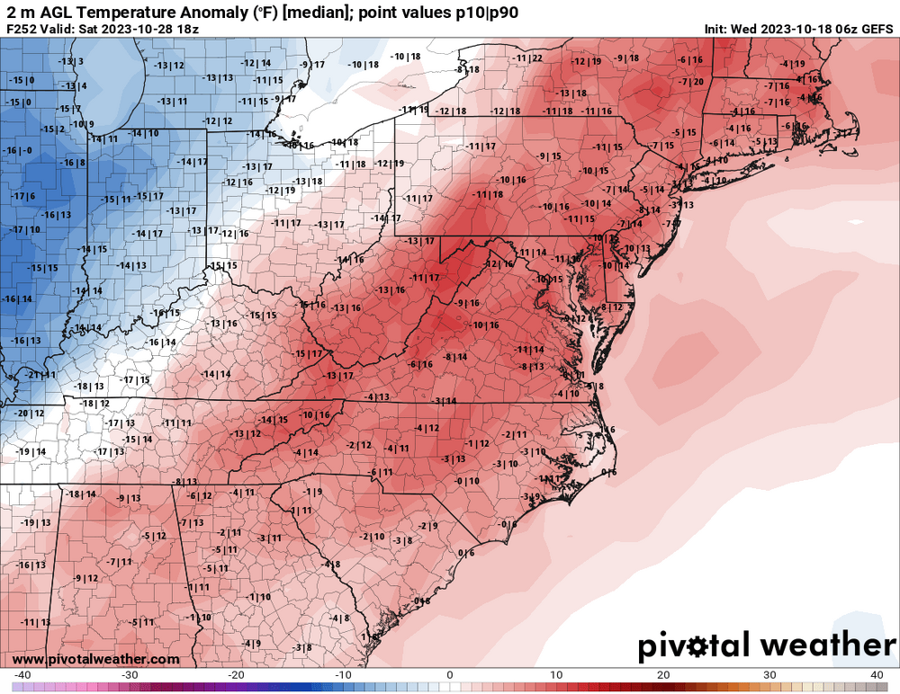
Greensboro averages 6 days with lows in the 30s or lower going back to 1903. Despite this, Greensboro has not had an above average number of days since 2008 (which had 9). We have had two days so far this month, but will almost certainly remain at 4 or less days through the end of the month with the upcoming warm up
-
3 hours ago, Met1985 said:
Lots more photos from this weekend.


Sent from my SM-G998U using Tapatalk
Where's the creek photo taken?
-
 1
1
-
-
12 hours ago, eyewall said:
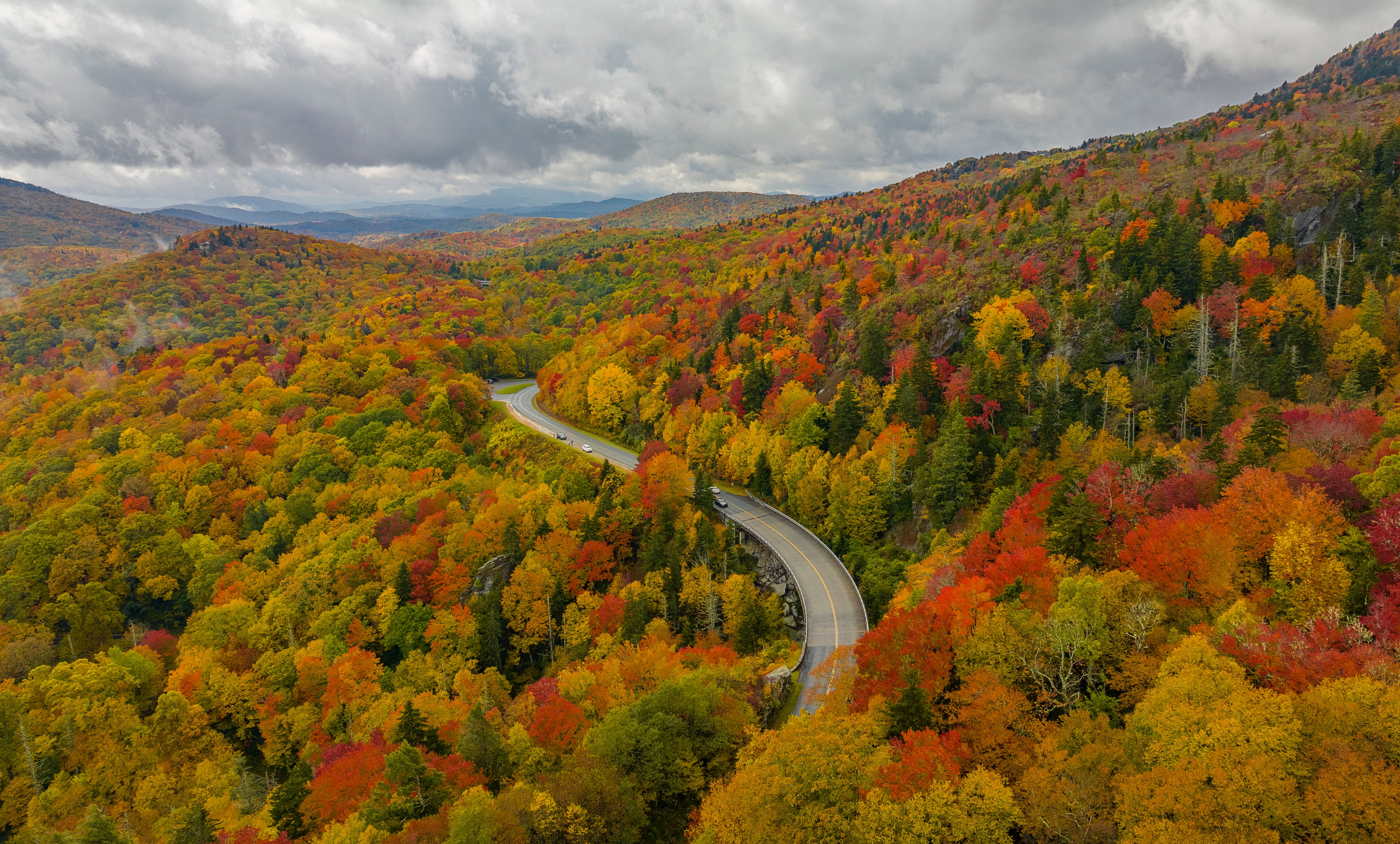
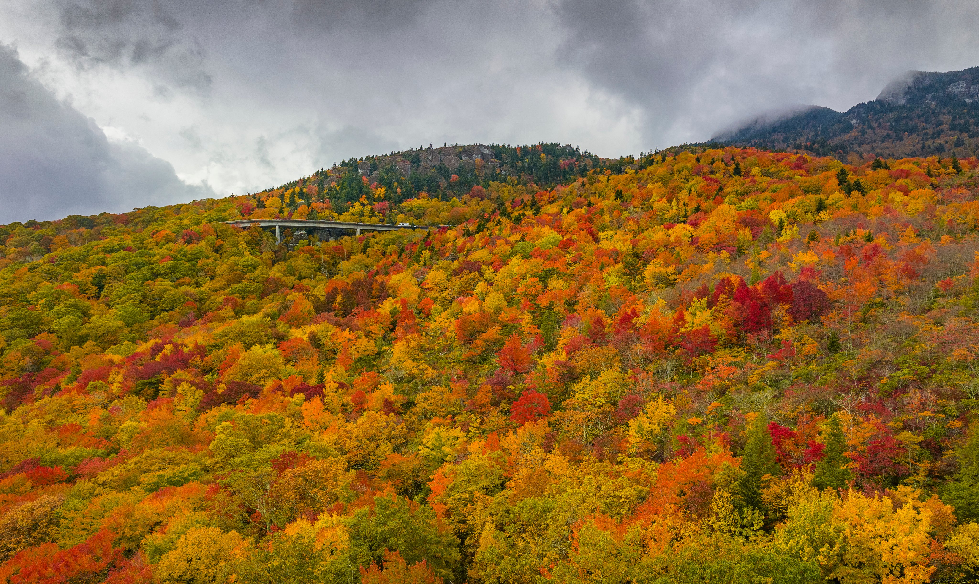
Still going through the 10/20 shots:
These are great! Tis the season for oversaturated foliage photos on social media, it's refreshing to see photos with minimal editing. The colors speak for themselves!
-
3
-
-
26 minutes ago, WinstonSalemArlington said:
Next two weeks, widespread frosts on the pumpkin
In between those cold periods, a warmup.
-
2
-
-
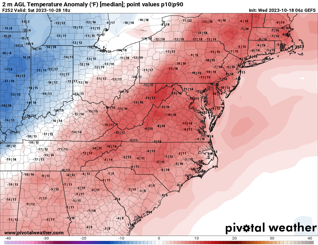
Winter is coming. We're about a month away from when according to climo, we might conceivably see some flakes.
-
4
-
-
It briefly popped up to 59 today at the airport, but looks like it will not reach 60 for the first time since April 8. That's pretty much right on average. Seems like normally this occurs on a rainy day, but I don't have any data to back that up.
-
7 hours ago, NorthHillsWx said:
Pacific (Pacific east and west) producing this year
8 out of 11 typhoons in the WPAC this year have reached category 3+ intensity. 6 out of 8 on the EPAC have achieved the same.
-
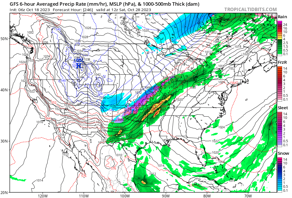
AccuWeather is calling for wintry mix on Christmas Eve and Christmas in the Triad. Lock it in folks.

-
 3
3
-
-
10 hours ago, WinstonSalemArlington said:
Scandinavian blocking
There's a parade of recurving typhoons in the Pacific. I'd have to believe that will reinforce blocking heading into late October (or at least that's the correlation that's been mentioned in the past)
-
4
-
-
Quite possibly the prettiest storm of the year. Also a contender for strongest of the year.
https://x.com/135knots/status/1712038686479761797?s=20

-
1
-
-
35 minutes ago, NorthHillsWx said:
Landfall at peak intensity and intensifying rapidly. Wish there was footage from the landfall point but thankfully this kept heading south into extremely rural countryside
Josh morgerman is trying to make it to the landfall point seems like a pretty risky proposition.
The eye has filled in right before landfall. Likely weakened back to cat 3, but too little too late of course
-
There have only been 9 major hurricane landfalls in the EPAC in Mexico since 1983. Or one every 4-5 years
-
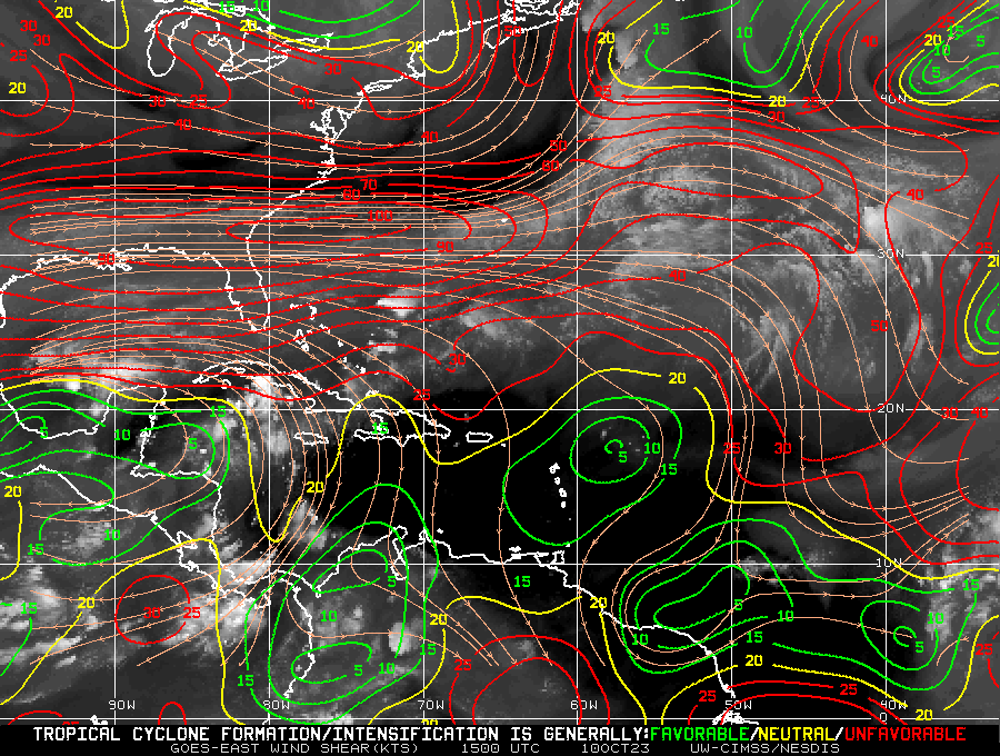
The wind shear over the SE US is incredible. Not sure I've seen values over 100 before.
-
2
-
-
20 minutes ago, Sandstorm94 said:
Hey y'all, you know I have been around the form for years now (Orangeburgwx), but this gal has some exciting news to share!
This will be my last few months here full time in the Southeastern States board seeing as how I am moving to Vermont at the end of the year. I will still drop in from time to time on the banter form to check in since I care about you all, and good luck in Jan/Feb.
Also, the 6z GFS is such a fucking tease...
Sent from my SM-S146VL using Tapatalk
I'm jealous! About the snow yes. But mostly the hiking. By all accounts stunning scenery around every corner out that way. Going to miss you're posts, but I know you will pop in for the big blizzard we get right after your move

-
1
-
2
-
-
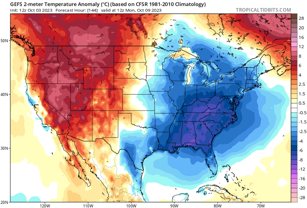
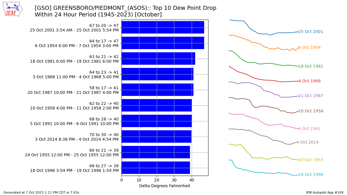
Pretty unusual to see as dramatic a drop in dewpoints in October. Going to bottom out in the upper 20s after being at 62 this morning. A drop of 35 in a 24 hour period would be just outside the top 10 for the month of October

-
2
-
-
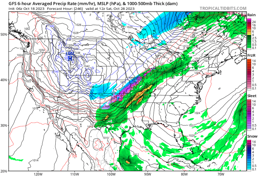
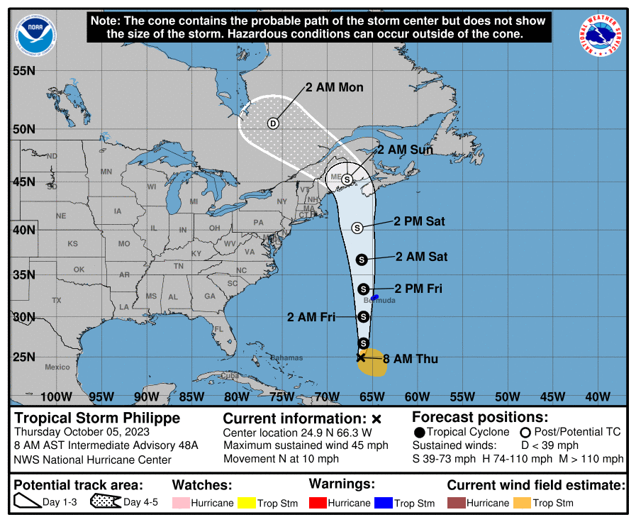
The cone vs ensemble spread is kinda wild
-
1 hour ago, GaWx said:
GEFS is still suggesting high chance for a +PNA for October as a whole with a likely +2+ peak in the dailies coming early next week. Hoping Oct doesn’t come in with too high of a +PNA, however:

Is our upcoming cold(ish) snap a direct result of the spike in PNA?
-
1
-
-
3 minutes ago, NorthHillsWx said:
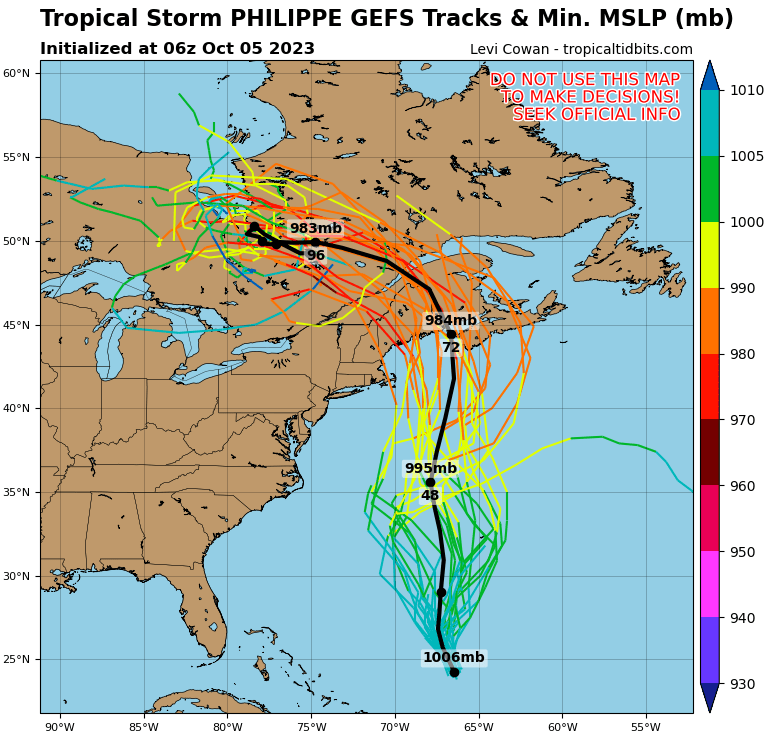
Per recon, radar, and sat, I’m not sure Philippe still has a closed center or meets criteria to still be a storm. Looks to have opened up
A hot mess indeed. CNN is currently running a story with the headline "an unusually hot Atlantic Ocean is neutralizing El Nino. That could be bad news for the rest of hurricane season." Right on cue, the Atlantic seems to have flipped a switch to it's usual hostile El Nino state. Shear all over the place and little signs of development.
-
 2
2
-
-
Nom nom

-
2
-


Central & Eastern Pacific Thread
in Tropical Headquarters
Posted