

olafminesaw
-
Posts
3,052 -
Joined
-
Last visited
Content Type
Profiles
Blogs
Forums
American Weather
Media Demo
Store
Gallery
Posts posted by olafminesaw
-
-
One thing to keep in mind is the radical difference between the way the GFS and Euro handle the next frontal system (at around hour 84). I have a feeling the Euro won't look anything like the GFS due to the downstream implications. It's going to take a while to iron this one out
-
 1
1
-
 1
1
-
-
I don't see this setup flipping to rain for most of the Piedmont

-
25 minutes ago, eyewall said:
I am not sure why everyone excited about ice lol.
I wouldn't say I'm excited, but this is a weather board and I'm interested in weather, regardless of the degree to which I enjoy it. Ice storms are fascinating from a meteorological perspective, even if they are the saddest of frozen precip types
-
1
-
-
The 0z Icon also has a pretty significant snow to ice storm (mostly ice)
-
2
-
-
About a quarter of the GFS ensembles show big mixy hits. Most of the rest are pretty suppressed or the energy cuts to our west and it's too warm
-
The Euro on board with the storm idea. Model consensus at the moment is mid-levels will be a struggle, but as others have said, CAD may rear it's ugly head
-
1
-
-
25 minutes ago, cbmclean said:
Here is a ranked graph of RDU snowfall from 1991-2020. Note the Carolina crusher sticks out like a beautiful sore thumb.
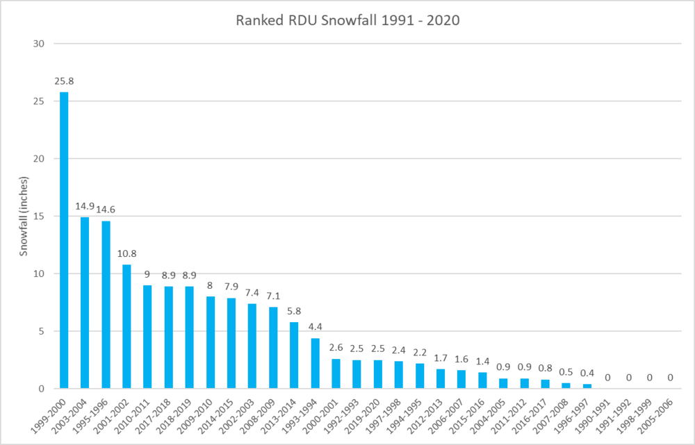
I know RDU Climo sucks, but crazy that 3"+ storms only occur about every 2-3 years.
Question: how did you compile the data for multi day storms? I've been meaning to do a similar analysis for Greensboro, but only find day snowfall data out there.
-
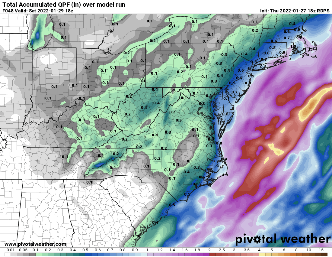
In other news...
.thumb.png.c701d2f13da14fc0aa307b86b2428a54.png)
-
1
-
-
Seems the long range favors mixy slopfests. We shall see. This is the time of year where marginal temp events rarely work out and the wedge always wins
-
Coming down pretty good in Greensboro, despite light radar returns
-
1
-
-
Wetbulb temp of 35 in Greensboro. Just waiting for the precip to arrive
-
I think the perception about Greensboro is drive by the fact that we do tend to cash in to some degree on most events effecting this board and tend to do well when Raleigh flips to rain. However, a lot of times, we end up stuck on the fringes, whether it's southern VA that gets the jackpot, or Fayetville.
-
4
-
-
1 minute ago, Buddy1987 said:
Not sure what I was expecting but not overly enthused with the radar at the moment. Should we expect it to fill in decent amount toward sunset?
Should start to see development between 4-5 up your way. But lots of Virga until the atmosphere gets saturated
-
 1
1
-
-
2 minutes ago, CentralNC said:
that is quite a trough.
Are we quite sure it's not an opening into the underworld?
-
 2
2
-
-
Anyone who gets 2"+ is going to see some pretty decent drifts with gusts in the mid 30s
-
2
-
2
-
-
As someone said a few pages back, models have no idea what the qpf distribution is going to play out. Just gotta watch where the best envelope and wait for now casting. I just wish this wasn't in the middle of the night
-
-
Lol, the 10:1 weenie map has 40" over my house for the full run
-
-
I don't know whether to feel nervous or confident about the fact that most models have consistently put the best banding over the triad.
-
4
-
-
8 minutes ago, WXNewton said:
For what is worth the 6z HRRR showed a very similar setup as Euro with rotating a band of moisture through the Foothills and NW Piedmont into Upstate SC. It too is trying to pop a low under the foot of the mountains. I know it's the HRRR at long range but definitely something to keep an eye on for folks around 77 and 85 corridor.

Yep, it's some love from the ULL, with some enhancement from the jet as the trough goes negative. The mid-Atlantic forum is bemoaning the fact that all the best dynamics for this feature are down here, so that's always a good sign
-
2
-
-
3 minutes ago, jlh said:
Very similar to the RGEM, perhaps ever so slightly further west.
RGEM is the RDPS (confusing I know)
-
1
-
1
-
-
The heavier bands could put down snow pretty quick. Unfortunately the window is small for accumulating snow. Also have to battle surface temps at onset

-
1
-
-
I know it's frustrating to watch the coastal portion of the storm slip away, but honestly, not a bad look for a 1-3" of fluff for most of the Piedmont. Even with a late phase, the backside potential is decent


.png.f4f1a5cf91a96166fd54b1d48f550148.png)


Mid to Long Range Discussion ~ 2022
in Southeastern States
Posted
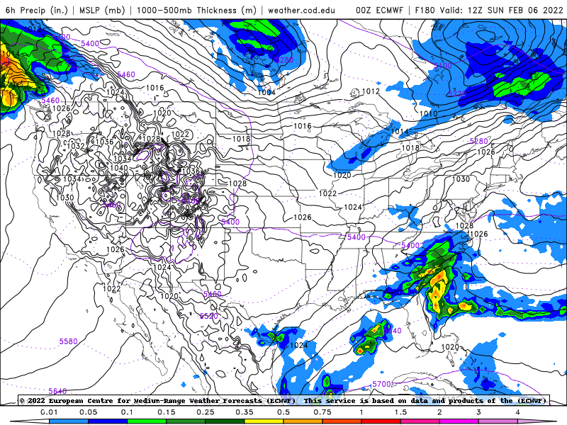
Euro gets frozen precip in the area, but about 24 hours later, so not nearly as good a look with the high having retreated to the east significantly more than the GFS