

olafminesaw
-
Posts
3,052 -
Joined
-
Last visited
Content Type
Profiles
Blogs
Forums
American Weather
Media Demo
Store
Gallery
Posts posted by olafminesaw
-
-
8 minutes ago, buckeyefan1 said:
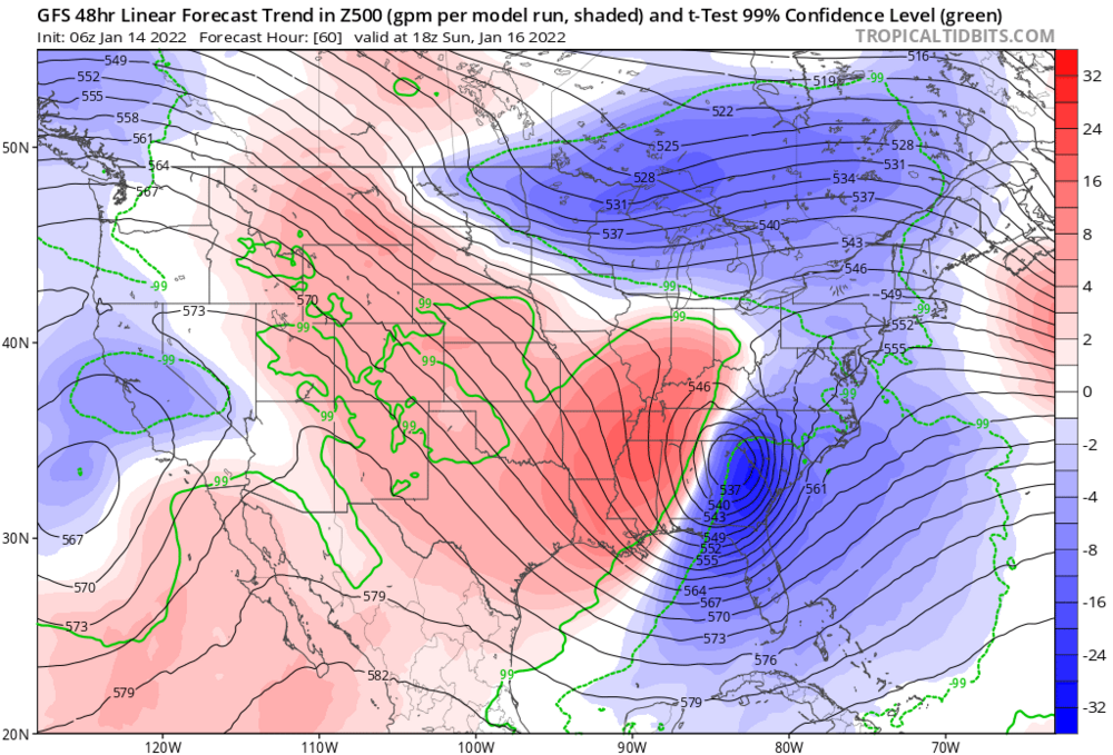
Nothing has changed at 51

2 days ago we would have been celebrating the placement of the ULL on that map. What went wrong? Just look at the decrease in heights. Not too shocked to see blocking fail to materialize in a La Nina year
-
 1
1
-
-
-
-
Actually seems like a pretty easy forecast for the most part with the convergence of the models. With the caveat of figuring out how much ip vs zr
-
Seems like regardless of track, the trend had been to reduce the size of the snow thump area at the leading edge. Why is that?
-
2 minutes ago, wncsnow said:
The RGEM (better than NAM and Icon IMO) is a much better track for most.
Pretty torchy in the mid levels though
-
GSP is bullish

-
5
-
 1
1
-
 2
2
-
-
Just now, BooneWX said:
Now it’s hundreds of miles south again

Haha, yeah, it's drunk. There's a reason it's called happy hour, and as per usual the 18z NAM is the main offender
-
Live by the NAM, die by the NAM
-
1
-
-
Gives some sense of where the freezing line may end up at it's warmest, although I suspect you could shift it *East* about 50 miles

-
1
-
-
15 minutes ago, snowmaker13 said:
That's alot of precip! Expecting the windward side of the mountains to overperform.

Also I think sometimes convection along the coast can reduce precip totals for the Piedmont. Something to watch.
-
1
-
-
10 minutes ago, eyewall said:

No surprise that when eastern Kentucky gets heavy snow, there's significant mixing issues
-
Accuweather's "Wintercast" feature is actually decent. Gives probabilities for accumulation ranges. Calling for the most likely scenario of 1-3" of snow and .5"-1" of ice, which is a little gung-ho on ice for the triad.
-
With the complexity of the low transfer, ensembles become less of a factor from here on out I think
-
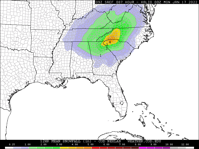
6z blend of models
-
4 minutes ago, buckeyefan1 said:
Blizzard conditions


Sleet drifts! Sounds kinda epic
-
 1
1
-
-
5 minutes ago, wncsnow said:
nam thermals suck lots of ip
Winds ripping at 70 kts out of the SE at 850 mb
-
1 minute ago, ILMRoss said:
if looking at the hr 84 NAM is hazardous for your health then this run is probably going to send half of this board to the ER
I was looking at 6z by accident, but my point still stands (even more so)
-
There's some good looking panels, but posting the hr 84 NAM is hazerdous to the health of weenies. Main takeaway is a good shift south. Hopefully the rest of 12z guidance follows the NAM's lead (we all know it rarely happens that way)
-
1
-
-
-
A piece of our energy is coming ashore in the Pac NW, we wait and watch for development over the Canadian plains later today

-
P-type maps show freezing rain, but mostly sleet, only freezing rain on the fringes (also, those dynamics, wowzers!)

-
1
-
-
1 minute ago, buckeyefan1 said:

Raging sleet storm for many
-
1
-
-
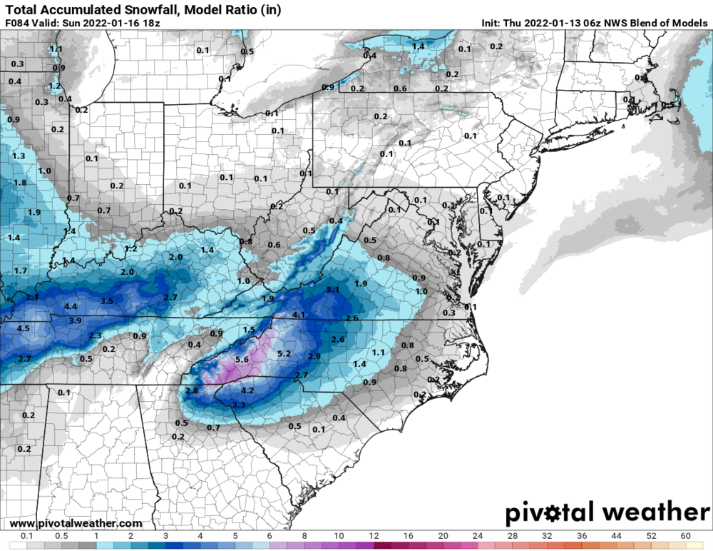
RAH point forecast for Greensboro still calling for all snow
 (5.5" on the hourly graph). But the discussion acknowledges the ice threat:
Saturday night, little rain is expected. The bulk of the precipitation will fall as snow overnight, with sleet/freezing rain eventually mixing in across the south as warmer air begins to move in aloft. The push of warm air begins in earnest after sunrise Sunday, which should limit the areal extent of snow by Sunday afternoon. Rain will eventually make its way in along the I-95 corridor, but farther to the west, sleet and/or freezing rain will be the dominant precipitation types, depending on the depths of the warm layer aloft and cold layer at the surface. The GFS and European are now in better spatial agreement with the dry slot moving directly across central NC, reducing the potential for wraparound snowfall Sunday night, although the ECMWF is now about 6 hours slower than the GFS. A few days ago, this system looked as if it would simply be a rain/snow event. Over the last 72 hours, the westward trend of the surface low moving farther inland makes a widespread significant icing event appear more and more likely west of I-95.-
1
-
 1
1
-

.gif.b5e6f5b93bdaf744e728b6e6de7960f1.gif)
.png.92bed6d2b57b4c154565ee53aff995bb.png)


Jan 15-16 Winter Storm
in Southeastern States
Posted
Nasty sounding fro Raleigh. Good to finally get some clarity on precip type, with the 3km NAM coming into range