.png.2082198afdafcedf9ad03f1d6dfb7336.png)
HIPPYVALLEY
-
Posts
32,714 -
Joined
-
Last visited
Content Type
Profiles
Blogs
Forums
American Weather
Media Demo
Store
Gallery
Everything posted by HIPPYVALLEY
-
Yeah, blues, funk and rock are my jam nowadays. It’s good to see young kids are still into Led Zeppelin, Rolling Stones and Grateful Dead.
-
Yeah, well when my kid is college-age I’ll probably need to sell them to pay for tuition. LOL. All of them are originals I bought in the 90s
-
I have a great collection of vinyl: cypress hill, tribe called quest, nwa, pharcyde, digable planets, missy elliot, bdp, gang star, talib kweli, mos def...
-
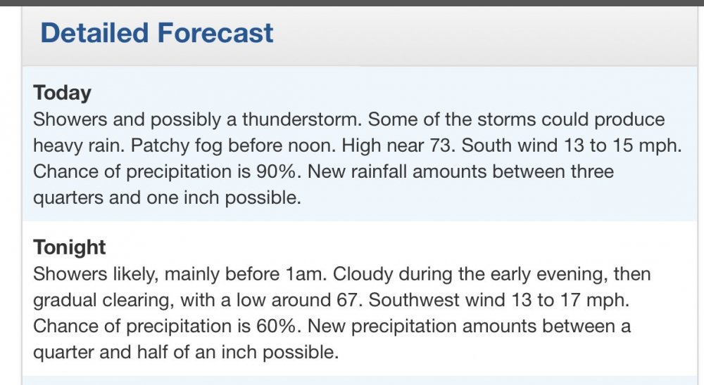
This forecast isn’t going to work out so well for the Cape:
-
Yup, Cape is looking gray but mostly dry. We have had approximately one hour of rain in Falmouth this week. Meanwhile, I bet my rain gauge will be at least half full when I return to Greenfield tonight.
-
I had to pick it up myself but I scored 2 1/2 cords of well seasoned hardwood for $400 total. Going rate around Greenfield right now is close to $300 / cord for seasoned which is pretty high. Doesn’t really make any sense that there is somewhat of a wood shortage this year because last year was mild. Two of the Wood guys I spoke to said that people were kind of hoarding it this year which is absurd. Toilet paper is one thing but the pandemic and firewood supplies should be a non-issue.
-
Yes, hopefully the latter one is moving into a well timed, anomalous arctic front. Feet and feet for the interior.
-
The Connecticut River Valley infrastructure is exponentially larger than it was in 1938. A Storm of that magnitude coming up the CRV in 2020 would probably be the most damaging hurricane in US history. Some would be months without power. The 1938 storm took down over a billion board feet of lumber in New England and New York State. Check out the book “New England hurricane” it was put out by the Federal Writers Project in 1939. You can still find relatively cheap copies. Fantastic pictures.
-
.thumb.png.4150b06c63a21f61052e47a612bf1818.png)
Summer 2020 Banter and random observations
HIPPYVALLEY replied to Baroclinic Zone's topic in New England
I’ve never driven the Mount Washington auto road but I have skied it. We didn’t realize you were supposed to pay to do that so got reprimanded a bit. Lol -
Significant Severe Weather Event Possible Thursday, August 27, 2020
HIPPYVALLEY replied to weatherwiz's topic in New England
Just light rain on the Cape for about 2 hours. -
Significant Severe Weather Event Possible Thursday, August 27, 2020
HIPPYVALLEY replied to weatherwiz's topic in New England
Brightening a bit in Falmouth now. -
Summer 2020 Banter and random observations
HIPPYVALLEY replied to Baroclinic Zone's topic in New England
-
Wouldn’t take much of a West bump to send a big surge into the bay.
-
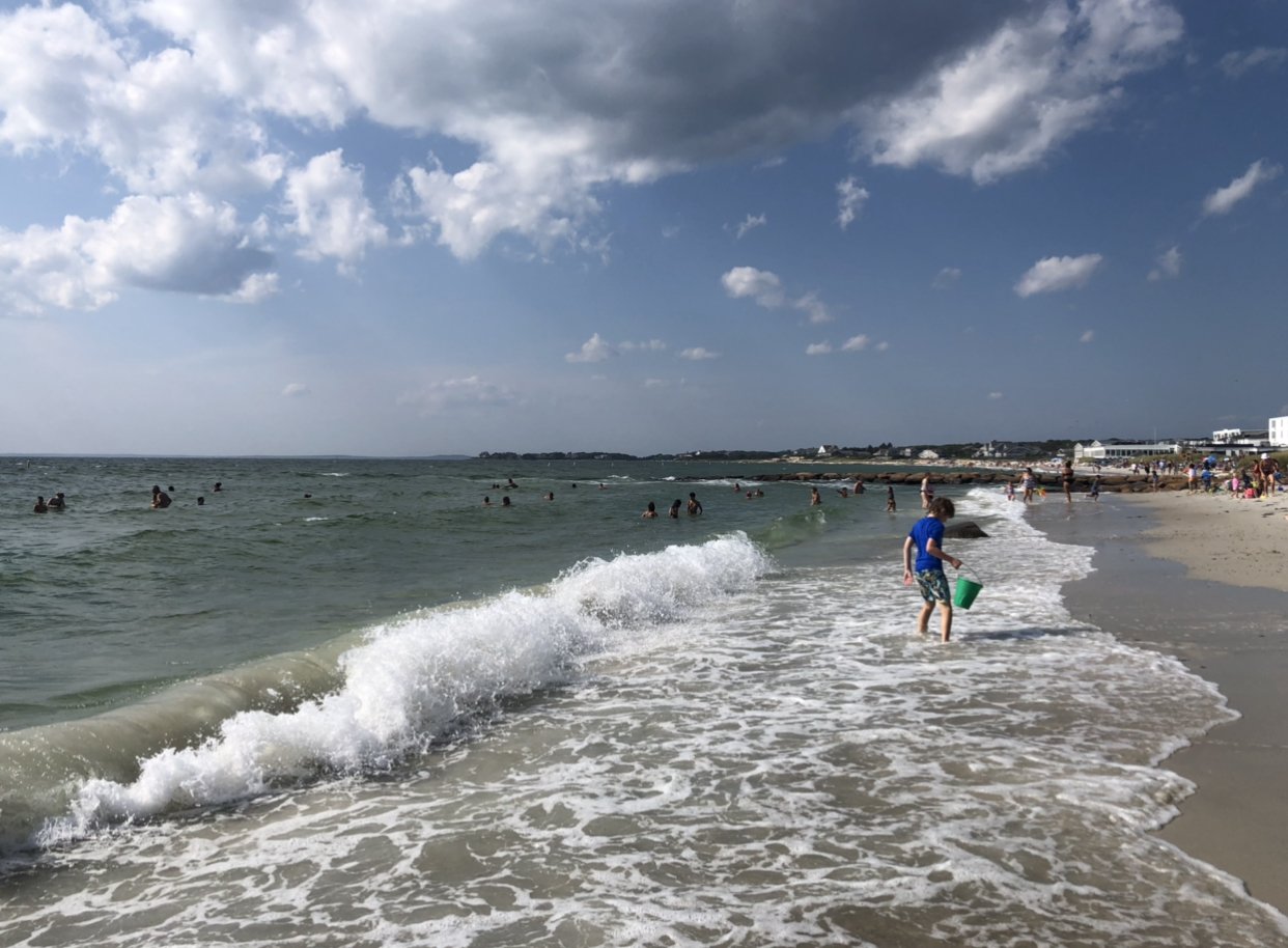
Beautiful day in Falmouth. Chilling at Kevin‘s favorite beach. Decent waves to splash in too.

-
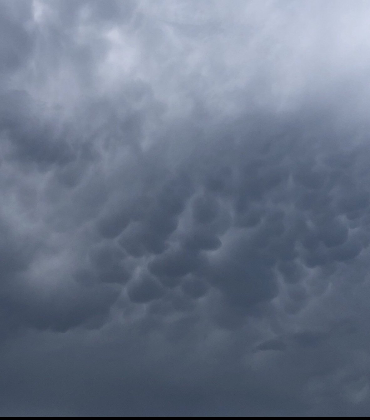
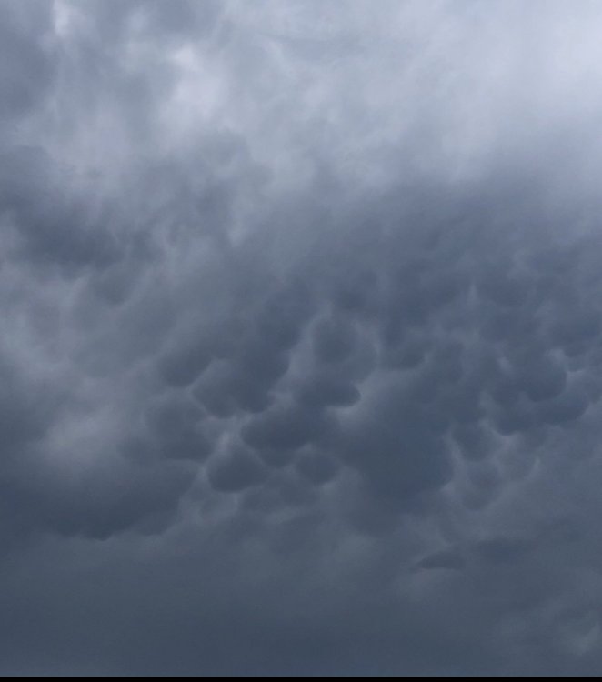
Nice mamantus in Falmouth today.
-
Summer 2020 Banter and random observations
HIPPYVALLEY replied to Baroclinic Zone's topic in New England
Watching “the day after tomorrow” with my nine-year-old for the first time and he is loving it! what a weenie movie, especially the global radar images shots. -
Yeah looks like stations in Greenfield only got 0.12. Nada in Falmouth although I think they got it pretty good here on Saturday.
-
That only helps wells and reservoirs if those areas go right back to high and dry.
-
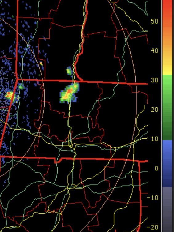
Still looks pretty intense just E of you.
-
Falmouth is dry ground. SW wind blowing across Buzzards Bay ate up the storms.?
-
Tonight’s T-storms were either under forecast or people just were not paying attention. Every underpass on I-495 between Bolton and Middleborough had a half dozen or more motorcycles and riders parked underneath.
-
Rain was so intense we had to get off 495 in Milford and go hit five guys burgers. Constant cloud to ground lightning while driving South. we left Greenfield at 4 PM and had not gotten a drop of rain today.
-
Nice little isolated downpour right over Greenfield right now.
-
Well, now we have this: https://www.space.com/earth-magnetic-field-dent-anomaly.html
-
Summer 2020 Banter and random observations
HIPPYVALLEY replied to Baroclinic Zone's topic in New England
This is exactly what my next door neighbors had done last week. I have not yet asked them if it made difference.