

Typhoon Tip
-
Posts
43,575 -
Joined
-
Last visited
Content Type
Profiles
Blogs
Forums
American Weather
Media Demo
Store
Gallery
Everything posted by Typhoon Tip
-
Man...that's a shit pattern for California ... Almost looks like an 'atmospheric river' ... I mean, c'mon ... how many different ways can we see the pattern NOT look like La Nina before we realize La Nina ain't running the show -
-
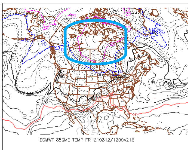
Mmm... until I see this, ... fill/ leave the Canadian shield, I don't care how utopic the synoptic backyard looks, whatever happens after next week isn't without risk afterward. That said, as the month ages obviously the sun's perpetual 'bright flash' off a hydrogen bomb becomes evermore the modulating factor- ...ever think of that? That bright flash that blinds people in nuclear bomb explosion, that's what the sun is ..... ALWAYS ... heh, kinda neat We can even lose that cold bank account up there and still go through a 'marginal' bowling ball vulnerability - although I wonder if that's less favored this year ..
-
It's a big useful factor at this time of year right there. yeah - Thing is ... parroting Scott early ...it's interesting that is not a BD look. How the hell did we wend the hemisphere into that modeled look in March... ...maybe owing to the rising NAO out there.. unknown Folks, you shouldn't get hopes up if you are spring enthusiasts until that's inside D4.5 because we've all got time-trialed experience in this part of the world - very minute synoptic construct changes can end that with a lvl cold wedge, doing so out of nowhere in sort term corrections. Yet, still overall verify the pattern recognition as a success - we are the Labrador 'Red Headed' step child, eating shit so that the rest of 'em get cake.
-
D6 Euro is insane nape on this 12z run... At least by the coarse view - if that depiction where enough, might as well be naked angles of one's carnal dreams tongue tickling beneath the ears with that look ... Actually, D7 DEFINITELY is... in fact, that would be straight warm-like
-
I've tempted the notion in my internal monologue a few times ... I don't know about that in any absolute sense, tho.. It seems already that sort of N displaced Bermuda ridge ..where by an anomalous easterly wind band has come into the M/A at higher latitudes? That seems to be a "quasi" established ... maybe even warning that that could eventual evolve. Perhaps as a more distant destiny given a few decades of continued unmitigated, relentless rise in global warming/CC - I am not personally privy to the most recent state of the art with the longer termed climate modeling - but... I wonder if a future world is so warm that we lose the Ferrel distinction altogether, and what emerges becomes ever more like a two cellular hemisphere: HC and the Polar regions... It seems these velocity soaked winters are really an early warning signal that the intrusion of the HC into the mid latitudes is underway - at an insidiously slow rate ... I say that in part sardonically, but it is happening just slowly enough to creep. But that's all speculation. I am an accomplished Sci fi author, full disclosure and I can sell this shit when not attempting to "sell" anything. I just love the pastime of open discourse and created witticism and admit to advancing more plausibility than at times is really very 'possible' - I try to make it clear which is which tho. I would prefer not driving people's opinions ...I would only wish thought provocation and then have that maybe lead to skeptical testing.
-
Yup...I was wrong .... well, 'hoping' anyway, that the clouds were not going to make it SE due to drying ( although you may be in it either way in that regard -) ... It's clouded over here. Nape over - Not so down near the Pike...
-
You and me both... it's been a crushing winter ( for me personally...) and just the change in environment - any change is good at this point for me frankly. I don't normally get affected by sensible weather stuff.. or the modeling noise, but the former personal stuff is making this experience rather unique. Seeing no white and tinting green in lawn... hell, maybe even swell a few Forsythia shrub buds - is that too much to ask? ...begging the Dickensian ward whipper ... Those might be welcoming as symbolic to better times. It really has not been a very entertaining meteorological winter, so not much hope ...none of these events left me ultimately very inspired. Although the 30" CSI band from N or ALB to mid NH was point fantastic. Otherwise, this has been a drag slog of rationalized bs to get through ... and I know I may be in the minority but I do love summer, ...tracking heat...tracking convection. These are equally as interesting to me as deep winter fair ... The last thing my personal druthers either wants nor requires at this point is protracting abysmal cold weather that only placates nostalgia threads of storms of spring yore, but won't deliver shit out the window. ... You know, in a separate texting thread a Met buddy referred to yesterday as a "bottom 10 day - only in New England can a gem sky of irradient life giving sun manage to pull off a piece of shit afternoon " Lol ..funny
-
Probably ... that's the course of least regret... I would not [ personally ] go so far as declaring mortality on winter but that's me. Obviously you/we ...all should keep in mind and do ( it is hoped..) that even an inferno spring can nest a juggernaut ...even into April's ... It is a matter of probability, year to year. This year? Probability is sloped against substantive snow occurring due to the back-ground antecedent ... ambrosia of signals that I've grown tired or reiterating and won't ... It's not "one of those 1984" spring vibes in that sense, nor in the hemispheric observable indicators... Folks should also keep in mind that even if next weeks' warm up proves just that and only that, and we are heading back into some sort of regressed cooler appeal to the N/A synoptics for a another stint, it will have to be modulating/off-setting warm just by pure increasing spring sun... Indirectly related : The models - I have noticed - tend to "forget" the seasonal migration beyond ... D6 or so.. .tending to wash it out and receded back to a colder look if the pattern leading was already cold.. It's like they fight it by data scrubbing over the processing as though it is error-checked - lol.. ..or don't have enough of a differential awareness into the super-synoptic forcing of seasonal change - interesting..
-
Ooooh ha-ho-ho-ho ... so you're adMITting it's napey now -
-
In any event... it's going to be chillier/ish the next 3 days... Chillier than today - It' interesting, but this cold plume anomaly that pinched off and zipped down across southern Canada and stung us yesterday ... isn't merely trundling away into oblivion. It's so deep in the troposphere that it's creating an "inverse west-based negative NAO" - it's depth is pulling the index negative more so than the blocking heights in the other direction. The low its self is anchoring and doing a fuji-wara around some kind of synoptic Lagrangian point over the lower Maritimes, and as that happens it will re-situate CAA/ reinvigorate it for a day...day and half, keeping us locked in a dry "super duper entertaining and soothing" cryo-flow out of the frozen tundra of eastern Canada... Aren't you all glad you pined for winter to keep going ? ....the gods of the atmosphere tried sooo hard to placate your dreams but could only get you so far - and now...this is what you get. LOL.. D6 ... for spring enthusiasts... hard to say if that's "no turning back" or if the distant range does drive a regressed appeal for while... My guess is that will happen just by common sense over where in the hell we are located in the geography...
-
First of all ...he's using N/stream biased V16 .. that was his first self-torpedoing mistake for anyone with modicum of critical thinking - Secondly, he is a self-torpedoing mistake... Thirdly, .. I'm not sure about others in the greater ambit of Meteorology, climatology, ..and environmental sciences, but to me... any reliance on March 1956 is outmoded thinking - it shows a distinct lack of awareness ..or in the least evinces less so therein, to the rigors of CC and how it is changing the total 'eddy tendencies' of the hemispheric circulation envelope. Climate is a result of weather events/ n-terms. Weather events are produced by eddy tendencies... 1956's weather was driven by a type of circulation (eddy tendency) that is different than today... See where that is going? These so-called "analogs" could be coincident numerological data sets ... Looking at a CDC's nightly AO monitoring/prognostic source ... the AO could not imaginatively be more against a PV dislodgement event heading into mid month. I suspect the PARANORMAL model is hyper processing for the same forcing that is causing the ensemble mean to do this interim nadir - which only goes to the neutral axis btw before explosively rising through the Ides... But he's not going to filter or consider any/all that in any weighted fairness... He's going to ply it to impress his constituency -
-
This won't get read after this first sentence - I'm sure... but I've also noticed an interesting aspect about the synoptic behavior during springs into early summers over eastern N/A ...particularly along and above the mid latitudes. I've called it "continental folding pattern" - personal sort of euphemism for how the fast flow [ apparently ] of the mid and higher latitudes of the Pacific are still impinging on the super-circumstance of the western N/A high country - the cordillera of the Canadian - U.S. Rockies .. This longer termed persisting fast Pac flow is force up, and then by Coriolis convention/physics it is forced it to turn right producing DVM mass loading; which creates an enhanced tendency for higher heights ... Down stream is enhancing eastern Canadian trough It seems to me more common in spring and autumn, ...and "I think" [ hypothesis incoming] ..that is the root cause in this seasonal lag effect people are catching onto. It's why it's snowing vastly more frequently in Octobers/Novembers than the previous 100 years of climo ( prior to ... 2000 etc..), as well, why we've have so many CAA events later into April and Mays... These cold intrusions that are out of season are belied by the ongoing AN - baseline CC signal that's also in place at all times. We don't see them in the yearly means...We just see a year that was .. decimals, or 1 or 2 above normal... But it has snowed in f'n May, like 9 of the last 19 springs ... and probably that often in October.. I remember in 1987, on October 10...there was a strong coastal storm that dumped an impressive early season blue bomb over the Capital District/western CT ... and I could smell the snow in the air even though it only rained here in eastern Mass.. I thought that was an incredible to 'smell snow' so early in the year... Now? ..it's like, Halloween so where's winter. Anyway, ..even extending this later into late May into the mid summer period...I am noticing tendencies for a 700 to 500 mb level easterly flow to set up N of Bermuda that tends to come into the M/A ...more and more. This has muted big heat from getting up here... despite some big time toppy ridge looks at times. The big ridge around the 4th of July ..I think that was 2017, ..the one where the GFS finally had to give up on its N/stream bias ...but in doing so, went completely nuts and put up 111 F high temperatures for HFD-BED like this was sage land between the jungle and desert over NE Sierra Leone of west Africa ... no problem... of course we only managed 94 to 97 .. Big heat, but believe it or not... left it on the field. That set up hybridized that usually polarward position of the Bermuda deep layer typology such that that easterly "trade" jet came into the M/A .. and muted thicknesses under those towering 600 dm ridge heights. You could have packed 585 thicknesses in there with east, and made a buck-04 out of that but it was like synoptic-scaled taint. No one would notice that ... It's just unknowable to anyone outside tortured realm of crushing Meteorological-nerdology ... haha. Who would at 96/75 anyway - But in general... I've seen this in a lot of June and July's in recent years.. where you set up an anticyclonic mid level rotation tendency between NS and Bermuda, which places the real heat conveyor up into the NE Lakes and Ontario - last year's big heat over NNE in May... while DCA-PHL-NYC were un-memorably warm, is probably the better example of a kind of synoptic inverse effect of the Bermuda ridge ( CC related no doubt...) ...re-positioning in the means more N.
-
Yeah, was just musing that precisely - although I might be willing to make that distinction as warm vs cool season in general - the old d8 switch. I feel this way about big heat monitoring ..circa late May thru early August - exactly ...Recognize the synoptic precursors, first - 'do they survive the GEF polar jet OCD gauntlet'; does the EPS carry the torch? ... etc... Those are the type of internal monologues when at D10 ..etc. If the signal is there on D5 ...I'll post - and summarily be ignored do to content of course... but that's another story. Then, as Will's probably intimating there ... we need that D4-6 window to get passed the New England sore-butt, BD micro climate hell that sends signal destructor air masses SW under the flow even oblivious to God himself... .. which brings us to or < D4 LOL I dunno ...I agree with your statement 100% ... If I were grading the quiz in this course, "Butt Bang Synoptics 101" .. I'd give you an A+ for that comparison, but I'd red ink a comment that says that of the two... "it does seem that heat side is even more fragile and prone to failure than the coveted D8 Euro bomb" ... we just happen to remember the cruelty of failure in the winter more, because by nature of this committy...no one really gives enough-a shit to even pay attention to the abysmal heat-handling of the guidance in the summer. Lol ..sorry, I find this all amusing -
-
Right now we are calm here in Ayer. Up from 19 to 31 already ... it's actually an explosive diurnal recovery already, without mixing.. We'll see what happens when this decoupled air mass couples back up - I think the clouds up stream are oreographically vulnerable to d-slope evaporation tho - we'll see. Edit: 33 .. it's rising fast!
-
Yeah that's a critical factor ... I don't know what the 'wind chill' threshold is for busting up that fragile cocoon of mild air that bubbles around the nape ( haha...) I mean anything beyond flag wobbling starts interfering pretty fast..
-
To day has a sneaky nape potential ... MOS is matured up ticks now ..44 MET and 48 MAV for KASH is bankable with nearly full sun, light wind - that's actually spot on the 'nape affect' Nape - the faux warm appeal of calm wind under bathing higher intensity solar insolation isolating the observer from the actual temperature. ... Anyway, I could see some patio temperatures even nook their way to 51, and after low of 19 F ...that's also a sneaky very deep diurnal recovery. Just some weather obs this morning...
-
Not any attempt to conjure an unintended ...unwinnable political popsicle headache but wasn’t the CDC gutted of the pandemic arm by the previous administration ? the incoming administration has had to scaffold a response model almost from scratch. ...seems the CDC may take the oath of least liability by always implicating the worst of if all possible scenarios -
-
Lol, someone got it
-
Yeah... that's a good point actually - in the spirit of it ... doesn't this wind bomb earlier today qualify as "In like a Lion" ??
-
It's like how do trees and plant life even grow in NE Mass... I learned that crash course in 1984 ...when I moved to New England with family back then, Rockport Mas. We arrived mid summer the previous year so it wasn't as noticeable. The following April comes around... fog. Fog fog...more fog. Sun comes out.. Finally! It warms up, but 11:45 am, ice wind comes in, 64 to 38 in 30.1 seconds flat.. more fog - ahhh, not sure I like this, began to cross my mind. One Saturday I went down to watch my uncle''s softball game in Danvers... It was 70 F there. Sweet was the air in maple tree blossoms. Green grass in the ball park, and you could smell the 'melon' tones of it having just been groomed. In fact, the air carried the aromatic smell of land lover's warm season along with all these smells of brighter side of life. For the first time in my life I actually appreciated small swarms of gnats behind people's heads. Different energy... Back across the bridge into Cape Ann and by the time we arrived home... 44, with the deliciously life giving pall of low tide hanging in the air. I definitely decided that I didn't want to live like that. We moved to Acton later that summer ... I do miss the pier life.. The boat shoes and the smell of lobster steamers. The over-shoulder seagull whine as though asking me to liberate some of my bagel. The sound of harbor bells. Actually, in the winter itself there is a kind of ghostly value in serenity about that setting up there ...when the whir of polar marine wind is harmonic around telegraph poles and wires lining the shore roads.. It's a cultural acceptance - you cross the bridge on Yankee Division Highway ... cast no illusions over self that you are not in Kansas anymore, ocean meets land is beautiful.. It smells like oyster poop and salt nuclei, and if the breeze is blowing right from the down town... maybe the occasional waft of elephant ear fried dough ... If one accepts the marine life, there is no ruptured expectations ... and its charm gathers its own value - and you can grow to miss that, given how time manufactures nostalgia. I still would only return for small doses though.. Knowing it's an option is good enough for me..
-
It's actually a good point, Will - for all my protestations over this warm up happening - this region of the planet is always prone to that ... This little micro spring climate gets left out of the larger look even when it's warm overall - it's like ones pattern recognition verifies from their prison cell -
-
Sorry to ask just curious what the pathogenicity is really like with this thing and first hand accounts are interesting. I mean with these masks and shit... ugh. This has got to stop - despite illness and losing smell/taste ... fact of the matter is, no part of human evolutionary passed set us up to endure this forever- I think we're seeing soft revolt across society. Vaccine is coming just in the nick of time. I mean they were 'alleviating restrictions' at state scales not two or three weeks past the monster winter spike in cases, when contrasting...not two or three weeks after designation of Pandemic by the WHO a year ago Decemeber ...all of civility as we know it shut down tighter than a bull's ass at fly time. If anything, post said winter spike we should have been seeing tumble weeds in the streets with weeds growing out of parking lot cracks, industry silenced...and the sounds of bird of pray resonating through the skies... That sort of bending away from commitment to the cause ...that's a way of evolution sort of tapping all this on the shoulder I think - interesting... Anyway, with the vaccine - especially the single dose rollout ... 150 million Americans should be immune by April 10 ( check that...that might have been revised), and that's half the population ... herd immunity has got to be sooner than we think, and the "emergency" status lifted - there's hope now folks I have a friend ..close friend that is a father to two adorable 4 and 6 year olds, wife, home...in the thick of early parenthood and very typically cautious. Masks... hand sanitizing... limiting public exposure ... distancing. Darted trips out for sundries and groceries... the whole thing. COVID-19 strikes... What he did have was a myopically self-centered boss and owner of small company who is ... in my estimation, a sociopath. I mean, he kept it from his staff that he had been exposed to his nephew, when he went to some family thing and the nephew got sick with it ... some two days later. Which means ..everyone that was there at that gathering needed, by behest of common f'ing knowledge ( this all happened just last month) be quarantine and all that ... Didn't do it - kept it to him self. Boss gets it... dominoes through much of his staff. He put his business interest- welfare and his legacy before the health and safety of his employees... At some point ... shouldn't that be like 2nd or 3rd degree criminally liable ? I mean ... if you walk into a party and poor toxin into the punch bowl ... that's 1st degree premeditated... Walk into the party and intoxicate the air with your bio-phage ... what's the f'n difference? Anyway, he wore masks at work... and they did social distancing ... still wasn't enough to stop him and few of his colleagues from suffering their boss' self-centered 'wrath.' He's a non-confrontational type... He only mentioned it softly to his boss that his kids and wife were exposed ... They all got it. The two kids and wife self-resolved at home inside of a week - that seems to be the common experience from what I am gathering from others, too. He ended in the hospital for 3 days, though on a banana-bag. It seems that's what this is all about - not knowing who is going to self resolve on the couch in a four days, and who is going to need the banana bag ... or worse yet, intubation Afterward, his boss acted blase about ... glib - just like a sociopath would. Friend is quietly looking for a new gig.
-
It could not be more painfully obvious these GFS models struggle with modulation or awareness ( somehow ...) going from cold --> warm d(seasons) physical forcing ... It seems to diminish the the seasonal intake that is integral at point of ingest/initializations ... over the course of the runs. Removing heat/diabatic hemispheric forcing like it assumes it error or something... By D7 .. 10, it has all been removed .. asymptotically. By D12 ...forget it - It's why I wonder if this warm up next week might be bigger when it is at hand ..because it will no longer be processed through the GFS' 'season change vaccine'
-
I know ... I mean it's not even for loathing winter and wanting spring and all the babble bs... the model will f'ing do this in July if it can - it's like it was engineered by climate deniers trying to hide from global warming by running a version that provides an alternate cold biased world. haha Is this really the "organic" physics at work? if it is ...those need better peer reviewal...
-
Curious ... do you know where you most likely were exposed with the fateful dosing ?


