

Typhoon Tip
-
Posts
44,217 -
Joined
-
Last visited
Content Type
Profiles
Blogs
Forums
American Weather
Media Demo
Store
Gallery
Everything posted by Typhoon Tip
-
oh Brian beat me to it .... right ?
-
Jesus.... I cannot imagine a synopsis for Sunday into Mem Day, more diametric to the GFS than what the Euro has, without it just being on another planet. It seems to me there are two sensitivities vying for 'f-up the holiday rites' 1 -NAO; it's out there as a wild card. The Euro's been flip flopping with magnitude and placement. So has the GFS... But in either scenario, if that gets westerly limb over the domain, we have BD issues regardless of the closed deal - so this is kind of a personal obs/addendum. 2 ...that closed low. The Euro has zero, the GFS is miserable... the GGEM is in between. The Euro actually sends Monday afternoon toward HHH while what ... 52 with east windy rhea into CC Bay on the GFS. Note, the NAO can often be modeled negative, and just not be negative when the time comes. It may not be factoring ... just sayn' so long as it's there.
-
GGEM looked better to me - fwiw. still ends up with piping high retreating E ...which isn't hugely warm, no. But it looks fair aloft
-
yeeeah.. on the fence personally. That weird cut off three weeks ago, that pinched at first as though it would stay E and spare, ...did that huge clockwise track spanning some 7 days...only to come back up the coast as a smearing vestige. It also served as an 'inverted block' because the high pressure initially over Maine couldn't sink SE of the Cape. It was sort of anchored in a position to keep us in an east flow. Remember? I mean it was like 4 dry but cloud days with drilling E wind, followed by 4 sunny but still drilling E wind when all that happened. These inverted blocks happen too - This thing that the GFS and GGEM reverted to in recent run cycles, hint at doing a similar inverted aspect ... hold the high to a N position E of Boston. That said, the cut off isn't anywhere close to the same frame-up momentum, as that big gyre back whence. The other thing, I've noticed this in the past with models over many years actually - they seem prone in the mid range to disproportionately drive surface responses from weak mid level mechanics. The GFS has a single close 500 mb contour, ...filling at that, as it rotates closer to the MA. Yet N of up the coast results near gale CCB coming into the Bite of NY. I don't know if that's really true - seems a bit too much of a response.
-
Mother's day was ruined... Now mem day weekend destroyed by the GFS... ? Starting last year, that makes all holidays destroyed in a relentless series spanning over a years... kinda interesting
-
My personal hunch is, that will continue as we press further onward into/thru the warm season. Then, next autumn, GFS model performance will improve again. Lot of words to describe what is subtly, albeit importantly different between the GFS operational run and it's competing other model types: As faster wintertime basal state geostrophic wind velocity, once again, proves it is the new paradigm during winters ... first creeps on during OND ... the operational GFS model then 'defaults' back to having that uncanny performance edge in that D6+ range. As an aside, I noticed all this and its knack for that, began during this era of more rapid version upgrades. Hypothetically: 10% better in performance, at that range, isn't saying much in terms of larger/super synoptic handling? No. However, small movements with big objects can have ginormous impacts at smaller sub-continental/regional scales. But also, these small morphology matters to the behavior of storm genesis, as well a 'atmospheric logistics' with embedded features et el. This may be why over the last several seasons, the general voice has noted the Euro has faltered to the GFS more and more during outer mid and extended handling. In short, I believe it's because the GFS' speed biases - but here's the thing. It's not 'right' per se? Its error is being hidden by the tendency for faster overall hemispheres ... it looks right. The old adage, 'right for the wrong reason' The speeding tendency is a cumulative one - it grows out in time ( I have noted..). By D6 ... 8, particularly in the winter season, it will routinely be some 6 to as much at 10 dm colder N of the jets. That steeper gradient ...instructs the higher velocity. It's simple. Something about it thermal dynamics of cloud and latent heat and UVM budgeting complexity in the NCEP's version of Navier Stokes LOL. But that model isn't necessarily going to stop attempting dump cold into vortexes, just because it is summer - necessarily. summer, vs winter. It may not apply in this case with Mem day... I'm just op-ed'ing about it. It seems all the models are having difficulty with the -NAO mode change. Dimensions of volume and timing ... I think if we -NAO, there's going to be a BD proneness, too
-
Mem day heat
-
Yeah that’s prolly right. still interesting.
-
It just occurred to me… 20 years ago on this date in 2002 Worcester had an inch and a half of snow and we had cat paws in Waltham at 38° in a wind swept nor’easter… Pretty sure that was 2002 and May 22… Or something like that
-
We may split next weekend ...end Sunday into Monday in a heat surge. But yeah, some of these days this preceding week could be real massage weather. wow. Talkin 77/48 type stuff
-
What's the daily record for Worcester ? Mesowest has 89.6 ... depending on that site's funky rounding method, .. a new METAR should be arriving any time now.
-
I think you're going to have a better shot at this on Thursday/late .. into Friday .if timing works out.
-
This is an impressive note.
-
Me neither ... that other goofiness aside, I posted about this a couple hour ago. Heights are following only slowly ... The front seems like it's paralleling the flow.
-
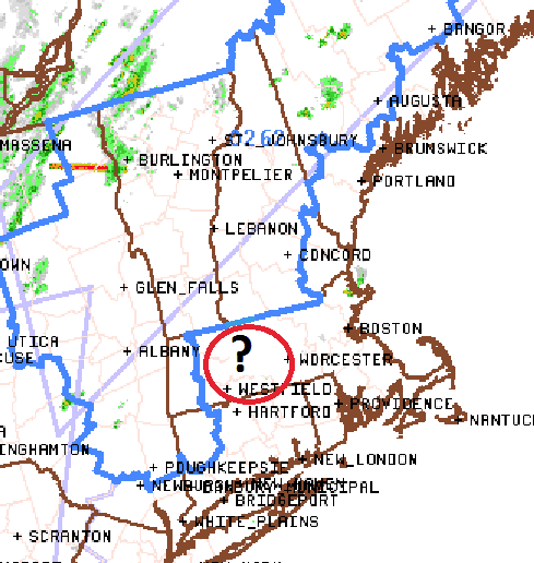
I've always scratched my head when they do this kind of illustrating ... Obviously "in or around" should suffice, but is it really impossible to be a little tidier? - haha. Danbury CT, and Nashua NH ... bombed. But that light sprinkle in Orange MA? Phew, that almost shut things down, huh Is it really hard to just draw that from HFD to PWM and call it a day? I think it's pretty clear they relay upon county lines - or I suspect so ... - and it may not be convenient to do so, but this technology isn't like DNA - it's not causing cancer if they change how they f'n do that. Guess there's more important problems in the world.
-
yeah our winds here along Rt 2 are convincingly W to WSW.. 94/66
-
I bet the warm air floods out to WInthrop over the afternoon..
-
Impressive... BED 97 ! 93 here
-
I can see the tops from here ... Appears a wind shift is working E. We've gone WSW to almost due W here over the last hour, with more tree top movement .. Probably 20mph over the canopies. anyway, it appears there is a convergence there where that lingering SE inflow is being met by this pulse moving E, situated over NE Mass
-
of course ... a mid level deck start emerging.
-
Yeah I've been trying to engineer a way for others to get into the 90 club all morning. Verdict still out on success - lol.. But agreed. I think though this day has more chance of scouring out the subtle stable layer that's plagued the bottom of the sounding. It's really from you to about Logan... along and E of the line is 3 to 5 or < below the 85 I have presently here. My wind is SW... ASH is E... But above the deck there's a little more momentum ...blah blah, the boundary that's 'not really there' retreats?
-
Yeah, 10 after 10 ? interesting to test that. If it works out, we'll edge big heat.
-
I'm wondering how proficient convection will penetrate SE across the non-hydrostatic gradient later tonight. Those heights are not in any hurry to fall - though receding slowly. You like height falls, while still elevated hydrostatics -that's the cap recession happening with elevated CIN moving off if need be, or, just making for very sensy triggers. For this region of the country, we could use some mid level wind momentum too/shear kinematics to give assist. Those mechanics ... are they in place tonight S-E of ALB? This looks like a candidate for a front to come in underwhelming and end up paralleling the flow before fading ... It'll be enough to make for 73/49 top 10 gems for a couple days ...then - There's been a better convective signal for the end of the week that's been consistent in all the guidance.
-
Over arcing synoptic ridging is suppressing anything from happening over CNE/SNE, so far through this period, yet is insufficient in kinematically driving an offshore wind. Which allows an oceanic creep to move into into eastern regions like at scene out of that B- '80 horror called "The Fog" Great. So we desiccate in cool misery. Actually, not me here in Ayer - I'm commiserating for the E and SE folk, where clearly ... modeling was not sophisticated enough to see these oddities nuance them out of this summer burst before it really became clear in very short term, that would be the case. They should get some this afternoon - me thinks. I've been literally right on that interface between the two worlds. Drive up to Westford's Wholefoods ( lest I rely upon the local 'rural' Americana 'canned ravioli' chains ..), which is immediately astride I-495 there ...and you can sometimes smell the mash-up between eastern mass industrial effusion and marine taint, and it's routinely 7 to 10 F cooler. That location is only about 7 mi E of my longitude. Yesterday was about 87, though, while we were 91.
-
Looking and comparing E regional obs, it appears wherever decoupled overnight - and those close to and E of that boundary Saguaro posted above were more proficient in the regard - end up back in a N drift. Those closer to the coast, variable between NE-SE. W of that boundary, the weakly decoupled area was more variable to dead calm. Yet, ....WPC analyzed the synoptic weird boundary that seems to fester with physics disconnected from God ( ), repositioned farther NE up into southern Maine. Sarcasm aside, that boundary does not really reflect these meso scale circumstances that are still plaguing the 'warm stretch.' What I am also noticing this morning, as we heat up... as the temperature rises to between 78 and 80 ( now ), sites are showing a flip to WSW ...albeit very light. ORH at 1000 feet is WSW the whole way. One thing this whole ordeal apparently lacked was a strong enough llv gradient to drive the wind field/fronts along. This is a stagnated scenario, or close to it. The air quality around the region as the yellowed sun rises through it is pretty 'ozoney' for only having DPs in the mid 60s ...and I think that makes sense given the lack of sufficient mixing associated with that former reasoning. As we continue to warm, the feeble deeper layer environmental wind momentum may just be enough to mix out that stranded air mass over eastern zones ... I dunno mid day. Nashua was 73 with an E flag wobble zephyr; Bedford popped to 79 and went WSW.
