

Typhoon Tip
-
Posts
44,235 -
Joined
-
Last visited
Content Type
Profiles
Blogs
Forums
American Weather
Media Demo
Store
Gallery
Everything posted by Typhoon Tip
-
You're on point... The MJO's behavior is (likely) because it is/has been in destructive interference against the La Nina basin footprint. The La Nina has been remarkably well -coupled this autumn. Personally, ( full disclosure ) I was optimistic that would not be the case (the La Nina part of it). Ha. It would be more loosely coupled, which is not unprecedented over the last 10 years of varying ENSO states ( much to the chagrin of those that are heavily ENSO reliant). The recent decadal history of that was a hopeful trend that we would not have this longitudinal flow structure coming into western N/A. It wasn't just that ...there is a growing body of transition season behavioral evidence for seasonal lapsing. We have observed early/late cool snaps capably of harboring actual snow events, as early as Octobers and as late as Mays, going back to 2000. This has - more or less to be determined causally - been coinciding with the acceleration of climate changing during these last 20 years. Whether that is so or not, a statistical oddity in the least, but it also played into the idea above. If seasonal lapse was causing W/NE N/A ridging early, while (perhaps) La Nina were vague --> ..etc. Neither seemed to materialize per that hope - I mean... it wasn't an 'expectation,' it really was hoping. Ah well... There is a statistical bases for 'early performing' La Nina winters. It's perhaps related to the fact that ENSO signals tend to decouple more so during summers, for obvious reasons related to planetary relaxation of gradient turning off triggers/dispersion mechanics...etc. So that does provide a narrow window for late Novie to early Jan ... but it's not dependable. It's just adding a little. That's not doing too well either LOL.
-
It would be nice to see a -WPO ...yeah. Seeing as everything is W--> E ( ultimately) and not -NAO controlled. haha. But I've been watching the eastern Asian/west Pacific for signs of a -WPO to help transmit a AB signal down through the N. Pacific Basin and we're not getting it as of the last month. It's interesting (then) that we are still getting episodic -EPO's in the models because the WPO caries a positive correlation with the EPO. +WPO wouldn't infer. I'm wondering if we are actually verifying these -EPOs though? that's a good question. In the general sense of things ... a better Pacific would help matters for winter enthusiasts.
-
Rabbit hole of psychosis... haha
-
Can't have 'too much information' you can only have ( or not...) the ability to process it, both appropriately and responsibly - the rest is individual and/or group shenanigans.
-
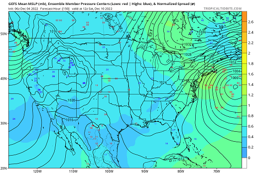
a I'm not completely sold that the 9th .. 10th period - admittedly now just 6.5-ish days away and thus "outer medium range" - should be ignored for winter enthusiasm, if not more practical operational needs frankly. Here is the 06z mean, which en masse is an increased implication along a four consecutive cycles, with a classic W-smeared spread, within larger synoptic envelope that is pretty classic -NAO ...with large polar high parked quintessentially N-NE of Maine ... Farmer John's odds ... I'd place them around 30% ... 25, a non-zero but more importantly, elevating risk, if one chooses to use this GEFs means. More over, the behavior of the individual members still showing general poor handling of the NAO exertion of the local hemisphere. Predictive skill is fleeting. There's variety there, with a growing tendency ( also hinted now in the operational version) to even meld the 10th escape failure, into the latter 12.13 system arrival. That's creating a morass of possibilities there, ranging from a complete suppression, to a protracted light cooling QPF event that probably evolves into a winter profile. And all likely to be parsed into something more real/discrete only upon shorter terms. There's really very low actual deterministic value ...even as near as the D6 above... But I can tell you, it is not merely subjective ...rather is objective, that there are a large number of significant events in the catalogues that had a D6..7 synoptic structure and spread that looked like that above, and the westerly smear turned out to be telling. Also, this hearkens back to 5 days ago: the reasoning and advice then, that these "threats" would emerge in short order compared to either normal signals at range, or user preference ( haha, clearly on the latter, huh), ... really, none of that has changed, despite the range between the neg vs pos narratives owned by various posters. You don't know. you don't. Fwiw - the 17th has an impressive multi-cycle presentation, too. In fact, that's keeping with both the consensus for colder hemisphere deeper in the month, but also not a bad intuitive fit for the climate suggested gestation wrt the super synopsis when dealing with modestly elevating PNA's during either collapse or pulsed -NAOs.
-
The overt skeptical position sees theirs/the 50% on their side as an extraordinarily large value LOL just sayn' good luck.
-
This is a kind of 'personalism' but this is one of the "blue-bomb months" of the year. Granted, on the front side...but by the time 156 hours rolls around we're out around the 9th...which is getting into the sweet climo of whence marginal wet forecasts bust cotton balls. This can happen any point in autumn and spring, really... Seeing that cartoon layout with blue holes punched in it over western MA/E NY ...etc, is obviously there because it's "marginal" ... Two aspects: one, ... trending colder as the system nears was a bankable error correction up to about 15 years ago... Since, either model improvements, climate change, or both, seem seems to lend to less of that... That said, a -2 SD west limb NAO may tilt that the other way. So there's some speculation art here, too.
-
I've noticed that about the GFS. Whenever it cuts the low, the airmass ahead is colder, but erodes after a period of snow/sleet amounting to 1/2" mockery. When it collapses and respects the NAO hemisphere ...it's warm on the N side of the storm tracks. Seems the model has been parameterized ...not to snow like on purpose. hahaha joking-
-
No ... but it may not be right. There's a probability embedded in those regions/structures.
-
George ... I am going to do you a favor as a reward for having not used the word 'blizzard' over the span of your last 20 posts ... The storm loading pattern is from the Pacific. Not the block. The Pacific matters in fact entirely. Blocking is just an indication of where storms can't go, but it is in fact there because of the total circulation/wave mechanical forcing that is always vectored W--> E in the NH mid latitudes. Which means ... the Pacific ultimately caused the block. Just helping you understand the conceptualization of this stuff. There is no storm if the Pacific does not provide disturbances ( and by Pacific in this context, that means "from west to east" ). Also, the blocking episodes that do materialize can be too aggressive...and cause a larger scale destructive interference pattern, and so the Pacific can do it's part to deliver disturbances into eastern N/A ...but they get summarily damped out by compression and velocity surpluses ...which is a shearing factor. Not just about suppressing - the block is really only a favorable aspect within a narrower window than people probably are aware. Lakes cutters are less likely in the presence of a west limb -NAO...yes, that is true...but if the -NAO is decaying as a system is organizing, it may move in that direct.
-
Yes ...but a lot happens in that amount of time. It comes down to greater expectations for excitement when the ball is in play. NFL Football is also just one example... The NBA can't be ridiculed for the same product model. Baseball certainly can - it's taking hits in recent generation(s), too. Again, it was not about the sport in that missive? The satire was directed toward the cultural attention span. agreed though, all these products are over-sold. They could actually make all the money they need on other exposure methods. Jerseys and uniforms, side-line graphics, field paint. Other techniques to get it across anyway. It may be in the works... with the increased streaming tech infrastructure, the 'cable captive audience' model is slipping into history.
-
heh... it is what is - 270 hours is unfortunately just a wee bit too far out in time.... It's just fun to talk about the movie lol.
-
Wow... that Dec 13.14 thing is a dynamic little beast. It's got a warm seclusion wrapped into the core as it moves straight E astride L.I., with sub-0C 850s N of the track...
-
Nah the surface evolution is better than okay there guys. Jeez - I may be speaking to the straw man in the room, and I realize that there are those on the immediate coast/near-by oceanic climo taints that get screwed ( anyway...) at this time of year, but what is depicted there is correctable for everyone - relative to your IMBY climate. I would even watch 144 hour for courier and ives holiday mooders in the air for shopping and Nut Cracker donuts and cider evenings because that GFS 2-meter layout is dubious... That's likely to really be a low level growth region/beneath a saturated inversion from oceanic flow riding over 925 mb sub-freezing air as a viable correction there. Yeah, synoptic storm peels south and misses, but leaves us in long fetch of steadily cooling after that too... Of course ...all this is just speaking to this one run of the oper. GFS ... haha -
-
I was directing toward the 'tenor'
-
What ? huh I saw two mid level bombs on this oper. GFS. Oh they're out there in time, sure, but I'm throwing a confused at myself over a hostile take of the 12z run. Maybe it didn't reflect well in the surface evolution? much less the blue colors haha. I dunno, I'll go take a look. But as far as the height handling and the wave propagation aspects of Meteorology, that was encouraging to me as a winter enthusiast because it at least showed some respect for the NAO hemisphere in driving deeper centers E and not W of New England. Dec 13.14 and 17.18 ...and at this range, regardless of the surface particular design it's still more about the mid level height scaffolding ...ens etc, anyway and worry about that other shit later.
-
Yeah... by the way, - the previous missive is by no means a commentary that devalues Soccer - that 'should' be clear to the reader? The missive is more a tongue-in-cheek satire ( of sorts ... shy of real supposition ) into the fleeting attention span of Americans, and why-for Soccer doesn't carry the same popularity. You know... ( and ugh) we live in an present zeitgeist where it's 'fun' ( some how) to take exception for seemingly least excuse to do so -... it's called 'recreational outrage' but I digress. Personally, I like the game. I watched the Americans ( and Brazil...as I have friends from that region). I will continue to do so. ...well, apparently not the Americans - oops. My futility missive had merit after all. haha. No, but the usefulness of the game to world, and the U.S. slowness to wake up to that, doesn't say anything about the game itself.
-
Funny... no sooner did I post that muse... the U.S. hero'ed in a goal some how. Wah waah See? That's how the online social media game is played - chances to win or lose on every play, not just the game.
-
May as well go ahead and contribute to derailing a thread that's the worst kind of evil: perpetual optimism that never produces.... I played soccer in my youth. Between the ages of 10 and 13, I played those four years. I wasn't good. I wasn't bad. Mostly I just didn't pay attention. Even while the game was being played, whether I was running around or not, I remember being there ... but not much else. I think I may have once even 'headed' a ball successfully, not intending to do so. I was watching a CB rolling out over a horizon when the object found my head... 'Uhph! oh? right' and the coach said 'way to go'. The game is boring by American cultural wiring - it's like trying to propagate an MJO wave out out of the marine sub-continent, into a La Nina footprint... only with soccer, the energy there is out of phase with the energy of the people. We need faster dynamic switches. It's just in our cultural nature. Events need to trigger excitement, because they have elements of uncertainty that really prove to 'save the day', vastly more frequently ... perhaps right down to the scale of the momentary play on the 'ball'. Quick, expedient retries at glory. The next time down the court. The next snap of the football. The next delivery of the puck down to the other end of the ice. I can't tell you how many times I've seen 17 points scored in the last 5 minutes of an NFL game, steal victory from the monster of defeat. In Soccer? I can't tell you how many times I've seen who ever scores first, wins... proving the the rest of the game a futile slog fest; the first goal happens in the first 10 of 90 eternal minutes of the affair... That is just not the way we are wired. It's amazing really that MLB has survived, though it is faltering ( most likely causally related ). The excitement of NFL, NBA, and to some lesser extent, NHL ... these sports either knew this about the population, or just were lucky to have evolved within the target demographic they have. Their products directly tap the 'it can still happen' nerve, at the pace that is required to keep the attention of this culture centered. Soccer may never take on the appeal to the common populate beyond having reason for parents to vent to one another over the travails of living in a sped up, tense dynamic seeking hurried culture ( ironically) that's equally unsatisfying to them. Once in while, you get that soccer dad or mom that gets in the face of the ref and embarrasses everyone - but all they are really doing is trying to find the control they don't have over their unsatisfying job or home-life ... using an event that is supposed to be teaching children something else entirely. That doesn't really substantiate the game, but to that hot headed parent's taking exception over their brat's deserved penalty kick, a venting therapy sure felt completely necessary to them.
-
Likely to dive south from that position ...
-
It is ...still a ways out there, but that D8 synopsis is a bona fide "Montreal Express" ... talking flash freezing pond and small lake surfaces with that set up. wow.
-
just fyi ... the control run - which is code for George's basement I guess - has something of a historic nature D14 up the EC. Establishes a pressure depth not seen in the PHL-NYC span in decades outside of the tropics, and maybe there too. Down 963 I think but the resolution's a little mottled. The mid level ( 500 mb) hgts core down 510 dm centered over Baltimore. ... It's doing that in a 'relaxed' mode of the NAO ( ) too ... ( wink is for everyone). It's just that the relaxation is happening perhaps a 3-5 days sooner, hence 13.14.15 for a big dog. I mean really big dog. Talkin' St Bernard/bull mastiff hybrid got with Great Dane It's D11-12 though... It's not a deterministic produce of course, but whatever they do in "controlling" the run, I would be curious how far they had to really push the input metrics to get to that solution.
-
If I may add a little to this… Similar logic: I don’t really even care if we miss an event in the first two weeks of December when we’re looking up the mt at an avalanche of possibilities - seasonally yeah some years are really really bad… They just don’t “avalanche” but point is there’s three months or possibly four to work things out
-
Yeah we’ll … it’s always been a possibility with this. I realize you’re kidding but the laws of physics and nature don’t become irrelevant – the NAO will tend to relax at some point - it won’t sit there like a brick in the atmosphere. So even if that one compresses it us not likely they all will thereafter but then again, there’s no guarantee the NAO will even be a factor well out in time. The ensemble suggested it will last a while though. Point is it will pulse in and out. The good systems will happen when it’s in d(NAO)
-
I don’t think anybody required caution flags in the first place so not sure where that’s coming from?


