

Typhoon Tip
-
Posts
44,234 -
Joined
-
Last visited
Content Type
Profiles
Blogs
Forums
American Weather
Media Demo
Store
Gallery
Everything posted by Typhoon Tip
-
Again again again… The NAO is notoriously stochastic in guidance handling. The fact that this one’s been behaving doing better over the last week or so is really an anomaly in itself we’ve been lucky up to this point not to be dealing with that but you know?
-
And just to be funnin’ …I actually wouldn’t mind that position in a scalar sense of it if we could just lop about 30 or 40 dam off the top of that sucker
-
Oh it’s even worse… I mean after two weeks of build up that should’ve gone the other direction then do that? It’s even worse because at least in the other since you did get some snow at some point. I guess just since we’re being silly here… the upshot is that that happens on the 13th and 14th and there’s plenty of time to manufacture something in the recovery period after - assuming there will be one.
-
The GFS at 12 Z offers yet another option… Completely remove any effect of the NAO exertion …allowing 13.14.15 to Grinch through the Lakes. you know the recurrence of that kind of phenomenon is getting more and more difficult as the years go by to believe it’s purely random lol No but I’m not sure this model run really fits the mode of what’s going on here. I’d probably give this run a lower probability of success
-
The observations would suggest so… Yeah. Keeping in mind this is relative to predictive measurability and using what ‘s given. I mean the pattern could collapse into a compressed velocity soaked meat grinder and we could still end up getting something out of it - it’s just not modeled at the time. Those reach around more typically minoring events would also go quite far in saving the spirits in here lol. But at this range really we just have to try and sift down to the main nuggets of influence out there in the pattern. It seems the NAO is handling stable and it is the Pacific is the one that’s acting like the unattended firehose flopping around in the model runs Will said it in a nice concise manner just then - a communication art I typically fail at … But if you just stick to that as a basic canvas requirement everything that I mentioning about the NAO this morning becomes rather academic. It’s just that it matters presently as we try to sniff out events because that fundamental aspect seems to be dictating our success right now in dealing with modeling noise I feel pretty confident in the perturbation out there 12.13.14 but it’s really unclear whether it’s gonna get constructive feedback or destructive feedback and I think most of that sensitivity again is centered in what the PNAP is going to do
-
The PNA is the mass field that’s demonstrating the greater variability during this era of outlook projections. Interesting. It’s interesting because there’s been a pattern of more vs less sensible impact east of 100W in either the operational, or the ensemble mean, when/if they take turn bulging more or less +PNA/+PNAP respectively. In other words … the sensitivity over whether we produce or fail over the next weeks of this thing appears to be mainly of Pacific origin. Strange to see the NAO of all stochastic pain in the neck indices be so shoulder rubbing stable.
-
Meh … punching the clock as we labor through model runs that vacillate between constructive vs destructive interference. Yesterday constructed Overnight more than less destructed If it need be said, 7.8.9 is still beyond D 6 (fairly…), implying as it should that it may trend back colder - NNE is part of this sub forum … etc. While 13.14.15 is still yet beyond the ‘operational event horizon’. Of the two intervals 13.14.15, despite being beyond predictive usefulness…, has the better conceptualized chances, however … con I’m still toying with: the question of an overly compressed flow over mid latitude dominating the NAO continent is still unanswered. We conjecture that there’s likely to be at least some of that … agreed. But there’s virtually 0 assessment possible from this range whether that becomes too inhibitory during. The models are good … probably best at telling us which impulses could be interesting, if they are allowed to do so. But are particularly lousy in the “if” area beyond that ‘predictive event horizon’ above. I’ve been discussing for years that the NAO presumption is a bit off a false read … probably left over from the early popularization while not fully knowing the true nature of the index’ implication spectrum if the 1990s. It’s the D(index) with a steady diet of non interference Pac wave entry from the west that enthusiasts want … Just keeping my own expectations in check for now.
-
I’m pretty sure 1888 wound up in a frontal structure similar to that.
-
I don’t know what if any significance this is, probably nothing beyond symbolic, but this might be the first time this autumn I’ve heard turbine gusts from actual CAA
-
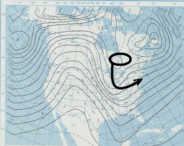
Noticed that ... The key is the aft regiom of the ORD S/W...If that pops taller into Canada ... it will trigger that western SPV to curl and subsume - that's a 1978 redux look there, but is hardly claiming analog - just the 'behavior' in principle... This GFS solution doesn't get it done ..but it's damn close!
-
Where's Brian ? - we need to petition him to institute a limitation on the use of the word Blizzard - I don't care how fascist it is to limit free speech, at some point we gotta throw hands
-
Agreed
-
Yeah I am not inclined to think a New Jersey model bomb/Miller B is type favored given the totality of all guidance sources but native to that one particular model solution? -actually in the process of slowing or decelerating everywhere really quickly in a day or two leading to that … it’s probably just model hallucination but if you wanted to get a big dog done that’s how you do it by the way… The GFS trended pretty heavy for that 7.8.9 heh hadn’t looked. That’s probably already almost thread worthy considering a large consortium of our subform lives in Central -northern New England I’m also a little biased in favor of that event because it’s something I saw like six days ago frankly I think I mentioned it back then so so much for self promotion ha ha Overall I’d say this GFS run is the most representative of the pattern forcing and having a polar jet punch further south across astern North America over prior runs. It’s interesting to see the operational runs finally conceding to the weight of their ensemble means assumption we might’ve almost been able to make considering every single family were saying the same thing
-
Yeah it is too bad that is at the tail end of that run because that is setting up a monster - I mean if one’s into that sort of thing … haha. yeah that wave diving south of Chicago‘s got a no chance other than the closing off with that look and it’s going to be doing it under a fresh ambient baroclinicity and a ton of cold air - I can tell that without even looking at the other charts, and if the other charts don’t have it their wrong. so there. Lol
-
I still think 7.8.9 can trend I also lean more 13.14.15 than I do 20th. But obviously that’s just where we sit now and trends up to this point… Everything together and techniques in mind -all that. I reserve the right to modulate. I think we are going to have to conserve some progression in the flow so anything that’s a model on a given day probably moves up in time so I understand the tastiness of the 17th of the month but I just think if there’s something real around then, which I’m inclined to think there is, it’s likely to get bumped up by a day or two. And I agree that flatter faster systems while we slip stream
-
It’s an interesting duality there… In one hand it’s very doubtful that we’re breaking the December single month snowfall records-although we can hope right? But on the other hand it’s definitely quite viable that that specific region of Northeast or mass where you live gets totally b-f*ed. Just as a wise gambler…
-
The world ends on that day. The billionaires are already heading to their top secret enclaves to wait it out. Appears an extra terrestrial event is going to happen that surpasses Carrington by perhaps a factor of 5.
-
Yep… I spoke about that earlier that exact same aspect because of the differentiating mass fields the correction factor is likely pointed south , i.e colder solution either way
-
Nasty mix after an initial snow burst.
-
Rumor has it ‘competence’ is the main objective …
-
Absolutely… But again, I was just speaking to the general readers and education point not to be swept away by that look without considering it - that’s all. I mean the circumstance of compression and wind howling and all that stuff and hoping that it relaxes a little and allows those stream interactions and stuff to happen… The fact the matter is we don’t know if that’s going to end up that way in a lot of what goes on in here lol it’s just psychology management ha ha ha but if people are prepared then there’s less of that jilted sense I guess. Umm actually no… Because as history of social media dynamics had repeatedly shown … we can set that table with Ming Dynasty elegant anf people will still eat on the floor and get all pissed off anyway… Kidding .. a little. But like I said it’s also not a showstopper… Compression can neg interfere …more likely in the big dog scenarios. We can also end up with overrunning typology. We’ve seen big results happen from seemingly innocuous flat wave events too. I mean we can also get into the abstraction of climate change and higher pwat that cause systems to act weird - the list is endless if you want to start drilling in. I think the psychology in here would be managed well enough in a nickel and dime result. Yup. You’re right about the relaxation. In fact when I look at all the biggest ones in history (except maybe 1993 super storm which is more like an atmospheric rogue wave…), they happen when the basic geometric pattern shape of the flow was in place but you didn’t have a berserker amount of gradient between the trough and the ridge nodes. It all comes down to baseline velocity versus exit —>entry velocity’s in short waves embedded
-
Agreed … I’ve been impressed with ‘scalar’ analogue. fwtw It’s a revolving door thing as you hint tho. Depends on timing the noise within … which ultimately decided system typology
-
The only problem I see there is whether or not the ‘neutral’ height field departures in the SE are just an artifact of the flow compression - you know this … I’m just mentioning for the general reader. If so … those neutral layers in the TV are misrepresenting a destructive interference pattern. Insidiously, too, as it sort of hides under cloak of otherwise impressionable features -but the screaming velocities that result are not being represented. It’s not a show stopper … just an aspect to bear in mind. Anomalies don’t describe “why” they exist … it could be normal hgts because cold hgts are compressing S … but compression absorbs S/Ws.
-
Keep in mind … the COD is a weakened state …. It’s exertion in terms of forcing wave mechanical dispersion/modulation downstream drops below the forcing of the westerlies and becomes lower correlative. In other words … phase 8.1.2 migrations while within the COD do not represent in the pattern very well.
-
It’s good speculation but the reason the MJO has been reproducing that same behavior of collapsing into to the COD astride the 7/8 quadrants of the RMM has more to do with the wave attempting to move out of the marine continent … straight into a headlong -ENSO circulation footprint. And not being strong enough … it loses out within that destructive tension. Notice the wave seems to briefly amplify in 7s? Anology is a wave rearing up nearing the shore Phase 8 —> 1..2 is actually a constructive interference wrt the -AO should it succeed. It destabilizes the AA phase of the N PAC Basin … triggering tendencies for wave migration into higher latitudes which proceeds blocking events.


