

Typhoon Tip
-
Posts
44,520 -
Joined
-
Last visited
Content Type
Profiles
Blogs
Forums
American Weather
Media Demo
Store
Gallery
Everything posted by Typhoon Tip
-
mm... I've made no restraint in my expressing how I feel about spring around in New England. It's subjective, ...admittedly. But I find it loathsome. I don't really spin it as 'not so bad' at times just because it's like today. I think it is bad, with days scattered over time that are not as bad. But because we know what's in store, it's tainted. I don't like a sunny, 74 day in April, when knowing it is going to snow in two days. That's a weird personal thing ( probably...) but that day is like an abusive spouse that loves you to death when their not choking you in a narcissistic rage. No but it's just me. I have a very short tolerance for days like yesterday and the annoyance isn't compensated enough I guess. So over the long run, I'd rather not live here between ~ March 24 and Mother's Day if I had any choice.
-
Which by the way... we enter the solar maximum on May 5.... four days. Which means today isn't a whole helluva lot different, just sayin. It's equivalent to August 10 or 11
-
Similar... 56 but that pancake CU bloom patched it's way off to the SE and has left us 90+% open sky with some of the most uncontaminated blue the Earth can muster in this pre-holocaust industrial history lol Very light wind, and with the sun now officially insanely hot standing there it's giving that allusion to it being warmer.
-
Looks like it's thinning out some
-
haha, I know where you live just be studying the tendency that seems to be fixed. Seriously, it's probably terrain determined to some degree
-
This looks like a terrific opportunity for Brian to end up under one of those stationary diurnal cloud streets while it's sunny a mi E and W of his immediate neighborhood ?
-
It might zygote as cat paws or even some mangled bow-tie pastas if the cold infant CCB head gets this far NW Sunday morning, too. Kind of an interesting day. 12z could have some cold rain mixing in if the CCB head gets as far W as Worcester to SE NH, then is sharply clears by 10 or 11am as the back edge rolls out with that fast moving developing coastal. It's not a big system. Compact actually... those tend to have a sharper back edge on rad and sat. So you're sitting there in misery, and then least expecting a brilliant sun bursts forth through the S windows. That backside environment appears to only be weakly CAA mixing as there's not a steep vertical delta-T...while also being down slope. That might allow the temperature to get near 50. I was looking at the 700 and 500 mb level RH and the %ages are < 50. Some DVM may offset the pancake destruction. Point being, going from Labradorian nut sack to at least a C+ afternoon is an interesting sensible flip.
-
Today's a sneaky mild naper. In fact, with May sun potency now lasing the land and man, might even subjectively argue it gets warm out there mid afternoon for an hour or two. (altho hold on. One caveat: not sure if we pancake destruct this, which would cap temp rise....) Sunday morning? there may be wet snow falling around the top and tuck towns of the Worcester Hills. That sure is fuck won't be normal - it would objectively be well below normal actually... However, (today's sneak warm) + ( Sunday morning cold butt pump)/2 = typical bullshit godless NE spring climate by average so yeah...I guess that argues near normal in the aggregate It's a matter of magnitude. Does the cold anomaly on Sunday out weigh today's warmth? It might be a fun 4 min comparison on Tuesday morning for nerds that like to crunch those numbers. Tuesday and Wednesday are going to be close to bigger warmth. It's going to depend on whether the warm boundary that is more and less defined among the models, ...actually gets through here. Climo says it doesn't and gets shunted some how, some way. Even when there is no physics to shunt, Earth seemingly comes up with physics ( like interdimensional weather) in order to get what it wants: pumping NE spring enthusiast bum. Seriously though, if we can get S of the perceived boundary, we surge from Sunday local era nadir to AN for those two days. That'll prooobably seal the first 7-day's worth of the month as +
-
10th-14th is a transition period suggested by the numerical trajectories ...albeit recently emergent. However, it was at least vaguely hinted starting 5 or so days back. As of a last night's computation from all three major source, GEFs, EPS, GEPs, there's movement toward a neutral EPO, -PNA state. That's basically shutting down BN. Adding to that presumption, the AO and NAO are flat-lined, perhaps seasonally too. That tells me that the op. Euro's extended warm surge into the latitudes of the lower Lakes ( huge swarm outbreak in the Euro 300 hours btw -), with 80s to southern Ontario may not be dependable per se, but at least the principle of a bigger flip is well founded. We'll see where it goes. Personally lean to this having legs tho. That's the broad orbital perspective. At a bit more of a discrete level, ...Tuesday and Wednesday next week are precariously close to going excessively above normal. A typical result in this latter leg of CC; when the environment "allows" a warm departure, the result is disproportionately warmer than normal compared to when the environment is pushing cool departures. Scott and I have an ongoing interesting observation about this... if you look at just about any month's climate records since last autumn when this cold hemispheric look became dominate, despite that being the case those months will host something like 3 or 4 days stretches with +15 to +20, separated by 10 or so days of -3. So that month ends up either near normal or even decimals above normal, while having successfully cheated everyone that enjoys warmth from being able to subjectively feel like that was ever the case. HAHA. It's been a total liar journey for months now. We used to have a saying back in the day, "Statistics lie". The irony being that they don't... but they do at times belie the daily experience. You'll formulate your impression over 10 days of -3 much more so than 2 or 3 days of 70s.
-
The structure of the local hemisphere is a winter look, no question. Replete with STJ rippin' over Texas and over the deep S, with a low lat trough in the SW lagging. If that were February, we'd have winter storm watches up by tomorrow morning because that mess would be coming up ... And well, it's not so metaphoric really considering there's a coastal near missing in 2 days. It sucks. It just does.
-
-SAD incarnate ^
-
Of course it does... ? at least to some degree. Weather and climate have been a guiding influence on humanity throughout all evolution. Cultures have rituals that were ultimately rooted in cyclical climate, as well as more transient weather types. It affects the individuals, who in turn and en masse, then creates the moods and modes of the group. That's all a no brainer to anyone with a menially read background. To mention, Seasonal Affective Disorder is a very real phenomenon/diagnostic condition (SAD). So is -SAD. It's a rarer condition but it's basically a smaller percentage of population actually get a sense of angst from sunny, warm and fair weather days - I've long suspected that many in here with this fairly obvious ( though they attempt to hide it ) aversion to summer are suss for being in that group. That's natural... but what isn't, and is weird, is someone using ( like a drug 'user') forecast models on computer screens to trigger them. That's what's weird... And unhealthy.
-
it's the temperatures that grinds me down. I don't care as much if the sun's obscured by cloudiness all day ... I get really ticked off it's cold. Some subjectivity as to season, as well as what 'cold' means to the skin - okay 55 sucks when it is cloudy. Ireland this, or sun and 67 every 4 days ... that's attempting to gaslight a piece of shitness as something better than it really is. But that's just me.
-
it’s interesting that Tue/Wed lower trop synopsis in there considering the local hemisphere
-
...no one person in particular mind you ... lol I just have a cataclysmic sense, like it is pending, global in scale - there are ...unnerving things going on that interestingly enough, no one in here talks about. interesting. closed circuit for a social media depot, I'll tell you that.
-
Most of you won't be alive in 2056
-
Oh..ha.. yeah, wedding out doors ...but you know, forecasting a wedding in April or early May should require at minimum a consult with a local climatologist, who most likely would have advised against that initiative. hahaha I mean, c'mon man. Really. Wedding most popular month is June. Not sure if that favorable weather -related, but I'm sure climate did influence that being the cast over many generations. It's just too hot in July and August for get-up entire, and prior to about June 7 is dodging buckshot patterns.
-
Seeing as you ask haha not me. Altho, with one stipulation - we don't parlay from week's ending rain into unending relentless Labradorian nut sweat weather that never truly ends until summer begins on August 11th and ends with an early cold snap in early September ...essentially ruining the whole summer. 2020 did something like that... ugly year for warm enthusiasts. No, the worst year was 2000. I lived in Waltham that summer... man... we put together a lot of 69/62 misty diurnals that year and it just stole the whole fucking go if it - Anyway, excluding something like that ... I'd like to grab a basin wide 2-3" soaker that then more ideally moves into days that are pithy warm - not gossamer like depending entirely on sun and nape affect. I like those...but the air smells like glacial farts in 60 shade/71 sun and just comes off as fragile and fake. But we dream ...
-
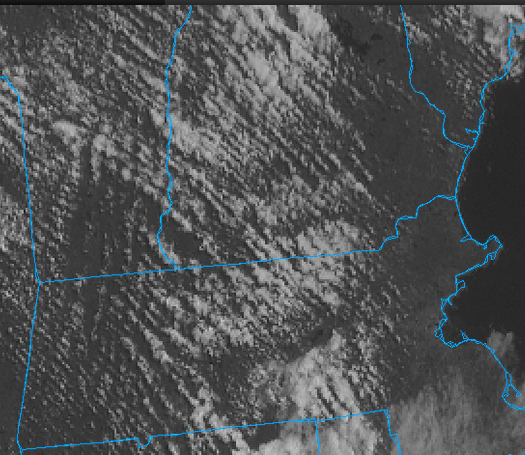
It's neat to watch this... That low in the ocean is clearly attempting to retrograde W at the same time this axis of schmutz is attempting to move E. https://weather.cod.edu/satrad/?parms=subregional-New_England-02-24-0-100-1&checked=map&colorbar=undefined
-
Looks ( again) like 10th to 15th of May's the next step out. Between now and then, variability with annoying troughs ... cold east oceanic flow, at other times false warmth type shit
-
Isn't that above average ?
-
Looks like the operational model versions are trying to keep the circulation more progressive through this weekend. Prior thinking was -NAO type back-logs would risk stalling rhea wheels in the region or close enough to shut down a 1/2 month's worth of outdoor life. If we end up with lows getting N of us though, event if it's BN ... west wind is at least interludes where it's better.
-
Yeah, good point. In order to trigger MAGAt republicans, the one dimensional linear thought progression is a much more effective management tool hav to rite in littel wurds
-
https://theonion.com/report-every-place-on-earth-has-wrong-amount-of-water-1851544516/
-
All these offices incurred staffing losses when we made 'merica fuckin' awesome agin'. I'm sure SPC, being under the NOAA umbrella, are in a similar situation where top-down imposed cuts erode their abilities? That'd be my high confidence guess, considering there's been articles written about how staffing cuts lent to poorer hurricane this and that, too... It's a pervasive problem that we the mouth breathers, in order to form a more perfect union, had the audacity to believe would get us anywhere closer to a more perfect union. This facet of the times we are in ...hasn't gone away. Yet we keep having these post where we are surprised this and that. No ... we are not surprised. What we all are is disconnected, in all aspects of the reality we create at a civilization level, from the consequences of our collective actions - apparently.. This can be easily proven. Well, by this shit above... But it can be proven by the predicament of anthropomorphic -induce CC and the enabled, unabashed denialism ... which really is so detached from objective reality - well, put it this way, that same compos mentis voted a convicted felon to be president. 'Nough said. It can be proven by everything in between. This is also part of the most probable Fermi Paradox explanation, "where is everyone" ( meaning civilizations in the cosmos). Probably every advancing civilization in the universe hits this dilemma eventually. Most fail the test. The rest of the missing ... likely related to the fact that a single light year's worth of physical distance is so vast it too greatly exceeds human capacity to dimensionalize just how far that is - viable worlds are separated by too many 10s to definitely too many thousands of them. Try to imagine traveling at 183,000 miles in one second, for 4.5 years, in perpetuity - you really can't, and that's our nearest solar system neighbor. Civilizations innovate the ability to survive in this seemingly, universally constructed isolation...("agency" tongue-in-cheek), and that innovation then exceeds the background trials and tribulations of the pure biological-Darwinian requirement, -----> resting in relative affluence is unavoidable as Nature, including all life, abide the universal physical Law of Least Action. Such that the Law of Lessening Returns kicks in. Apathy and sloth take over. This creates a nonchalance to morality and virtuosity, too. This enabling to flout advice and act sort of recalcitrant to the objective reality and truth that our grand kids are less likely to survive ( ironically...), than we are, due to ecological breakdowns that apparently have to fuckin' happen before the 90th percentile dipshits admit it... won't be obvious until we all see them dropping dead. Basically ... culminating in a veritable carelessness with dad's species gun scenario. That'd be a cool scene in a sci fi cinema, whence interstellar aliens happen by our solar neighborhood and detect a world with bio-markers... so, they come check it out. What they find makes Shelley's "Ozymandia" the best metaphor to describe.


