

Typhoon Tip
-
Posts
44,539 -
Joined
-
Last visited
Content Type
Profiles
Blogs
Forums
American Weather
Media Demo
Store
Gallery
Everything posted by Typhoon Tip
-
The phenomenon appears to be taking place elsewhere, too, around the 30N ( ~ ). India, suffering its greatest heat wave on record relative to date, is also ... prior to the onset of monsoon. That said, Mexico nor India are delayed monsoon - typically begins in June. It is the heat that is/has been premature. There's a cause for that, which is disconnected from the monsoon circulation as a response to seasonal forcing.
-
Report: Another Year of Record Heat for the Oceans
Typhoon Tip replied to donsutherland1's topic in Climate Change
It stops when the protogene of the cause is removed from the system. -
Getting increasingly concerned for significant heat mid month. Wholesale telecon collapse in all major ensemble systems wrt +PNA ….possible even a mode reversal. Mode flipping PNA to negative PNA is the eastern North America loading pattern for big heat. Meanwhile the distant “probability Horizon” of the operational runs are starting to pick up on the scaffolding for southwest heat release timing well with that numerical suggestion above. A week of +PNA first though… Which I’m not even sure how much it’s gonna cool off because it looks like the vortex stretches and elongates north of us really and that’s going to block the cold from actually getting around and underneath. Maybe more seasonal with thunderstorm risks
-
man... an average month might make us all rage in frigid declaration. May finished + 4 at ORH and + 5 at HFD. Who'd a thunk. It's probably my own issue but for some reason, these don't feel like warm months to me. what the f is wrong with me
-
https://phys.org/news/2024-05-delhi-limits-human-hot-countries.html
-
We may be setting up significant heat mid month
-
Occasional Thoughts on Climate Change
Typhoon Tip replied to donsutherland1's topic in Climate Change
I've wondered before how a 1936 heat wave would be if it occurred today. The thing is, it's not just an arithmetic assumption - like ...we cannot just assume since the climate is X degrees warmer, add that difference to the outcome. That's not how things work. The 'synergistic feedback,' a phenomenon that has been contributing to those heat explosions taking place all over the globe, cannot really be predicted as they are emergence that exceed the parametric input into the system ...i.e., "more than the sum of the contributing factors" ... that is why modeling will fall shy of the extreme results. The idea here, if one is intuitive and clever, the "synergistic potential" in 1936 is different than it is in 2024. For example, better land management and thus sustaining irrigation ... it's not clear how that would effect a feedback model. The daily "burst" temp is higher today than back whence...no doubt. Just looking at London, the Pac NW ...France and Australia and SE Asia frequencies. But the better land management may cap some of the extremeness too. It's a lot of math there. -
Occasional Thoughts on Climate Change
Typhoon Tip replied to donsutherland1's topic in Climate Change
You know it's funny ... the circulation was always about the slow moving thermal-haline cycle/forcing with the fresh water inclusion at surface density/buoyancy effecting the chimney fall rates ... ultimately slowing the overturning cross hemispheric oceanic circulation. We've actually been discussing that for ... wow 30 years at this point. That's still out there as far as I'm aware. Particularly if Greenland decides to unburden it's Millennial mass. etc... But wait, now we have these other circulation mode catastrophes emerging that show the not-so-slow moving characteristic. Beautiful. -
I'm hoping the small volumetric scale of this house will assist the application and use-case ... not noticing much bias when cooling vs heating. I'm going to leave the baseboard resister heat installed this first winter coming up here and we'll see. This house heats up and cools down very quickly, probably owing to said scale.
-
Just my personal hunch/hypothesis but ... the Earth's various complexly interacting forces creates a kind of 'elasticity' in the system, where the system recoils after exertion has been forcing deviation from era-relevant norms. We observed a multi-year Nina ... It suddenly evacuated a year ago February ( centered more so upon - ), and immediately by mid summer everything rebounds, and like all rebound mechanics ...they tend to go above, before coming back down, ...overcompensating a little...before finally coming to a rest. The atmosphere in all directions and heights soared, BEFORE the El Nino could possibly have been causal. Then, the El Nino limps onto the seen a month+ later, only some 60 or so % of the magnitude that it was modeled to be. This is very speculative and sort of 'artistic' as an impression. But plugging a taut rubber band? So we had that 4 year Nina, the Nino may not have really represented a true pan-systemic globally integrating El Nino, but a rebound span of time. Then, as it then recoils, the models may now be 'overstating' a new Nina .. this goes on until - This is all predicated on the assumption that new mechanics won't get involved that break up this immediate cause-and-effect sequencing - in fact it's likely that happens and obfuscates.. but oh well. I wonder if the impending Nina is weaker than this last Nino, which was both weaker than the preceding 4 year Nina but also was overstated by modeling prior to it.
-
Could even be a wake-up call. A pulse reading that a modality is formulating where the bulk populous leans toward the veracity of climate change. If these democratic society leaders want to retain their power seats, they'd better plug their shit into something like the objective reality - dangerously hot air is in the commoner's living rooms. Having 100 to 110 routinely over the 2 to 3 weeks leading the election ...prooobably didn't hurt her cause? Lol. I'm just speculating here, but I find that amusing. It would be interested to hearing exit polling commentary, though. Perhaps the masses have spoken, and their collective vote sends a message that if you want power and control over issues that affect all people, you had better stop screwing around. Either way, to suffer that kind of heat and then a left wing climate specialist - like no shit! 'Hmm, maybe we ought to seek council from those with a sense of what's f'ing going on outside their environmentally controlled ivory towers.'
-
I wouldn’t try to assess Tolland Connecticut as having the same problem with back doors as say, Bedford Massachusetts because the two locations just do not have comparable experiences with regard to that phenomenon. I don’t think you should try to make that assessment from that location either because you would be incorrect. That said today’s back door never actually came down. There’s a difference between having a gradient wind be northeast across the area, vs a cold wind burst associated with the back door rolling under. Where I am located in Ayer Massachusetts a Northeast wind is actually a land source and it was doing it under 850s that were plenty warm enough to keep us close to 80° under full sun, which is what happened
-
Unfortunately ... climatology is not created by Trump dynamics... There is a dense list of empirical and objective realities that directly disprove your assessment there. We've already had several this year that jammed your bs down your throat. Stick to rallies, kid
-
Put it this way ... the climate is changing fast enough now that "colder than normal patterns" may verify diurnals that average still > 0 but less than +.5 F as the mean - leaving folks scratching heads. It's like our neutral is above the 30 year normalized mean. While rather standard deviation warm patterns routinely over perform. I suspect the objective numbers already elucidate this to more than less "degree" ( pun hopefully annoying ...) anyway. Then every once in a lengthening while, the big NE Pac ridge cold loads and does a big dump into mid latitude
-
Today surprised me... I really was not visualizing this at all. I had more emphasis on a morning BD, with perhaps strata shreds and the vague aromatic sea to the air ... 62 laboring to 73 type thing. This? same sky here. Hot blue. It's 86 at max and currently bouncing between that and 84 with very little wind movement. Luckily, the DPs are out of Kevin's comfort zone. There is some cooling to the ENE breeze boundary currently moving W through eastern MA but it's not big. ASH is on the sea side of that thing and are still 84
-
lol. I don't actually own one
-
I bet you in the long run you'd still pay less money to electric - plus, you'll get a bigger return on the value of the home if/when you upgrade. That's a big consideration. Up to you. But you also benefit from noise and vibration reduction ..so there's other intangibles. Also, there are big rebate programs that may not have been in place last year. Not sure if it state mandated? might be. But here we get 10K ...so that's half that amt you just cited above, making an ~ 20,000 for your home more like 10 if the rebates are national. worth looking into.
-
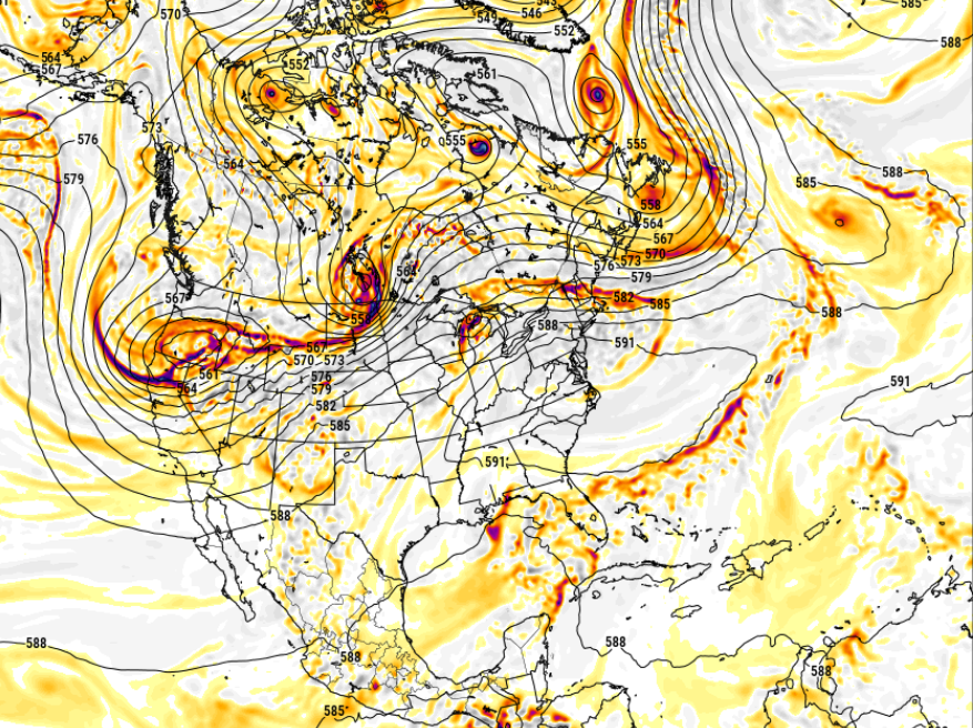
That is interesting ... how well that maps over that bias ( summer ). But, I'm halting at the doorstop of interesting for now. The longer termed ( obviously, less dependable - ) telecon favor a relaxation of the +PNA as we get passed mid month. Seeing more and more members attempting the diametric mode... well shit speak of the devil, the 12z GFS - obviously to early for confidence. That below actually contains a S/W heat release/kinetic air mass rattling around inside of it. Look at that MCS traffic - that's something I have not seen now in years...a southern Ontario MCC
-
Too early for MDR activation anyway. Some of that may be changing associated with CC ... not getting into that. By and large, the first week of June is more typically "home grown" so to speak, which covers the western Caribbean, GOM and adjacent of Florida on the Atl side.
-
Occasional Thoughts on Climate Change
Typhoon Tip replied to donsutherland1's topic in Climate Change
I'm not sure you understood what 'equivalency' means? Just in case, referring to relative to climatology of the respective regions. Believe me, if you look at the empirical numbers of diurnal high temperature in the Pac Nw and in London, they are not only comparable to the SD by climate, at those latitudes, I would argue that Pac NW beats in direct scalar comparison anyway. It was routinely at or above 115 F up there just for the purpose of that one example. One aspect though ... DPs were likely not comparable - but I am not honestly sure about that metric/comparison. If it were 115 in both places, the tropics may have a much deadlier consequence in HI, due to attending theta-e density ... but also, much greater thermodynamic signature. -
I went Minis... It actually makes the best sense for return on investment for this little abode. My house is technically listed as a single family home - yeah right! If that "family" consists of one dude and a cat. I mean it has an upstairs with two bedrooms, but it's really a geometric marvel how that is the case. Anyway, I'm not sure the next owner won't just raise the fucker and build a new edifice as, though I've improved the foundation ... it is still a nasty silver fish breading hole crawlspace and mouse rest stop on the rodentia interstate. It doesn't have a laundry room so I have to stack the washer and drier kitty corner to my kitchen counter/cabinetry... there's too many things about this place to make it unappealing to all but first time buyers. I'm just trying first and foremost of getting away from NGRID charging 700 a mo in electricity with these resistor base-boards from 1965. Anyway, not worth a whole ducting system for this tiny volume.
-
Why not invest or at least at minimum, inquire/investigate Mini split technology? You're a Republican, right? Which risking the assumption for a moment, doesn't that also mean you are inherently interested in both the acquisition of, but most importantly the retention of your personal wealth? This becomes simple arithmetic - and obvious - at this point: Mini splits will cool your home for a significant fraction of the cost that is required to run those window machines. Or perhaps you already have Mini's and your just yanking chains?
-
Occasional Thoughts on Climate Change
Typhoon Tip replied to donsutherland1's topic in Climate Change
This is unfortunately not true. It would be nice if that were the case, but ... it's happened twice at equivalency into the British Isles/latitudes in the last several years. The Pacific NW in 2021... The frequency of these occurrence has been rising. And there are papers being published on reviewed-reserved servers that discuss - next time I happen by one I'll be happy to send over the link. -
Occasional Thoughts on Climate Change
Typhoon Tip replied to donsutherland1's topic in Climate Change
I get how the math works... That's why I said "equivalency" in that. That was a synergistic R-wave feed back, the likes of which have been occurring with increasing frequency world over, that has struck Mexico and the Marine climate region over to Florida. Those are different phenomenon from the normalized CC footprint. That's what we were getting at before -
Occasional Thoughts on Climate Change
Typhoon Tip replied to donsutherland1's topic in Climate Change
One had to go by context root on that exchange between Don and myself. It's been above normal ... but we are not over a Standard Deviation distinction like they've been down there. We certainly could have been much more extreme given the pattern, but the pattern foot print has been preventative from bringing that. Equivalent would have been much more excessive, with consistency, to ORD-NYC latitudes.


