
DRVTS
-
Posts
157 -
Joined
-
Last visited
About DRVTS

Recent Profile Visitors
1,934 profile views


-
 Been snowing light but steady here in n putnam since 7:30. 1/3 inch on the board. really no virga this am. incoming radar looks decent. I have the "norlun board" in place just in case...
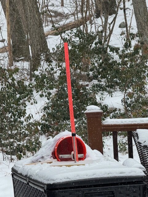
-
Two Mdt to high impact events NYC subforum; wknd Jan 6-7 Incl OBS, and mid week Jan 9-10 (incl OBS). Total water equiv by 00z/11 general 2", possibly 6" includes snow-ice mainly interior. RVR flood potential increases Jan 10 and beyond. Damaging wind.
DRVTS replied to wdrag's topic in New York City Metro
First few feathery flakes in Norther Putnam co currently. Seems early. No virga? -
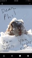
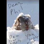
Could we be looking at a "peeper-paster" storm?
-
Did the CCB already move through? Where did it set up?
-
closing in on 6" moderate snow 31.3
-
Wet manglers mixing in temp 36.1 carmel 850ft temp steadily dropping since dark
-
At what point in the storm will the IVT begin to present itself. It seems that it's position will be the difference between 2 and 10 inches. I dont know how the NWS still gives Putnam 6-12 when the forcasted temp never drops below 33 for the entire storm.
-
What will be the over/under elevation number that makes or breaks the big accumulations... It was 32.4 degrees for the whole storm yesterday, and I got 2 inches. (850ft in Carmel) .3 degrees lower would have probably yielded 6-7 inches This storm is like Forest's box of chocolates...you never know what youre gonna get
-
So when does the He-Man's American Weather Snow Weiner Snowstorm Chasing Club have its first official meeting, Imagine this whole crew meeting up and heading to the center of the bullseye with a storm like this? Maybe starting a Snow Storm Chasing Charter company would be a winning business idea as these winters continue to deprive the depraved snow weenies We would be the first chapter.
-
1 inch at 850ft carmel 32.2
-
Shes coming in hot...overperformer?
-
2/13 Light/Moderate Snowfall Nowcasting & Observations
DRVTS replied to Northof78's topic in New York City Metro
Glad you are still checking though. Keep us updated -
if only we were in the bull's-eye seven days ago....
-
37.2 here. Looks like the cold is moving south of Albany nearing Norther Dutchess co.
-
37.2 in norther Putnam Co. Seems about 3 degrees lower than expected at this time. Not sure if it is meaningful, but they have my area changing to freezing rain at around 4am.


