fountainguy97
-
Posts
1,267 -
Joined
-
Last visited
Content Type
Profiles
Blogs
Forums
American Weather
Media Demo
Store
Gallery
Everything posted by fountainguy97
-
09z RAP jumping on the colder/wetter side is big. Everything has ticked better overnight for Estsern areas. Even NAM/HRRR. hopefully the RAP move is a sign and the NAM jumps again at 12z!
-
It is a tick better and ultimately didn't get worse. Consider that trend stopped. It would be so ironic that I've spent almost all week in the low 20s and the few hours of the week I need to be frozen I sit in the mid 30s haha
-
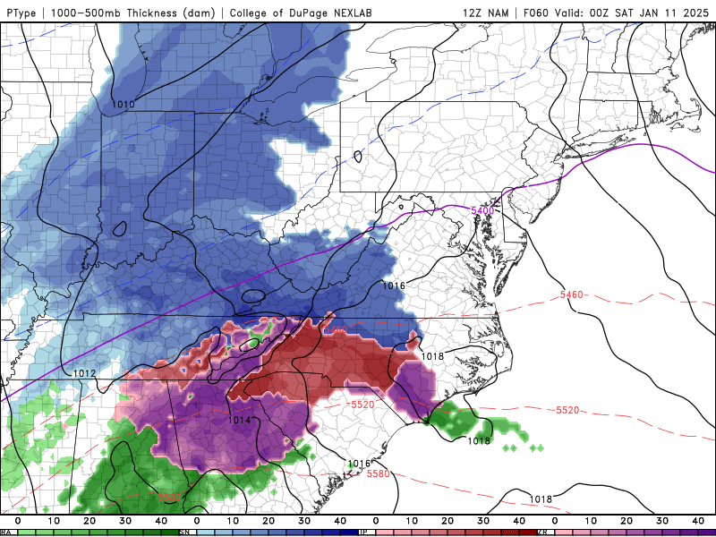
06z nam Hr 21 is slightly more positive tilt (better) looks like it's 18z run and not like the worse 00z. 12km nam still massive mixing issues. But it did tick better in the upper levels. Key is the trend stopped. Mountain shadow qpf issue is much better this time too.
-
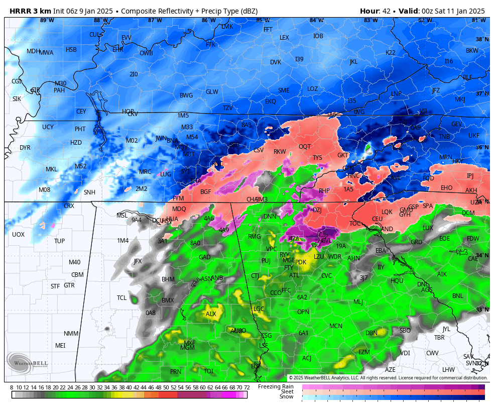
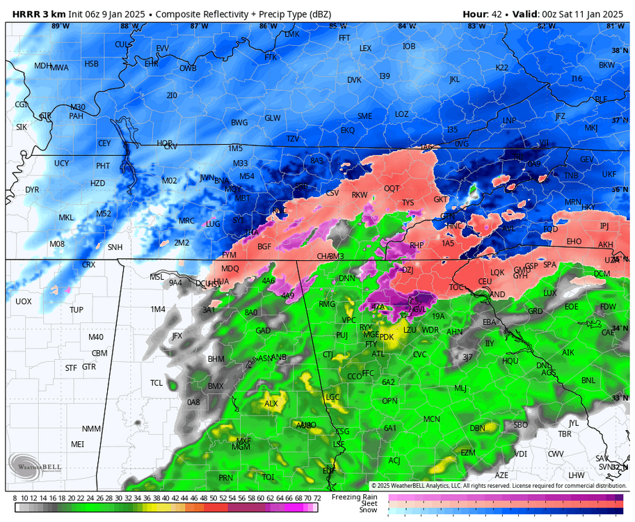
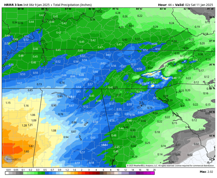
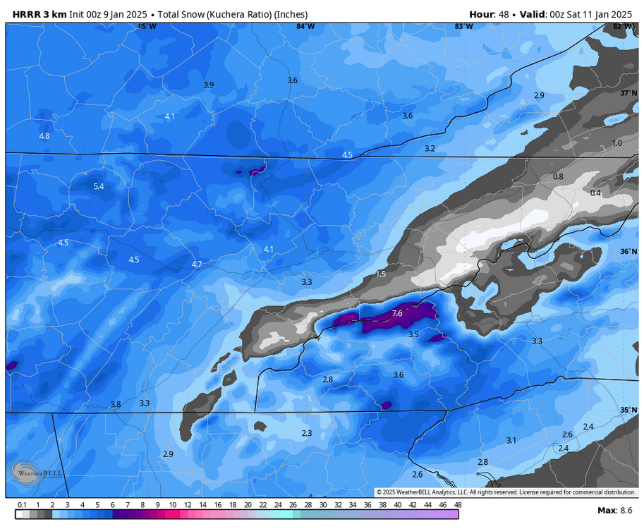
I am randomly up at 06z time so I'll pull the night shift. 06z hrrr has importantly stopped the bleeding and even reversed. Eastern areas still having mountain shadow issues but it's much less noticeable this go around. Still going to cut the low into the apps though. You can clearly see better qpf across eastern regions. Warm nose is better too.
-
The 12km NAM tries its hardest to go negative tilt. Even more amped run inbound.
-
Yeah hrrr is pretty horrible past 12 hrs for sure. Not putting any stock into it at all
-
Ruh roh temp and moisture issues. We toss.

-
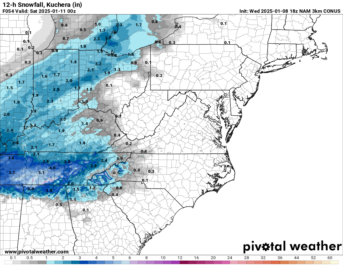
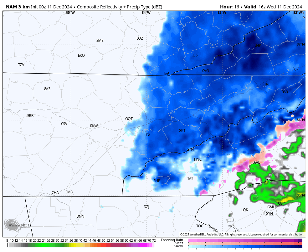
3KM picking up on my concern for myself and fellow border counties. Very obvious moisture/downslope issues. NW may bail myself out but verbatim the 3km would make for a long Saturday for me watching it snow across the mountain.

-
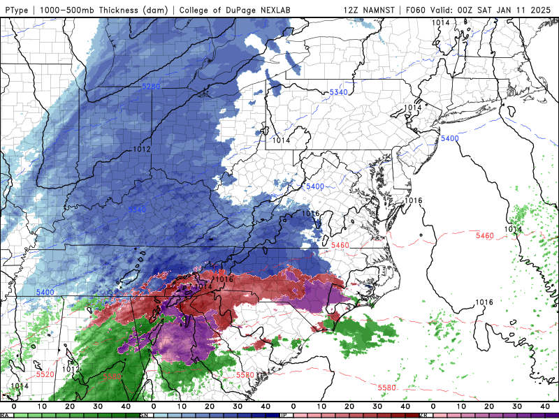
18Z nam at 27hrs is more neutral tilt. Likely an even more amped run coming. These Northern pieces are notorious for some last second trends like this
-
3km much better. Wouldn't trust it at this range though.
-
Yeah this is fun. Lol
-
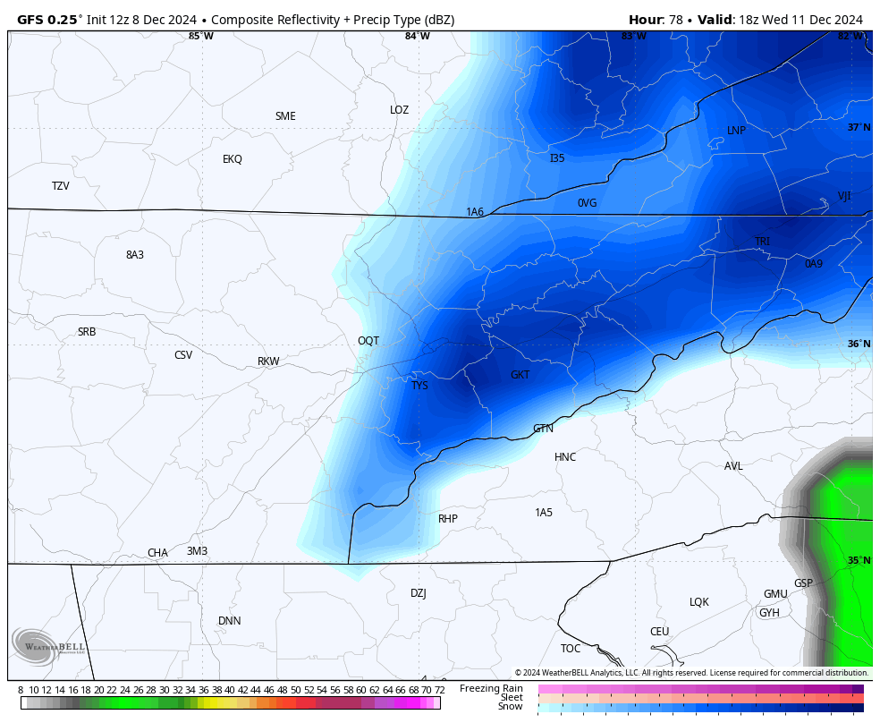
GFS continuing the theme of slashing QPF lol. Hopefully just a head fake but I have a feeling it's not.
-
Yeah I was just curious. I honestly haven't experienced many true system driven events. Vast majority of my 5 years here has been NW stuff. the way I interpret it is a south to north element in precip trajectory can cause dry spots along the border counties. Today seems to be more of a west to east trajectory. Hoping we avoid any issues with precip lol
-
How concerned about dryslot/downsloping do you guys think I should be? Some earlier gfs runs that were more of a south to north orientation had a nice hole over the TN/NC border. thinking the flatter west to east we have seen more today is helping prevent that for my backyard?
-
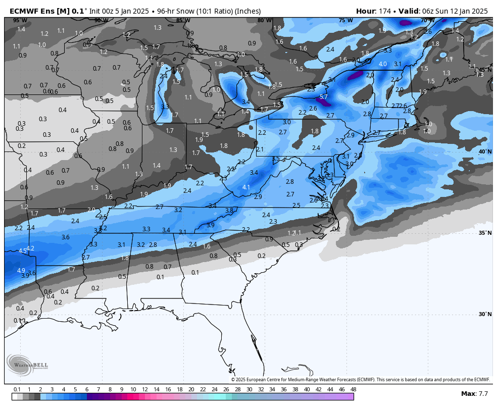
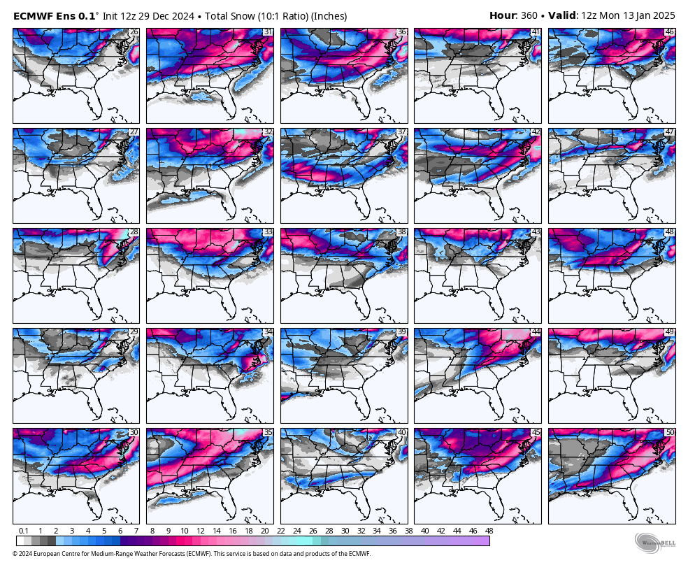
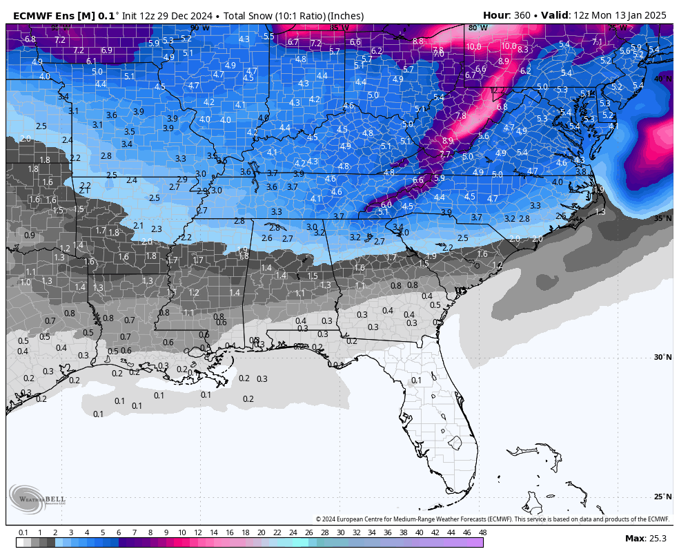
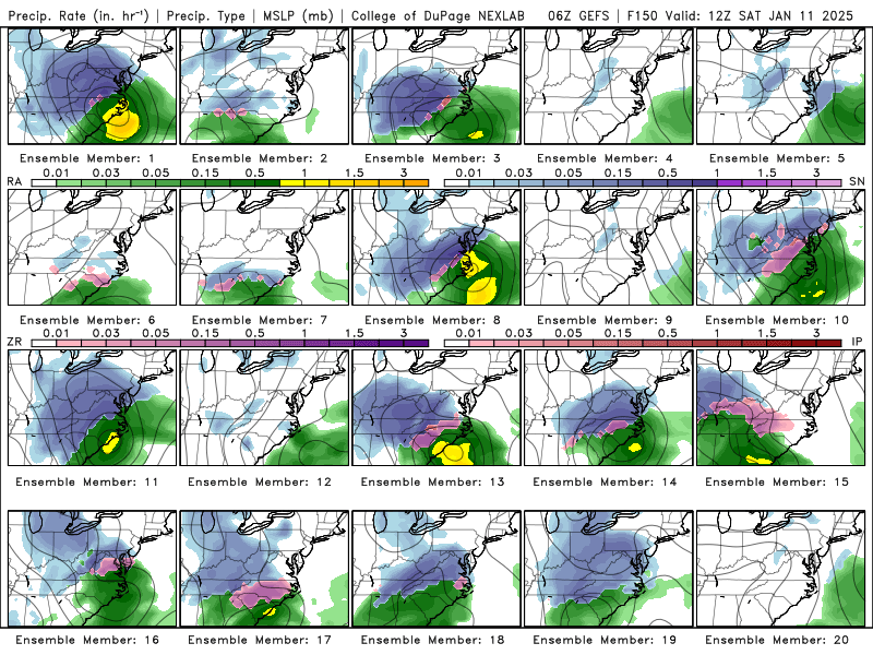
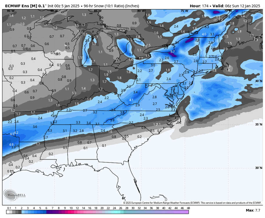
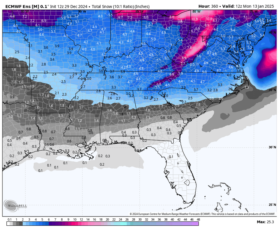
In the 4-7 day timeframe my rule is you always want to be in the middle of solutions. If you are hugging one model that's the most amped or the most suppressed 99% of the time you will end up disappointed. This storm we (being Central/Eastern TN) are dead center in the middle of solutions. Take this 6z GEFS shot. A few amped. A few suppressed. The majority in the middle. Look at this EPS average. That's money with onset being 5-6 days out. I think people on twitter and other forums are too caught up tracking run to run OP changes right now. With a phasing system ensembles are a very powerful tool. While OP runs are jumping the last day of trends on ensembles has been stellar. Phasing is always a tight rope. And one that may take another 72 hrs to nail down.
-
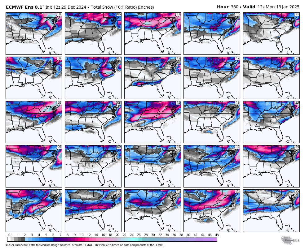
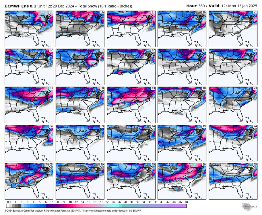
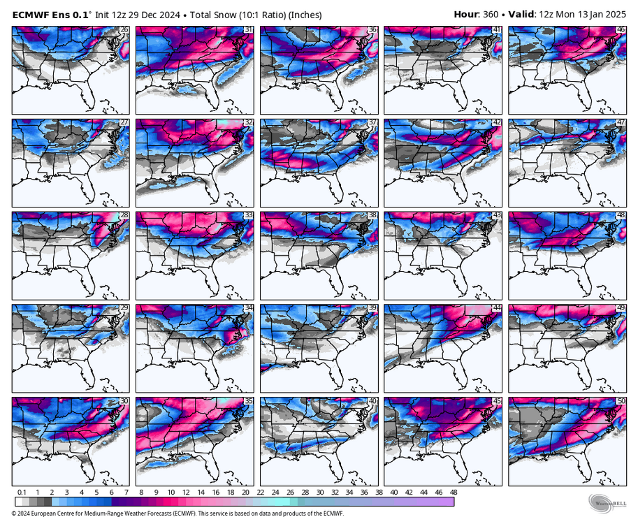
When was the last time you saw an ensemble run like this? Something big is brewing...
-
These setups with 2 systems back to back always get confusing to follow along with. Can't look at the 22nd until the 19th is set. Gfs pushes the 19th trough so far east the later event is suppressed OTS and shredded. That's actually a pretty common evolution of this pattern. Seen it many times.
-
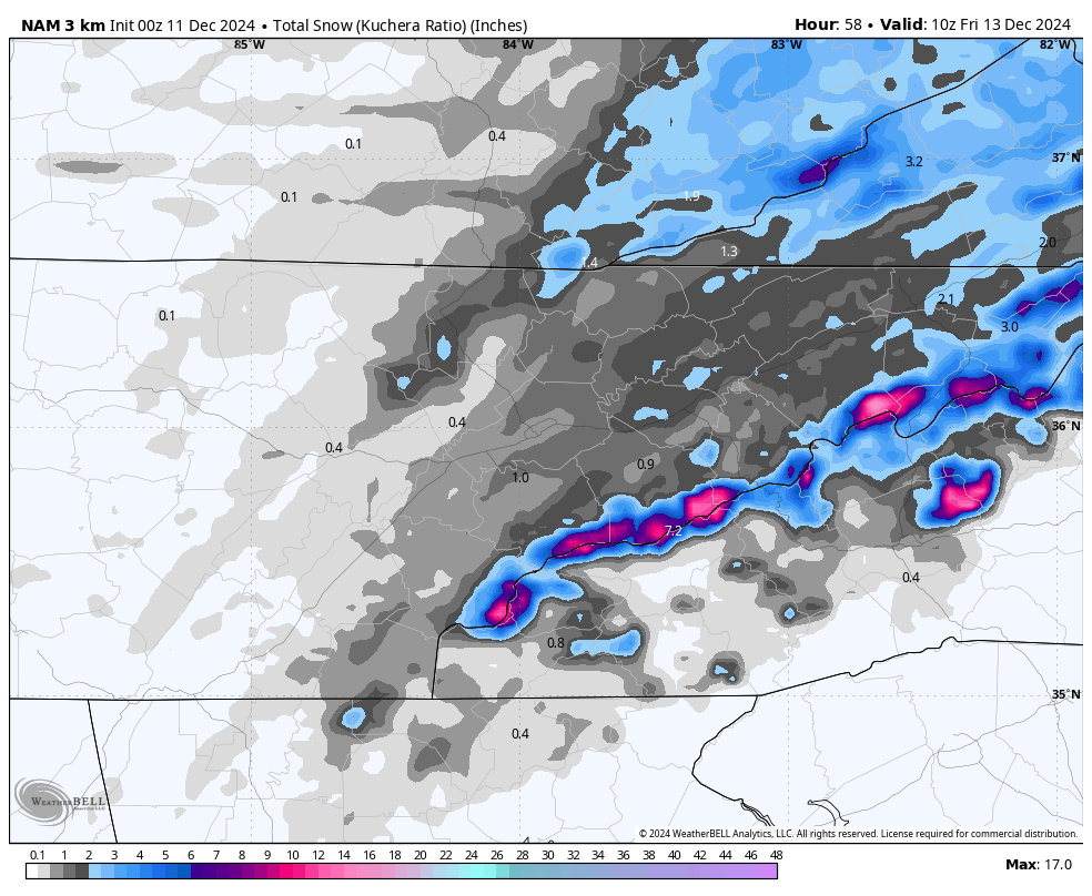
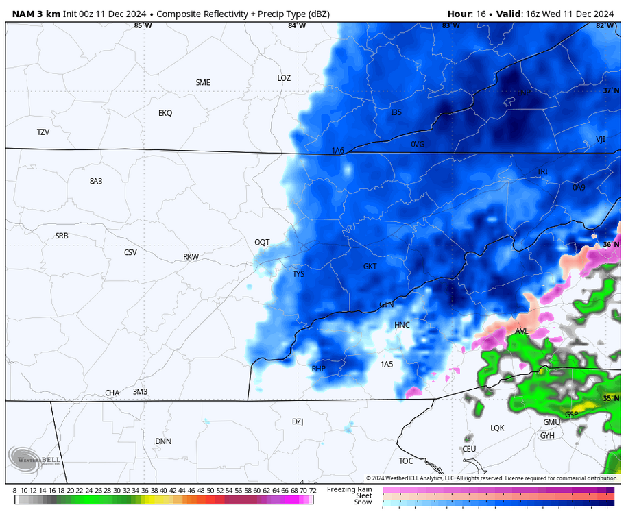
Latest nam is beautiful for tmrw morning. Some nice NW powder pads totals for mountains tomorrow night. I'm all in on it haha. Hrrr much less aggressive. NAM has been better this year so far. of course need to cut this down by half at least for ground temps etc.

-
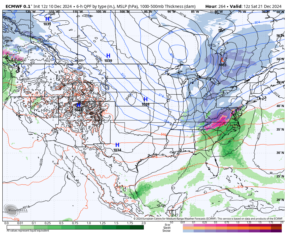
Yeah now that a global has jumped on board I'm extremely interested in that timeframe. I have found it best to pay attention when the Euro is the first global to sound the alarm. nice signal for the East Coast. Tomorrow has turned more novelty than anything at this point. Daytime killing us on temps. Especially the valley.
-
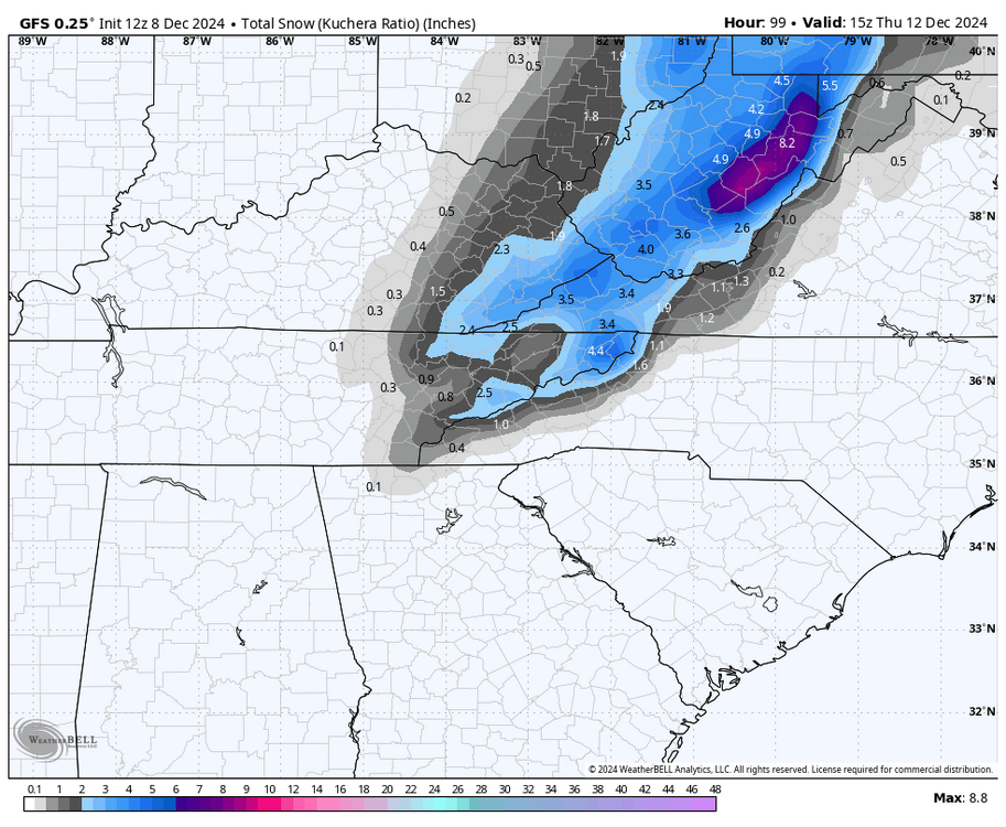
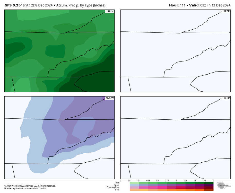
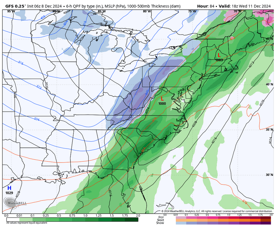
12z gfs nice bump up in QPF on the snowy side. Continues a trend of more consolidated sourthern lobe. this is now not far from shades of the Christmas 2020 event. Pretty sure that one really strengthened on models in the short term like this is.

-
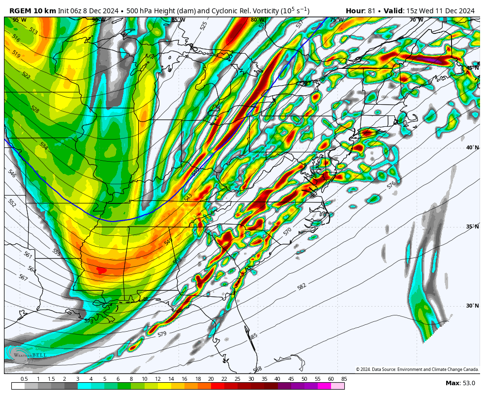
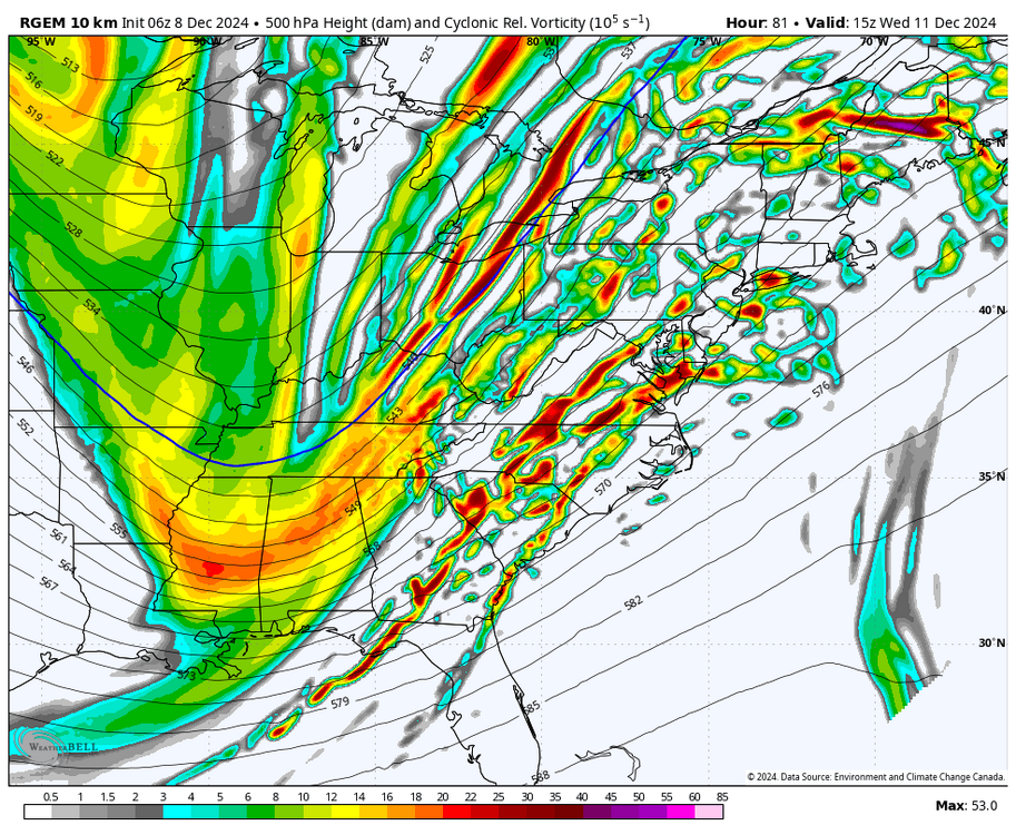
Hmmm. RGEM supports. Would be daytime and warm/wet ground so not exactly a money maker. But maybe something fun to watch.
-
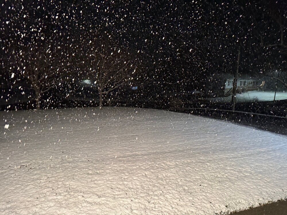
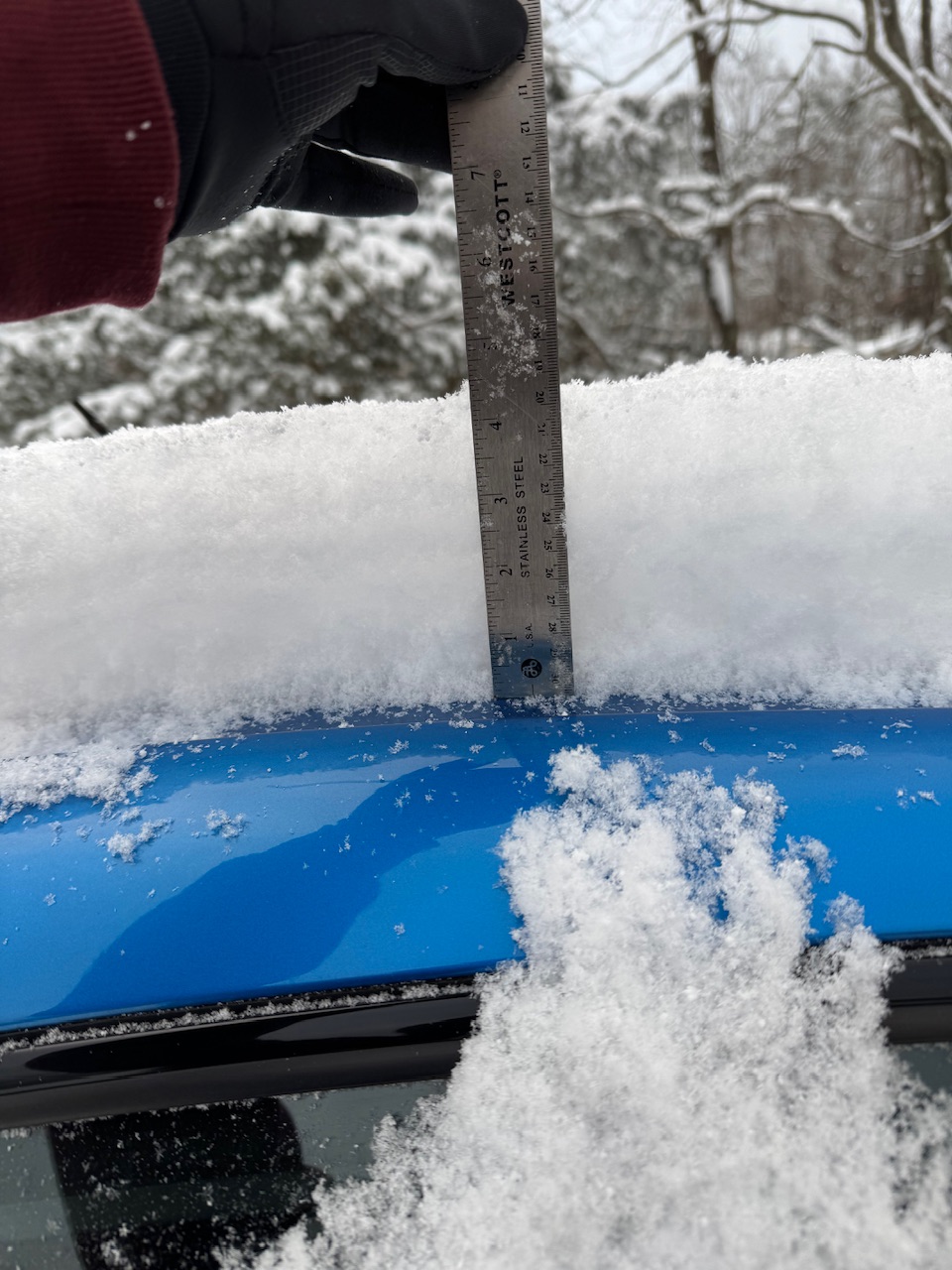
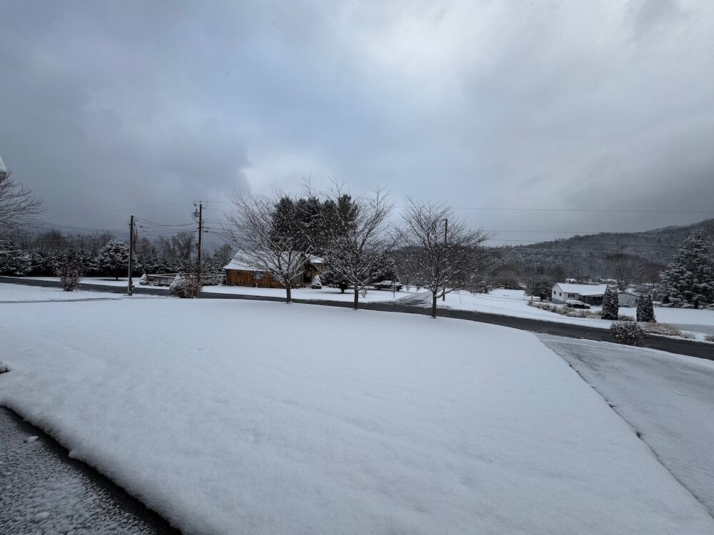
I can't believe it but I woke up to double what the NAM had for me. Although I was skeptical of the low totals considering the NAM had 8hrs of snow in the mid-20s. Pleasantly surprised this morning! This 4.5" (adding what is still falling) of snow is more snow than the last two winter totals.

-
2.5" total here. Most fell in that first wave of precip. my totals the last 2 winters are 4.3 (23-24) and 4.0 (22-23).
-
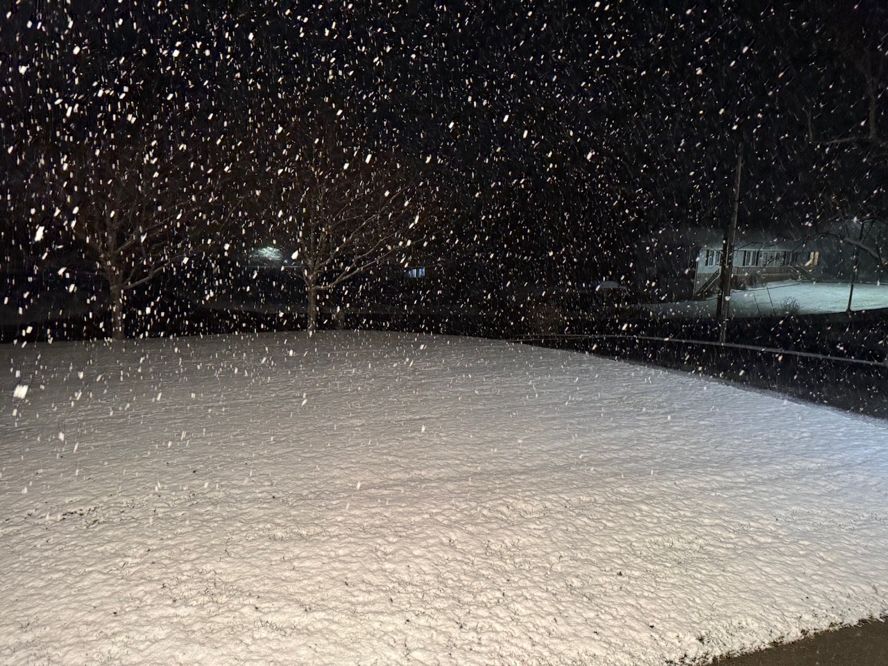
Wow getting crushed here. Was not expecting this quick of a start. 30.6.