fountainguy97
-
Posts
1,267 -
Joined
-
Last visited
Content Type
Profiles
Blogs
Forums
American Weather
Media Demo
Store
Gallery
Everything posted by fountainguy97
-

January 2026 Short/Medium Range Thread
fountainguy97 replied to John1122's topic in Tennessee Valley
Well I am changing my tune now. The HP isn't much different access models. But the main thing is how much Baja energy is injected. UK and CMC fully pull it east into the system. While the ICON and GFS don't. That amps the up the storm more than anything -
January 2026 Short/Medium Range Thread
fountainguy97 replied to John1122's topic in Tennessee Valley
In the past models often "shove" the LP into the CAD too much at this stage. It's hard to tell if that will translate to such an extreme event but I am hopeful we will see the HP push win out some more than it is. -
January 2026 Short/Medium Range Thread
fountainguy97 replied to John1122's topic in Tennessee Valley
It can be hard to process all the wiggling but at 12z I see our "cone of uncertainty" narrowing pretty significantly. The outliers are not as outlier. The wiggling continues but the distance from extreme to extreme has tightened. -
January 2026 Short/Medium Range Thread
fountainguy97 replied to John1122's topic in Tennessee Valley
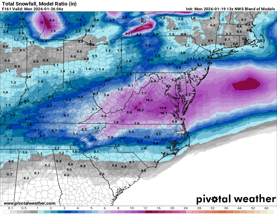
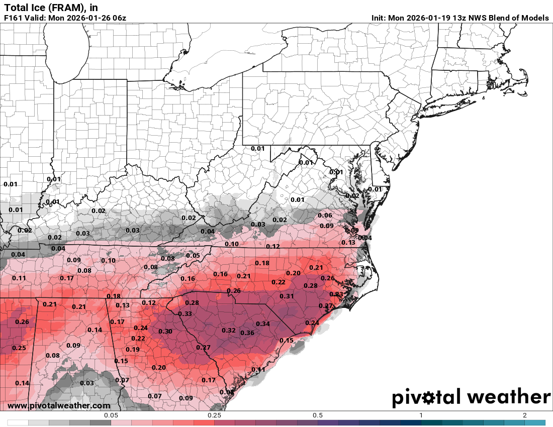
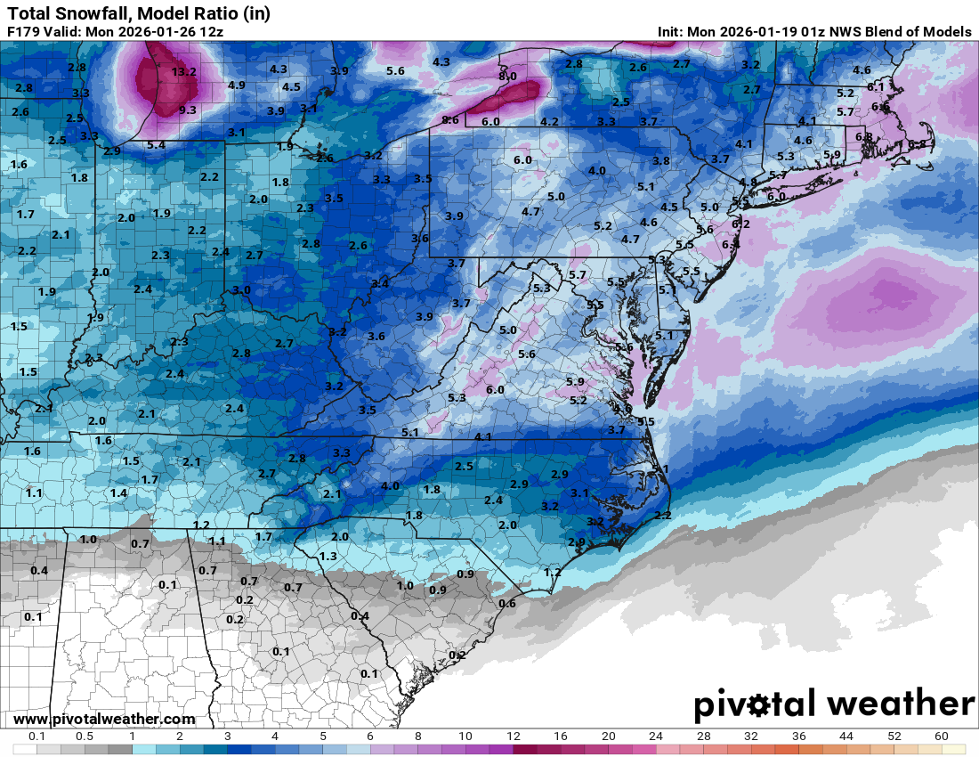
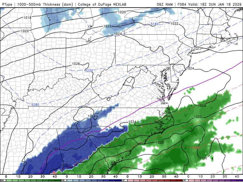
NBM helping to bring things into focus. definitely think that the classic CAD with miller B handoff is taking over right now vs the slider scenario. This is going to come down to how strong is that HP. And can it keep the storm suppressed.

-
January 2026 Short/Medium Range Thread
fountainguy97 replied to John1122's topic in Tennessee Valley
It did. Good tick south -
January 2026 Short/Medium Range Thread
fountainguy97 replied to John1122's topic in Tennessee Valley
UK is a beauty. Big tick south Update: it is also going to be a blood bath of ice for ETN -
January 2026 Short/Medium Range Thread
fountainguy97 replied to John1122's topic in Tennessee Valley
We are right in the middle of solutions so far at 12z. CMC north, GFS south with euro having been in the middle at 06z. That is precisely where you want to be at this stage. -
January 2026 Short/Medium Range Thread
fountainguy97 replied to John1122's topic in Tennessee Valley
Overnight ensembles are juicy. Lots to be ironed out but you can clearly see the classic CAD boundaries setting up. Hopefully the zr outputs end up being a lot of sleet. the NBM shows the footprint well.
-
January 2026 Short/Medium Range Thread
fountainguy97 replied to John1122's topic in Tennessee Valley
Can already see the classic CAD look on the blend of models. someone may end up with a truly historic ice storm
-
January 2026 Short/Medium Range Thread
fountainguy97 replied to John1122's topic in Tennessee Valley
I feel the same way. I think climo would leave us in the ice category. And the snow stays into KY, VA. Just my gut talking -
January 2026 Short/Medium Range Thread
fountainguy97 replied to John1122's topic in Tennessee Valley
Phew.
-
January 2026 Short/Medium Range Thread
fountainguy97 replied to John1122's topic in Tennessee Valley
NAM is about to be an absolute behemoth. -
January 2026 Short/Medium Range Thread
fountainguy97 replied to John1122's topic in Tennessee Valley
Big tick NW on GEFS. I don't see anything that would really keep this super suppressed. GFS is not backing down yet.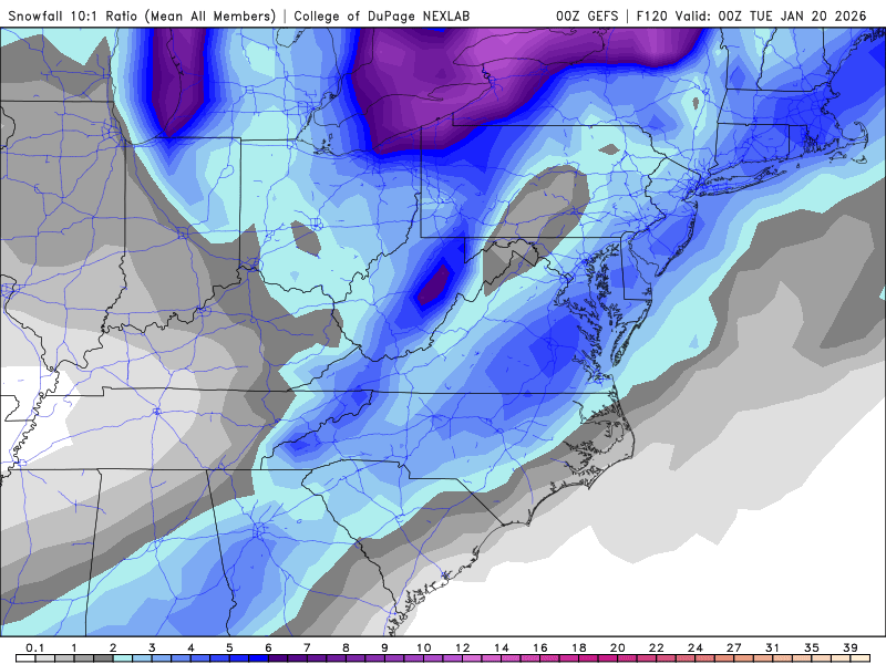
-
January 2026 Short/Medium Range Thread
fountainguy97 replied to John1122's topic in Tennessee Valley
I'm not going to lie. This winter has been so frustrating and continues to be. We can't seem to manage a single decent synoptic driven snow. I've been checked out since the little event the first week of November and that hasn't changed and doesn't look to. I guess the plus side is I've had more sleep over the winter than ever before. Just incredible how bad the short term trends have been for this mid-week event. Yet another token NW event on deck. -
December 2025 Short/Medium Range Forecast Thread
fountainguy97 replied to John1122's topic in Tennessee Valley
I'm not surprised at all but this event has been a complete and total failure by the models. It's a toasty 38 here and I've racked up .30 of rain. Hrrr and nam and RRFS had only a couple hrs of rain before a changeover around 6am. I don't think even the NW stuff will be snow this afternoon. I hope my friends and family over in Eastern NC don't have the same fate! -
December 2025 Short/Medium Range Forecast Thread
fountainguy97 replied to John1122's topic in Tennessee Valley
55 here now! Hrrr and nam both keep the border counties snow. Looks like a nice 1-2" surprise may be in store for my area. I'll believe it when it's falling from the sky though. -
December 2025 Short/Medium Range Forecast Thread
fountainguy97 replied to John1122's topic in Tennessee Valley
Hrrr had me at 40 at 12... it's 34 currently. -
Fall/Winter 2025-26 WX Discussion Thread
fountainguy97 replied to Carvers Gap's topic in Tennessee Valley
My house here in Erwin! -
Fall/Winter 2025-26 WX Discussion Thread
fountainguy97 replied to Carvers Gap's topic in Tennessee Valley
Phew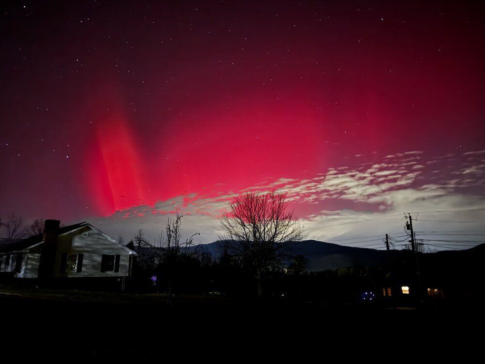
-
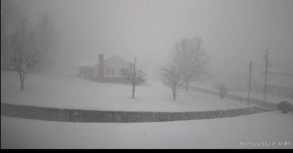
high res video from my weather cam of the snow squall earlier today. White out conditions! Really cranks at the 2:30 mark and onward. Gusts over 20mph. Click here for snow squall video
-
I hope you just looked outside. full on whiteout conditions!!
-
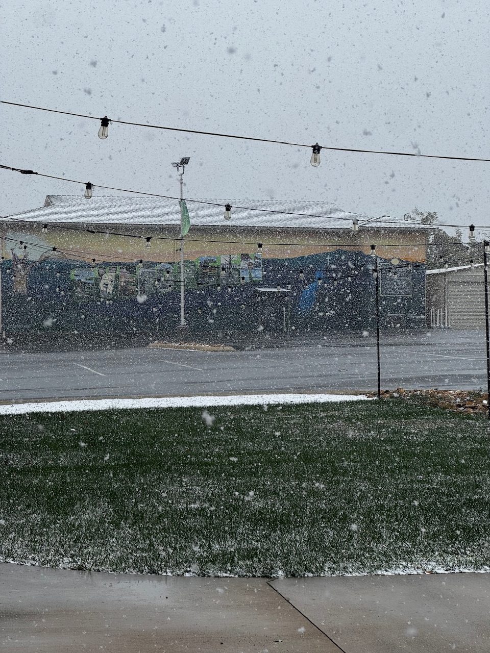
These bands are fun. 27 with quarters falling and it's November 10th.

-
Fall/Winter 2025-26 WX Discussion Thread
fountainguy97 replied to Carvers Gap's topic in Tennessee Valley
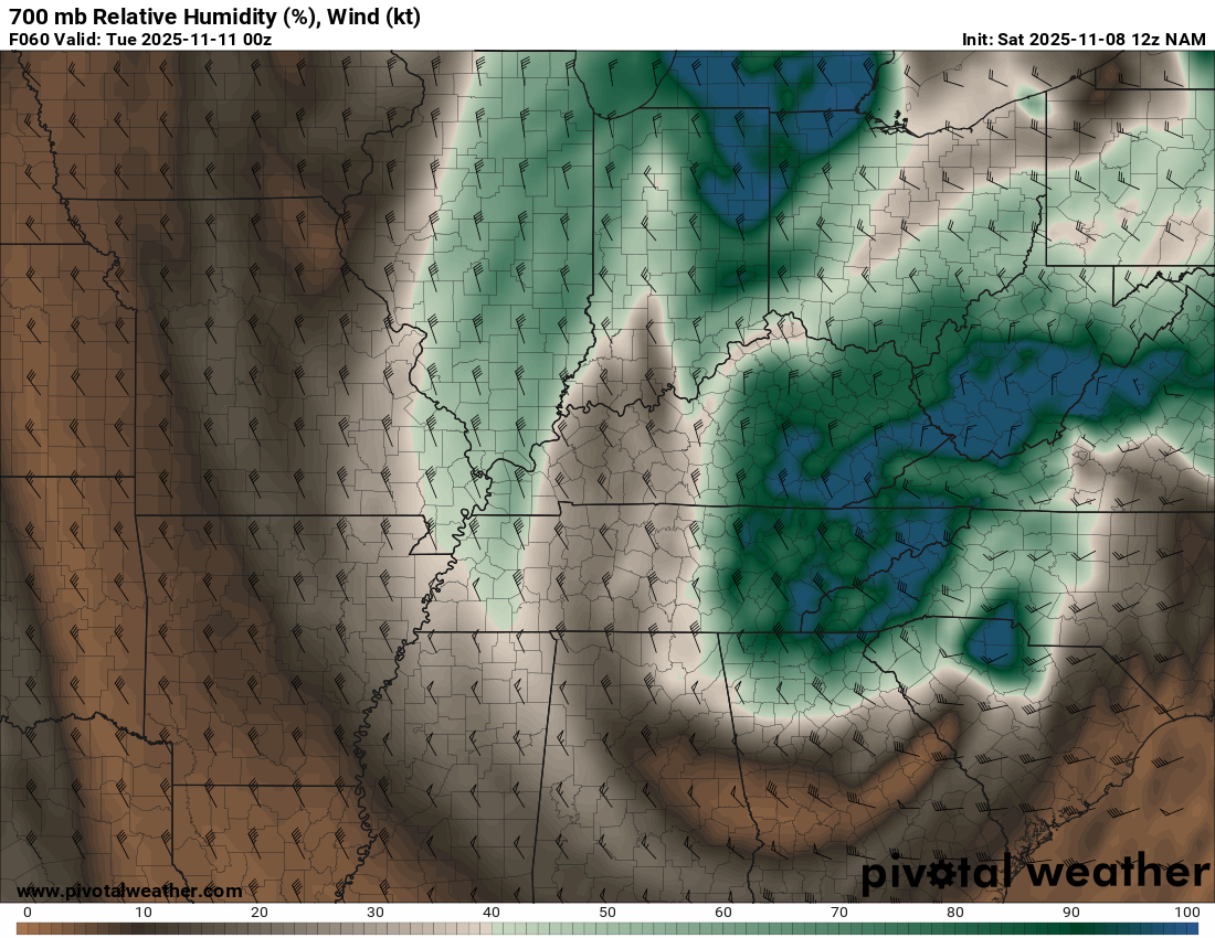
This is a very deep batch of moisture (for NW events) and is more than just your typical NW flow. If the NAM is correct this would bring a few hours of snow across a large portion of the region and not just confined to the NW slopes.
-
Fall/Winter 2025-26 WX Discussion Thread
fountainguy97 replied to Carvers Gap's topic in Tennessee Valley
Finally getting into range of high res and the NAM is bringing the goods. This ULL could be fun. Perfect timing right after sunset. And we are COLD COLD. -
Fall/Winter 2025-26 WX Discussion Thread
fountainguy97 replied to Carvers Gap's topic in Tennessee Valley
Not to derail the thread but why did it get shut down? Drama?