fountainguy97
-
Posts
1,267 -
Joined
-
Last visited
Content Type
Profiles
Blogs
Forums
American Weather
Media Demo
Store
Gallery
Everything posted by fountainguy97
-
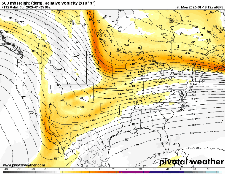
we do often see models strengthen the hP in the short term. But it's a losing battle if we have a triple phase I fear. The balancing act we need is incredibly thin. We need a strong enough HP and a weak enough Baja interaction to keep things flat and suppressed. But not too flat and also not too strong. Cliomo and history though would tell me to expect a strengthening of the HP and CAD in the short term but the question remains does that really matter if we can't avoid the phase of doom out west? The UK and EURO for sure stopped the trend at 06z but we need a reversal from them starting asap
-
12z will be a defining run I believe. Remember the gfs 06z is basically the "middle ground" of what models showed a couple days ago. Could we see the models come back to the gfs? Euro excels in the 6-10 day period but I do think the gfs can be extremely strong in this 3-5 day slot. I've seen that before. Euro picks it up initially and is the leader then loses it and the gfs remains consistent throughout. Just some psych ward level wishcasting.
-
Yeah, that's a very weird shift on the euro and doesn't match anything else. It rotating the northern energy that far west and flat, but it did tick better at the surface and that tells me there's still a lot of volatility in the northern stream which means we may have a shot.
-
Definite tick for more separation. A tick in the right direction
-
Euro may be a tick tick better for us. Maybe. It's definitely not worse
-
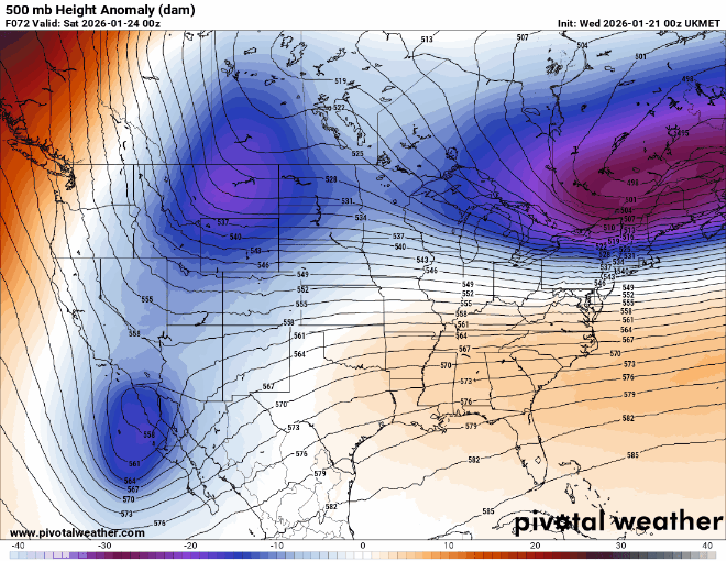
Uk shift at 06z. Not insignificant. Euro to follow?
-
Case in point. The 06z Uk just ticked the northern wave 50 miles further east (more separation).
-
On the positive side we have 36 more hours for this to tick one way or another so it does have room to come back. The Baja energy has been sampled some but the northern piece which is where the trend has happened hasn't been touched yet and won't be for a while. But don't hold your breath.
-
00z nam starting off with a major trend toward a early phase.
-
Let's see what 00z has for us. But yea this one may be "on the ropes" if you love snow. One thing I've seen many times with big events is models over-trending in this 3.5-4.5 day period. And then adjust back a few ticks closer in. This is a good reminder for myself that worrying about it will do nothing but give you bags under your eyes and ruin your day. We have no control.
-
So either 18" of snow or a warm rain... got it lol
-
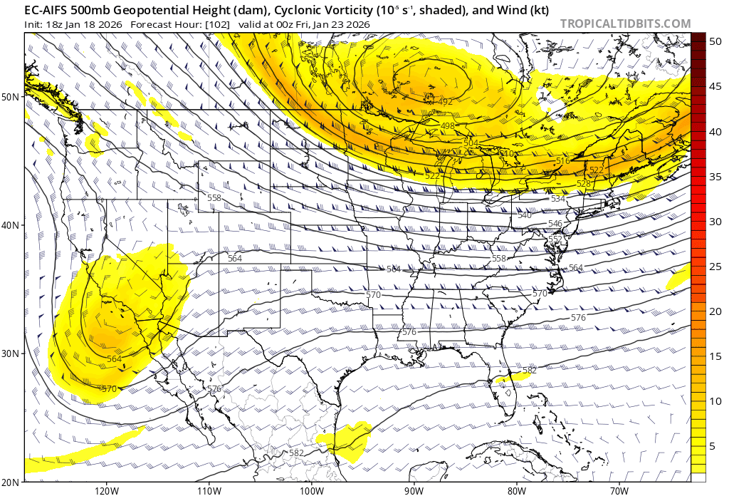
Euro coming north as well
-
It's pretty apparent a lot of us will mix. I don't think it'll be as severe as the CMC but I highly doubt we see the gfs slider as a final result. The energy flying around from the Baja will "kink" the flow enough to give us a NE tilt vs the flat look. Gfs has been all over the place and its ensemble doesn't match it very well.
-
The 06z UK has the Baja energy hanging back a little more than 00z. Which is great! It's one of the northern models currently. Only goes out to hr 66 at 06z
-
You know I always thought the gfs was the best model. Haters gonna hate. Was that me saying the gfs is garbage yesterday? No that was fountainguy96.
-
The gfs is nice. But it's not leading the pack. Let's see what the euro does today. The northern solutions (cmc, UK) are the fly in the ointment . Let's see them take a step this direction.
-
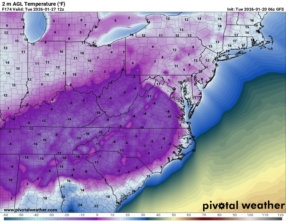
The cold after... serious issues for those without power.
-
Yep that's enough N trend. I'll never complain again if Mother Nature gives us the 06z gfs. I promise. Just a textbook evolution to deliver 2 feet for TN
-
Gfs likely will tick north here and more amped. It absorbed more of the Baja energy.
-
Mmm.. don't like what I'm seeing at 00z. All models taking a big step to the CMC. Euro now has a lot of mixing. We are trending away from a slider and more to an amped up LP. Going to cause tons of mixing issues and likely rain for East TN. Not a good trend at all. And it's across all models.
-

January 2026 Short/Medium Range Thread
fountainguy97 replied to John1122's topic in Tennessee Valley
Tick tick tick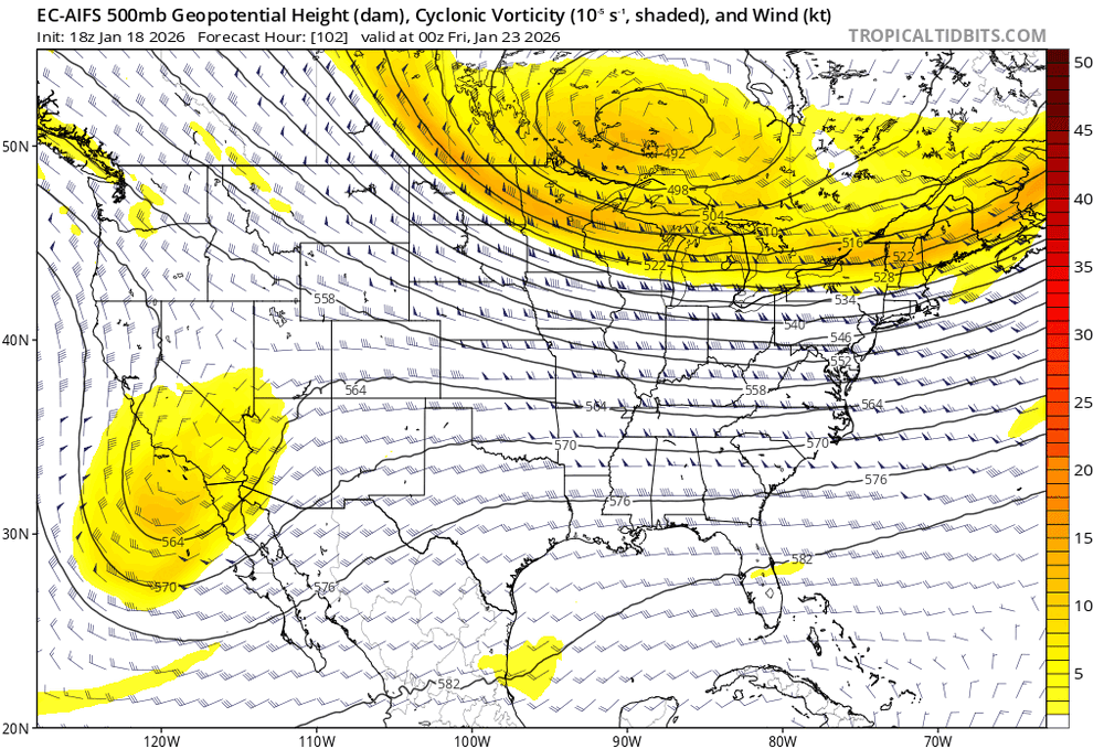
-
January 2026 Short/Medium Range Thread
fountainguy97 replied to John1122's topic in Tennessee Valley
Yep. Not a full "cave" but it jumped south enough to be inline with UK and CMC. The cone of uncertainty continues to shrink -
January 2026 Short/Medium Range Thread
fountainguy97 replied to John1122's topic in Tennessee Valley
AIFS still a big cutter but much better than last night. Similar to UK and CMC. It held the Baja back more. But still brings it all with it -
January 2026 Short/Medium Range Thread
fountainguy97 replied to John1122's topic in Tennessee Valley