fountainguy97
-
Posts
1,267 -
Joined
-
Last visited
Content Type
Profiles
Blogs
Forums
American Weather
Media Demo
Store
Gallery
Everything posted by fountainguy97
-
Back in January 2024 I chased a MWE in camp creek. Sustained 70+ mph haha was pretty fun!
-
So verbatim I'm sitting in a cold stream of air with 20-30mph winds with zr falling for 12+ hours. Nice
-
Last post lol. The way I see it is the fast downsloping winds are creating friction with the surrounding air and pulling the cold air through the valleys.

-
And camp creek and roan mountain I guess are almost creating a vacuum pulling that cold air through the valleys which is why the cold air is cold and not warm like the actual downsloping region.
-
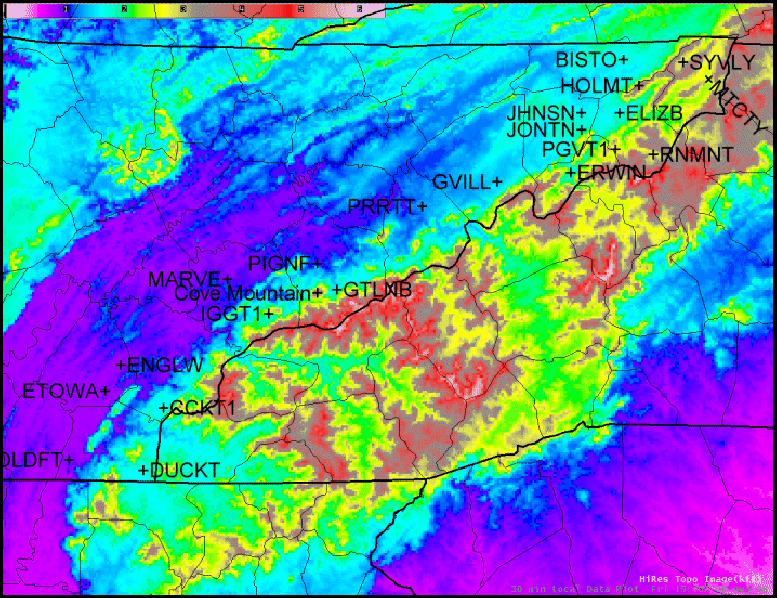
Can clear,y see the two valleys here.
-
If we see Morristown talk about this we will know they are watching us haha. I was typing this out. The cold streaks seem to line up with the valleys. So I'm assuming the reason for the cold air is the wind is pulling the CAD could air over.
-
Very true. I've never thought about the temperature of mountain wave winds lol. But yes I think that's the conclusion I've come too.. and it's a scary one for myself. My house is quite literally in the coldest streak coming over Erwin.
-
WeatherFront app is amazing btw. Yeah it's coming over the mountains I believe. Crazy to see. This wind is siding the cold transport.
-
So I wonder if the downsloping is actually aiding in transporting the CAD over into Erwin keep those tongues of cold temps. Crazy
-
Very cool to see the micro climates showing. Also hoping I don't end up in a pocket of zr the entire event haha
-
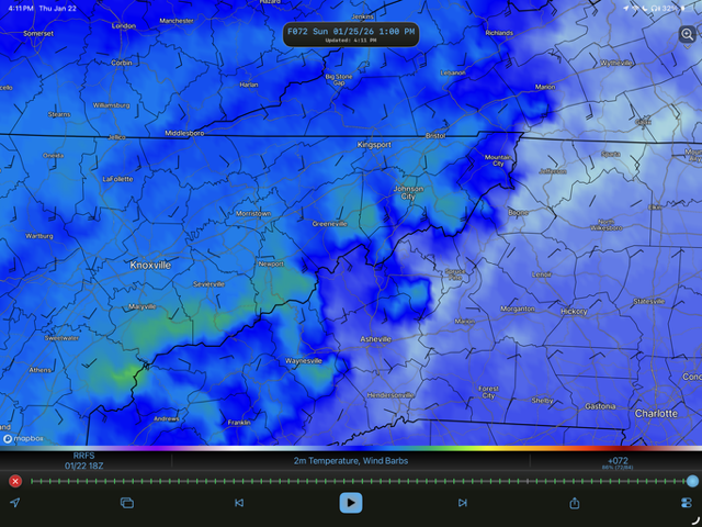
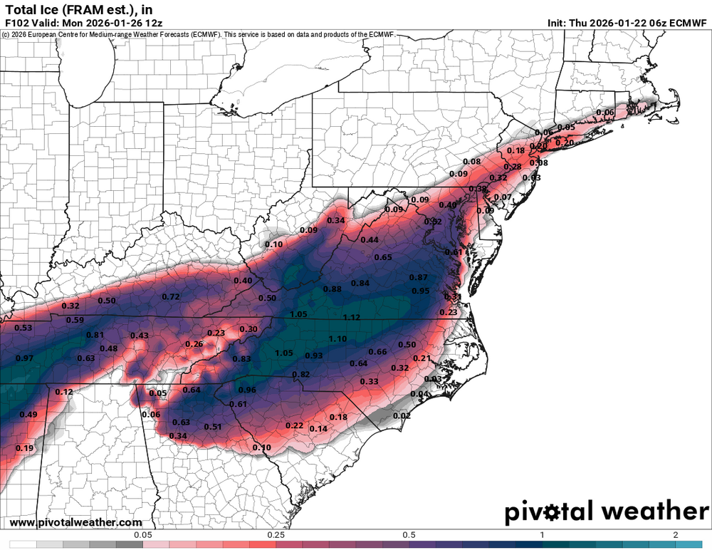
The rrfs takes forever to erode the CAD between those downsloping hotspots. Over an inch of zr for my backyard.
-
Seems like the nam has them too. Maybe just downslopjng the warm areas?
-
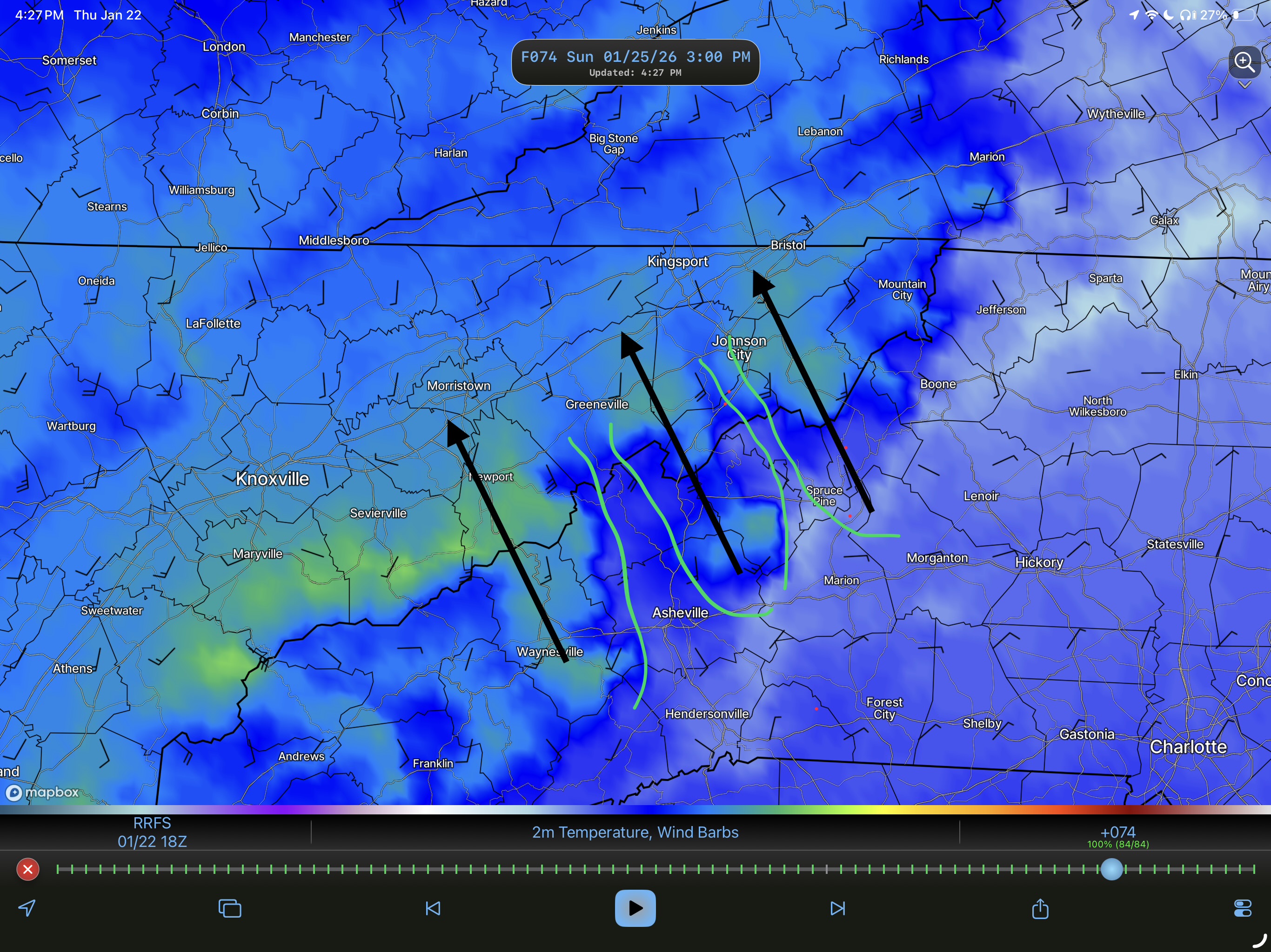
Anyone want to try to guess what these fingers of freezing temps are on the GRAF? just random model physics?
-
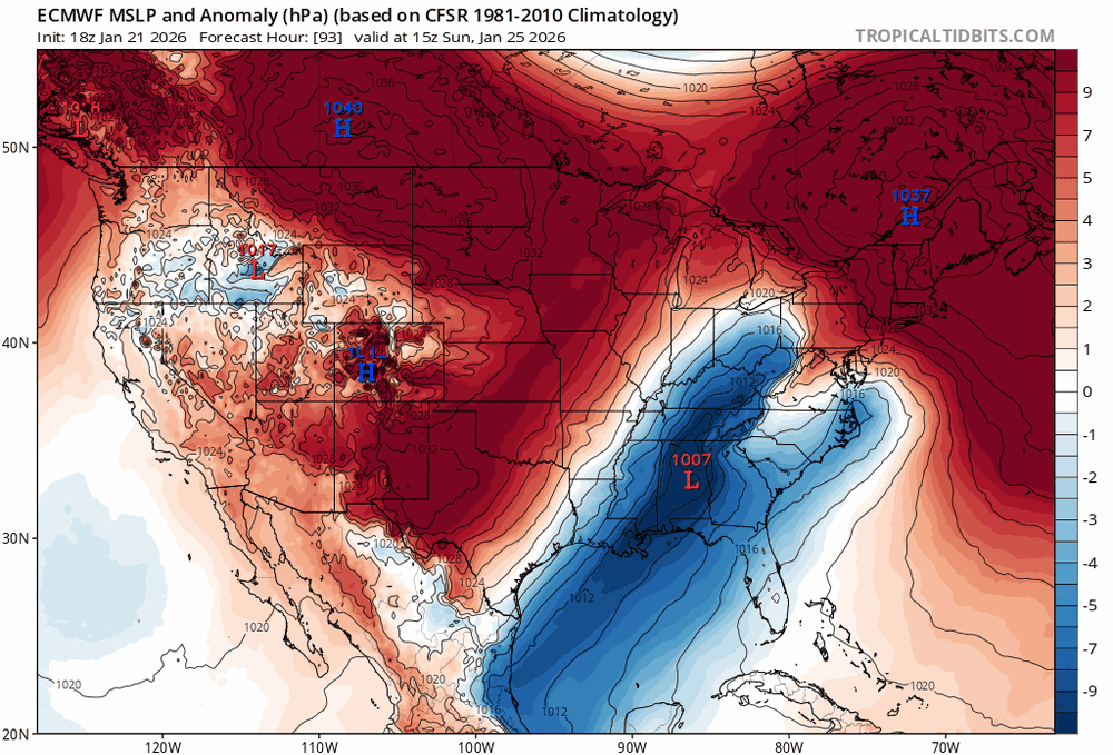
I believe we may be seeing the typical pattern of strengthening the CAD in the short term. the more that high unifies the less of a path north that low has. GFS squeezes the low east because its Hp is stronger.
-
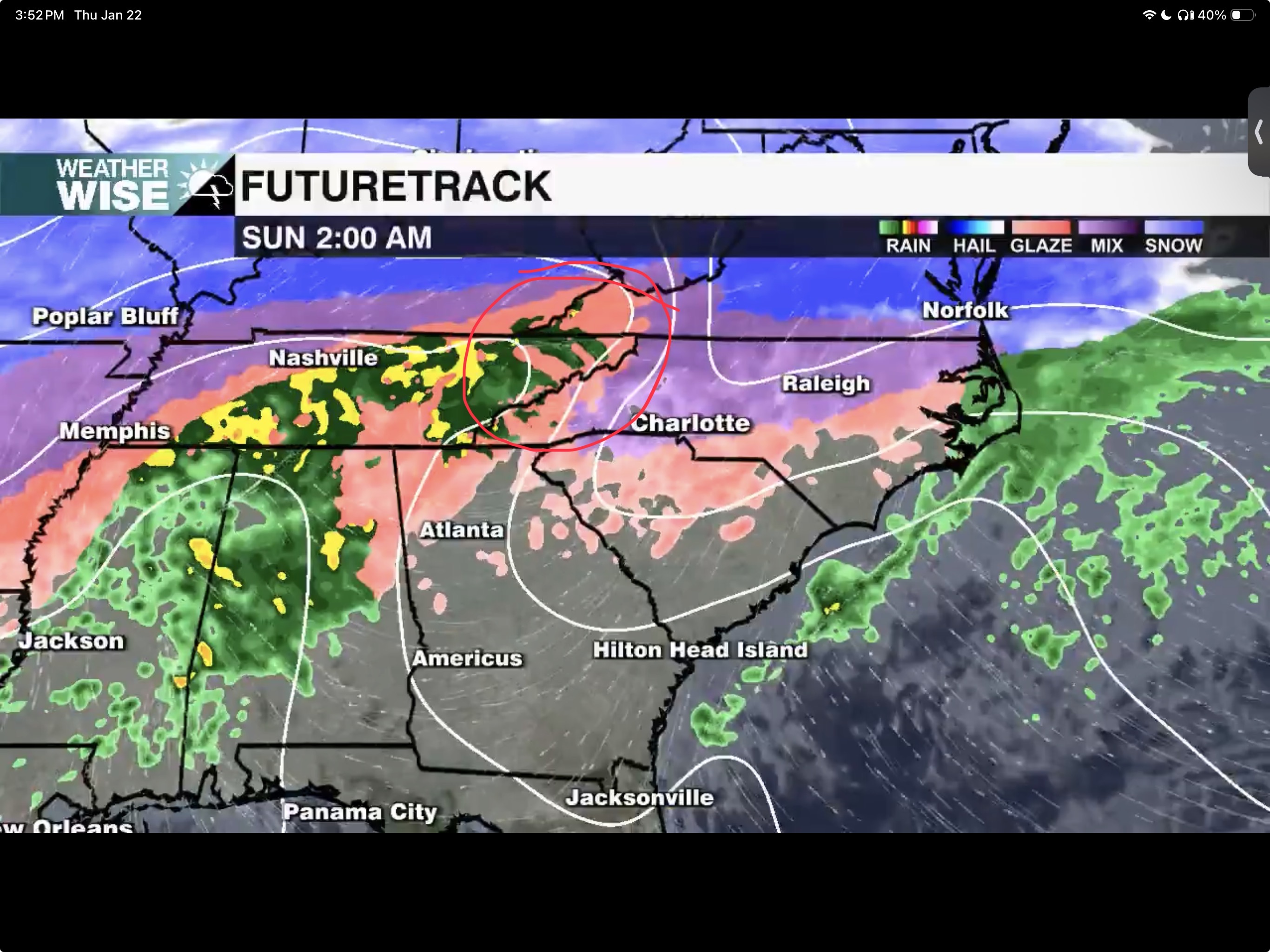
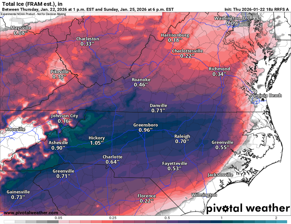
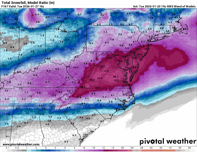
How much accumulation do you think WTN and WNC sees from this? I typically say half of this map but their temps are 20-25 for the duration for both areas of ZR. Rates are not insanely heavy .1-.15 an hour
-
much more separation. the Northern piece is hundreds of miles further east by hour 84.
-
The GFS is much improved at 500mb. BUT that gives some areas the most catastrophic ice setup we have seen yet. Literally freezing rain for 48 hours straight for some areas.
-
yeah absolutely I understand that. Maybe 5-6 years ago before I owned a home I would still enjoy an ice setup but now? No thank you. The 12z Euro actually does have "lighter" zr amounts for TN as a whole. It really pushes the warmth north. We can hope that continues
-
no doubt about it. 12z looking bleak. I think I'm more than ok with this amping into an apps runner to avoid ice issues. Even though deep down that hurts my weather loving heart. I think this one is gone and personally will go down as one of the biggest let downs of an extremely disappointing winter.
-
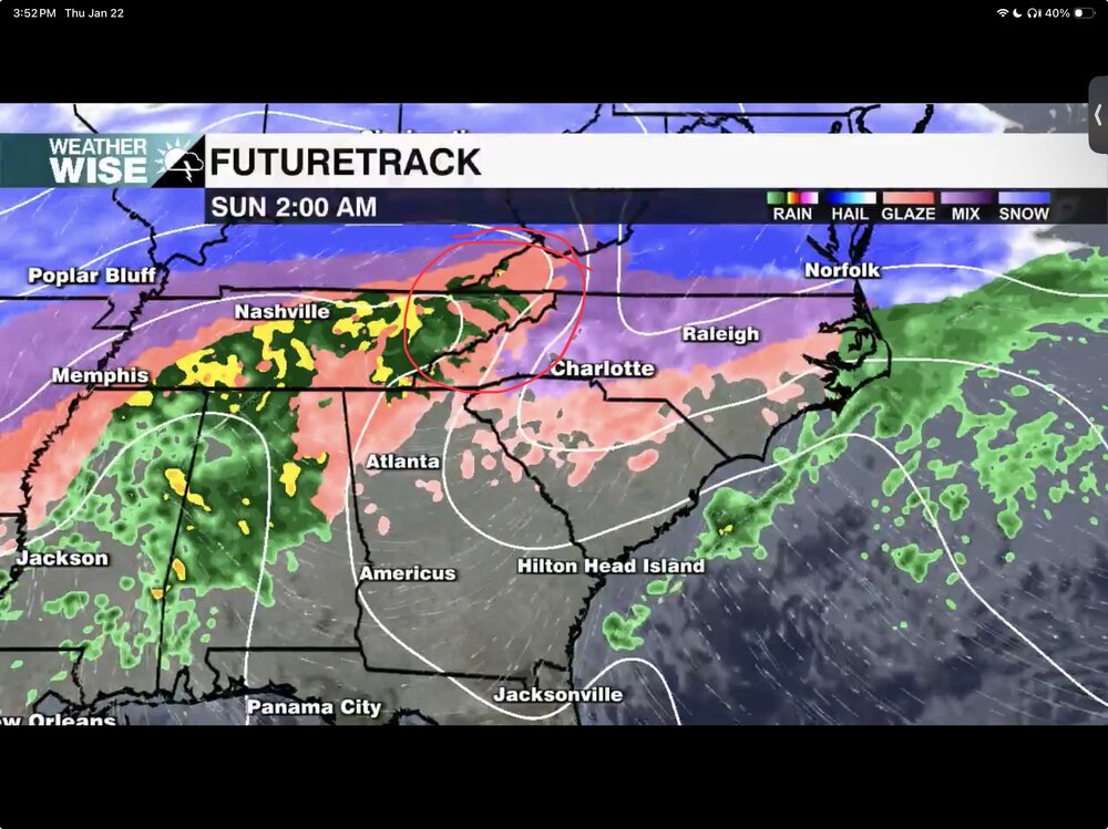
that sounds nearly picture perfect what we are likely seeing this weekend. Downsloping may "save" the Eastern region.
-
yeah these 12z runs are wonky. A ton of variables with the NS energy. We are getting some weird evolutions because of that.
-
And the way I understand it it is basically one run behind Op models.
-
Unfortunately that's just simply not true. the NBM has jumped way north over the last 3 runs.
-
Not seeing anything of note on 12z so far. Not looking good.
-
if this does just go miller A I bet there will be some NW flow to soothe the wounds haha