-
Posts
1,267 -
Joined
-
Last visited
Content Type
Profiles
Blogs
Forums
American Weather
Media Demo
Store
Gallery
Everything posted by fountainguy97
-
I'm digging this weekend for my backyard. Single digits and NW powder. Sounds like a good time!
- 372 replies
-
- 7
-

-
- cold
- arctic blast
-
(and 1 more)
Tagged with:
-
January 15th-17th 2024 Arctic Blast/Snow Event
fountainguy97 replied to John1122's topic in Tennessee Valley
Wow. Every single school system in the entire STATE is closed tomorrow. -
Unlike the last event with the DGZ 11,000ft up the DGZ may actually be just a few hundred off the surface. Absurd NW soundings on the gfs. I can get behind this one
- 372 replies
-
- 6
-

-
- cold
- arctic blast
-
(and 1 more)
Tagged with:
-

January 15th-17th 2024 Arctic Blast/Snow Event
fountainguy97 replied to John1122's topic in Tennessee Valley
18 and high ratio snow here. Nice finale to the event! Roads covered again -

January 15th-17th 2024 Arctic Blast/Snow Event
fountainguy97 replied to John1122's topic in Tennessee Valley
Timelapse of the wild ptypes rates from this storm. Overall a pretty interesting event! -

January 15th-17th 2024 Arctic Blast/Snow Event
fountainguy97 replied to John1122's topic in Tennessee Valley
Not to derail the event but you guys with snow may just get the rare snow on snow event this Thursday evening. (It's still snowing in Eastern TN at this point) add to this the temps we are about to experience. Quite the winter week. -

January 15th-17th 2024 Arctic Blast/Snow Event
fountainguy97 replied to John1122's topic in Tennessee Valley
I'm getting concerned about the icing potential tonight. I'm at 31.8 with rain/snow and fog rolling in... hrrr has patchy precip until 5am.. thats a lot of ice building. Even worse when it comes in waves and gets the chance to hard freeze -

January 15th-17th 2024 Arctic Blast/Snow Event
fountainguy97 replied to John1122's topic in Tennessee Valley
I think we have a combo of things causing the mixing. That's why it's hard to pinpoint. For my local. I'm at 2000ft. The sounding below is hrrr initialization which is off at the surface. I'm currently at 32.0. I highly doubt I'm having warm nose melting. I think rates slack and I lose moisture in the DGZ (yellow portion of the red line) as you can see with the green and red separation. also. The DGZ is super high between 550-650mb or roughly 11,000-15,000. That's HIGH. Most of the moisture is well below that. Typically it's much much lower. I think that's the smoking gun for the issues with Ptype today. Unusually high DGZ. so I think that's likely going to cause problems tonight during this final portion of the storm. outside my local in the valley I think it's a combo of the extra elevation of warmth and this that's causing issues. -

January 15th-17th 2024 Arctic Blast/Snow Event
fountainguy97 replied to John1122's topic in Tennessee Valley
Now poof... rain. 32.0. I think this is a DGZ moisture issue. -

January 15th-17th 2024 Arctic Blast/Snow Event
fountainguy97 replied to John1122's topic in Tennessee Valley
Our main show is exiting over the next couple of hours. Then we have several several hours of lighter and spotty precip behind. What Ptype will it be? No one knows lol -

January 15th-17th 2024 Arctic Blast/Snow Event
fountainguy97 replied to John1122's topic in Tennessee Valley
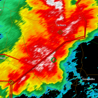
Clearly some form of warm nose has remained anchored over the mid-valley. Notice how that bright banding (blue which indicates melting aloft) hits a wall and changes to white across NE TN. Pretty neat to watch unfold. -

January 15th-17th 2024 Arctic Blast/Snow Event
fountainguy97 replied to John1122's topic in Tennessee Valley
How much do you have? Such a strange system. I'm 99% sure this is to blame on timing. If this came through any other time really it's all snow. I mixed with rain for a couple hours from 3-4:45 but even then never went full rain. And I was the one the high-res had no snow for. -

January 15th-17th 2024 Arctic Blast/Snow Event
fountainguy97 replied to John1122's topic in Tennessee Valley
wow it's snowing HARD. 32.2. Quarter sized flakes. -

January 15th-17th 2024 Arctic Blast/Snow Event
fountainguy97 replied to John1122's topic in Tennessee Valley
Agreed. It's like having two discussions at once. Nowcasting reports and then discussion on last second models for the areas it hasn't begun yet. -

January 15th-17th 2024 Arctic Blast/Snow Event
fountainguy97 replied to John1122's topic in Tennessee Valley
Still 32.5 90% slushy snow some rain now. 400ft below me it's almost all rain. Will be interesting to see how the evening goes. If we can get back down below 32 could add an inch onto the slushy inch I've got. -

January 15th-17th 2024 Arctic Blast/Snow Event
fountainguy97 replied to John1122's topic in Tennessee Valley
3-4pm will be the height of daytime heating. If we stay frozen through that good chance we remain for duration. 32.7 hanging on to the snow! -

January 15th-17th 2024 Arctic Blast/Snow Event
fountainguy97 replied to John1122's topic in Tennessee Valley
Roads white. Even interstates. Half dollars falling! 32.5 -

January 15th-17th 2024 Arctic Blast/Snow Event
fountainguy97 replied to John1122's topic in Tennessee Valley
31.8 Beautiful snow. I'll take this as an absolute win. -

January 15th-17th 2024 Arctic Blast/Snow Event
fountainguy97 replied to John1122's topic in Tennessee Valley
Beautiful snow. Roads turning slushy and white. Hate we are abt to cross 32 here. -

January 15th-17th 2024 Arctic Blast/Snow Event
fountainguy97 replied to John1122's topic in Tennessee Valley
Honestly this couldn't be worse timing. Needed this overnight and it's a different ballgame. -

January 15th-17th 2024 Arctic Blast/Snow Event
fountainguy97 replied to John1122's topic in Tennessee Valley
Here comes the warm push. Temp rising rapidly to 30.9 now. Mulch is white. Grass is spotty white. Considering I was expecting mostly rain this is a win! Changeover to rain coming in the next hour or two. -

January 15th-17th 2024 Arctic Blast/Snow Event
fountainguy97 replied to John1122's topic in Tennessee Valley
Back to snow/sleet. Wonder if it's moisture driven? Probably is for me. But idk abt over there. -

January 15th-17th 2024 Arctic Blast/Snow Event
fountainguy97 replied to John1122's topic in Tennessee Valley
Temp 30.0 I have switched to sleet/drizzle in lighter rates. The closest model to my temps right now is the gfs and fv3. Meso models arnt even remotely close. regardless I am mixing and signs of mixing are widespread at the moment -

January 15th-17th 2024 Arctic Blast/Snow Event
fountainguy97 replied to John1122's topic in Tennessee Valley
Down to 29.8 holding the line over here in ETN! Lol the 12z hrrr had me 34 at this time it seems snow came a couple hrs early and has helped lock in the cold. Need rates to stay steady. We will see what happens as the sun really cranks up -

January 15th-17th 2024 Arctic Blast/Snow Event
fountainguy97 replied to John1122's topic in Tennessee Valley
Yeah I'm at 30.2 and actually dropped from 30.4 under this snow. How long can I hold out before the transition? hrrr was already above 32 hrs ago for me.


