Jump to content

fountainguy97

Members
  • Posts

    1,124
  • Joined

  • Last visited

Everything posted by fountainguy97

  1. Yeah the 3km 06z is a beautiful example of this. Looks like a bowling ball of heavy precip just rotating over portions of Eastern and NE TN. Most models do have that and the EURO has consistently shown it. hopefully we can get the hrrr back on board
  2. Looks very similar to 3km NAM. Concerned about the hrrr coming in so snowless for East TN but it’s prone to random runs like that. I think at 12z this morning we should get better model agreement.
  3. For what its worth the 3km and RAP are super close together. Just need the RGEM to hop on board and we have the trifecta of high res models on our side. The RGEM isn't my favorite model. But it does do well at times.
  4. this 12km run lol 9 inches of snow in 6 hrs in southern Unicoi
  5. Almost always. Yes. Most globals have convective feedback issues which can stunt precip growth away from the center of a storm system. Iike @Daniel Boone said it’s time for high res models to take the lead. But I find it encouraging to see euro coming in beefy for the mountains.
  6. i feel like you are right. Mostly because globals often struggle with the mesoscale nature of convection. And that explains why the GFS family struggles and the EURO does a tad better. EURO imo has always been the better ULL model. And speaking of. 12z euro is also starting to pick up an enhanced band of convection. although not as expansive north as high res models. Nice to see EURO still delivering significant snowfall to the Eastern areas and backing up the high res amounts. This to me validates those beefier high res runs of the RAP and 12km NAM.
  7. ULL driven events like this are the absolute worst type of winter event. haha this thing will be "trending" one way or the other up to the last minute most likely. I have to say I'm pretty optimistic with 12km nam, RGEM, RAP and the 3km all showing enhacned banding features. just a matter of where they end up. Its possible a band of 2" hr rates swings through most of NE TN. and wherever it pivots could get slammed.
  8. The 15z RAP is just absolutely absurd. Dumping wet paste like crazy. We know it wont verify but wow check it out.
  9. Yeah I didn’t follow it hardcore because I was in Raleigh and a little grumpy about missing it hahaha but I remember the gfs being terrible. Hoping we do get the Euro camp to verify.
  10. The difference between the 18z GFS and EURO for NE TN is just a joke. Gfs has no snow while euro has a legit major winter storm. Onset is inside 3 days....
  11. On the cusp here. 36 surface with a tiny warm layer left. Sky across the valley is heavy and white with peaks above 3k in the clouds. Feels like snow Upstream radar is looking so good. I am pumped.
  12. Yeah I’ve always thought the NaM had a wet bias but they did upgrade it last year. It’s consistently been the driest with backside energy with all models significantly wetter. Will be an interesting system to watch.
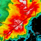
  13. Am I dreaming?? NAM and HRW families keep upping snowfall. And my high today was a solid 8 below modeled. someone pinch me.
  14. Models slowly upping my snowfall toward 3-4 inches. Still wary of them as it’s tough to nail down the elevation influence but man this looks promising. Cautiously optimistic. Although I’ve been burned on NW flow before.
  15. Our system is well on its way this morning! everything looks right on track using the upper air WV loops. Going to be a beautiful phase later during this storms life. the darker and light yellow dry air trough over the Dakotas is our northern stream energy. hoping for 1-2 inches here at 2000ft in Erwin! Small potential to bust higher than that I think in this setup.
  16. Hope this look holds! Of course it’s the LONG range NAM and loves to over amp.
  17. Hey all. Interesting storm. Tons of small variables can really enhance or suppress our backside moisture. Hoping to squeeze out an inch or two here! Waiting to see what high res models show over the next day. Very fascinating storm evolution. 3km has a legit line of broken cells and then snow a few hrs later.. going to be a wild few days.
  18. Here are the analog Temps! Very similar to Carver's thoughts above! The Precip is dry BUT its a dry December, wet January, dry February. Here are the 3 months combined. Here is the wet January Anyway, I thought I'd just throw these out here I'm cautiously optimistic about this winter. Not so much because of a signal for massive cold but more of the chance we have to buck the recent winter patterns we have been stuck in. A weak nina or cool neutral can actually end up very favorable for alot of areas if we have the right setup elsewhere on the globe. PNA is also bucking its recent pattern of - in winter and + in summer (the last THREE winters have averaged a -PNA in DJF then prolonged + in summer). Currently we have seen a nice -PNA this summer. hopefully with some luck that can switch into the fall toward a +PNA through winter.
  19. Very interestingly I just pulled my first batch of analogs for the winter and low and behold they fall right in line with you thoughts outlined above. I just looking for similar ENSO progressions and pulled these years. I omitted a few that had strong ninos/ninas but left a few that actually hovered neutral but dipped back into Nino. Analogs: 92-93, 95-96, 03-04, 05-06, 10-11, 12-13 Purple zones are similar to 2020. Brown designates ENSO which mostly correspond to the way 2020 is evolving (some lag by a few months) Red is a zone that stands apart of the 2020 map. The older maps are more coarse so who knows how similar they truly are. Anyway, in general these years all share some very similar global SST patterns. I'm just throwing these in here. This is how those analogs evolved vs how we are evolving so far. PDO Analog Comparison QBO analog Comparison PNA Analog Comparison Hurricane Activity Comparison I found this extremely interesting. 5 of the 6 analogs were hyperactivte cane seasons. While things are not set in stone it is pretty likely that this year comes out very active as well. Analog US temps/precip in next post
  20. Got absolutely blasted earlier today. 40dbz on radar. by far the most intense snow squall I’ve ever seen. Was a mix of snow/graupel. Near white out for a few minutes! Definitely a top 1 snow event for me today. enjoy!
  21. I wouldn’t put much stock in the NAM. Check this error.
×
×
  • Create New...