

wxdude64
-
Posts
7,613 -
Joined
-
Last visited
Content Type
Profiles
Blogs
Forums
American Weather
Media Demo
Store
Gallery
Everything posted by wxdude64
-
LOL, folks pulling up global averages. Hey, it has been cold for a 7-10 day period, something most folks in this forum have wanted to see or been looking forward to for some time, enjoy it before it is sadly +12 again. Several record LOWS set in Blacksburg's NWS area this week. I set one myself.
-
27.7/21.0 at 7 am this morning, about 10 degrees warmer than the previous week or so. Low was 18.5 around 10 pm then rose rest of night. Already up to 31.8 degrees at 8 am.
-
First day with temps not getting out of the 20's, 29.6 high, 14.9 low with gusty NW/W breezes. Low was reached around 2 am then temps climbed overnight to the current 19.8/10.0 at 8 am with high cirrus in the sky. Woodstove has gotten a heck of a good workout last few days.
-
I can literally count the snowflakes as they drift by lol. Currently 19.1/9.7 with mostly cloudy skies and those drifting flakes.
-
LOL, been 30-31 for hours this afternoon/evening. Temps jump up to 35 and finally the precip that's been falling on radar last 2 hours gets to the ground.... as rain.
-
Up to 26.6/16.2 at 12:30 pm here. NWS playing the 'catch-up game', already lowered high from 40 to 37, which is likely still a bit high IMO. The 'point and click' just says flurries and snow showers, nothing about accumulation. Just west has an inch so maybe we get at least a white ground lol. The high winds and temps are what they are harping on, 26 low for tonight (where we are now) and then falling rest of the day to around 20 by 5 pm with 40-55 mph winds.
-
Already clouded over (seems a bit early per forecast) and 20.4/13.8 outside. That may make the 40 high they called for a bit tough to reach.
-
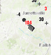
Sure hope all is well up near Jarrettsville.....
-
13.0 for the low (no record, 10 in 2000), high was 31.7 (again no record, 30 in 1989). Chilly, breezy yesterday during day. Mostly clear and calm overnight. Currently 13.8/11.8 at 8 am.
-
I'm a couple hours away, but if you need some wood...
-
My numbers for the month of November 2024 Averaged high was 59.9 degrees vs a normal of 55.4 degrees, a +4.5 degrees above average. The warmest day was the 1st with a 78.4 degree reading. Averaged low was 37.4 degrees vs a normal of 31.0 degrees, a +6.4 degrees above average. The coldest temp recorded was 24.5 degrees on the 30th. Overall averaged temp was 48.6 degrees vs a normal of 43.2 degrees, a +5.4 degrees above average and places it tied for 3rd warmest with 2003 and behind 1985's blistering 53.0 and the 49.7 degrees of 1999. Total precip for the month was 1.59 inches vs a normal of 2.78 inches, -1.19 inches below average. Greatest rainfall was on the 15th with 1.06 inches falling. There were 11 days with measurable, 3 days with a 'T' and 16 dry days. Total snowfall for the month was 0.2 inches vs a normal of 0.3 inches, a -0.1 below average. Greatest snowfall was on the 22nd with 0.2 inches. There was one day with measurable snow, 2 days with a 'T' and 27 snowless days. Highest wind recorded was 40 mph on the 21st. There were ten days with winds above 25 mph. Several new records; the 0.2 inches was a new snowfall record for the 22nd, the 1.06 inches was a new rainfall record for the 15th, and set a new 'warm minimum' on the 8th. Overall a quite warm and semi-dry month with one decent cold shot in the middle. Records go back to October 1979.
-
Cool! (literally lol) Low was 14.3 here, close but 1979's 12 holds. What I DID set was a new 'cool max' at 31.3 degrees, breaking 33.0 from both 2005 and 2010. LOL, I just realized I made 3 of the last 9 comments about my 31.3 high, sorry folks!
-
You got me curious, so I looked. It will be a new 'cool max' for the date, beating 33's from both 2005 and 2010!
-
Remember that well.
-
First sub freezing high of the season here, 31.3 degrees.
-
Low was 17.8 degrees. Had several rounds of snow showers and flurries yesterday from noon thru about 5 pm. Ground turned white a couple of times, but not enough to measure, looked and felt like winter.
-
Low was 24.2, currently light snow (started off and on since noon) and 35.5/28.4.
-
DCA: -1.1 NYC: -1.5 BOS: -0.7 ORD: -0.4 ATL: -0.3 IAH: +0.6 DEN: +0.6 PHX: +1.4 SEA: -0.4 DCA: 18.8 NYC: 36.2 BOS: 44.3 ORD: 37.8 DTW: 41.3 BUF: 122.9 DEN: 71.2 SEA: 7.4 BTV: 102.7
-
Might get a pre midnight 'low' at DCA for the date.
-
More clouds are filling in, seems to be holding temp up a bit and DP is rising. Currently 27.1/10.1.
-
Sadly true.
-
35.2 high, currently 29.7/3.8 with a little bit of high cirrus. Should drop fast until the lower/heavier clouds get here.
-
Beautiful!
-
Wishing all a Happy Thanksgiving, stay safe out there! And eat plenty of turkey
-
Yep, 74th anniversary yesterday and today!


