IWXwx
-
Posts
6,627 -
Joined
-
Last visited
Content Type
Profiles
Blogs
Forums
American Weather
Media Demo
Store
Gallery
Everything posted by IWXwx
-
Pretty nice shot of it. I saw that it had a little rotation on the velocity scans. I'm with you on the ROF. Modals showing it staying north, but as has been mentioned here, it usually ends up Coriolising south. If it does stay north, we'll be in the swamp-ass oven for days on end, so pick your poison.
-
@Jackstraw, it looks like you might get lucky as that random storm slides by juuuuuussssst a little to your northeast (using my Bob Uecker voice.)
-
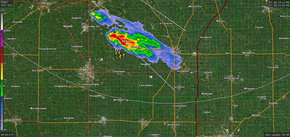
Wow, you're really getting killed by the rain. We had 1.31" yesterday/this morning. We also had a downburst. Lots of trees and powerlines down in about 1 x 4 mile area. I purposely drove into it as I close to it when I saw it on the velocity scan. A tree came down across the road I was on about a minute after I passed it. Here is part of my dashcam video. The first part is the shelf cloud (sped up slightly) and the last part is driving into it. No audio at first and the last couple minutes is me driving into the abyss, to which the video doesn't do justice. Most of the time, I could only go about 10 MPH.
-
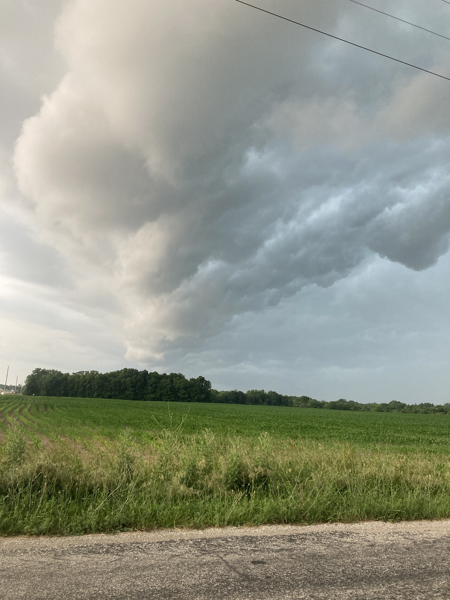
Here's my shelf cloud when it was overhead pic from yesterday

-
Off topic but you are right about expansion north of Indy. I remember when you could drive south to within a mile of 465 and have corn fields. Now it's concrete well north of Westfield and Noblesville, and quickly approaching Pendleton.
-
Wow, quite a difference in a short distance. I've had less than half of that all month.
-
We've had a sharp cutoff up here. As of 7AM, the southern part of the county has had well over 3", and just a few miles north in Huntington, .13"
-
2.89" of rain overnight through 7 AM (Eastern time) and still raining. Feast or famine.
-
We did have a nice diurnal swing today, but not over 100 degrees.
-
That's what happens when some imbeciles decide to take a meat clever to NOAA personnel.
-

2025 Short Range Severe Weather Discussion
IWXwx replied to Chicago Storm's topic in Lakes/Ohio Valley
Stay downstate. -
Looks like I'll be heading northwest today and south tomorrow
-
Got hammered between 6:30-6:50 (EDT) this morning. Caught 0.53" in that timeframe, with pea sized hail and some great lightning. The hardest I've seen it rain in a long time. Nice way to wake up on a Saturday morning.
-
F
-
It wasn't your imagination. https://www.msn.com/en-us/general/general/the-u-s-just-had-its-windiest-start-to-spring-in-nearly-50-years/ar-AA1CvYrA?utm_source=GetKim.com
-
2024-'25 The winter of the mid-south.
-
...except hard work.
-
With over 2 1/2" (over an inch and a half in the past 24 hrs.) of rain here in the past week and another 2-3" forecast for Friday-Sunday, we won't have to worry about drought for awhile. I may not get into my garden until May if this keeps up. At least it's not going to be like the Ohio River valley. They might need boats to travel.
-
Same here. I've had stronger storms that weren't even warned.
-
I'm feeling your pain. My last two years totals put together are eight inches under my yearly average!!
-
I was on NWSChat when that happened. IWX said that it wasn't lining up with velocity/reflectivity scans and speculated that it might have been a microburst.
-
Spring 2025 Medium/Long Range Discussion
IWXwx replied to Chicago Storm's topic in Lakes/Ohio Valley
We had 6 brush/field fires in our county from 4PM Tuesday-4PM yesterday. -
Nocturnal passage FTL. Clowns to the left of me, jokers to the right, here I am
-
I spent a lot of time outside today. “Give a man a shovel and he’ll clear the sidewalk. Give a man a snowblower and he’ll clear the neighborhood.” - My Wife
-
Yeah, I was just thinking the same thing about Bo and woah! His area is really sucking this year.