mitchnick
Members-
Posts
28,595 -
Joined
Content Type
Profiles
Blogs
Forums
American Weather
Media Demo
Store
Gallery
Everything posted by mitchnick
-
Snow in Hanover, but the back end is close. Just another reminder how this winter was a disappointment with snow.
- 1,093 replies
-
- severe
- thunderstorms
-
(and 1 more)
Tagged with:
-
My office used to be in Hanover. In fact, Emergency Management may be in the same complex if I'm not mistaken. If it is the same complex, rest assured she'll have better choices in the area to eat than Popeye's.
- 1,093 replies
-
- severe
- thunderstorms
-
(and 1 more)
Tagged with:
-
-
I was just going to post that the 12z Gfs had this. Surprised the Nam has it too.
-
Make it 5x now.
-
-
4 runs in a row on the Gefs giving me 6"+ of fantasy snow. I'll wait to see if it's still there after 3 more runs before looking under what circumstances or when it falls during the 360 hours. Lol
-
No it won't. I hate severe, unless it's severe cold.
-
First flakes imby
-
Stopped precipitating here. Nam probably ends up right with it being SE, as I am defeated.
-
All I can think of when I see Tofu in the store is an abbreviation of toe fungus.
-
Wet flakes mixing in now.
-
Look to be 80-90% sleet now.
-
Sleet has started to mix in imby.
-
Love this radar. https://weather.cod.edu/satrad/nexrad/?parms=CCX-N0B-1-24-100-usa-rad
-
You can see the front come through the forum on this radar. https://weather.cod.edu/satrad/nexrad/?parms=LWX-N0B-1-24-100-usa-rad
-
-
-
-
Thank you for that crucial forum update
-
Central PA Spring 2026 Discussion/Obs Thread
mitchnick replied to Voyager's topic in Upstate New York/Pennsylvania
Why not? The exercise would have been good for her...maybe not on 2nd thought. -
Central PA Spring 2026 Discussion/Obs Thread
mitchnick replied to Voyager's topic in Upstate New York/Pennsylvania
I was just up in Selensgrove earlier today to pick up my new (used) car. Glad I left this morning. Still hoping to hear from Bliz soon. -
Central PA Spring 2026 Discussion/Obs Thread
mitchnick replied to Voyager's topic in Upstate New York/Pennsylvania
Wow. I hope Bliz is OK. Marysville was in its path. -
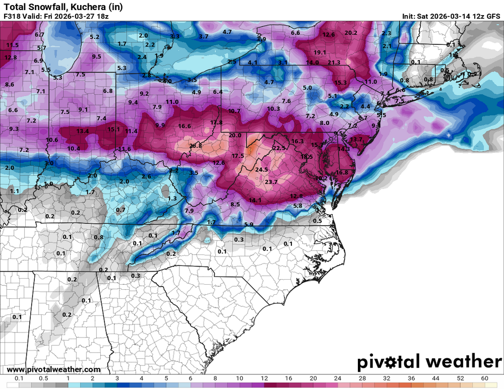
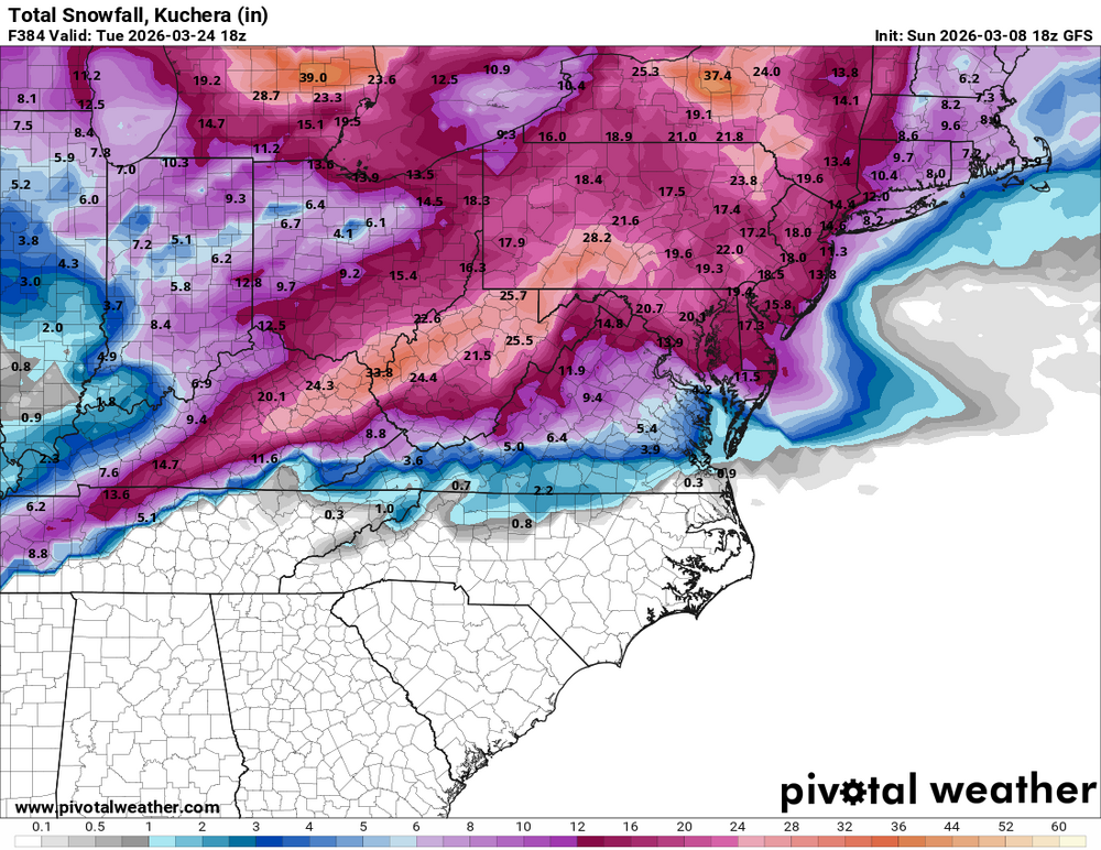
Anyone other than me notice the Gfs Kuchera is more than the 10:1 map? That's impressive for mid-March.
-
We're not here for insight, we're here for entertainment....and the 18z is just that!

.thumb.png.6560dd0f7856946e6f7261ecf92be6c9.png)


.thumb.png.95336cbaec756297e9a8d177d2de4ff5.png)
.thumb.png.e45cedf6bd6ddb8c123713fb1d8da0b8.png)


.thumb.png.c6ea0e199ee05308480802d659a7d707.png)
